Directions to Felder e Prokopenko (Boqueirão) with public transportation
The following transit lines have routes that pass near Felder e Prokopenko
How to get to Felder e Prokopenko by bus?
Click on the bus route to see step by step directions with maps, line arrival times and updated time schedules.
From Rua 24 Horas, Centro
42 minFrom Rua Marechal Hermes, São José Dos Pinhais
92 minFrom Rua Bolsão dos Papagaios, Pinhais
70 minFrom Rua Professor Pedro Viriato Parigot de Souza, Campo Comprido
71 minFrom Umbará, Umbará
44 minFrom Vitoria Regia, Cic
55 minFrom Rua Engenheiros Rebouças, Rebouças
47 minFrom Estação Tubo Praça Carlos Gomes, Centro
29 minFrom R. Anita Garibaldi, Ahu
49 minFrom Parque Barigui, Bigorrilho
56 min
Bus stops near Felder e Prokopenko in Boqueirão
Bus lines to Felder e Prokopenko in Boqueirão
- 021 INTERBAIRROS II (ANTI-HORÁRIO), Capão Raso → Hauer,VIEW
- 526 ITAMARATI / VILA SÃO PEDRO, Terminal Hauer → Terminal Capão Raso ,VIEW
- 020 INTERBAIRROS II (HORÁRIO), Hauer → Capão Raso,VIEW
- 519 MAD. SÃO FRANCISCO / IGUAPE, Terminal Hauer ↺ São Francisco / Iguape (Circular),VIEW
- 525 HAUER / CAPÃO RASO, Terminal Hauer → Terminal Capão Raso,VIEW
- 513 HAUER / BOQUEIRÃO, Terminal Hauer → Terminal Boqueirão,VIEW
What are the closest stations to Felder e Prokopenko?
The closest stations to Felder e Prokopenko are:
- R. Evaristo da Veiga, 2191 is 155 meters away, 3 min walk.
- R. Evaristo da Veiga, 2212 is 193 meters away, 3 min walk.
- R. Oliveira Viana, 1622 is 636 meters away, 9 min walk.
- R. Humberto Ciccarino, 180 is 669 meters away, 9 min walk.
Which bus lines stop near Felder e Prokopenko?
These bus lines stop near Felder e Prokopenko: 020 INTERBAIRROS II (HORÁRIO), 021 INTERBAIRROS II (ANTI-HORÁRIO), 513 HAUER / BOQUEIRÃO, 526 ITAMARATI / VILA SÃO PEDRO.
What’s the nearest bus station to Felder e Prokopenko in Boqueirão?
The nearest bus stations to Felder e Prokopenko in Boqueirão are R. Evaristo da Veiga, 2191 and R. Evaristo da Veiga, 2212. The closest one is a 3 min walk away.
What time is the first bus to Felder e Prokopenko in Boqueirão?
The 519 MAD. SÃO FRANCISCO / IGUAPE is the first bus that goes to Felder e Prokopenko in Boqueirão. It stops nearby at 3:17 AM.
What time is the last bus to Felder e Prokopenko in Boqueirão?
The 519 MAD. SÃO FRANCISCO / IGUAPE is the last bus that goes to Felder e Prokopenko in Boqueirão. It stops nearby at 2:18 AM.
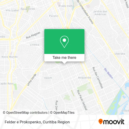
See Felder e Prokopenko, Boqueirão, on the map
Public Transit to Felder e Prokopenko in Boqueirão
Wondering how to get to Felder e Prokopenko in Boqueirão? Moovit helps you find the best way to get to Felder e Prokopenko with step-by-step directions from the nearest public transit station.
Moovit provides free maps and live directions to help you navigate through your city. View schedules, routes, timetables, and find out how long does it take to get to Felder e Prokopenko in real time.
Looking for the nearest stop or station to Felder e Prokopenko? Check out this list of stops closest to your destination: R. Evaristo da Veiga; R. Evaristo da Veiga; R. Oliveira Viana; R. Humberto Ciccarino.
Bus: 020 INTERBAIRROS II (HORÁRIO), 021 INTERBAIRROS II (ANTI-HORÁRIO), 513 HAUER / BOQUEIRÃO, 526 ITAMARATI / VILA SÃO PEDRO, 519 MAD. SÃO FRANCISCO / IGUAPE, 525 HAUER / CAPÃO RASO.
Want to see if there’s another route that gets you there at an earlier time? Moovit helps you find alternative routes or times. Get directions from and directions to Felder e Prokopenko easily from the Moovit App or Website.
We make riding to Felder e Prokopenko easy, which is why over 1.5 million users, including users in Boqueirão, trust Moovit as the best app for public transit. You don’t need to download an individual bus app or train app, Moovit is your all-in-one transit app that helps you find the best bus time or train time available.
For information on prices of bus, costs and ride fares to Felder e Prokopenko, please check the Moovit app.
Use the app to navigate to popular places including to the airport, hospital, stadium, grocery store, mall, coffee shop, school, college, and university.
Felder e Prokopenko Address: Rua Luiz Dallagassa, 241 Boqueirão Curitiba-PR 81670-150 street in Boqueirão
- Raquel Erzinger Joias,
- Nakamura Comércio de Manutencao de Maquinas Copiadoras L,
- Bueno Artefatos de Metal,
- Rua Antônio Rebelatto 1600,
- Qualifruti Hortifruti,
- Rua cleto da silva,
- Joinville,
- Mercado Masnei,
- Rua Major Theolindo Ferreira Ribas,
- COPE - Centro de Operações Policiais Especiais,
- Mundo Para Todo Mundo - Escola - Unilehu,
- Rua Raggi Izar,
- Má Amaral Nails Designer,
- Escola Municipal Prof. Guilherme Butler,
- Casa Rosada Bar Executivo,
- Igreja Evangélica Caminho da Verdade,
- Rua Evaristo da Veiga 2459,
- Rua 25 de Agosto 51,
- Rua Hipólito da Costa 2470,
- Rua Evaristo da Veiga, 2517 - Boqueirão
Places Near Felder e Prokopenko (Boqueirão)
- Hospital Da Cruz Vermelha, Batel,
- Hhhhh, Fazendinha,
- Pontifícia Universidade Católica do Paraná (PUCPR), Prado Velho,
- Rua General Mário Tourinho, Campina Do Siqueira,
- Parque Barigui, Mercês,
- Rua Martim Afonso 558, Mercês,
- Jardim Botânico de Curitiba PR, Centro,
- Hospital do Rocio, Campo,
- Hospital Universitário Evangélico de Curitiba, Bigorrilho,
- Hospital Erasto Gaertner, Jardim Das Américas,
- Shopping Estação, Rebouças,
- Hospital Nossa Senhora Das Graças, Mercês,
- Hospital Madalena Sofia, Bairro Alto,
- Hospital de Clínicas (HC - UFPR), Centro,
- Park Shopping Barigüi, Mossunguê,
- Arena Da Baixada - Curitiba,
- Campo Largo, Campo,
- Shopping Palladium, Portão,
- Jockey Plaza Shopping Center, Tarumã,
- Hospital Angelina Caron, Campina Grande Do Sul
How to get to popular places in Curitiba Region with public transit
Get around Boqueirão by public transit!
Traveling around Boqueirão has never been so easy. See step by step directions as you travel to any attraction, street or major public transit station. View bus and train schedules, arrival times, service alerts and detailed routes on a map, so you know exactly how to get to anywhere in Boqueirão.
When traveling to any destination around Boqueirão use Moovit's Live Directions with Get Off Notifications to know exactly where and how far to walk, how long to wait for your line, and how many stops are left. Moovit will alert you when it's time to get off — no need to constantly re-check whether yours is the next stop.
Wondering how to use public transit in Boqueirão or how to pay for public transit in Boqueirão? Moovit public transit app can help you navigate your way with public transit easily, and at minimum cost. It includes public transit fees, ticket prices, and costs. Looking for a map of Boqueirão public transit lines? Moovit public transit app shows all public transit maps in Boqueirão with all Bus and Cable Car routes and stops on an interactive map.
Curitiba Region has 2 transit type(s), including: Bus and Cable Car, operated by several transit agencies, including Sistema Integrado de Mobilidade (URBS), Sistema Integrado de Mobilidade (AMEP), URBS (Cartões bancários e Dinheiro), URBS (Cartões bancários / Cartão URBS), AMEP (Cartões bancários / Cartão MetroCard), AMEP (Cartões bancários / Cartão MetroCard / Dinheiro), Viação Colombo (Dinheiro), TRIAR (Cartão TRIAR / Dinheiro), Empresa Curitiba Cerro Azul (Dinheiro), Expresso Nossa Senhora da Penha (Dinheiro), Empresa Campo Alto Tijucas (Dinheiro), Auto Viação São José (Cartão VEM / Dinheiro), BRT S/A (Cartão VEM / Dinheiro), TransPiedade (Cartão Cidadão / Dinheiro) and Oceânica Sul (Cartão Transporte / Dinheiro)