Directions to Fernanda (Atuba) with public transportation
The following transit lines have routes that pass near Fernanda
How to get to Fernanda by bus?
Click on the bus route to see step by step directions with maps, line arrival times and updated time schedules.
From Avenida Presidente Affonso Camargo 330, Jardim Botânico
33 minFrom Dapi Mercês, Mercês
43 minFrom Estação Tubo Bento Viana, Água Verde
44 minFrom Rua Silveira Peixoto 1040, Batel
44 minFrom SENAC PR, Centro
26 minFrom RH Nossa, Rebouças
39 minFrom Alameda Júlia da Costa, Bigorrilho
43 minFrom Batel, Batel
46 minFrom Avenida Comendador Franco, Uberaba
54 minFrom Hospital Nossa Senhora das Gracas - Centro de Diabetes, Alto Da Glória
37 min
Bus stops near Fernanda in Atuba
Bus lines to Fernanda in Atuba
- 237 PARQUE ATUBA, Terminal Santa Cândida ↺ Parque Atuba (Circular),VIEW
- O69 MAD. QUATRO BARRAS / SANTA CÂNDIDA, Terminal Santa Cândida → Terminal Quatro Barras,VIEW
- 238 ATUBA / SANTA CÂNDIDA, Terminal Santa Cândida → Estação Atuba,VIEW
- B06 GUARAITUBA / RUI BARBOSA (VIA MARACANÃ / SEMIDIRETO), Marechal Dedoro / Rui Barbosa → Terminal Guaraituba ,VIEW
- B20 GUARAITUBA / CABRAL (VIA MARACANÃ), Terminal Guaraituba → Terminal Cabral,VIEW
- B43 RIO VERDE, Praça da Bíblia → Terminal Boa Vista,VIEW
- O62 QUATRO BARRAS / GUADALUPE (VIA ESTAÇÃO ATUBA), Terminal Guadalupe → Terminal Quatro Barras,VIEW
- C72 VILA PALMITAL / GUADALUPE (VIA ESTAÇÃO ATUBA), Vila Palmital (31 de Março) → Terminal Guadalupe,VIEW
- B89 GUARAITUBA / RUI BARBOSA (VIA MARACANÃ / CABRAL), Terminal Guaraituba → Praça Rui Barbosa,VIEW
- 222 VILA ESPERANÇA, Terminal Boa Vista → Vila Esperança,VIEW
- 229 MAD. PENHA / FERNANDO DE NORONHA, Terminal Boa Vista ↺ Penha (Circular),VIEW
- N61 CAMPINA GRANDE DO SUL / GUADALUPE, Terminal Campina Grande do Sul → Terminal Guadalupe,VIEW
- N62 JARDIM PAULISTA / GUADALUPE, Terminal Guadalupe → Terminal Jardim Paulista,VIEW
- N72 EUGÊNIA MARIA / GUADALUPE, Eugênia Maria → Terminal Guadalupe,VIEW
- O74 QUATRO BARRAS / GUADALUPE, Terminal Quatro Barras → Terminal Guadalupe,VIEW
- Y99 TUNAS DO PARANÁ / GUADALUPE, Terminal Guadalupe → Tunas do Paraná,VIEW
- 342 BAIRRO ALTO / BOA VISTA, Terminal Bairro Alto → Terminal Boa Vista,VIEW
- B69 MAD. CURITIBA / SÃO DIMAS, Terminal Guadalupe → São Dimas,VIEW
- 030 INTERBAIRROS III, Terminal Bairro Alto → Terminal Santa Cândida,VIEW
What are the closest stations to Fernanda?
The closest stations to Fernanda are:
- R. Odete Laura Foggiato 764 is 291 meters away, 4 min walk.
- Av. Marechal Mascarenhas de Moraes, 261 is 387 meters away, 6 min walk.
- R. Roaldo Brun, 1296 is 414 meters away, 6 min walk.
- R. Pery Sotto Maior Bittencourt, 105 is 417 meters away, 6 min walk.
- R. Roaldo Brun, 1180 is 448 meters away, 6 min walk.
- Av. Marechal Mascarenhas de Moraes, 1820 is 534 meters away, 7 min walk.
Which bus lines stop near Fernanda?
These bus lines stop near Fernanda: 237 PARQUE ATUBA, B06 GUARAITUBA / RUI BARBOSA (VIA MARACANÃ / SEMIDIRETO), B20 GUARAITUBA / CABRAL (VIA MARACANÃ), C72 VILA PALMITAL / GUADALUPE (VIA ESTAÇÃO ATUBA).
What’s the nearest bus station to Fernanda in Atuba?
The nearest bus station to Fernanda in Atuba is R. Odete Laura Foggiato 764. It’s a 4 min walk away.
What time is the first bus to Fernanda in Atuba?
The 229 MAD. PENHA / FERNANDO DE NORONHA is the first bus that goes to Fernanda in Atuba. It stops nearby at 3:00 AM.
What time is the last bus to Fernanda in Atuba?
The 229 MAD. PENHA / FERNANDO DE NORONHA is the last bus that goes to Fernanda in Atuba. It stops nearby at 3:00 AM.
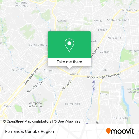
See Fernanda, Atuba, on the map
Public Transit to Fernanda in Atuba
Wondering how to get to Fernanda in Atuba? Moovit helps you find the best way to get to Fernanda with step-by-step directions from the nearest public transit station.
Moovit provides free maps and live directions to help you navigate through your city. View schedules, routes, timetables, and find out how long does it take to get to Fernanda in real time.
Looking for the nearest stop or station to Fernanda? Check out this list of stops closest to your destination: R. Odete Laura Foggiato 764; Av. Marechal Mascarenhas de Moraes; R. Roaldo Brun; R. Pery Sotto Maior Bittencourt; R. Roaldo Brun; Av. Marechal Mascarenhas de Moraes.
Bus: 237 PARQUE ATUBA, B06 GUARAITUBA / RUI BARBOSA (VIA MARACANÃ / SEMIDIRETO), B20 GUARAITUBA / CABRAL (VIA MARACANÃ), C72 VILA PALMITAL / GUADALUPE (VIA ESTAÇÃO ATUBA), O69 MAD. QUATRO BARRAS / SANTA CÂNDIDA, 238 ATUBA / SANTA CÂNDIDA, N61 CAMPINA GRANDE DO SUL / GUADALUPE, N62 JARDIM PAULISTA / GUADALUPE, N72 EUGÊNIA MARIA / GUADALUPE, O74 QUATRO BARRAS / GUADALUPE, Y99 TUNAS DO PARANÁ / GUADALUPE, B43 RIO VERDE, O62 QUATRO BARRAS / GUADALUPE (VIA ESTAÇÃO ATUBA), B69 MAD. CURITIBA / SÃO DIMAS, 030 INTERBAIRROS III.
Want to see if there’s another route that gets you there at an earlier time? Moovit helps you find alternative routes or times. Get directions from and directions to Fernanda easily from the Moovit App or Website.
We make riding to Fernanda easy, which is why over 1.5 million users, including users in Atuba, trust Moovit as the best app for public transit. You don’t need to download an individual bus app or train app, Moovit is your all-in-one transit app that helps you find the best bus time or train time available.
For information on prices of bus, costs and ride fares to Fernanda, please check the Moovit app.
Use the app to navigate to popular places including to the airport, hospital, stadium, grocery store, mall, coffee shop, school, college, and university.
Fernanda Address: Rua Jovino Cavalheiro dos Santos, 55 Atuba Curitiba-PR 82630-305 street in Atuba
- Zanona Tecnologia da Informacao,
- Inove It,
- Apaj Smcc,
- Beatriz Reichmann Mendes,
- Mgl Serviços,
- Dm Works,
- Precisão Corretora de Seguros,
- Capela Santa Teresinha do Menino Jesus - Jardim Tereza Glaser,
- Clb Incorporadora,
- Condominio Zaragoza,
- Studio Fioretti,
- Silmara Alencar,
- Goveia and Goveia Engenharia Eletrica,
- Jue Modas,
- Digiponto Sistemas,
- Gmk Digital,
- capela Santa Terezinha do Menino Jesus, Atuba,
- A Pastora Cosmetics,
- Calamara Treinamentos,
- E Bom sem Gluten
Places Near Fernanda (Atuba)
- Rua General Mário Tourinho, Campina Do Siqueira,
- Hospital de Clínicas (HC - UFPR), Centro,
- Jockey Plaza Shopping Center, Tarumã,
- Rua Martim Afonso 558, Mercês,
- Jardim Botânico de Curitiba PR, Centro,
- Parque Barigui, Mercês,
- Arena Da Baixada - Curitiba,
- Shopping Palladium, Portão,
- Hospital do Rocio, Campo,
- Hospital Angelina Caron, Campina Grande Do Sul,
- Hospital Da Cruz Vermelha, Batel,
- Campo Largo, Campo,
- Hospital Erasto Gaertner, Jardim Das Américas,
- Shopping Estação, Rebouças,
- Hhhhh, Fazendinha,
- Pontifícia Universidade Católica do Paraná (PUCPR), Prado Velho,
- Park Shopping Barigüi, Mossunguê,
- Hospital Nossa Senhora Das Graças, Mercês,
- Hospital Madalena Sofia, Bairro Alto,
- Hospital Universitário Evangélico de Curitiba, Bigorrilho
How to get to popular places in Curitiba Region with public transit
Get around Atuba by public transit!
Traveling around Atuba has never been so easy. See step by step directions as you travel to any attraction, street or major public transit station. View bus and train schedules, arrival times, service alerts and detailed routes on a map, so you know exactly how to get to anywhere in Atuba.
When traveling to any destination around Atuba use Moovit's Live Directions with Get Off Notifications to know exactly where and how far to walk, how long to wait for your line, and how many stops are left. Moovit will alert you when it's time to get off — no need to constantly re-check whether yours is the next stop.
Wondering how to use public transit in Atuba or how to pay for public transit in Atuba? Moovit public transit app can help you navigate your way with public transit easily, and at minimum cost. It includes public transit fees, ticket prices, and costs. Looking for a map of Atuba public transit lines? Moovit public transit app shows all public transit maps in Atuba with all Bus and Cable Car routes and stops on an interactive map.
Curitiba Region has 2 transit type(s), including: Bus and Cable Car, operated by several transit agencies, including Sistema Integrado de Mobilidade (URBS), Sistema Integrado de Mobilidade (AMEP), URBS (Cartões bancários e Dinheiro), URBS (Cartões bancários / Cartão URBS), AMEP (Cartões bancários / Cartão MetroCard), AMEP (Cartões bancários / Cartão MetroCard / Dinheiro), Viação Colombo (Dinheiro), TRIAR (Cartão TRIAR / Dinheiro), Empresa Curitiba Cerro Azul (Dinheiro), Expresso Nossa Senhora da Penha (Dinheiro), Empresa Campo Alto Tijucas (Dinheiro), Auto Viação São José (Cartão VEM / Dinheiro), BRT S/A (Cartão VEM / Dinheiro), TransPiedade (Cartão Cidadão / Dinheiro) and Oceânica Sul (Cartão Transporte / Dinheiro)
Public transit lines with stations closest to Fernanda in Atuba
Bus lines with stations closest to Fernanda in Atuba
R. Roaldo Brun, 1296
 B06 GUARAITUBA / RUI BARBOSA (VIA MARACANÃ / SEMIDIRETO)GUARAITUBA / RUI BARBOSA (via MARACANÃ / SEMIDIRETO)
- B20 GUARAITUBA / CABRAL (VIA MARACANÃ)GUARAITUBA / CABRAL (via MARACANÃ)
- B43 RIO VERDERIO VERDE
- O62 QUATRO BARRAS / GUADALUPE (VIA ESTAÇÃO ATUBA)QUATRO BARRAS / GUADALUPE (via ESTAÇÃO ATUBA)
- C72 VILA PALMITAL / GUADALUPE (VIA ESTAÇÃO ATUBA)VILA PALMITAL / GUADALUPE (via ESTAÇÃO ATUBA)