Directions to Ferr Paseo Bravo (San Gregorio Atzompa) with public transportation
The following transit lines have routes that pass near Ferr Paseo Bravo
How to get to Ferr Paseo Bravo by bus?
Click on the bus route to see step by step directions with maps, line arrival times and updated time schedules.
From Facultad de Medicina Veterinaria y Zootecnia, Puebla
51 minFrom Grupo Valle de Los Angeles, Puebla
64 minFrom Estafeta, Puebla
41 minFrom Fraccionamiento La Hacienda, Puebla
35 minFrom San Ramón Castillotla, Puebla
56 minFrom Teotihuacan, Puebla
45 minFrom Lomas 5 de Mayo, Puebla
46 minFrom Parque Industrial Resurrección, Puebla
57 minFrom Central De Abastos Puebla, San Pedro Cholula
54 minFrom La Joya, Puebla
49 min
Bus stops near Ferr Paseo Bravo in San Gregorio Atzompa
Bus lines to Ferr Paseo Bravo in San Gregorio Atzompa
What are the closest stations to Ferr Paseo Bravo?
The closest stations to Ferr Paseo Bravo are:
- Calzada Zavaleta-Campestre is 91 meters away, 2 min walk.
- Calzada Zavaleta, 3912 is 94 meters away, 2 min walk.
- Calzada Zavaleta 103 is 205 meters away, 3 min walk.
- Insurgentes Y Calzada Zavaleta is 399 meters away, 6 min walk.
- Rafael Ávila Camacho-Pinos is 668 meters away, 9 min walk.
Which bus lines stop near Ferr Paseo Bravo?
These bus lines stop near Ferr Paseo Bravo: A8, RUTA CREE - MADERO.
What’s the nearest bus station to Ferr Paseo Bravo in San Gregorio Atzompa?
The nearest bus stations to Ferr Paseo Bravo in San Gregorio Atzompa are Calzada Zavaleta-Campestre and Calzada Zavaleta, 3912. The closest one is a 2 min walk away.
What time is the first bus to Ferr Paseo Bravo in San Gregorio Atzompa?
The RUTA COORDINADOS SAN JERÓNIMO is the first bus that goes to Ferr Paseo Bravo in San Gregorio Atzompa. It stops nearby at 5:01 AM.
What time is the last bus to Ferr Paseo Bravo in San Gregorio Atzompa?
The A8 is the last bus that goes to Ferr Paseo Bravo in San Gregorio Atzompa. It stops nearby at 11:42 PM.
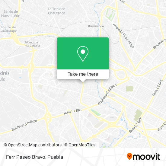
See Ferr Paseo Bravo, San Gregorio Atzompa, on the map
Public Transit to Ferr Paseo Bravo in San Gregorio Atzompa
Wondering how to get to Ferr Paseo Bravo in San Gregorio Atzompa? Moovit helps you find the best way to get to Ferr Paseo Bravo with step-by-step directions from the nearest public transit station.
Moovit provides free maps and live directions to help you navigate through your city. View schedules, routes, timetables, and find out how long does it take to get to Ferr Paseo Bravo in real time.
Looking for the nearest stop or station to Ferr Paseo Bravo? Check out this list of stops closest to your destination: Calzada Zavaleta-Campestre; Calzada Zavaleta; Calzada Zavaleta 103; Insurgentes Y Calzada Zavaleta; Rafael Ávila Camacho-Pinos.
Bus: A8, RUTA CREE - MADERO, RUTA 3, RUTA 3A, RUTA COORDINADOS SAN JERÓNIMO, RUTA CSJ.
Want to see if there’s another route that gets you there at an earlier time? Moovit helps you find alternative routes or times. Get directions from and directions to Ferr Paseo Bravo easily from the Moovit App or Website.
We make riding to Ferr Paseo Bravo easy, which is why over 1.5 million users, including users in San Gregorio Atzompa, trust Moovit as the best app for public transit. You don’t need to download an individual bus app or train app, Moovit is your all-in-one transit app that helps you find the best bus time or train time available.
For information on prices of bus, costs and ride fares to Ferr Paseo Bravo, please check the Moovit app.
Use the app to navigate to popular places including to the airport, hospital, stadium, grocery store, mall, coffee shop, school, college, and university.
Ferr Paseo Bravo Address: Calzada Zavaleta 3704, Santa Cruz Buenavista, 72150 Puebla, Puebla street in San Gregorio Atzompa
- Diseño en Cristal,
- Instituto Universitario Boulanger,
- Pintumex,
- Santa Cruz Guadalupe,
- San Pablo Farmacia,
- Wilbing Centro Universitario,
- Instituto Andes de Puebla,
- Prissa Suc. Zavaleta,
- Reino Iglesia,
- Refaccionaria Tauro,
- Banco Bbva,
- Dumas - Cocina Artesanal Contemporánea,
- Woki's Park Puebla,
- Dentalesp,
- Pastelería St. Germain,
- Banco Scotiabank Inverlat,
- Zavaleta (Santa Cruz Buena Vista),
- Domino's,
- Wings Army Zavaleta,
- Crepería Dulce
Places Near Ferr Paseo Bravo (San Gregorio Atzompa)
- 25 Zona Militar, Puebla,
- Hospital General Regional 36 IMSS San Alejandro, San Andrés Cholula,
- Centro de Desarrollo Comunitario Tres Cruces, Puebla,
- Plaza Las Animas, Puebla,
- Tres Cruces, Puebla,
- Ciudad Judicial del Estado de Puebla, San Andrés Cholula,
- Parque Puebla, Puebla,
- Centro Integral de Servicios CIS, San Andrés Cholula,
- Hospital Traumatología y Ortopedia de Puebla, San Pedro Cholula,
- Estadio Cuauhtémoc, Puebla,
- Galerías Serdán, San Pedro Cholula,
- Secretaria de Finanzas, Puebla,
- Plaza Dorada Centro Comercial, Puebla,
- Centro Comercial Angelópolis, San Andrés Cholula,
- Complejo Cultural Universitario, Ocoyucan,
- SAT, San Andrés Cholula,
- Parque Ecologico, Pue., San Andrés Cholula,
- Ciudad Universitaria, Puebla,
- Hospital Imss La Margarita, Puebla,
- Zona de los Fuertes, Puebla
How to get to popular places in Puebla with public transit
Get around San Gregorio Atzompa by public transit!
Traveling around San Gregorio Atzompa has never been so easy. See step by step directions as you travel to any attraction, street or major public transit station. View bus and train schedules, arrival times, service alerts and detailed routes on a map, so you know exactly how to get to anywhere in San Gregorio Atzompa.
When traveling to any destination around San Gregorio Atzompa use Moovit's Live Directions with Get Off Notifications to know exactly where and how far to walk, how long to wait for your line, and how many stops are left. Moovit will alert you when it's time to get off — no need to constantly re-check whether yours is the next stop.
Wondering how to use public transit in San Gregorio Atzompa or how to pay for public transit in San Gregorio Atzompa? Moovit public transit app can help you navigate your way with public transit easily, and at minimum cost. It includes public transit fees, ticket prices, and costs. Looking for a map of San Gregorio Atzompa public transit lines? Moovit public transit app shows all public transit maps in San Gregorio Atzompa with all bus routes and stops on an interactive map.
Puebla has 1 transit type(s), including: bus, operated by several transit agencies, including RUTA, RUTA Alimentadoras, Rutas Convencionales and Líneas temporales