How to get to Fifth Avenue by bus?
Click on the bus route to see step by step directions with maps, line arrival times and updated time schedules.
Light Rail stations near Fifth Avenue in Jerusalem
- Davidka Light Rail Station, 5 min walk,VIEW
Bus stops near Fifth Avenue in Jerusalem
Bus lines to Fifth Avenue in Jerusalem
- 1, Shazar Boulevard/Binyanei HaUma,VIEW
- 17, Dulchin/Ben Porat,VIEW
- 18, Malha Train Station Parking/Drop-off,VIEW
- 19, Main Entrance/Hadassah Ein Kerem,VIEW
- 34, HaOman/Baram,VIEW
- 51, Malchei Israel/HaTurim,VIEW
- 66, Meridor/Yoseftal,VIEW
- 66A, Safra Campus/University Entrance Terminal,VIEW
- 71, Mirsky/Mintz,VIEW
- 74, Har Nof Terminal/Kanfei Nesharim,VIEW
- 102, Jerusalem Central Station/Yafo,VIEW
- 103, HaOman/Baram,VIEW
- 163, Binyanei HaUma/HaNasi HaShishi,VIEW
- 202, Mitzpe Yeriho,VIEW
- 209, Ma'ale Adumim,VIEW
- 211, Jerusalem,VIEW
- 217, Modi'in-Maccabim-Re'ut,VIEW
- 269, Beit El,VIEW
- 270, Jerusalem,VIEW
- 900, Kikar HaShabbat/Strauss,VIEW
What are the closest stations to Fifth Avenue?
The closest stations to Fifth Avenue are:
- Davidka Light Rail Station is 325 meters away, 5 min walk.
- HaNevi'im/HaRav Kook is 335 meters away, 5 min walk.
- King George/Ben Yehuda is 347 meters away, 6 min walk.
- Eliyash is 366 meters away, 6 min walk.
- Strauss/Prague is 450 meters away, 7 min walk.
- Davidka Square/HaNeviim is 473 meters away, 7 min walk.
Which bus lines stop near Fifth Avenue?
These bus lines stop near Fifth Avenue: 163, 17, 19, 19A, 22, 71, 78, 92.
Which light rail line stops near Fifth Avenue?
1 (Neve Yaakov - North→Hadassah Ein Kerem)
What’s the nearest light rail station to Fifth Avenue in Jerusalem?
The nearest light rail station to Fifth Avenue in Jerusalem is Davidka Light Rail Station. It’s a 5 min walk away.
What’s the nearest bus station to Fifth Avenue in Jerusalem?
The nearest bus station to Fifth Avenue in Jerusalem is HaNevi'im/HaRav Kook. It’s a 5 min walk away.
What time is the first light rail to Fifth Avenue in Jerusalem?
The 1 is the first light rail that goes to Fifth Avenue in Jerusalem. It stops nearby at 5:16 AM.
What time is the last light rail to Fifth Avenue in Jerusalem?
The 1 is the last light rail that goes to Fifth Avenue in Jerusalem. It stops nearby at 12:38 AM.
What time is the first bus to Fifth Avenue in Jerusalem?
The 480 is the first bus that goes to Fifth Avenue in Jerusalem. It stops nearby at 3:13 AM.
What time is the last bus to Fifth Avenue in Jerusalem?
The 480 is the last bus that goes to Fifth Avenue in Jerusalem. It stops nearby at 3:14 AM.
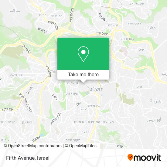
See Fifth Avenue, Jerusalem, on the map
Public Transit to Fifth Avenue in Jerusalem
Wondering how to get to Fifth Avenue in Jerusalem? Moovit helps you find the best way to get to Fifth Avenue with step-by-step directions from the nearest public transit station.
Moovit provides free maps and live directions to help you navigate through your city. View schedules, routes, timetables, and find out how long does it take to get to Fifth Avenue in real time.
Looking for the nearest stop or station to Fifth Avenue? Check out this list of stops closest to your destination: Davidka Light Rail Station; HaNevi'im/HaRav Kook; King George/Ben Yehuda; Eliyash; Strauss/Prague; Davidka Square/HaNeviim.
Bus: 163, 17, 19, 19A, 22, 71, 78, 92, 1, 18, 34, 104, 115, 480, 7, 19A, 22A, 72, 9, 9A, 25, 45, 105, 25A, 36, 56, 59.Light Rail: 1.
Want to see if there’s another route that gets you there at an earlier time? Moovit helps you find alternative routes or times. Get directions from and directions to Fifth Avenue easily from the Moovit App or Website.
We make riding to Fifth Avenue easy, which is why over 1.5 million users, including users in Jerusalem, trust Moovit as the best app for public transit. You don’t need to download an individual bus app or train app, Moovit is your all-in-one transit app that helps you find the best bus time or train time available.
For information on prices of bus and light rail, costs and ride fares to Fifth Avenue, please check the Moovit app.
Use the app to navigate to popular places including to the airport, hospital, stadium, grocery store, mall, coffee shop, school, college, and university.
Fifth Avenue Address: יפו ירושלים, ירושלים, 94222 street in Jerusalem
- Yafo & Yaabetz,
- Ariel Airbnb,
- Mini Allenby,
- Rabbi Agan Street 12,
- Taxi Service Exit Point to Tel Aviv,
- Jaffa Center,
- Yeshivat Binyan Olam,
- Sde Bar,
- Avi Model,
- Ben Yehuda Pedestrian Mall,
- Bell Tower Medical Center,
- Kashiuf Electronics,
- Rav-Kav,
- Nathan Strauss & Jaffa,
- 242,
- Jaffa Center / King George Light Rail Station,
- Hillel Designs,
- Naomi Vision Boutique,
- Jerusalem Hostel,
- Shmaya Baruch Hefetz Square
Places Near Fifth Avenue (Jerusalem)
- Tel Hashomer Base, Ramat Gan,
- Bislach 17, Ramat Negev Regional Council,
- Glilot Complex, Hof HaSharon Regional Council,
- Kashcafe, Kiryat Ata,
- Ichilov Hospital, Tel Aviv-Yafo,
- Beilinson Hospital, Petah Tikva,
- HaKotel, Jerusalem,
- Tel HaShomer North Gate, Ramat Gan,
- Ramat Gan Stadium, Ramat Gan,
- Bloomfield Stadium, Tel Aviv-Yafo,
- Southern Medical Center, Ramat Negev Regional Council,
- Yarkon Park, Tel Aviv-Yafo,
- Expo Tel Aviv, Tel Aviv-Yafo,
- Azrieli, Tel Aviv-Yafo,
- Menora Mivtachim Arena, Tel Aviv-Yafo,
- Dizengoff Center, Tel Aviv-Yafo,
- Assuta Hospital - Ramat HaHayal, Tel Aviv-Yafo,
- Carmel Market, Tel Aviv-Yafo,
- Moovit Office, Nes Ziona,
- Gideon Camp - Military Base 7, Emek Lod Regional Council
How to get to popular places in Israel with public transit
Get around Jerusalem by public transit!
Traveling around Jerusalem has never been so easy. See step by step directions as you travel to any attraction, street or major public transit station. View bus and train schedules, arrival times, service alerts and detailed routes on a map, so you know exactly how to get to anywhere in Jerusalem.
When traveling to any destination around Jerusalem use Moovit's Live Directions with Get Off Notifications to know exactly where and how far to walk, how long to wait for your line, and how many stops are left. Moovit will alert you when it's time to get off — no need to constantly re-check whether yours is the next stop.
Wondering how to use public transit in Jerusalem or how to pay for public transit in Jerusalem? Moovit public transit app can help you navigate your way with public transit easily, and at minimum cost. It includes public transit fees, ticket prices, and costs. Looking for a map of Jerusalem public transit lines? Moovit public transit app shows all public transit maps in Jerusalem with all Bus, Israel Railways, Light Rail, Carmelit / Rachbalit and Shuttle routes and stops on an interactive map.
Israel has 5 transit type(s), including: Bus, Israel Railways, Light Rail, Carmelit / Rachbalit and Shuttle, operated by several transit agencies, including Dan, Tel Aviv Light Rail - Tevel - Red Line, Israel Railways, Egged, Metropoline, Kavim, Electra Afikim, Nateev Express, Extra, Extra Jerusalem, Jerusalem Light Rail - Kfir, Egged Jerusalem Envelope Route, Dan Badarom, Dan Beer-Sheva and Electra Afikim Transport