Directions to Fight Factory (Puebla) with public transportation
The following transit lines have routes that pass near Fight Factory
How to get to Fight Factory by bus?
Click on the bus route to see step by step directions with maps, line arrival times and updated time schedules.
From Lomas de Angélopolis Cascatta, Santa Clara Ocoyucan
89 minFrom Secretaría de Educación Pública, San Pedro Cholula
48 minFrom Iglesia de Ocotlán, Puebla
32 minFrom Torre JV, San Andrés Cholula
38 minFrom Preparatoria Calderón Buap, Puebla
54 minFrom Cinépolis, Puebla
52 minFrom Ixtepec, Puebla
66 minFrom La Comer Angelópolis, San Andrés Cholula
35 minFrom Lienzo Charro de Puebla, Puebla
54 minFrom Roma, Puebla
53 min
Bus stops near Fight Factory in Puebla
- Avenida José Ma. Lafragua, 8503, 1 min walk,VIEW
- J. María Lafragua 8711, 2 min walk,VIEW
- J. Ma. Lafragua O 24 Sur, 8702, 3 min walk,VIEW
- J. Ma. Lafragua O 24 Sur, 8729, 4 min walk,VIEW
- Avenida José Ma. Lafragua, 8304, 4 min walk,VIEW
- Avenida Del Jardín, 4 min walk,VIEW
- Boulevard José María Lafragua O 24 Sur, 8164, 4 min walk,VIEW
- Avenida José Ma. Lafragua, 8270, 4 min walk,VIEW
- Avenida José Ma. Lafragua, 8321, 6 min walk,VIEW
Bus lines to Fight Factory in Puebla
- LÍNEA PERIFÉRICO, Ramal Finsa - Buap (Circuito),VIEW
- RUTA LÍNEA M1, Ramal 2, Santo Tomas Chautla,VIEW
- RUTA REMANENTE 1, Ramal 1, San Rafael Oriente - Cabañas Del Lago (Regreso),VIEW
- RUTA S3, Ramal 1, La Cruz - Centro,VIEW
- RUTA 10B, Ramal 1, Cabañas Del Lago - San Jerónimo Caleras,VIEW
- RUTA M2, Ramal 1, San Pedro Zacachimalpa - Centro,VIEW
- RUTA 10A, Ramal 1, San Fco Totimehuacán - San Felipe Hueyotlipan,VIEW
- RUTA TEPEACA - PUEBLA, Ramal 1, Valsequillo - B. De San Sebastián (Ida),VIEW
- RUTA SANTA CATARINA, Ramal 1, Santa Catarina - Las Cuartillas (Regerso),VIEW
- RUTA 55, Ramal 2, La Margarita - Concepción La Cruz (Regreso),VIEW
- RUTA 72 - 14 SUR, Ramal 2 Xilotzingo - Los Héroes De Puebla (Regreso),VIEW
- RUTA CUAUTINCHÁN, Ramal 2, Huehuetlán - Veinte De Noviembre,VIEW
- RUTA VILLA FRONTERA, Ramal 1, Jorge Murad - San José Xilotzingo (Regreso),VIEW
What are the closest stations to Fight Factory?
The closest stations to Fight Factory are:
- Avenida José Ma. Lafragua, 8503 is 17 meters away, 1 min walk.
- J. María Lafragua 8711 is 126 meters away, 2 min walk.
- J. Ma. Lafragua O 24 Sur, 8702 is 159 meters away, 3 min walk.
- J. Ma. Lafragua O 24 Sur, 8729 is 244 meters away, 4 min walk.
- Avenida José Ma. Lafragua, 8304 is 284 meters away, 4 min walk.
- Avenida Del Jardín is 292 meters away, 4 min walk.
- Boulevard José María Lafragua O 24 Sur, 8164 is 294 meters away, 4 min walk.
- Avenida José Ma. Lafragua, 8270 is 299 meters away, 4 min walk.
- Avenida José Ma. Lafragua, 8321 is 413 meters away, 6 min walk.
Which bus lines stop near Fight Factory?
These bus lines stop near Fight Factory: LÍNEA PERIFÉRICO, RUTA 10B, RUTA 72 - 14 SUR, RUTA LÍNEA M1, RUTA REMANENTE 1.
What’s the nearest bus station to Fight Factory in Puebla?
The nearest bus station to Fight Factory in Puebla is Avenida José Ma. Lafragua, 8503. It’s a 1 min walk away.
What time is the first bus to Fight Factory in Puebla?
The RUTA VILLA FRONTERA is the first bus that goes to Fight Factory in Puebla. It stops nearby at 6:00 AM.
What time is the last bus to Fight Factory in Puebla?
The RUTA 10B is the last bus that goes to Fight Factory in Puebla. It stops nearby at 11:57 PM.
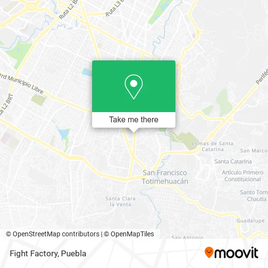
See Fight Factory, Puebla, on the map
Public Transit to Fight Factory in Puebla
Wondering how to get to Fight Factory in Puebla? Moovit helps you find the best way to get to Fight Factory with step-by-step directions from the nearest public transit station.
Moovit provides free maps and live directions to help you navigate through your city. View schedules, routes, timetables, and find out how long does it take to get to Fight Factory in real time.
Looking for the nearest stop or station to Fight Factory? Check out this list of stops closest to your destination: Avenida José Ma. Lafragua; J. María Lafragua 8711; J. Ma. Lafragua O 24 Sur; J. Ma. Lafragua O 24 Sur; Avenida José Ma. Lafragua; Avenida Del Jardín; Boulevard José María Lafragua O 24 Sur; Avenida José Ma. Lafragua; Avenida José Ma. Lafragua.
Bus: LÍNEA PERIFÉRICO, RUTA 10B, RUTA 72 - 14 SUR, RUTA LÍNEA M1, RUTA REMANENTE 1, RUTA S3, RUTA M2, RUTA 10A, RUTA TEPEACA - PUEBLA, RUTA 55, RUTA SANTA CATARINA.
Want to see if there’s another route that gets you there at an earlier time? Moovit helps you find alternative routes or times. Get directions from and directions to Fight Factory easily from the Moovit App or Website.
We make riding to Fight Factory easy, which is why over 1.5 million users, including users in Puebla, trust Moovit as the best app for public transit. You don’t need to download an individual bus app or train app, Moovit is your all-in-one transit app that helps you find the best bus time or train time available.
For information on prices of bus, costs and ride fares to Fight Factory, please check the Moovit app.
Use the app to navigate to popular places including to the airport, hospital, stadium, grocery store, mall, coffee shop, school, college, and university.
Fight Factory Address: Fight Factory, Boulevard José María Lafragua, Fraccionamiento Sarh Xilotzingo, 72593 Puebla, Puebla street in Puebla
- RCH Tintotería Planchaduría y Lavandería,
- Centenarios Academia de Baile,
- Super Xico,
- Coco Crazy,
- Cintep,
- Xico,
- Pozolería Cielito Lindo Puebla,
- Escuela Jardín de Niños Oberlin,
- Cemitas La Explosiva,
- Zamagui,
- Cemitas Tres Milanesas,
- Jorge y Merino,
- Refacciones Económicas,
- El Arte del Pan-Panadería,
- Lomas del Sur,
- Estética Unisex Jennifer,
- Fraccionamiento Sarh Xilotzingo,
- Papeleria La Goma,
- Diseño Tienda de Cosmetico y Hechura de Prendas y Compostura,
- Nyfsf Gym Puebla
Places Near Fight Factory (Puebla)
- Centro Integral de Servicios CIS, San Andrés Cholula,
- Complejo Cultural Universitario, Ocoyucan,
- SAT, San Andrés Cholula,
- Secretaria de Finanzas, Puebla,
- 25 Zona Militar, Puebla,
- Hospital Imss La Margarita, Puebla,
- Plaza Las Animas, Puebla,
- Tres Cruces, Puebla,
- Parque Ecologico, Pue., San Andrés Cholula,
- Estadio Cuauhtémoc, Puebla,
- Centro Comercial Angelópolis, San Andrés Cholula,
- Zona de los Fuertes, Puebla,
- Centro de Desarrollo Comunitario Tres Cruces, Puebla,
- Galerías Serdán, San Pedro Cholula,
- Ciudad Universitaria, Puebla,
- Hospital Traumatología y Ortopedia de Puebla, San Pedro Cholula,
- Ciudad Judicial del Estado de Puebla, San Andrés Cholula,
- Hospital General Regional 36 IMSS San Alejandro, San Andrés Cholula,
- Plaza Dorada Centro Comercial, Puebla,
- Parque Puebla, Puebla
How to get to popular places in Puebla with public transit
Get around Puebla by public transit!
Traveling around Puebla has never been so easy. See step by step directions as you travel to any attraction, street or major public transit station. View bus and train schedules, arrival times, service alerts and detailed routes on a map, so you know exactly how to get to anywhere in Puebla.
When traveling to any destination around Puebla use Moovit's Live Directions with Get Off Notifications to know exactly where and how far to walk, how long to wait for your line, and how many stops are left. Moovit will alert you when it's time to get off — no need to constantly re-check whether yours is the next stop.
Wondering how to use public transit in Puebla or how to pay for public transit in Puebla? Moovit public transit app can help you navigate your way with public transit easily, and at minimum cost. It includes public transit fees, ticket prices, and costs. Looking for a map of Puebla public transit lines? Moovit public transit app shows all public transit maps in Puebla with all bus routes and stops on an interactive map.
Puebla has 1 transit type(s), including: bus, operated by several transit agencies, including RUTA, RUTA Alimentadoras, Rutas Convencionales and Líneas temporales