How to get to Filzi by bus?
Click on the bus route to see step by step directions with maps, line arrival times and updated time schedules.
From Civil Motorization of Florence, Sesto Fiorentino
83 minFrom Sesto Fiorentino Station, Sesto Fiorentino
77 minFrom Bruno Buozzi Street, Campi Bisenzio
64 minFrom Municipality of Sesto Fiorentino, Sesto Fiorentino
77 minFrom Design Campus, Calenzano
46 minFrom Primark, Campi Bisenzio
68 minFrom Nencini Sport 1, Calenzano
54 minFrom Sesto Fiorentino, Sesto Fiorentino
86 minFrom San Mauro a Signa, Signa
107 minFrom I Gigli, Campi Bisenzio
67 min
How to get to Filzi by train?
Click on the train route to see step by step directions with maps, line arrival times and updated time schedules.
Bus stops near Filzi in Prato
Train stations near Filzi in Prato
Bus lines to Filzi in Prato
What are the closest stations to Filzi?
The closest stations to Filzi are:
- Filzi 7 is 132 meters away, 2 min walk.
- Pistoiese 22 is 189 meters away, 3 min walk.
- Speri is 414 meters away, 6 min walk.
- Prato Porta Al Serraglio is 729 meters away, 10 min walk.
- Prato Central is 1651 meters away, 22 min walk.
Which bus line stops near Filzi?
1+ (Hospital Entrance)
Which train line stops near Filzi?
R (Pistoia/Pisa)
What’s the nearest train station to Filzi in Prato?
The nearest train station to Filzi in Prato is Prato Porta Al Serraglio. It’s a 10 min walk away.
What’s the nearest bus station to Filzi in Prato?
The nearest bus station to Filzi in Prato is Filzi 7. It’s a 2 min walk away.
What time is the first train to Filzi in Prato?
The R is the first train that goes to Filzi in Prato. It stops nearby at 4:57 AM.
What time is the last train to Filzi in Prato?
The R is the last train that goes to Filzi in Prato. It stops nearby at 1:00 AM.
What time is the first bus to Filzi in Prato?
The 1+ is the first bus that goes to Filzi in Prato. It stops nearby at 6:24 AM.
What time is the last bus to Filzi in Prato?
The 1+ is the last bus that goes to Filzi in Prato. It stops nearby at 8:29 PM.
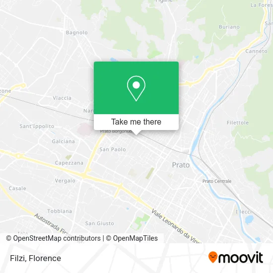
See Filzi, Prato, on the map
Public Transit to Filzi in Prato
Wondering how to get to Filzi in Prato? Moovit helps you find the best way to get to Filzi with step-by-step directions from the nearest public transit station.
Moovit provides free maps and live directions to help you navigate through your city. View schedules, routes, timetables, and find out how long does it take to get to Filzi in real time.
Looking for the nearest stop or station to Filzi? Check out this list of stops closest to your destination: Filzi 7; Pistoiese 22; Speri; Prato Porta Al Serraglio; Prato Central.
Bus: 1+, 207, SC, 11.Train: R.
Want to see if there’s another route that gets you there at an earlier time? Moovit helps you find alternative routes or times. Get directions from and directions to Filzi easily from the Moovit App or Website.
We make riding to Filzi easy, which is why over 1.5 million users, including users in Prato, trust Moovit as the best app for public transit. You don’t need to download an individual bus app or train app, Moovit is your all-in-one transit app that helps you find the best bus time or train time available.
For information on prices of bus and train, costs and ride fares to Filzi, please check the Moovit app.
Use the app to navigate to popular places including to the airport, hospital, stadium, grocery store, mall, coffee shop, school, college, and university.
Filzi Address: Via Fabio Filzi, 116 59100 Prato street in Prato
- Video 2000 Group,
- Via Fabio Filzi, 83,
- Andrei,
- Puggelli Adult Footwear,
- JLD Music Bar,
- Opificium,
- Puggelli Shoes,
- Mercatino Sky of Jin Xianqiao,
- Nan Hotpot Prato,
- Hao XI Hao,
- Macao Game Room by Huang Jianbo & C.,
- Frati & Frati by Furio Frati & Co.,
- Amazon Counter-Smart 24 Telecommunications,
- General Association of Italian-Chinese Commerce - Autonomous Section,
- Righini Massimo,
- Yipinjia,
- Vallenova di Quadrati Carlo Giuseppe & C.,
- CGIL Labor Chamber Prato,
- S.T.E.,
- Perri
Places Near Filzi (Prato)
- I Gigli, Campi Bisenzio,
- Nelson Mandela Forum, Florence,
- Piero Palagi Hospital Facility-Florence, Florence,
- Santa Maria Nuova Hospital, Florence,
- Michelangelo Square, Florence,
- IKEA Florence, Sesto Fiorentino,
- Field of Mars, Florence,
- Artemio Franchi Municipal Stadium, Florence,
- Cascine Park, Florence,
- Torregalli Hospital Scandicci *, Scandicci,
- OOO, Florence,
- Michelangelo Square, Florence,
- Verdi Theater, Florence,
- Tobacco Manufacture, Florence,
- Mandela Forum (Nelson Mandela Forum), Florence,
- Visarno Arena, Florence,
- Campi Bisenzio, Campi Bisenzio,
- Visarno Hippodrome, Florence,
- Asmana, Campi Bisenzio,
- Santa Maria Novella Station, Florence
How to get to popular places in Florence with public transit
Get around Prato by public transit!
Traveling around Prato has never been so easy. See step by step directions as you travel to any attraction, street or major public transit station. View bus and train schedules, arrival times, service alerts and detailed routes on a map, so you know exactly how to get to anywhere in Prato.
When traveling to any destination around Prato use Moovit's Live Directions with Get Off Notifications to know exactly where and how far to walk, how long to wait for your line, and how many stops are left. Moovit will alert you when it's time to get off — no need to constantly re-check whether yours is the next stop.
Wondering how to use public transit in Prato or how to pay for public transit in Prato? Moovit public transit app can help you navigate your way with public transit easily, and at minimum cost. It includes public transit fees, ticket prices, and costs. Looking for a map of Prato public transit lines? Moovit public transit app shows all public transit maps in Prato with all Bus, Train, Light Rail, Ferry and Funicular routes and stops on an interactive map.
Florence has 5 transit type(s), including: Bus, Train, Light Rail, Ferry and Funicular, operated by several transit agencies, including Florence Urban - Tuscan Bus Lines, GEST, Livorno and Province - Tuscan Bus Lines, Arezzo, Florence and Provinces - Tuscan Bus Lines, Prato and Province - Tuscan Bus Lines, Lucca and Province - Tuscan Bus Lines, Massa, Carrara and Province - Tuscan Bus Lines, Pisa and Province - Tuscan Bus Lines, Grosseto, Siena and Provinces - Tuscan Bus Lines, Arezzo, Siena and Provinces - Tuscan Bus Lines, Florence and Province - Tuscan Bus Lines, Pistoia and Province - Tuscan Bus Lines, Siena and Province - Tuscan Bus Lines, Arezzo and Province - Tuscan Bus Lines and Trenitalia