Directions to Fim Yapi L.S. (Nilüfer) with public transportation
The following transit lines have routes that pass near Fim Yapi L.S.
 Bus: 43A, B20A, B20B, B20C, B20D.
- Metro: 2, 3.
- Cable Car: PANAYIR - KENT MEYDANI, 6K1, ÇALI - KÜÇÜK SANAYI.
How to get to Fim Yapi L.S. by bus?
Click on the bus route to see step by step directions with maps, line arrival times and updated time schedules.
From Bursa Orhangazi Minubusu, Osmangazi
59 minFrom Atatürk Mesleki ve Teknik Anadolu Lisesi, Nilüfer
43 minFrom Emek Otobüs Durakları, Osmangazi
78 minFrom Akçalar Mahallesi, Osmangazi
43 minFrom 93/E Terminal - Uludağ Üniv., Nilüfer
49 minFrom Şükrü Şankaya Anadolu Lisesi, Osmangazi
46 minFrom Bursa Şevket Yılmaz Eğitim ve Araştırma Hastanesi, Nilüfer
48 minFrom Z Yolu, Yıldırım
56 minFrom Timurtaşpaşa Otobüs Durakları, Osmangazi
37 minFrom Bursa Jandarma K. Özel Harekat Tabur Komutanlığı (JÖH), Osmangazi
59 min
How to get to Fim Yapi L.S. by metro?
Click on the metro route to see step by step directions with maps, line arrival times and updated time schedules.
Bus stops near Fim Yapi L.S. in Nilüfer
Metro station near Fim Yapi L.S. in Nilüfer
- Fatih Sultan Mehmet, 16 min walk,VIEW
Cable Car station near Fim Yapi L.S. in Nilüfer
- 20. Sokak 22, 44 min walk,VIEW
Bus lines to Fim Yapi L.S. in Nilüfer
- B20A, Bursaspor Acemler İst.-Gümüştepe,VIEW
- B20B, Gümüştepe - Bursaspor Acemler İst.,VIEW
- B20C, Atatürk Kent Ormanı - Bursaspor Acemler İst.,VIEW
- B20D, B20d - Bursaspor Acemler İst. - Dağyenice,VIEW
- B20G, Bursaspor Acemler İst. - Gökçeören,VIEW
- 2E, Kültür Mh. - Ring,VIEW
- 2B, Bursaspor Acemler İst.-Doğancı,VIEW
- 2BT, Bursaspor Acemler İst. - Tuzaklı,VIEW
- B3, Kültür Mh. - Ring,VIEW
- B3K, B3k - Küçüksanayi İstasyonu Ring,VIEW
- 6F1, Acemler Aktarma Merkezi-Demirci,VIEW
What are the closest stations to Fim Yapi L.S.?
The closest stations to Fim Yapi L.S. are:
- Kavakdere Cd. 9 is 33 meters away, 1 min walk.
- Zafer Sk. 4 is 38 meters away, 1 min walk.
- Kavakdere Cd. 11 is 64 meters away, 2 min walk.
- Ata Cd. 20 is 69 meters away, 2 min walk.
- Çamlıca Mh. Muhtarlığı 2 is 272 meters away, 4 min walk.
- Fatih Sultan Mehmet is 1230 meters away, 16 min walk.
- 20. Sokak 22 is 3353 meters away, 44 min walk.
Which bus line stops near Fim Yapi L.S.?
43A (U.Ü. Öğrenci Yurdu - Murat Hüdavendigar Blv.)
Which metro lines stop near Fim Yapi L.S.?
These metro lines stop near Fim Yapi L.S.: 2, 3.
Which cable car line stops near Fim Yapi L.S.?
PANAYIR - KENT MEYDANI (Kent Meydanı (1.Hat))
What’s the nearest metro station to Fim Yapi L.S. in Nilüfer?
The nearest metro station to Fim Yapi L.S. in Nilüfer is Fatih Sultan Mehmet. It’s a 16 min walk away.
What’s the nearest bus station to Fim Yapi L.S. in Nilüfer?
The nearest bus stations to Fim Yapi L.S. in Nilüfer are Kavakdere Cd. 9 and Zafer Sk. 4. The closest one is a 1 min walk away.
What time is the first metro to Fim Yapi L.S. in Nilüfer?
The 2 is the first metro that goes to Fim Yapi L.S. in Nilüfer. It stops nearby at 5:32 AM.
What time is the last metro to Fim Yapi L.S. in Nilüfer?
The 2 is the last metro that goes to Fim Yapi L.S. in Nilüfer. It stops nearby at 3:17 AM.
What time is the first bus to Fim Yapi L.S. in Nilüfer?
The B20A is the first bus that goes to Fim Yapi L.S. in Nilüfer. It stops nearby at 6:21 AM.
What time is the last bus to Fim Yapi L.S. in Nilüfer?
The B20A is the last bus that goes to Fim Yapi L.S. in Nilüfer. It stops nearby at 12:21 AM.
What time is the first cable car to Fim Yapi L.S. in Nilüfer?
The ÇALI - KÜÇÜK SANAYI is the first cable car that goes to Fim Yapi L.S. in Nilüfer. It stops nearby at 6:33 AM.
What time is the last cable car to Fim Yapi L.S. in Nilüfer?
The ÇALI - KÜÇÜK SANAYI is the last cable car that goes to Fim Yapi L.S. in Nilüfer. It stops nearby at 12:18 AM.
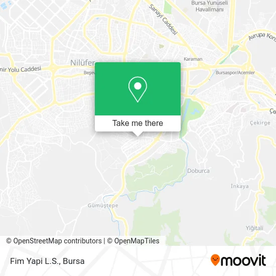
See Fim Yapi L.S., Nilüfer, on the map
Public Transit to Fim Yapi L.S. in Nilüfer
Wondering how to get to Fim Yapi L.S. in Nilüfer? Moovit helps you find the best way to get to Fim Yapi L.S. with step-by-step directions from the nearest public transit station.
Moovit provides free maps and live directions to help you navigate through your city. View schedules, routes, timetables, and find out how long does it take to get to Fim Yapi L.S. in real time.
Looking for the nearest stop or station to Fim Yapi L.S.? Check out this list of stops closest to your destination: Kavakdere Cd. 9; Zafer Sk. 4; Kavakdere Cd. 11; Ata Cd. 20; Çamlıca Mh. Muhtarlığı 2; Fatih Sultan Mehmet; 20. Sokak 22.
Bus: 43A, B20A, B20B, B20C, B20D, B20G, 2E, B3, B3K, 2B, 2BT.Metro: 2, 3.Cable Car: PANAYIR - KENT MEYDANI, 6K1, ÇALI - KÜÇÜK SANAYI.
Want to see if there’s another route that gets you there at an earlier time? Moovit helps you find alternative routes or times. Get directions from and directions to Fim Yapi L.S. easily from the Moovit App or Website.
We make riding to Fim Yapi L.S. easy, which is why over 1.5 million users, including users in Nilüfer, trust Moovit as the best app for public transit. You don’t need to download an individual bus app or train app, Moovit is your all-in-one transit app that helps you find the best bus time or train time available.
For information on prices of metro, bus and cable car, costs and ride fares to Fim Yapi L.S., please check the Moovit app.
Use the app to navigate to popular places including to the airport, hospital, stadium, grocery store, mall, coffee shop, school, college, and university.
Fim Yapi L.S. Address: Kavakdere Caddesi, 16260 Çamlıca, Nilüfer street in Nilüfer
- NIRVANA AJANS MATBAA TABELA,
- Konak Eğitimciler Cad.,
- Fuat Bakgör Aile Sağlığı Merkezi,
- Gökkaya sitesi,
- Akdenız Doner,
- Bursa Akvaryum Balık,
- Kervan Dondurma,
- Carrefour Starbucks,
- Seferışıklar köyü,
- Çamlıca,
- Vet Et Kasap,
- Eltam Elektrik,
- Kavakdere Caddesi,
- Hazal Unlu Manülleri,
- Çalimca,
- Profilo Yetkili Servisi,
- Manola Evleri,
- Çamlıca Mah Kavakdere Cad Gül Sitesi,
- Onur Market,
- Peyhane Patisserie
Places Near Fim Yapi L.S. (Nilüfer)
- Bursa Hayvanat Bahçesi, Osmangazi,
- Sur Yapı Marka Avm, Osmangazi,
- FSM Bulvarı, Nilüfer,
- Dörtçelik Çocuk Hastanesi, Nilüfer,
- Şehir Hastanesi, Nilüfer,
- Bursa Cumalıkızık Köyü, Osmangazi,
- Bursa, Osmangazi,
- Çekirge Devlet Hastanesi Otobüs Durağı, Osmangazi,
- Nilüfer Ağız ve Diş Sağlığı Merkezi, Nilüfer,
- bursa mudanya, Mudanya,
- Bursa Yüksek İhtisas Eğitim ve Araştırma Hastanesi Nilüfer Ek Binası, Nilüfer,
- ÖzdilekPark Bursa Nilüfer, Nilüfer,
- Mustafakemalpaşa Karacabey Dolmuş Durağı, Mustafakemalpaşa,
- Millet Mahallesi,
- Şevket Yılmaz Eğitim ve Araştırma Hastanesi, Yıldırım,
- Ali Osman Sönmez Onkoloji Hastanesi, Osmangazi,
- Podyum Park, Nilüfer,
- Sur Yapı Marka, Nilüfer,
- Bursa Terminal, Nilüfer,
- Bursa Teleferik, Yıldırım
How to get to popular places in Bursa with public transit
Get around Nilüfer by public transit!
Traveling around Nilüfer has never been so easy. See step by step directions as you travel to any attraction, street or major public transit station. View bus and train schedules, arrival times, service alerts and detailed routes on a map, so you know exactly how to get to anywhere in Nilüfer.
When traveling to any destination around Nilüfer use Moovit's Live Directions with Get Off Notifications to know exactly where and how far to walk, how long to wait for your line, and how many stops are left. Moovit will alert you when it's time to get off — no need to constantly re-check whether yours is the next stop.
Wondering how to use public transit in Nilüfer or how to pay for public transit in Nilüfer? Moovit public transit app can help you navigate your way with public transit easily, and at minimum cost. It includes public transit fees, ticket prices, and costs. Looking for a map of Nilüfer public transit lines? Moovit public transit app shows all public transit maps in Nilüfer with all Bus, Metro, Light Rail, Cable Car and Gondola routes and stops on an interactive map.
Bursa has 5 transit type(s), including: Bus, Metro, Light Rail, Cable Car and Gondola, operated by several transit agencies, including BursaRay, BurTram, BBBUS, Burulaş, Minibüs, İlçe Otobüsleri and Bursa Teleferik