How to get to Finca Chaparral by bus?
Click on the bus route to see step by step directions with maps, line arrival times and updated time schedules.
Bus stop near Finca Chaparral in Manzanares El Real
- Manzanares El Real - Gta. El Montañero, 27 min walk,VIEW
Bus lines to Finca Chaparral in Manzanares El Real
What are the closest stations to Finca Chaparral?
The closest stations to Finca Chaparral are:
- Manzanares El Real - Gta. El Montañero is 2082 meters away, 27 min walk.
Which bus lines stop near Finca Chaparral?
These bus lines stop near Finca Chaparral: 720, 724.
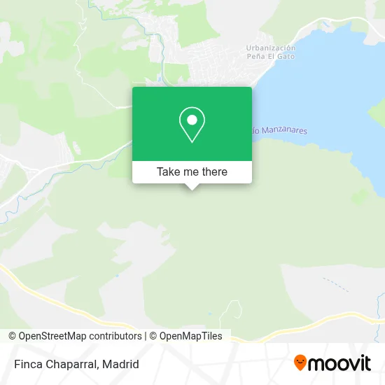
See Finca Chaparral, Manzanares El Real, on the map
Public Transit to Finca Chaparral in Manzanares El Real
Wondering how to get to Finca Chaparral in Manzanares El Real? Moovit helps you find the best way to get to Finca Chaparral with step-by-step directions from the nearest public transit station.
Moovit provides free maps and live directions to help you navigate through your city. View schedules, routes, timetables, and find out how long does it take to get to Finca Chaparral in real time.
Looking for the nearest stop or station to Finca Chaparral? Check out this list of stops closest to your destination: Manzanares El Real - Gta. El Montañero.
Bus: 720, 724, 728, LANZADERA.
Want to see if there’s another route that gets you there at an earlier time? Moovit helps you find alternative routes or times. Get directions from and directions to Finca Chaparral easily from the Moovit App or Website.
We make riding to Finca Chaparral easy, which is why over 1.5 million users, including users in Manzanares El Real, trust Moovit as the best app for public transit. You don’t need to download an individual bus app or train app, Moovit is your all-in-one transit app that helps you find the best bus time or train time available.
For information on prices of bus, costs and ride fares to Finca Chaparral, please check the Moovit app.
Use the app to navigate to popular places including to the airport, hospital, stadium, grocery store, mall, coffee shop, school, college, and university.
Finca Chaparral Address: 28410 Manzanares El Real street in Manzanares El Real
- Embalse de Manzanares el Real o Santillana,
- 13-58,
- Caenpa S.L. B88383237,
- Funeraria Nuestra SeñOra de los Remedios. Tanatorio Manzanares El Real,
- 1358,
- Cementerio Municipal De Manzanares El Real,
- 13-58 (Discoteca 13-58),
- Río Samburiel,
- 13lounge,
- Segresco,
- Aparcamiento Municipal,
- Canroman Sierra Norte,
- Pascual Guijarro Ines,
- American Expres,
- Escape Room la Mazmorra Mental,
- Garcia Palomino Pablo,
- Punto de carga para vehículos eléctricos,
- La Rueca,
- Albera Medio Ambiente,
- Baco Music
Places Near Finca Chaparral (Manzanares El Real)
- Calle de López de Hoyos 169, Madrid,
- Tres Aguas, Alcorcón,
- Nassica, Área Metropolitana De Madrid Y Corredor Del Henares,
- Hospital Clínico Universitario San Carlos, Madrid,
- Plenilunio, Área Metropolitana De Madrid Y Corredor Del Henares,
- Plaza Mayor, Madrid,
- Rastro De Madrid, Área Metropolitana De Madrid Y Corredor Del Henares,
- Sala La Riviera, Madrid,
- Centro Comercial La Gavia, Área Metropolitana De Madrid Y Corredor Del Henares,
- Estacion de Chamartin, Madrid,
- Mendez Alvaro, Madrid,
- Mercadillo de Majadahonda, Majadahonda,
- Centro Comercial Oasiz Madrid, Área Metropolitana De Madrid Y Corredor Del Henares,
- Wizink Center, Madrid,
- Estadio Wanda Metropolitano, Área Metropolitana De Madrid Y Corredor Del Henares,
- Centro Comercial La Vaguada, Área Metropolitana De Madrid Y Corredor Del Henares,
- Palacio De Vistalegre, Área Metropolitana De Madrid Y Corredor Del Henares,
- Hospital Universitario La Paz, Madrid,
- Hospital Universitario Ramón y Cajal, Madrid,
- Centro Comercial Islazul, Área Metropolitana De Madrid Y Corredor Del Henares
How to get to popular places in Madrid with public transit
Get around Manzanares El Real by public transit!
Traveling around Manzanares El Real has never been so easy. See step by step directions as you travel to any attraction, street or major public transit station. View bus and train schedules, arrival times, service alerts and detailed routes on a map, so you know exactly how to get to anywhere in Manzanares El Real.
When traveling to any destination around Manzanares El Real use Moovit's Live Directions with Get Off Notifications to know exactly where and how far to walk, how long to wait for your line, and how many stops are left. Moovit will alert you when it's time to get off — no need to constantly re-check whether yours is the next stop.
Wondering how to use public transit in Manzanares El Real or how to pay for public transit in Manzanares El Real? Moovit public transit app can help you navigate your way with public transit easily, and at minimum cost. It includes public transit fees, ticket prices, and costs. Looking for a map of Manzanares El Real public transit lines? Moovit public transit app shows all public transit maps in Manzanares El Real with all Bus, Train, Metro and Light Rail routes and stops on an interactive map.
Madrid has 4 transit type(s), including: Bus, Train, Metro and Light Rail, operated by several transit agencies, including Metro de Madrid, Metro Ligero, Tranvía de Parla, Renfe Cercanías - Servicios de Autobús especiales, Renfe Cercanias, Renfe Cercanías, EMT, Interurbanos, Urbanos de Alcalá de Henares, Urbanos de Alcobendas, Urbanos de Alcorcón, Urbanos de Algete, Urbanos de Aranjuez, Urbanos de Arganda del Rey and Urbanos de Arroyomolinos