How to get to End of the Road by bus?
Click on the bus route to see step by step directions with maps, line arrival times and updated time schedules.
From Esselunga Supermarkets, Pisa
40 minFrom Md Barbantini Medical Care Center, Lucca
87 minFrom Santa Zita Care Home, Lucca
81 minFrom Le Piagge, Pisa
36 minFrom IKEA, Pisa
59 minFrom Don Franco Baroni Square, Lucca
88 minFrom San Luca Hospital, Lucca
96 minFrom Campo di Marte Health Citadel, Lucca
200 minFrom The Tower, Pisa
74 minFrom Decathlon, Farmhouse
99 min
How to get to End of the Road by train?
Click on the train route to see step by step directions with maps, line arrival times and updated time schedules.
Bus stop near End of the Road in San Giuliano Terme
- Asciano Trieste Church, 6 min walk,VIEW
Train station near End of the Road in San Giuliano Terme
- San Giuliano Terme, 51 min walk,VIEW
Bus lines to End of the Road in San Giuliano Terme
- 110, Agnano,VIEW
What are the closest stations to End of the Road?
The closest stations to End of the Road are:
- Asciano Trieste Church is 398 meters away, 6 min walk.
- San Giuliano Terme is 3966 meters away, 51 min walk.
Which bus lines stop near End of the Road?
These bus lines stop near End of the Road: 110, 60, E3.
Which train line stops near End of the Road?
R (Pistoia/Pisa)
What’s the nearest bus station to End of the Road in San Giuliano Terme?
The nearest bus station to End of the Road in San Giuliano Terme is Asciano Trieste Church. It’s a 6 min walk away.
What time is the first train to End of the Road in San Giuliano Terme?
The R is the first train that goes to End of the Road in San Giuliano Terme. It stops nearby at 5:37 AM.
What time is the last train to End of the Road in San Giuliano Terme?
The R is the last train that goes to End of the Road in San Giuliano Terme. It stops nearby at 10:01 PM.
What time is the first bus to End of the Road in San Giuliano Terme?
The 110 is the first bus that goes to End of the Road in San Giuliano Terme. It stops nearby at 8:07 AM.
What time is the last bus to End of the Road in San Giuliano Terme?
The 110 is the last bus that goes to End of the Road in San Giuliano Terme. It stops nearby at 8:00 PM.
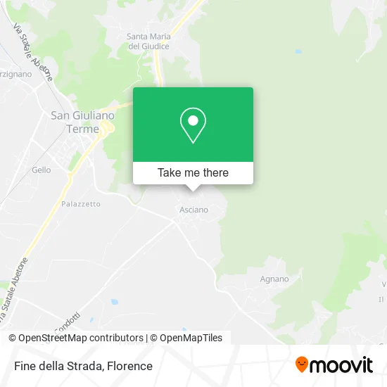
See End of the Road, San Giuliano Terme, on the map
Public Transit to End of the Road in San Giuliano Terme
Wondering how to get to End of the Road in San Giuliano Terme? Moovit helps you find the best way to get to End of the Road with step-by-step directions from the nearest public transit station.
Moovit provides free maps and live directions to help you navigate through your city. View schedules, routes, timetables, and find out how long does it take to get to End of the Road in real time.
Looking for the nearest stop or station to End of the Road? Check out this list of stops closest to your destination: Asciano Trieste Church; San Giuliano Terme.
Bus: 110, 60, E3.Train: R.
Want to see if there’s another route that gets you there at an earlier time? Moovit helps you find alternative routes or times. Get directions from and directions to End of the Road easily from the Moovit App or Website.
We make riding to End of the Road easy, which is why over 1.5 million users, including users in San Giuliano Terme, trust Moovit as the best app for public transit. You don’t need to download an individual bus app or train app, Moovit is your all-in-one transit app that helps you find the best bus time or train time available.
For information on prices of bus and train, costs and ride fares to End of the Road, please check the Moovit app.
Use the app to navigate to popular places including to the airport, hospital, stadium, grocery store, mall, coffee shop, school, college, and university.
End of the Road Address: Via di Ragnaia, 56017 San Giuliano Terme street in San Giuliano Terme
- Alga by Biagini & C.,
- Promo Races,
- Toscana Green Energy,
- L. Rosati Elementary School,
- Villa Lungomonte,
- Saint John the Baptist Church,
- Paradisino,
- San Giovanni Battista Parish of Asciano,
- Asciano Parish Circle,
- CSI - Italian Sports Center,
- Anffas Association of Intellectual and Relational Disabilities of Pisa,
- Carrefour Express,
- Simply Point,
- Amazon Locker-Libiano,
- Fulceri Bar,
- Rossi Alessandro,
- Pasero Marco,
- Enrico Pifferi Square,
- La Faeta Bar - Scarsi,
- Coli Maimo
Places Near End of the Road (San Giuliano Terme)
- Tobacco Manufacture, Florence,
- Asmana, Campi Bisenzio,
- Santa Maria Novella Station, Florence,
- Mandela Forum (Nelson Mandela Forum), Florence,
- Michelangelo Square, Florence,
- Santa Maria Nuova Hospital, Florence,
- Piero Palagi Hospital Facility-Florence, Florence,
- Visarno Hippodrome, Florence,
- Nelson Mandela Forum, Florence,
- Visarno Arena, Florence,
- Cascine Park, Florence,
- Field of Mars, Florence,
- Torregalli Hospital Scandicci *, Scandicci,
- IKEA Florence, Sesto Fiorentino,
- OOO, Florence,
- Michelangelo Square, Florence,
- Campi Bisenzio, Campi Bisenzio,
- Artemio Franchi Municipal Stadium, Florence,
- Verdi Theater, Florence,
- I Gigli, Campi Bisenzio
How to get to popular places in Florence with public transit
Get around San Giuliano Terme by public transit!
Traveling around San Giuliano Terme has never been so easy. See step by step directions as you travel to any attraction, street or major public transit station. View bus and train schedules, arrival times, service alerts and detailed routes on a map, so you know exactly how to get to anywhere in San Giuliano Terme.
When traveling to any destination around San Giuliano Terme use Moovit's Live Directions with Get Off Notifications to know exactly where and how far to walk, how long to wait for your line, and how many stops are left. Moovit will alert you when it's time to get off — no need to constantly re-check whether yours is the next stop.
Wondering how to use public transit in San Giuliano Terme or how to pay for public transit in San Giuliano Terme? Moovit public transit app can help you navigate your way with public transit easily, and at minimum cost. It includes public transit fees, ticket prices, and costs. Looking for a map of San Giuliano Terme public transit lines? Moovit public transit app shows all public transit maps in San Giuliano Terme with all Bus, Train, Light Rail, Ferry and Funicular routes and stops on an interactive map.
Florence has 5 transit type(s), including: Bus, Train, Light Rail, Ferry and Funicular, operated by several transit agencies, including Florence Urban - Tuscan Bus Lines, GEST, Livorno and Province - Tuscan Bus Lines, Arezzo, Florence and Provinces - Tuscan Bus Lines, Prato and Province - Tuscan Bus Lines, Lucca and Province - Tuscan Bus Lines, Massa, Carrara and Province - Tuscan Bus Lines, Pisa and Province - Tuscan Bus Lines, Grosseto, Siena and Provinces - Tuscan Bus Lines, Arezzo, Siena and Provinces - Tuscan Bus Lines, Florence and Province - Tuscan Bus Lines, Pistoia and Province - Tuscan Bus Lines, Siena and Province - Tuscan Bus Lines, Arezzo and Province - Tuscan Bus Lines and Trenitalia