Directions to Fios Em Formas (São Lourenço Da Mata) with public transportation
The following transit lines have routes that pass near Fios Em Formas
How to get to Fios Em Formas by bus?
Click on the bus route to see step by step directions with maps, line arrival times and updated time schedules.
From Parque Dois Irmãos, Dois Irmãos
35 minFrom Avenida Caxangá, Caxangá
49 minFrom Arena de Pernambuco, São Lourenço Da Mata
25 minFrom Av. Afonso Olindense, Várzea
54 minFrom Estação Rodoviária do Recife, Várzea
22 minFrom Zoológico Dois Irmãos, Dois Irmãos
36 minFrom Culto de Oração Irmã Isabel, Várzea
57 minFrom Caxangá, Caxangá
54 min
Bus stops near Fios Em Formas in São Lourenço Da Mata
Bus lines to Fios Em Formas in São Lourenço Da Mata
- 14.002 RECIFE - PAUDALHO, Recife - Paudalho,VIEW
- 14.003 RECIFE - FEIRA NOVA, Recife - Feira Nova,VIEW
- 14.004 RECIFE - CARPINA, Recife - Carpina,VIEW
- 14.005 RECIFE - LIMOEIRO, Recife - Limoeiro,VIEW
- 14.006 RECIFE - SURUBIM, Recife - Surubim,VIEW
- 14.008 RECIFE - SALGADINHO, Recife - Salgadinho,VIEW
- 14.009 RECIFE - UMBURETAMA, Recife - Umburetama,VIEW
- 14.010 RECIFE - NAZARÉ DA MATA, Recife - Nazaré da Mata,VIEW
- 14.017 RECIFE - TIMBAÚBA, Recife - Timbaúba,VIEW
- 815 CAMARAGIBE X CHÃ DE ALEGRIA, Camaragibe (Convencional),VIEW
- 821 RECIFE X CUMARU, Recife (Dantas Barreto - Convencional),VIEW
What are the closest stations to Fios Em Formas?
The closest stations to Fios Em Formas are:
- Av. Dr. Belmino Correia, 1 | Comercial Daterra is 484 meters away, 7 min walk.
- Av. Dr. Francisco Correia, 309 | Banco Itaú is 910 meters away, 12 min walk.
Which bus lines stop near Fios Em Formas?
These bus lines stop near Fios Em Formas: 2402 PARQUE CAPIBARIBE / CAXANGÁ, 2410 PARQUE CAPIBARIBE / TI TIP.
What’s the nearest bus station to Fios Em Formas in São Lourenço Da Mata?
The nearest bus station to Fios Em Formas in São Lourenço Da Mata is Av. Dr. Belmino Correia, 1 | Comercial Daterra. It’s a 7 min walk away.
What time is the first bus to Fios Em Formas in São Lourenço Da Mata?
The 2457 SÃO LOURENÇO (BACURAU) is the first bus that goes to Fios Em Formas in São Lourenço Da Mata. It stops nearby at 3:02 AM.
What time is the last bus to Fios Em Formas in São Lourenço Da Mata?
The 2457 SÃO LOURENÇO (BACURAU) is the last bus that goes to Fios Em Formas in São Lourenço Da Mata. It stops nearby at 3:33 AM.
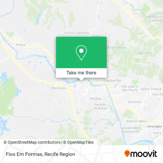
See Fios Em Formas, São Lourenço Da Mata, on the map
Public Transit to Fios Em Formas in São Lourenço Da Mata
Wondering how to get to Fios Em Formas in São Lourenço Da Mata? Moovit helps you find the best way to get to Fios Em Formas with step-by-step directions from the nearest public transit station.
Moovit provides free maps and live directions to help you navigate through your city. View schedules, routes, timetables, and find out how long does it take to get to Fios Em Formas in real time.
Looking for the nearest stop or station to Fios Em Formas? Check out this list of stops closest to your destination: Av. Dr. Belmino Correia; Av. Dr. Francisco Correia.
Bus: 2402 PARQUE CAPIBARIBE / CAXANGÁ, 2410 PARQUE CAPIBARIBE / TI TIP, 14.002 RECIFE - PAUDALHO, 14.003 RECIFE - FEIRA NOVA, 14.004 RECIFE - CARPINA, 14.005 RECIFE - LIMOEIRO, 14.006 RECIFE - SURUBIM, 815 CAMARAGIBE X CHÃ DE ALEGRIA, 821 RECIFE X CUMARU.
Want to see if there’s another route that gets you there at an earlier time? Moovit helps you find alternative routes or times. Get directions from and directions to Fios Em Formas easily from the Moovit App or Website.
We make riding to Fios Em Formas easy, which is why over 1.7 million users, including users in São Lourenço Da Mata, trust Moovit as the best app for public transit. You don’t need to download an individual bus app or train app, Moovit is your all-in-one transit app that helps you find the best bus time or train time available.
For information on prices of bus and subway, costs and ride fares to Fios Em Formas, please check the Moovit app.
Use the app to navigate to popular places including to the airport, hospital, stadium, grocery store, mall, coffee shop, school, college, and university.
Fios Em Formas Address: Avenida Prefeito Mário H. Mafra, Sao Lourenço da Mata São Lourenço da Mata-PE 54720-001 street in São Lourenço Da Mata
- Açaí Prediletto,
- Estrada Do Tip,
- Hospital petronila campos,
- Armazém Luiz e Família,
- Restaurante Bar 9&5,
- Adriana Salgados,
- Escola Técnica Estadual Alcides do nascimento Lins,
- Rua 24,
- Assigos,
- Batata Top Delivery,
- Spezzato Teen,
- Consulttab Assessoria Contábil,
- São Lourenço da Mata, Centro,
- Todo dia Sao Lourenco,
- Ginásio de Esportes O Pereirão,
- Viaduto de São Lourenço,
- Rhuan Víctor da Mata,
- 20º Batalhão de Policia Militar,
- Rua Frei Caneca 301/307,
- Parque Capibaribe
Places Near Fios Em Formas (São Lourenço Da Mata)
- tuuuuu, Olinda,
- Imip (Instituto Materno-Infantil De Pernambuco), Coelhos,
- Shopping Recife, Boa Viagem,
- Centro de Convenções de Pernambuco, Olinda,
- Parque da Jaqueira, Jaqueira,
- Imbiribeira, Imbiribeira,
- llll, Fundão,
- Shopping Patteo Olinda, Olinda,
- Marco Zero, Bairro Do Recife,
- SHOPPING GUARARAPES, Jaboatão Dos Guararapes,
- Hospital Maria Lucinda, Parnamirim,
- Arena de Pernambuco, São Lourenço Da Mata,
- Hospital Universitário Oswaldo Cruz, Santo Amaro,
- Hospital Geral De Areias, Areias,
- Hospital Agamenon Magalhães, Tamarineira,
- SHOPPING TACARUNA, Santo Amaro,
- Hospital Eduardo Campus Da Pessoa Idosa, Areias,
- Hospital Altino Ventura, Iputinga,
- Shopping RioMar Recife, Pina,
- hospital otavio de freitas - UTI, Tejipió
How to get to popular places in Recife Region with public transit
Get around São Lourenço Da Mata by public transit!
Traveling around São Lourenço Da Mata has never been so easy. See step by step directions as you travel to any attraction, street or major public transit station. View bus and train schedules, arrival times, service alerts and detailed routes on a map, so you know exactly how to get to anywhere in São Lourenço Da Mata.
When traveling to any destination around São Lourenço Da Mata use Moovit's Live Directions with Get Off Notifications to know exactly where and how far to walk, how long to wait for your line, and how many stops are left. Moovit will alert you when it's time to get off — no need to constantly re-check whether yours is the next stop.
Wondering how to use public transit in São Lourenço Da Mata or how to pay for public transit in São Lourenço Da Mata? Moovit public transit app can help you navigate your way with public transit easily, and at minimum cost. It includes public transit fees, ticket prices, and costs. Looking for a map of São Lourenço Da Mata public transit lines? Moovit public transit app shows all public transit maps in São Lourenço Da Mata with all Bus, Train, Subway and Ferry routes and stops on an interactive map.
Recife Region has 4 transit type(s), including: Bus, Train, Subway and Ferry, operated by several transit agencies, including CBTU (Metrorec), BORBOREMA IMPERIAL (TIP), BORBOREMA IMPERIAL (B.V), RODOVIÁRIA POTENGY, EMPRESA METROPOLITANA, CONSÓRCIO RECIFE, SÃO JUDAS TADEU, Expresso 1002, Rodotur Turismo, Complementar Recife, Sistema Municipal - Jaboatão, Sistema Municipal - Cabo, Sistema Municipal - Ipojuca, Rodoviária Borborema and Auto Viação Progresso