How to get to First Bank by bus?
Click on the bus route to see step by step directions with maps, line arrival times and updated time schedules.
From Lake Worth Tri Rail Station, Lake Worth
75 minFrom Greenacres, FL, Lake Worth
102 minFrom Amazon Fulfillment Center-DMI7, West Palm Beach
91 minFrom John I. Leonard High School, Lake Worth
83 minFrom Forest Hill Community High School, West Palm Beach
55 minFrom Tanger Outlets Palm Beach, West Palm Beach
67 minFrom Palm Beach State College, Lake Worth
87 minFrom Keiser University-West Palm Beach, Royal Palm Beach-West Jupiter
80 minFrom West Palm Beach Palm Beach Airport PBI, West Palm Beach
57 minFrom 1661B South Congress Avenue, Lake Worth
69 min
How to get to First Bank by train?
Click on the train route to see step by step directions with maps, line arrival times and updated time schedules.
Bus stop near First Bank in West Palm Beach
- ROYAL PALM WAY at S CNTY RD, 8 min walk,VIEW
Train stations near First Bank in West Palm Beach
Bus lines to First Bank in West Palm Beach
- 41, Rt 41 Southbound,VIEW
What are the closest stations to First Bank?
The closest stations to First Bank are:
- ROYAL PALM WAY at S CNTY RD is 626 yards away, 8 min walk.
- West Palm Beach is 2662 yards away, 32 min walk.
- West Palm Beach Amtrak Station is 2964 yards away, 35 min walk.
- West Palm Beach Station is 3026 yards away, 37 min walk.
Which bus lines stop near First Bank?
These bus lines stop near First Bank: 1, 44.
Which train line stops near First Bank?
TRIRAIL (Northbound To Mangonia Park)
What’s the nearest bus station to First Bank in West Palm Beach?
The nearest bus station to First Bank in West Palm Beach is ROYAL PALM WAY at S CNTY RD. It’s a 8 min walk away.
What time is the first train to First Bank in West Palm Beach?
The TRIRAIL is the first train that goes to First Bank in West Palm Beach. It stops nearby at 3:56 AM.
What time is the last train to First Bank in West Palm Beach?
The FLORIDIAN is the last train that goes to First Bank in West Palm Beach. It stops nearby at 4:16 PM.
What time is the first bus to First Bank in West Palm Beach?
The 41 is the first bus that goes to First Bank in West Palm Beach. It stops nearby at 6:46 AM.
What time is the last bus to First Bank in West Palm Beach?
The 41 is the last bus that goes to First Bank in West Palm Beach. It stops nearby at 5:09 PM.
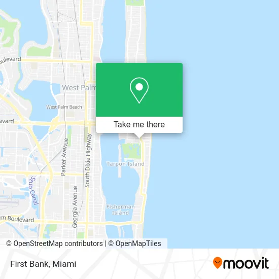
See First Bank, West Palm Beach, on the map
Public Transit to First Bank in West Palm Beach
Wondering how to get to First Bank in West Palm Beach? Moovit helps you find the best way to get to First Bank with step-by-step directions from the nearest public transit station.
Moovit provides free maps and live directions to help you navigate through your city. View schedules, routes, timetables, and find out how long does it take to get to First Bank in real time.
Looking for the nearest stop or station to First Bank? Check out this list of stops closest to your destination: ROYAL PALM WAY at S CNTY RD; West Palm Beach; West Palm Beach Amtrak Station; West Palm Beach Station.
Bus: 1, 44, 41.Train: TRIRAIL, BLFM, FLORIDIAN, SILVER METEOR.
Want to see if there’s another route that gets you there at an earlier time? Moovit helps you find alternative routes or times. Get directions from and directions to First Bank easily from the Moovit App or Website.
We make riding to First Bank easy, which is why over 1.5 million users, including users in West Palm Beach, trust Moovit as the best app for public transit. You don’t need to download an individual bus app or train app, Moovit is your all-in-one transit app that helps you find the best bus time or train time available.
For information on prices of bus and train, costs and ride fares to First Bank, please check the Moovit app.
Use the app to navigate to popular places including to the airport, hospital, stadium, grocery store, mall, coffee shop, school, college, and university.
First Bank Address: 205 Worth Ave Palm Beach, FL 33480 street in West Palm Beach
- NV Realty Group,
- Greenwich Movie Studios,
- Palm Beach Real Estate Team,
- TRH Management,
- Alysia Wolfskeil,
- Avesta Palm Beach LLC,
- Blue Heron Press,
- Burns Sarah,
- Palm Beach Insurance,
- Galerie Werner,
- Mirror Mirror Beauty,
- Paillot Equine Consulting,
- Craig Stein,
- Mirror Mirror Imagination Group,
- PBI Travel,
- Kim Renk,
- Jaeger-Lecoultre,
- Jewels in Time,
- Your Sparkling Event,
- Custom Crating
Places Near First Bank (West Palm Beach)
- Aventura Mall, Miami,
- Dolphin Mall Bus, Miami,
- Wynwood, Miami,
- Port of Miami Cruise Terminal, Miami,
- Little Havana, Miami,
- Brickell City Centre, Miami,
- Miami Design District, Miami,
- Keiser University Flagship Campus, West Palm Beach,
- Aventura Mall, Miami Beach,
- Miami Freedom Park, Miami,
- Hard Rock Stadium, Miami Gardens,
- Bayside Marketplace, Miami,
- Dolphin Mall, Miami,
- Sawgrass Mall, Miami,
- Sawgrass mall ( FL ), Miami Beach,
- Zoo Miami, Miami,
- Marlins Park, Miami,
- Miami-Dade County Courthouse, Miami,
- Richard E. Gerstein Justice Building, Miami,
- Miami VA Hospital, Miami
How to get to popular places in Miami with public transit
Get around West Palm Beach by public transit!
Traveling around West Palm Beach has never been so easy. See step by step directions as you travel to any attraction, street or major public transit station. View bus and train schedules, arrival times, service alerts and detailed routes on a map, so you know exactly how to get to anywhere in West Palm Beach.
When traveling to any destination around West Palm Beach use Moovit's Live Directions with Get Off Notifications to know exactly where and how far to walk, how long to wait for your line, and how many stops are left. Moovit will alert you when it's time to get off — no need to constantly re-check whether yours is the next stop.
Wondering how to use public transit in West Palm Beach or how to pay for public transit in West Palm Beach? Moovit public transit app can help you navigate your way with public transit easily, and at minimum cost. It includes public transit fees, ticket prices, and costs. Looking for a map of West Palm Beach public transit lines? Moovit public transit app shows all public transit maps in West Palm Beach with all Bus, Train, Light Rail and Ferry routes and stops on an interactive map.
Miami has 4 transit type(s), including: Bus, Train, Light Rail and Ferry, operated by several transit agencies, including Broward County Transit, Miami-Dade Transit, Metrorail, Palm Tran, Tri-Rail, Brightline, MARTY, City of Homestead Trolley, Key West Transit, Treasure Coast Connector, GoLine IRT, Amtrak, Greyhound-us, FlixBus-us and Aventura Express Shuttle Bus