How to get to First Baptist Church by bus?
Click on the bus route to see step by step directions with maps, line arrival times and updated time schedules.
From Fort Lauderdale-Hollywood International Airport (FLL) (Fort Lauderdale-Hollywood International Airpo, Hollywood
56 minFrom Kamal Singh, Plantation
71 minFrom Fort Lauderdale Cruise Terminal, Fort Lauderdale
62 minFrom Embassy Suites-Fort Lauderdale (Embassy Suites by Hilton Fort Lauderdale 17th Street), Fort Lauderdale
48 minFrom Amazon Fulfillment Center-DMF3, Pompano Beach
86 minFrom 95 Express Bus Stop, Fort Lauderdale
56 minFrom Lauderhill Mall, Plantation
51 minFrom Margate, FL, Coral Springs-Margate
75 minFrom Swap Shop, Fort Lauderdale
47 minFrom Red Carpet Inn Fort Lauderdale Airport / Cruise Port, Hollywood
54 min
Bus stops near First Baptist Church in Fort Lauderdale
Train station near First Baptist Church in Fort Lauderdale
- Cypress Creek Station, 49 min walk,VIEW
Bus lines to First Baptist Church in Fort Lauderdale
What are the closest stations to First Baptist Church?
The closest stations to First Baptist Church are:
- Dixie Highway/Northeast 34th Court is 503 yards away, 7 min walk.
- Oakland Park Boulevard/Northeast 10th Avenue is 656 yards away, 8 min walk.
- Cypress Creek Station is 4129 yards away, 49 min walk.
Which bus lines stop near First Baptist Church?
These bus lines stop near First Baptist Church: 50, 60, 72.
What’s the nearest bus station to First Baptist Church in Fort Lauderdale?
The nearest bus station to First Baptist Church in Fort Lauderdale is Dixie Highway/Northeast 34th Court. It’s a 7 min walk away.
What time is the first train to First Baptist Church in Fort Lauderdale?
The TRIRAIL is the first train that goes to First Baptist Church in Fort Lauderdale. It stops nearby at 4:38 AM.
What time is the last train to First Baptist Church in Fort Lauderdale?
The TRIRAIL is the last train that goes to First Baptist Church in Fort Lauderdale. It stops nearby at 10:43 PM.
What time is the first bus to First Baptist Church in Fort Lauderdale?
The 72 is the first bus that goes to First Baptist Church in Fort Lauderdale. It stops nearby at 5:12 AM.
What time is the last bus to First Baptist Church in Fort Lauderdale?
The 72 is the last bus that goes to First Baptist Church in Fort Lauderdale. It stops nearby at 1:23 AM.
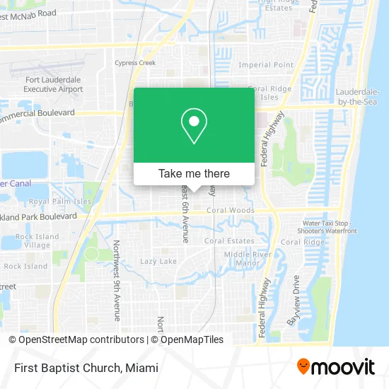
See First Baptist Church, Fort Lauderdale, on the map
Public Transit to First Baptist Church in Fort Lauderdale
Wondering how to get to First Baptist Church in Fort Lauderdale? Moovit helps you find the best way to get to First Baptist Church with step-by-step directions from the nearest public transit station.
Moovit provides free maps and live directions to help you navigate through your city. View schedules, routes, timetables, and find out how long does it take to get to First Baptist Church in real time.
Looking for the nearest stop or station to First Baptist Church? Check out this list of stops closest to your destination: Dixie Highway/Northeast 34th Court; Oakland Park Boulevard/Northeast 10th Avenue; Cypress Creek Station.
Bus: 50, 60, 72.Train: TRIRAIL.
Want to see if there’s another route that gets you there at an earlier time? Moovit helps you find alternative routes or times. Get directions from and directions to First Baptist Church easily from the Moovit App or Website.
We make riding to First Baptist Church easy, which is why over 1.5 million users, including users in Fort Lauderdale, trust Moovit as the best app for public transit. You don’t need to download an individual bus app or train app, Moovit is your all-in-one transit app that helps you find the best bus time or train time available.
For information on prices of bus and train, costs and ride fares to First Baptist Church, please check the Moovit app.
Use the app to navigate to popular places including to the airport, hospital, stadium, grocery store, mall, coffee shop, school, college, and university.
First Baptist Church Address: 801 NE 34th Ct Fort Lauderdale, FL 33334 street in Fort Lauderdale
- Drug Rehab Oakland Park,
- Capital Property Inspections,
- Shri Saraswati Devi Mandir - FHP,
- Mobile Web Nerd,
- Airbnb,
- Bonsai Wire Caddy,
- Fine Fit Medspa and Wellness,
- Moon Pizza Pie,
- Satellite Pinball Lounge,
- 855 Gallery Plaza,
- Lalo's,
- Health Mart Pharmacy,
- Cellular Plus Communications,
- Tradfax International,
- West Park Early Learning Center,
- Neuro Well,
- Sean Gentile,
- Olivum Tapas Bar,
- ADT 24-7 Monitoring & Home Security,
- Steven Camón
Places Near First Baptist Church (Fort Lauderdale)
- Bayside Marketplace, Miami,
- Richard E. Gerstein Justice Building, Miami,
- Wynwood, Miami,
- Aventura Mall, Miami,
- Miami Design District, Miami,
- Sawgrass mall ( FL ), Miami Beach,
- Sawgrass Mall, Miami,
- Dolphin Mall Bus, Miami,
- Marlins Park, Miami,
- Miami VA Hospital, Miami,
- Zoo Miami, Miami,
- Hard Rock Stadium, Miami Gardens,
- Miami-Dade County Courthouse, Miami,
- Keiser University Flagship Campus, West Palm Beach,
- Little Havana, Miami,
- Miami Freedom Park, Miami,
- Port of Miami Cruise Terminal, Miami,
- Brickell City Centre, Miami,
- Aventura Mall, Miami Beach,
- Dolphin Mall, Miami
How to get to popular places in Miami with public transit
Get around Fort Lauderdale by public transit!
Traveling around Fort Lauderdale has never been so easy. See step by step directions as you travel to any attraction, street or major public transit station. View bus and train schedules, arrival times, service alerts and detailed routes on a map, so you know exactly how to get to anywhere in Fort Lauderdale.
When traveling to any destination around Fort Lauderdale use Moovit's Live Directions with Get Off Notifications to know exactly where and how far to walk, how long to wait for your line, and how many stops are left. Moovit will alert you when it's time to get off — no need to constantly re-check whether yours is the next stop.
Wondering how to use public transit in Fort Lauderdale or how to pay for public transit in Fort Lauderdale? Moovit public transit app can help you navigate your way with public transit easily, and at minimum cost. It includes public transit fees, ticket prices, and costs. Looking for a map of Fort Lauderdale public transit lines? Moovit public transit app shows all public transit maps in Fort Lauderdale with all Bus, Train, Light Rail and Ferry routes and stops on an interactive map.
Miami has 4 transit type(s), including: Bus, Train, Light Rail and Ferry, operated by several transit agencies, including Broward County Transit, Miami-Dade Transit, Metrorail, Palm Tran, Tri-Rail, Brightline, MARTY, City of Homestead Trolley, Key West Transit, Treasure Coast Connector, GoLine IRT, Amtrak, Greyhound-us, FlixBus-us and Aventura Express Shuttle Bus