How to get to First Financial Bank-Closed by bus?
Click on the bus route to see step by step directions with maps, line arrival times and updated time schedules.
From Crispus Attucks High School, Indianapolis City (Balance)
53 minFrom Timber Point Apartments, Indianapolis City (Balance)
69 minFrom E 56th & 465, Indianapolis City (Balance)
63 minFrom Early Learning Indiana, Indianapolis City (Balance)
111 minFrom IU Health Employee Fitness Center (Fairbanks), Indianapolis City (Balance)
37 minFrom RSC Developments, Indianapolis City (Balance)
88 minFrom 21st St & Spencer Ave, Indianapolis City (Balance)
50 minFrom Matthew Roswog - Unitedhealthcare Licensed Sales Agent, Indianapolis City (Balance)
40 min
Bus stops near First Financial Bank-Closed in Indianapolis City (Balance)
Bus lines to First Financial Bank-Closed in Indianapolis City (Balance)
What are the closest stations to First Financial Bank-Closed?
The closest stations to First Financial Bank-Closed are:
- Broad Ripple Ave & Guilford Ave is 268 yards away, 4 min walk.
- Broad Ripple Station Nb is 417 yards away, 6 min walk.
Which bus lines stop near First Financial Bank-Closed?
These bus lines stop near First Financial Bank-Closed: 19, 82, 90.
What’s the nearest bus station to First Financial Bank-Closed in Indianapolis City (Balance)?
The nearest bus station to First Financial Bank-Closed in Indianapolis City (Balance) is Broad Ripple Ave & Guilford Ave. It’s a 4 min walk away.
What time is the first bus to First Financial Bank-Closed in Indianapolis City (Balance)?
The 90 is the first bus that goes to First Financial Bank-Closed in Indianapolis City (Balance). It stops nearby at 4:53 AM.
What time is the last bus to First Financial Bank-Closed in Indianapolis City (Balance)?
The 90 is the last bus that goes to First Financial Bank-Closed in Indianapolis City (Balance). It stops nearby at 1:10 AM.
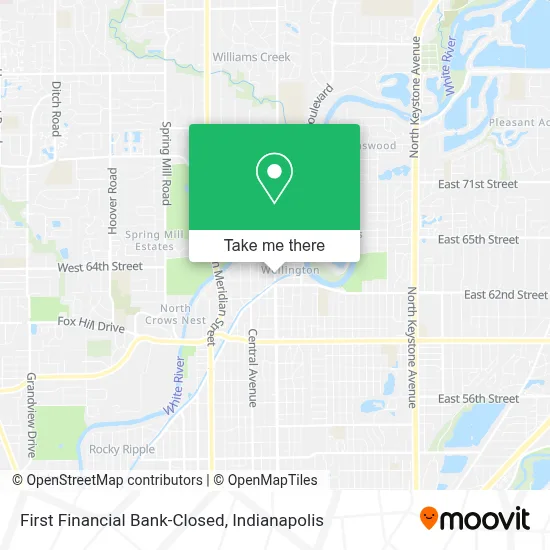
See First Financial Bank-Closed, Indianapolis City (Balance), on the map
Public Transit to First Financial Bank-Closed in Indianapolis City (Balance)
Wondering how to get to First Financial Bank-Closed in Indianapolis City (Balance)? Moovit helps you find the best way to get to First Financial Bank-Closed with step-by-step directions from the nearest public transit station.
Moovit provides free maps and live directions to help you navigate through your city. View schedules, routes, timetables, and find out how long does it take to get to First Financial Bank-Closed in real time.
Looking for the nearest stop or station to First Financial Bank-Closed? Check out this list of stops closest to your destination: Broad Ripple Ave & Guilford Ave; Broad Ripple Station Nb.
Bus: 19, 82, 90.
Want to see if there’s another route that gets you there at an earlier time? Moovit helps you find alternative routes or times. Get directions from and directions to First Financial Bank-Closed easily from the Moovit App or Website.
We make riding to First Financial Bank-Closed easy, which is why over 1.5 million users, including users in Indianapolis City (Balance), trust Moovit as the best app for public transit. You don’t need to download an individual bus app or train app, Moovit is your all-in-one transit app that helps you find the best bus time or train time available.
For information on prices of bus, costs and ride fares to First Financial Bank-Closed, please check the Moovit app.
Use the app to navigate to popular places including to the airport, hospital, stadium, grocery store, mall, coffee shop, school, college, and university.
First Financial Bank-Closed Address: 6320 N College Ave street in Indianapolis City (Balance)
- Forefront Dermatology,
- Laryn Steadman, MD, Faad,
- Adkin Management Group,
- Pactsafe,
- Broad Ripple Pantry,
- College Ave & 63rd St,
- Fresh Thyme / The Coil Parking Garage,
- CVS/pharmacy,
- Portico,
- Joyful Counseling,
- Vdzon G+T Jewelers,
- National Bank,
- Healthcare Chaos Management - HCM,
- John E Krol MD,
- Parking Garage Broad Ripple,
- Turntable,
- Scheffler Car Key Locksmith,
- Fox & Stults,
- Artistry in Clay Studio and Gallery,
- Harmony
Places Near First Financial Bank-Closed (Indianapolis City (Balance))
- 119 W 19th St Parking, Indianapolis City (Balance),
- Jersey Barn, Indianapolis City (Balance),
- Train Ride At Castleton Mall, Indianapolis City (Balance),
- Lucas Oil Stadium, Indianapolis City (Balance),
- Castleton Square Mall, Indianapolis,
- Indianapolis Airport Zone 2, Indianapolis City (Balance),
- Gainbridge Fieldhouse, Indianapolis City (Balance),
- Eskenazi Hospital, Indianapolis City (Balance),
- Methodist Hospital of Indianapolis, Indianapolis City (Balance),
- I-465 / I-65 Interchange, Indianapolis City (Balance),
- Indianapolis Motor Speedway, Speedway,
- THE BALT, Indianapolis City (Balance),
- St. Vincent Hospital - Indianapolis, Indianapolis City (Balance),
- Lilly Corporate Center (Eli Lilly & Co), Indianapolis City (Balance),
- Indiana, Indianapolis City (Balance),
- St. Vincent entrance #1, Indianapolis City (Balance),
- Cotter's Massage Parlor With Happy Endings, Indianapolis City (Balance),
- Indiana Convention Center, Indianapolis City (Balance),
- I U Health Methodist Hospital, Indianapolis City (Balance),
- Plainfield, IN, Plainfield
How to get to popular places in Indianapolis with public transit
Get around Indianapolis City (Balance) by public transit!
Traveling around Indianapolis City (Balance) has never been so easy. See step by step directions as you travel to any attraction, street or major public transit station. View bus and train schedules, arrival times, service alerts and detailed routes on a map, so you know exactly how to get to anywhere in Indianapolis City (Balance).
When traveling to any destination around Indianapolis City (Balance) use Moovit's Live Directions with Get Off Notifications to know exactly where and how far to walk, how long to wait for your line, and how many stops are left. Moovit will alert you when it's time to get off — no need to constantly re-check whether yours is the next stop.
Wondering how to use public transit in Indianapolis City (Balance) or how to pay for public transit in Indianapolis City (Balance)? Moovit public transit app can help you navigate your way with public transit easily, and at minimum cost. It includes public transit fees, ticket prices, and costs. Looking for a map of Indianapolis City (Balance) public transit lines? Moovit public transit app shows all public transit maps in Indianapolis City (Balance) with all bus routes and stops on an interactive map.
Indianapolis has 1 transit type(s), including: bus, operated by several transit agencies, including IndyGo, FlixBus-us and Greyhound-us