Directions to First Step Fence Solutions (Richmond) with public transportation
The following transit lines have routes that pass near First Step Fence Solutions
 Bus: 4B, 56, BRT, FLIXBUS N2601, 4A.
- Train: NORTHEAST REGIONAL.
How to get to First Step Fence Solutions by bus?
Click on the bus route to see step by step directions with maps, line arrival times and updated time schedules.
From Hampton University, Hampton
321 minFrom Lorton, VA - Amtrak Auto Train Station (LOR), Fairfax County
229 minFrom Busch Gardens Williamsburg (Employee Parking Lot), James City County
154 minFrom Potomac Mills Mall, Prince William County
214 minFrom Lorton, VA, Fairfax County
223 minFrom Rose Gaming Resort, Prince William County
239 minFrom Woodbridge, VA, Prince William County
158 minFrom Amazon Fulfillment Center-Ric3, Richmond
88 minFrom UVA Hospital Medical Center, Charlottesville
303 min
How to get to First Step Fence Solutions by train?
Click on the train route to see step by step directions with maps, line arrival times and updated time schedules.
Bus stops near First Step Fence Solutions in Richmond
Train station near First Step Fence Solutions in Richmond
- Pathrichmond Main Street Amtrak Station, 44 min walk,VIEW
Bus lines to First Step Fence Solutions in Richmond
What are the closest stations to First Step Fence Solutions?
The closest stations to First Step Fence Solutions are:
- Williamsburg + Tompkins is 340 yards away, 5 min walk.
- Admiral Gravely + Carlisle is 601 yards away, 8 min walk.
- Government & Rawlings is 998 yards away, 12 min walk.
- Pathrichmond Main Street Amtrak Station is 3750 yards away, 44 min walk.
Which bus lines stop near First Step Fence Solutions?
These bus lines stop near First Step Fence Solutions: 4B, 56, BRT, FLIXBUS N2601.
Which train line stops near First Step Fence Solutions?
NORTHEAST REGIONAL (Newport News)
What’s the nearest bus station to First Step Fence Solutions in Richmond?
The nearest bus station to First Step Fence Solutions in Richmond is Williamsburg + Tompkins. It’s a 5 min walk away.
What time is the first train to First Step Fence Solutions in Richmond?
The NORTHEAST REGIONAL is the first train that goes to First Step Fence Solutions in Richmond. It stops nearby at 5:19 AM.
What time is the last train to First Step Fence Solutions in Richmond?
The NORTHEAST REGIONAL is the last train that goes to First Step Fence Solutions in Richmond. It stops nearby at 6:52 PM.
What time is the first bus to First Step Fence Solutions in Richmond?
The 4B is the first bus that goes to First Step Fence Solutions in Richmond. It stops nearby at 5:32 AM.
What time is the last bus to First Step Fence Solutions in Richmond?
The 4A is the last bus that goes to First Step Fence Solutions in Richmond. It stops nearby at 11:53 PM.
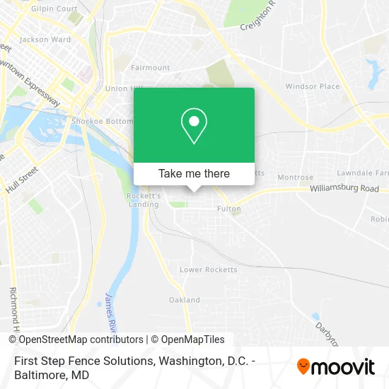
See First Step Fence Solutions, Richmond, on the map
Public Transit to First Step Fence Solutions in Richmond
Wondering how to get to First Step Fence Solutions in Richmond? Moovit helps you find the best way to get to First Step Fence Solutions with step-by-step directions from the nearest public transit station.
Moovit provides free maps and live directions to help you navigate through your city. View schedules, routes, timetables, and find out how long does it take to get to First Step Fence Solutions in real time.
Looking for the nearest stop or station to First Step Fence Solutions? Check out this list of stops closest to your destination: Williamsburg + Tompkins; Admiral Gravely + Carlisle; Government & Rawlings; Pathrichmond Main Street Amtrak Station.
Bus: 4B, 56, BRT, FLIXBUS N2601, 4A.Train: NORTHEAST REGIONAL.
Want to see if there’s another route that gets you there at an earlier time? Moovit helps you find alternative routes or times. Get directions from and directions to First Step Fence Solutions easily from the Moovit App or Website.
We make riding to First Step Fence Solutions easy, which is why over 1.5 million users, including users in Richmond, trust Moovit as the best app for public transit. You don’t need to download an individual bus app or train app, Moovit is your all-in-one transit app that helps you find the best bus time or train time available.
For information on prices of bus and train, costs and ride fares to First Step Fence Solutions, please check the Moovit app.
Use the app to navigate to popular places including to the airport, hospital, stadium, grocery store, mall, coffee shop, school, college, and university.
First Step Fence Solutions Address: 1111 Mt Erin Dr Henrico, VA 23231 street in Richmond
- Artisan Hill,
- Fruision Candle Bar,
- Clay Ground,
- Reign Studio 1,
- Fitness Longevity Gym,
- Social Savvy Geek,
- Sensory Anatomy Osteopathic Massage,
- Blue Atlas,
- Richmond Conservators of Works on Paper,
- Fulton Hill Studios,
- Fine Art Conservation of Virginia,
- Luv Jones Daycare,
- McCann Plumbing and Electric,
- Petal Foot Screen Printing,
- Sauls International Translation and Interpretation Services,
- Lin's Marine Parts & Service,
- Government Offices City Fire Stations,
- Powhatan's Hill Park,
- Powhatan Park,
- Pro Source Auto Detail
Places Near First Step Fence Solutions (Richmond)
- Rock Creek Tennis Center, Washington,
- The Anthem, Washington,
- National Zoo, Washington,
- PG Mall, Prince George's County,
- Capital One Arena, Washington,
- Warner Theatre, Washington,
- National Mall, Washington,
- Georgetown, Washington,
- Washington National Cathedral, Washington,
- Amazon Hq2, Arlington County,
- Pennsylvania Ave NW (3rd st and pennsylvania), Washington,
- Camden Yards, Baltimore,
- Museum Of The Bible, Washington,
- Marriott Marquis Washington, DC, Washington,
- M&T Bank Stadium, Baltimore,
- National Museum of African American History and Culture, Washington,
- Sibley Memorial Hospital, Washington,
- Basilica of the National Shrine, Washington,
- Washington DC VA Medical Center, Washington,
- Westfield Montgomery Mall, Montgomery County
How to get to popular places in Washington, D.C. - Baltimore, MD with public transit
Get around Richmond by public transit!
Traveling around Richmond has never been so easy. See step by step directions as you travel to any attraction, street or major public transit station. View bus and train schedules, arrival times, service alerts and detailed routes on a map, so you know exactly how to get to anywhere in Richmond.
When traveling to any destination around Richmond use Moovit's Live Directions with Get Off Notifications to know exactly where and how far to walk, how long to wait for your line, and how many stops are left. Moovit will alert you when it's time to get off — no need to constantly re-check whether yours is the next stop.
Wondering how to use public transit in Richmond or how to pay for public transit in Richmond? Moovit public transit app can help you navigate your way with public transit easily, and at minimum cost. It includes public transit fees, ticket prices, and costs. Looking for a map of Richmond public transit lines? Moovit public transit app shows all public transit maps in Richmond with all Bus, Train, Metro, Light Rail and Ferry routes and stops on an interactive map.
Washington, D.C. - Baltimore, MD has 5 transit type(s), including: Bus, Train, Metro, Light Rail and Ferry, operated by several transit agencies, including WMATA, Montgomery County Ride On, Fairfax Connector, TheBus, PRTC, DASH - Alexandria, Arlington Transit (ART), RTA of Central Maryland, MDOT MTA, MDOT MTA Light RailLink, MDOT MTA Commuter Bus, MDOT MTA Local Bus, FXBGO!, Virginia Railway Express (VRE) and MARC