How to get to First Stop by bus?
Click on the bus route to see step by step directions with maps, line arrival times and updated time schedules.
From Avenida de Machupichu, Madrid
53 minFrom Calle Ulises, Madrid
58 minFrom T2 - Aeropuerto Madrid-Barajas, Área Metropolitana De Madrid Y Corredor Del Henares
37 minFrom Avenida de Alfonso XIII, Madrid
67 minFrom AUTOCINE Madrid, Madrid
55 minFrom Hotel Meliá Castilla, Madrid
41 minFrom Paseo de la Castellana 259, Madrid
27 minFrom Calle de Francisco Gervás 10, Madrid
44 minFrom IFEMA, Madrid
48 minFrom Calle Fermin Caballero, Madrid
48 min
How to get to First Stop by train?
Click on the train route to see step by step directions with maps, line arrival times and updated time schedules.
How to get to First Stop by metro?
Click on the metro route to see step by step directions with maps, line arrival times and updated time schedules.
Bus stops near First Stop in Alcobendas
Metro station near First Stop in Alcobendas
- Marqués De La Valdavia, 20 min walk,VIEW
Train station near First Stop in Alcobendas
- Alcobendas - San Sebastián De Los Reyes, 41 min walk,VIEW
Bus lines to First Stop in Alcobendas
- 2, Alcobendas,VIEW
- 5, San Sebastián de los Reyes,VIEW
- 10, Circular de Alcobendas,VIEW
- 151, Intercambiador De Plaza De Castilla (Nivel -3, Islas 1 Y 2),VIEW
- 153, Pza. Universidad Popular - Est. Baunatal,VIEW
- 158, Av. San Luis - Av. Burgos,VIEW
- 827, Marqués Valdavia - Hipermercado,VIEW
- 828, Felicidad - Hechizo,VIEW
- N101, Intercambiador De Plaza De Castilla (Nivel 0, Isla 4),VIEW
- 154, Madrid (Chamartín) - S. S. Reyes Circular (por Fuencarral),VIEW
- 156, Madrid (Plaza de Castilla) - S. S. de los Reyes (P. I. Moscatelares),VIEW
- 161, Madrid (Plaza de Castilla) - Urb. Fuente del Fresno,VIEW
- 171, Madrid (Plaza de Castilla) - Urb. Santo Domingo,VIEW
- 152C, Madrid (Plaza de Castilla) - S. S. de los Reyes (Dehesa Vieja),VIEW
- 154C, Madrid (Plaza de Castilla) - S. S. de los Reyes (Avda. de los Quiñones),VIEW
- 11, Circular de Alcobendas,VIEW
- 157, Av. Camilo J. Cela - Gabriel G.ª Márquez,VIEW
What are the closest stations to First Stop?
The closest stations to First Stop are:
- Marqués Valdavia - Nemesio Castro is 89 meters away, 2 min walk.
- Libertad - Julián Baena Castro is 309 meters away, 5 min walk.
- P.º Chopera - Centro De Salud is 331 meters away, 5 min walk.
- Marqués De La Valdavia is 1525 meters away, 20 min walk.
- Alcobendas - San Sebastián De Los Reyes is 3128 meters away, 41 min walk.
Which bus lines stop near First Stop?
These bus lines stop near First Stop: 151, 153, 154, 157, 827.
Which train line stops near First Stop?
C4A (Alcobendas - S. S. De Los Reyes)
Which metro line stops near First Stop?
M-10 (Hospital Infanta Sofía)
What’s the nearest metro station to First Stop in Alcobendas?
The nearest metro station to First Stop in Alcobendas is Marqués De La Valdavia. It’s a 20 min walk away.
What’s the nearest bus station to First Stop in Alcobendas?
The nearest bus station to First Stop in Alcobendas is Marqués Valdavia - Nemesio Castro. It’s a 2 min walk away.
What time is the first metro to First Stop in Alcobendas?
The M-10 is the first metro that goes to First Stop in Alcobendas. It stops nearby at 6:05 AM.
What time is the last metro to First Stop in Alcobendas?
The M-10 is the last metro that goes to First Stop in Alcobendas. It stops nearby at 1:50 AM.
What time is the first train to First Stop in Alcobendas?
The C4A is the first train that goes to First Stop in Alcobendas. It stops nearby at 5:30 AM.
What time is the last train to First Stop in Alcobendas?
The C4A is the last train that goes to First Stop in Alcobendas. It stops nearby at 12:02 AM.
What time is the first bus to First Stop in Alcobendas?
The N101 is the first bus that goes to First Stop in Alcobendas. It stops nearby at 3:02 AM.
What time is the last bus to First Stop in Alcobendas?
The N101 is the last bus that goes to First Stop in Alcobendas. It stops nearby at 3:03 AM.
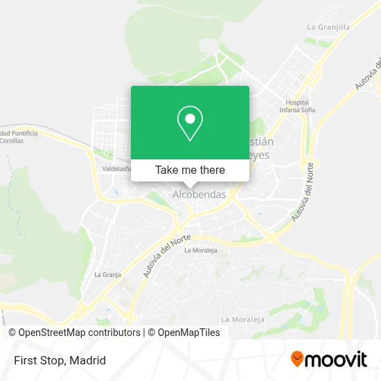
See First Stop, Alcobendas, on the map
Public Transit to First Stop in Alcobendas
Wondering how to get to First Stop in Alcobendas? Moovit helps you find the best way to get to First Stop with step-by-step directions from the nearest public transit station.
Moovit provides free maps and live directions to help you navigate through your city. View schedules, routes, timetables, and find out how long does it take to get to First Stop in real time.
Looking for the nearest stop or station to First Stop? Check out this list of stops closest to your destination: Marqués Valdavia - Nemesio Castro; Libertad - Julián Baena Castro; P.º Chopera - Centro De Salud; Marqués De La Valdavia; Alcobendas - San Sebastián De Los Reyes.
Bus: 151, 153, 154, 157, 827, 2, 5, 10, 156, 161, 171, 152C, 11.Train: C4A.Metro: M-10.
Want to see if there’s another route that gets you there at an earlier time? Moovit helps you find alternative routes or times. Get directions from and directions to First Stop easily from the Moovit App or Website.
We make riding to First Stop easy, which is why over 1.5 million users, including users in Alcobendas, trust Moovit as the best app for public transit. You don’t need to download an individual bus app or train app, Moovit is your all-in-one transit app that helps you find the best bus time or train time available.
For information on prices of metro, bus and train, costs and ride fares to First Stop, please check the Moovit app.
Use the app to navigate to popular places including to the airport, hospital, stadium, grocery store, mall, coffee shop, school, college, and university.
First Stop Address: Calle del Marqués de la Valdavia, 25 28100 Alcobendas street in Alcobendas
- Talleres y Automocion,
- Talleres Encar,
- Bar Casilda,
- Receptor,
- Arguelles Vital,
- Outlet Tu Armario Favorito,
- Albaik Fried Chicken,
- Amazon Counter-Uñas + Coquetas,
- Perfumerías Ikeraul,
- Calle Marqués de la Valdavia / Calle Isla de Córcega,
- C.E.I.P. Parque Cataluña,
- Convenience Store,
- Bazar Luna,
- Inpsico Consulta de Psicología,
- Corporación Fisiogestión,
- Pablo Girol Vizcay,
- Cepae Psicólogos,
- Construcciones J.D.M,
- Ibercientifica,
- Colchonerias Moreno
Places Near First Stop (Alcobendas)
- Sala La Riviera, Madrid,
- Hospital Universitario La Paz, Madrid,
- Mendez Alvaro, Madrid,
- Rastro De Madrid, Área Metropolitana De Madrid Y Corredor Del Henares,
- Calle de López de Hoyos 169, Madrid,
- Wizink Center, Madrid,
- Palacio De Vistalegre, Área Metropolitana De Madrid Y Corredor Del Henares,
- Centro Comercial La Vaguada, Área Metropolitana De Madrid Y Corredor Del Henares,
- Hospital Clínico Universitario San Carlos, Madrid,
- Hospital Universitario Ramón y Cajal, Madrid,
- Estadio Wanda Metropolitano, Área Metropolitana De Madrid Y Corredor Del Henares,
- Tres Aguas, Alcorcón,
- Nassica, Área Metropolitana De Madrid Y Corredor Del Henares,
- Centro Comercial Oasiz Madrid, Área Metropolitana De Madrid Y Corredor Del Henares,
- Estacion de Chamartin, Madrid,
- Centro Comercial Islazul, Área Metropolitana De Madrid Y Corredor Del Henares,
- Centro Comercial La Gavia, Área Metropolitana De Madrid Y Corredor Del Henares,
- Mercadillo de Majadahonda, Majadahonda,
- Plaza Mayor, Madrid,
- Plenilunio, Área Metropolitana De Madrid Y Corredor Del Henares
How to get to popular places in Madrid with public transit
Get around Alcobendas by public transit!
Traveling around Alcobendas has never been so easy. See step by step directions as you travel to any attraction, street or major public transit station. View bus and train schedules, arrival times, service alerts and detailed routes on a map, so you know exactly how to get to anywhere in Alcobendas.
When traveling to any destination around Alcobendas use Moovit's Live Directions with Get Off Notifications to know exactly where and how far to walk, how long to wait for your line, and how many stops are left. Moovit will alert you when it's time to get off — no need to constantly re-check whether yours is the next stop.
Wondering how to use public transit in Alcobendas or how to pay for public transit in Alcobendas? Moovit public transit app can help you navigate your way with public transit easily, and at minimum cost. It includes public transit fees, ticket prices, and costs. Looking for a map of Alcobendas public transit lines? Moovit public transit app shows all public transit maps in Alcobendas with all Bus, Train, Metro and Light Rail routes and stops on an interactive map.
Madrid has 4 transit type(s), including: Bus, Train, Metro and Light Rail, operated by several transit agencies, including Metro de Madrid, Metro Ligero, Tranvía de Parla, Renfe Cercanías - Servicios de Autobús especiales, Renfe Cercanias, Renfe Cercanías, EMT, Interurbanos, Urbanos de Alcalá de Henares, Urbanos de Alcobendas, Urbanos de Alcorcón, Urbanos de Algete, Urbanos de Aranjuez, Urbanos de Arganda del Rey and Urbanos de Arroyomolinos
Public transit lines with stations closest to First Stop in Alcobendas
Metro lines with stations closest to First Stop in Alcobendas
Train lines with stations closest to First Stop in Alcobendas
Bus lines with stations closest to First Stop in Alcobendas
Libertad - Julián Baena Castro
 154Madrid (Chamartín) - S. S. Reyes Circular (por Fuencarral)
- 156Madrid (Plaza de Castilla) - S. S. de los Reyes (P. I. Moscatelares)
- 161Madrid (Plaza de Castilla) - Urb. Fuente del Fresno
- 171Madrid (Plaza de Castilla) - Urb. Santo Domingo
- 152CMadrid (Plaza de Castilla) - S. S. de los Reyes (Dehesa Vieja)