Bus stops near First United Methodist Church in Smyth County
Bus lines to First United Methodist Church in Smyth County
- United States Government,
- Herbs & Health I,
- Tractor Supply,
- Marion Plaza (Tractor Supply),
- Sullins Outlet Ernie,
- Davita Dialysis Center,
- Travel Inn,
- Virginia House Inn,
- Smyth County Free Clinic,
- Soundz Hearing Centers,
- Magic Nails,
- MedExpress Urgent Care,
- Ollie's Bargain,
- Marion Family Pharmacy,
- USPS Collection Box - Blue Box,
- Vera Bradley,
- Curtiss Mary E MD PC,
- Domino's,
- Virginia Department of Motor Vehicles,
- DMV Customer Service Center
Places Near First United Methodist Church (Smyth County)
- Washington DC VA Medical Center, Washington,
- National Mall, Washington,
- Westfield Montgomery Mall, Montgomery County,
- Sibley Memorial Hospital, Washington,
- Rock Creek Tennis Center, Washington,
- Capital One Arena, Washington,
- Marriott Marquis Washington, DC, Washington,
- National Museum of African American History and Culture, Washington,
- Basilica of the National Shrine, Washington,
- Museum Of The Bible, Washington,
- PG Mall, Prince George's County,
- National Zoo, Washington,
- Georgetown, Washington,
- M&T Bank Stadium, Baltimore,
- The Anthem, Washington,
- Pennsylvania Ave NW (3rd st and pennsylvania), Washington,
- Washington National Cathedral, Washington,
- Warner Theatre, Washington,
- Amazon Hq2, Arlington County,
- Camden Yards, Baltimore
How to get to popular places in Washington, D.C. - Baltimore, MD with public transit
What are the closest stations to First United Methodist Church?
The closest stations to First United Methodist Church are:
- Presidential Apartments is 624 yards away, 8 min walk.
- Marion Plaza/Tractor Supply (Marion) is 932 yards away, 12 min walk.
- Walmart (Marion) is 1025 yards away, 13 min walk.
What’s the nearest bus station to First United Methodist Church in Smyth County?
The nearest bus station to First United Methodist Church in Smyth County is Presidential Apartments. It’s a 8 min walk away.
What time is the first bus to First United Methodist Church in Smyth County?
The MARION-ATKINS LOOP is the first bus that goes to First United Methodist Church in Smyth County. It stops nearby at 8:00 AM.
What time is the last bus to First United Methodist Church in Smyth County?
The MARION-ATKINS LOOP is the last bus that goes to First United Methodist Church in Smyth County. It stops nearby at 6:00 PM.
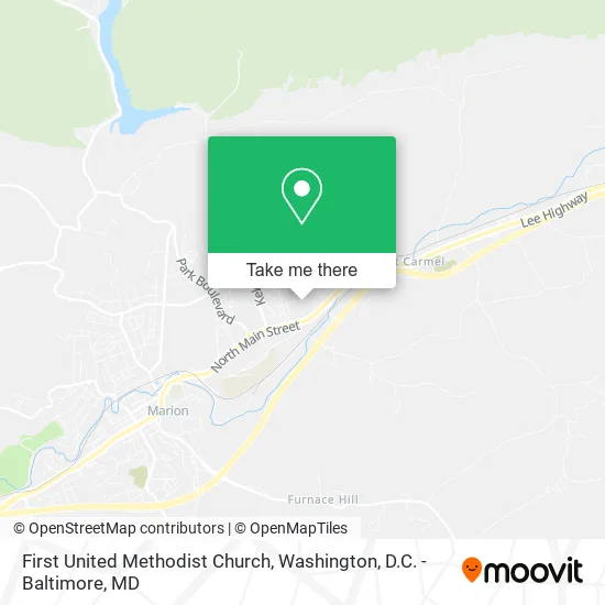
See First United Methodist Church, Smyth County, on the map
Public Transit to First United Methodist Church in Smyth County
Wondering how to get to First United Methodist Church in Smyth County? Moovit helps you find the best way to get to First United Methodist Church with step-by-step directions from the nearest public transit station.
Moovit provides free maps and live directions to help you navigate through your city. View schedules, routes, timetables, and find out how long does it take to get to First United Methodist Church in real time.
Looking for the nearest stop or station to First United Methodist Church? Check out this list of stops closest to your destination: Presidential Apartments; Marion Plaza/Tractor Supply (Marion); Walmart (Marion).
Want to see if there’s another route that gets you there at an earlier time? Moovit helps you find alternative routes or times. Get directions from and directions to First United Methodist Church easily from the Moovit App or Website.
We make riding to First United Methodist Church easy, which is why over 1.5 million users, including users in Smyth County, trust Moovit as the best app for public transit. You don’t need to download an individual bus app or train app, Moovit is your all-in-one transit app that helps you find the best bus time or train time available.
Use the app to navigate to popular places including to the airport, hospital, stadium, grocery store, mall, coffee shop, school, college, and university.
First United Methodist Church Address: 230 Larch St Marion, VA 24354 street in Smyth County
Get around Smyth County by public transit!
Traveling around Smyth County has never been so easy. See step by step directions as you travel to any attraction, street or major public transit station. View bus and train schedules, arrival times, service alerts and detailed routes on a map, so you know exactly how to get to anywhere in Smyth County.
When traveling to any destination around Smyth County use Moovit's Live Directions with Get Off Notifications to know exactly where and how far to walk, how long to wait for your line, and how many stops are left. Moovit will alert you when it's time to get off — no need to constantly re-check whether yours is the next stop.
Wondering how to use public transit in Smyth County or how to pay for public transit in Smyth County? Moovit public transit app can help you navigate your way with public transit easily, and at minimum cost. It includes public transit fees, ticket prices, and costs. Looking for a map of Smyth County public transit lines? Moovit public transit app shows all public transit maps in Smyth County with all Bus, Train, Metro, Light Rail and Ferry routes and stops on an interactive map.
Washington, D.C. - Baltimore, MD has 5 transit type(s), including: Bus, Train, Metro, Light Rail and Ferry, operated by several transit agencies, including WMATA, Montgomery County Ride On, Fairfax Connector, TheBus, PRTC, DASH - Alexandria, Arlington Transit (ART), RTA of Central Maryland, MDOT MTA, MDOT MTA Light RailLink, MDOT MTA Commuter Bus, MDOT MTA Local Bus, FXBGO!, Virginia Railway Express (VRE) and MARC