How to get to Fisher Development Associates by bus?
Click on the bus route to see step by step directions with maps, line arrival times and updated time schedules.
From New Rochelle, NY, New Rochelle
33 minFrom Mamaroneck NY, Mamaroneck
55 minFrom Rye Playland, Rye
56 minFrom Cross County Mall, Yonkers
74 minFrom Cross County Shopping Center, Yonkers
75 minFrom St. John's Riverside Hospital, Yonkers
77 minFrom Ridge Hill Mall, Yonkers
89 minFrom Regeneron Pharmaceuticals Inc, Tarrytown
80 minFrom Elmsford, NY, Elmsford
50 minFrom Port Chester, NY, Port Chester
30 min
Bus stops near Fisher Development Associates in Harrison
Bus lines to Fisher Development Associates in Harrison
What are the closest stations to Fisher Development Associates?
The closest stations to Fisher Development Associates are:
- Centre at Purchase 4 is 348 yards away, 5 min walk.
- 106 Corporate Park Dr is 424 yards away, 5 min walk.
- 105 Corporate Park Dr is 643 yards away, 8 min walk.
- Westchester Corporate Park is 736 yards away, 9 min walk.
- Purchase St @ Manhattanville Rd is 741 yards away, 9 min walk.
Which bus lines stop near Fisher Development Associates?
These bus lines stop near Fisher Development Associates: 13, 3, 82.
What’s the nearest bus station to Fisher Development Associates in Harrison?
The nearest bus stations to Fisher Development Associates in Harrison are Centre at Purchase 4 and 106 Corporate Park Dr. The closest one is a 5 min walk away.
What time is the first bus to Fisher Development Associates in Harrison?
The OWL is the first bus that goes to Fisher Development Associates in Harrison. It stops nearby at 6:42 AM.
What time is the last bus to Fisher Development Associates in Harrison?
The 12 is the last bus that goes to Fisher Development Associates in Harrison. It stops nearby at 7:05 PM.
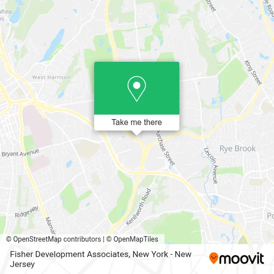
See Fisher Development Associates, Harrison, on the map
Public Transit to Fisher Development Associates in Harrison
Wondering how to get to Fisher Development Associates in Harrison? Moovit helps you find the best way to get to Fisher Development Associates with step-by-step directions from the nearest public transit station.
Moovit provides free maps and live directions to help you navigate through your city. View schedules, routes, timetables, and find out how long does it take to get to Fisher Development Associates in real time.
Looking for the nearest stop or station to Fisher Development Associates? Check out this list of stops closest to your destination: Centre at Purchase 4; 106 Corporate Park Dr; 105 Corporate Park Dr; Westchester Corporate Park; Purchase St @ Manhattanville Rd.
Bus: 13, 3, 82, OWL, WPP, 12.
Want to see if there’s another route that gets you there at an earlier time? Moovit helps you find alternative routes or times. Get directions from and directions to Fisher Development Associates easily from the Moovit App or Website.
We make riding to Fisher Development Associates easy, which is why over 1.7 million users, including users in Harrison, trust Moovit as the best app for public transit. You don’t need to download an individual bus app or train app, Moovit is your all-in-one transit app that helps you find the best bus time or train time available.
For information on prices of bus, costs and ride fares to Fisher Development Associates, please check the Moovit app.
Use the app to navigate to popular places including to the airport, hospital, stadium, grocery store, mall, coffee shop, school, college, and university.
Fisher Development Associates Address: 2 Manhattanville Rd street in Harrison
- Attain Fertility,
- S L D Commodities Inc.,
- 4 Manhattanville Rd,
- Havell's Holdings,
- The Good Table,
- Sompo International,
- Bright Horizon Children's Center Llc,
- Echnatoll Network Llc,
- Apollo Investment Fund Vii, Lp,
- Purchase, NY,
- Ophir Field,
- Tesla,
- Kobrand Wine and Spirits,
- Maxx Properties,
- Entrance I-684 N,
- Prince Lobel Tye,
- Hudson River Wealth Management,
- Townsquare Media,
- Hilltop Renovations Of Westchester,
- Janney Montgomery Scott Llc
Places Near Fisher Development Associates (Harrison)
- Hudson Yards, Manhattan,
- Times Square, Manhattan,
- Queens Center Mall, Queens,
- 26 Federal Plaza, Manhattan,
- Wall Street, Manhattan,
- Mountainside Hospital, Glen Ridge,
- 911 Memorial, Manhattan,
- Chinatown, Manhattan,
- SoHo, Manhattan,
- Katz's Deli, Manhattan,
- San Gennaro Feast, Manhattan,
- 111 Centre New York City Supreme Court, Manhattan,
- Pier 83, Manhattan,
- Rockefeller Center, Manhattan,
- 1 Police Plaza, Manhattan,
- 66 John Street, Manhattan,
- 376 Hudson Street, Manhattan,
- Bellevue Hospital, Manhattan,
- 3 Stone St, Manhattan,
- qqqq, Manhattan
How to get to popular places in New York - New Jersey with public transit
Get around Harrison by public transit!
Traveling around Harrison has never been so easy. See step by step directions as you travel to any attraction, street or major public transit station. View bus and train schedules, arrival times, service alerts and detailed routes on a map, so you know exactly how to get to anywhere in Harrison.
When traveling to any destination around Harrison use Moovit's Live Directions with Get Off Notifications to know exactly where and how far to walk, how long to wait for your line, and how many stops are left. Moovit will alert you when it's time to get off — no need to constantly re-check whether yours is the next stop.
Wondering how to use public transit in Harrison or how to pay for public transit in Harrison? Moovit public transit app can help you navigate your way with public transit easily, and at minimum cost. It includes public transit fees, ticket prices, and costs. Looking for a map of Harrison public transit lines? Moovit public transit app shows all public transit maps in Harrison with all Bus, Train, Subway, Light Rail, Ferry and Cable Car routes and stops on an interactive map.
New York - New Jersey has 6 transit type(s), including: Bus, Train, Subway, Light Rail, Ferry and Cable Car, operated by several transit agencies, including MTA Subway, Metro-North Railroad, LIRR, PATH, MTA New York City Transit - Express routes, MTA Bus, NJ Transit, NYC Ferry, NICE bus, Bee-Line Bus, NJ Transit Rail, Norwalk Transit District, Hartford Line, River Valley Transit and HART