How to get to Fit 10 Performance by bus?
Click on the bus route to see step by step directions with maps, line arrival times and updated time schedules.
Bus stop near Fit 10 Performance in Suffolk
- Bon Secours, 2 min walk,VIEW
Bus lines to Fit 10 Performance in Suffolk
- PU, Inbound,VIEW
What are the closest stations to Fit 10 Performance?
The closest stations to Fit 10 Performance are:
- Bon Secours is 152 yards away, 2 min walk.
Which bus line stops near Fit 10 Performance?
047 (College & Lake View)
What’s the nearest bus station to Fit 10 Performance in Suffolk?
The nearest bus station to Fit 10 Performance in Suffolk is Bon Secours. It’s a 2 min walk away.
What time is the first bus to Fit 10 Performance in Suffolk?
The PU is the first bus that goes to Fit 10 Performance in Suffolk. It stops nearby at 6:48 AM.
What time is the last bus to Fit 10 Performance in Suffolk?
The PU is the last bus that goes to Fit 10 Performance in Suffolk. It stops nearby at 8:15 PM.
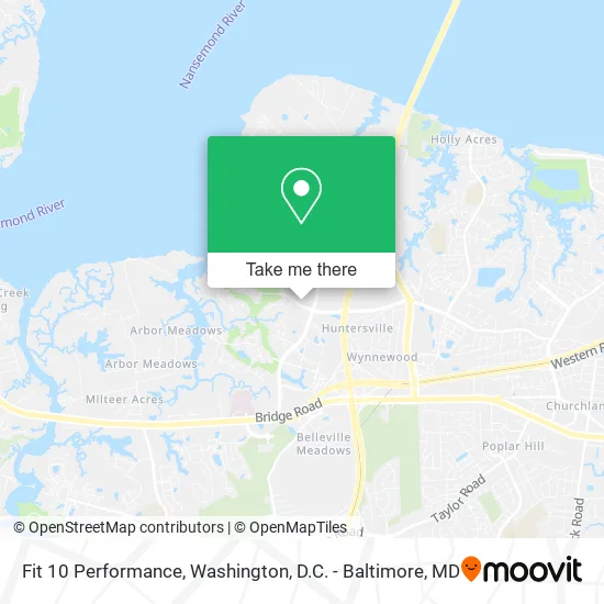
See Fit 10 Performance, Suffolk, on the map
Public Transit to Fit 10 Performance in Suffolk
Wondering how to get to Fit 10 Performance in Suffolk? Moovit helps you find the best way to get to Fit 10 Performance with step-by-step directions from the nearest public transit station.
Moovit provides free maps and live directions to help you navigate through your city. View schedules, routes, timetables, and find out how long does it take to get to Fit 10 Performance in real time.
Looking for the nearest stop or station to Fit 10 Performance? Check out this list of stops closest to your destination: Bon Secours.
Bus: 047, PU.
Want to see if there’s another route that gets you there at an earlier time? Moovit helps you find alternative routes or times. Get directions from and directions to Fit 10 Performance easily from the Moovit App or Website.
We make riding to Fit 10 Performance easy, which is why over 1.5 million users, including users in Suffolk, trust Moovit as the best app for public transit. You don’t need to download an individual bus app or train app, Moovit is your all-in-one transit app that helps you find the best bus time or train time available.
For information on prices of bus, costs and ride fares to Fit 10 Performance, please check the Moovit app.
Use the app to navigate to popular places including to the airport, hospital, stadium, grocery store, mall, coffee shop, school, college, and university.
Fit 10 Performance Address: 5140 River Club Dr Suffolk, VA 23435 street in Suffolk
- Nephrology Associates of Tidewater,
- Fresenius Kidney Care,
- Decent People Taproom,
- All Grit Athletics,
- Building #1,
- Riverfront Shoppes,
- Founders Pointe,
- Mayo Insurance Agency - Nationwide Insurance,
- Melissa Gross, Psychiatrist,
- Riverfront Dentistry,
- Carson Endodontics,
- Elgohary Anthony,
- Jasmine Malone, Psychiatric Nurse Practitioner,
- Asps Member,
- Skin2o Medspa,
- East West Realty,
- Sadler Building Corporation,
- Harbour View Kitchen & Bath,
- Lifestance Therapists & Psychiatrists Suffolk,
- Plastic Surgery Specialists : Dr. Helena M. Guarda
Places Near Fit 10 Performance (Suffolk)
- PG Mall, Prince George's County,
- Warner Theatre, Washington,
- M&T Bank Stadium, Baltimore,
- Westfield Montgomery Mall, Montgomery County,
- Pennsylvania Ave NW (3rd st and pennsylvania), Washington,
- Capital One Arena, Washington,
- Basilica of the National Shrine, Washington,
- Camden Yards, Baltimore,
- The Anthem, Washington,
- Georgetown, Washington,
- Museum Of The Bible, Washington,
- Washington DC VA Medical Center, Washington,
- National Mall, Washington,
- National Museum of African American History and Culture, Washington,
- Rock Creek Tennis Center, Washington,
- Amazon Hq2, Arlington County,
- National Zoo, Washington,
- Washington National Cathedral, Washington,
- Marriott Marquis Washington, DC, Washington,
- Sibley Memorial Hospital, Washington
How to get to popular places in Washington, D.C. - Baltimore, MD with public transit
Get around Suffolk by public transit!
Traveling around Suffolk has never been so easy. See step by step directions as you travel to any attraction, street or major public transit station. View bus and train schedules, arrival times, service alerts and detailed routes on a map, so you know exactly how to get to anywhere in Suffolk.
When traveling to any destination around Suffolk use Moovit's Live Directions with Get Off Notifications to know exactly where and how far to walk, how long to wait for your line, and how many stops are left. Moovit will alert you when it's time to get off — no need to constantly re-check whether yours is the next stop.
Wondering how to use public transit in Suffolk or how to pay for public transit in Suffolk? Moovit public transit app can help you navigate your way with public transit easily, and at minimum cost. It includes public transit fees, ticket prices, and costs. Looking for a map of Suffolk public transit lines? Moovit public transit app shows all public transit maps in Suffolk with all Bus, Train, Metro, Light Rail and Ferry routes and stops on an interactive map.
Washington, D.C. - Baltimore, MD has 5 transit type(s), including: Bus, Train, Metro, Light Rail and Ferry, operated by several transit agencies, including WMATA, Montgomery County Ride On, Fairfax Connector, TheBus, PRTC, DASH - Alexandria, Arlington Transit (ART), RTA of Central Maryland, MDOT MTA, MDOT MTA Light RailLink, MDOT MTA Commuter Bus, MDOT MTA Local Bus, FXBGO!, Virginia Railway Express (VRE) and MARC