How to get to Fitron by bus?
Click on the bus route to see step by step directions with maps, line arrival times and updated time schedules.
From Yu.A. Zhdanova 2/7, Sovetsky District
53 minFrom Stop "Golden Babylon", Sovetsky District
50 minFrom Inter Yuna Eye Clinic, Railway District
53 minFrom Zabota Diagnostic Center, Railway District
55 minFrom Golden Babylon, Sovetsky District
51 minFrom Left Bank of the Don, Kirovsky District
59 minFrom 149 Tekucheva Street, Kirovsky District
30 min
Shuttle stations near Fitron in Voroshilovsky District
What are the closest stations to Fitron?
The closest stations to Fitron are:
- Korolev Avenue is 97 meters away, 2 min walk.
- Dobrovolsky Street is 332 meters away, 5 min walk.
Which bus lines stop near Fitron?
These bus lines stop near Fitron: 18R, 21, 47, 83, 96.
Which shuttle lines stop near Fitron?
These shuttle lines stop near Fitron: 11, 38, 44, 47, 79.
What’s the nearest shuttle station to Fitron in Voroshilovsky District?
The nearest shuttle station to Fitron in Voroshilovsky District is Korolev Avenue. It’s a 2 min walk away.
What time is the first bus to Fitron in Voroshilovsky District?
The 45 is the first bus that goes to Fitron in Voroshilovsky District. It stops nearby at 5:02 AM.
What time is the last bus to Fitron in Voroshilovsky District?
The 77 is the last bus that goes to Fitron in Voroshilovsky District. It stops nearby at 11:24 PM.
What time is the first shuttle to Fitron in Voroshilovsky District?
The 66 is the first shuttle that goes to Fitron in Voroshilovsky District. It stops nearby at 5:33 AM.
What time is the last shuttle to Fitron in Voroshilovsky District?
The 96 is the last shuttle that goes to Fitron in Voroshilovsky District. It stops nearby at 11:52 PM.
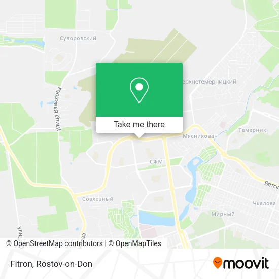
See Fitron, Voroshilovsky District, on the map
Public Transit to Fitron in Voroshilovsky District
Wondering how to get to Fitron in Voroshilovsky District? Moovit helps you find the best way to get to Fitron with step-by-step directions from the nearest public transit station.
Moovit provides free maps and live directions to help you navigate through your city. View schedules, routes, timetables, and find out how long does it take to get to Fitron in real time.
Looking for the nearest stop or station to Fitron? Check out this list of stops closest to your destination: Korolev Avenue; Dobrovolsky Street.
Bus: 18R, 21, 47, 83, 96.Shuttle: 11, 38, 44, 47, 79, 78, 83, 18L, 78, 19, 21, 21, 96, 96.
Want to see if there’s another route that gets you there at an earlier time? Moovit helps you find alternative routes or times. Get directions from and directions to Fitron easily from the Moovit App or Website.
We make riding to Fitron easy, which is why over 1.7 million users, including users in Voroshilovsky District, trust Moovit as the best app for public transit. You don’t need to download an individual bus app or train app, Moovit is your all-in-one transit app that helps you find the best bus time or train time available.
For information on prices of bus and shuttle, costs and ride fares to Fitron, please check the Moovit app.
Use the app to navigate to popular places including to the airport, hospital, stadium, grocery store, mall, coffee shop, school, college, and university.
Fitron Address: Королева, 10/4 street in Voroshilovsky District
- Korolev Avenue 10 Building 4,
- City Fashion,
- Korolev Avenue,
- Orbita Shopping Center,
- TRC Orbita,
- Trampoline Park #1,
- Kinopolis Orbita,
- MFC of Voroshilovsky District,
- Dobrovol'skogo Square (Korolev Avenue),
- UniCredit Bank,
- VEK,
- TC "Puck",
- Atelier, IP Sakhieva L.I,
- Two Cats,
- IP Ocheretko N.D.,
- Golden Hands, Atelier,
- Stock Exchange on Korolev Avenue,
- Cleanprofit-Yug Cleaning Company,
- Passport Desk at Koroleva,
- Kuban Farmstead
Places Near Fitron (Voroshilovsky District)
- 14 Line Street 63, Proletarsky District,
- BSMP-2, Voroshilovsky District,
- Pervomayskaya Station, Sovetsky District,
- Central Market,
- Regional Clinical Hospital #2, Pervomaisky District,
- Rostov Research Oncology Institute, Proletarsky District,
- Rostov Regional Clinical Hospital, Sovetsky District,
- Sailors Hospital, Pervomaisky District,
- Blagodatnaya Street 170, Sovetsky District,
- Pushkinskaya Street, 174, Kirovsky District,
- Temernik Market, Pervomaisky District,
- Rostov Zoo, Oktyabrsky District,
- Sholokhov Avenue,
- Regional Hospital #2,
- CDC "Health", Pervomaisky District,
- Shopping Center "Horizon", Voroshilovsky District,
- Rostov-on-Don Embankment,
- UFPS Military Unit 71609, Pervomaisky District,
- Gaidara Street, Leninsky District,
- City Clinical Hospital #20, Sovetsky District
How to get to popular places in Rostov-on-Don with public transit
Get around Voroshilovsky District by public transit!
Traveling around Voroshilovsky District has never been so easy. See step by step directions as you travel to any attraction, street or major public transit station. View bus and train schedules, arrival times, service alerts and detailed routes on a map, so you know exactly how to get to anywhere in Voroshilovsky District.
When traveling to any destination around Voroshilovsky District use Moovit's Live Directions with Get Off Notifications to know exactly where and how far to walk, how long to wait for your line, and how many stops are left. Moovit will alert you when it's time to get off — no need to constantly re-check whether yours is the next stop.
Wondering how to use public transit in Voroshilovsky District or how to pay for public transit in Voroshilovsky District? Moovit public transit app can help you navigate your way with public transit easily, and at minimum cost. It includes public transit fees, ticket prices, and costs. Looking for a map of Voroshilovsky District public transit lines? Moovit public transit app shows all public transit maps in Voroshilovsky District with all Bus, Light Rail, Trolleybus and Shuttle routes and stops on an interactive map.
Rostov-on-Don has 4 transit type(s), including: Bus, Light Rail, Trolleybus and Shuttle, operated by several transit agencies, including MUP MTK Rostovpassazhirtrans, MUP RTK, LLC RTK Ruseltrans and Minibuses