How to get to Flipbook Machine by bus?
Click on the bus route to see step by step directions with maps, line arrival times and updated time schedules.
From 500 Pearl Street, Manhattan
58 minFrom qqqq, Manhattan
74 minFrom Strand Bookstore, Manhattan
61 minFrom Flushing Hospital, Queens
75 minFrom Pier 88 Manhattan Cruise Terminal, Manhattan
88 minFrom Baruch College, Manhattan
100 minFrom Pier 11, Manhattan
79 minFrom 163-03 Horace Harding Expressway, Queens
65 minFrom Newport Mall, Jersey City
120 min
How to get to Flipbook Machine by subway?
Click on the subway route to see step by step directions with maps, line arrival times and updated time schedules.
Bus stops near Flipbook Machine in Queens
Subway stations near Flipbook Machine in Queens
Bus lines to Flipbook Machine in Queens
What are the closest stations to Flipbook Machine?
The closest stations to Flipbook Machine are:
- Flushing Av/Onderdonk Av is 311 yards away, 4 min walk.
- Starr St/Woodward Av is 457 yards away, 6 min walk.
- Jefferson St is 504 yards away, 6 min walk.
- Seneca Av is 563 yards away, 7 min walk.
- Metropolitan Av/Flushing Av is 583 yards away, 7 min walk.
Which bus lines stop near Flipbook Machine?
These bus lines stop near Flipbook Machine: B39, B57, Q39, Q54.
Which subway lines stop near Flipbook Machine?
These subway lines stop near Flipbook Machine: G, L, N.
What’s the nearest subway station to Flipbook Machine in Queens?
The nearest subway station to Flipbook Machine in Queens is Jefferson St. It’s a 6 min walk away.
What’s the nearest bus station to Flipbook Machine in Queens?
The nearest bus station to Flipbook Machine in Queens is Flushing Av/Onderdonk Av. It’s a 4 min walk away.
What time is the first subway to Flipbook Machine in Queens?
The L is the first subway that goes to Flipbook Machine in Queens. It stops nearby at 3:01 AM.
What time is the last subway to Flipbook Machine in Queens?
The L is the last subway that goes to Flipbook Machine in Queens. It stops nearby at 3:09 AM.
What time is the first bus to Flipbook Machine in Queens?
The B38 is the first bus that goes to Flipbook Machine in Queens. It stops nearby at 3:01 AM.
What time is the last bus to Flipbook Machine in Queens?
The B38 is the last bus that goes to Flipbook Machine in Queens. It stops nearby at 3:26 AM.
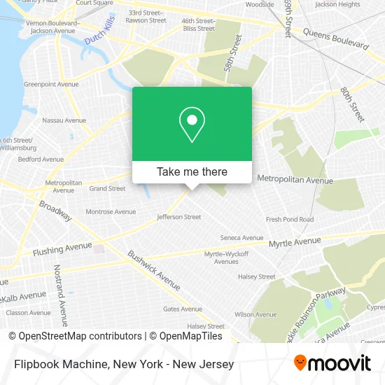
See Flipbook Machine, Queens, on the map
Public Transit to Flipbook Machine in Queens
Wondering how to get to Flipbook Machine in Queens? Moovit helps you find the best way to get to Flipbook Machine with step-by-step directions from the nearest public transit station.
Moovit provides free maps and live directions to help you navigate through your city. View schedules, routes, timetables, and find out how long does it take to get to Flipbook Machine in real time.
Looking for the nearest stop or station to Flipbook Machine? Check out this list of stops closest to your destination: Flushing Av/Onderdonk Av; Starr St/Woodward Av; Jefferson St; Seneca Av; Metropolitan Av/Flushing Av.
Bus: B39, B57, Q39, Q54, B38.Subway: G, L, N, M.
Want to see if there’s another route that gets you there at an earlier time? Moovit helps you find alternative routes or times. Get directions from and directions to Flipbook Machine easily from the Moovit App or Website.
We make riding to Flipbook Machine easy, which is why over 1.5 million users, including users in Queens, trust Moovit as the best app for public transit. You don’t need to download an individual bus app or train app, Moovit is your all-in-one transit app that helps you find the best bus time or train time available.
For information on prices of bus, subway and train, costs and ride fares to Flipbook Machine, please check the Moovit app.
Use the app to navigate to popular places including to the airport, hospital, stadium, grocery store, mall, coffee shop, school, college, and university.
Flipbook Machine Address: 17-17 Troutman St street in Queens
- Nu Custom Embroidery and Screen Printing,
- Rawchocolatelove,
- Dubai Music Entertainment,
- Dubpixel Inc,
- Psychobabble Therapy and Wellness,
- Seneca Garden,
- Wholesale Scarves - Jasmine Trading Corp,
- Nonbinary Studios,
- We Less Than Three,
- Think Creative Trading Inc,
- Tiger Accessories Inc.,
- Bjb Hats,
- Tomio Cctv Commercial and Trading Corp,
- Midtown NY Trading Inc.,
- 1by1 Wireless,
- I&H Wireless - Wholesale Cell Phone Accessories,
- Kiko Group Usa,
- Cowboy Global Corp,
- Nyc Custom Cabinetry Llc,
- George Versailles Furniture Lighting
Places Near Flipbook Machine (Queens)
- Times Square, Manhattan,
- Bellevue Hospital, Manhattan,
- Chinatown, Manhattan,
- SoHo, Manhattan,
- Katz's Deli, Manhattan,
- 3 Stone St, Manhattan,
- 1 Police Plaza, Manhattan,
- 911 Memorial, Manhattan,
- qqqq, Manhattan,
- 26 Federal Plaza, Manhattan,
- Mountainside Hospital, Glen Ridge,
- 111 Centre New York City Supreme Court, Manhattan,
- Queens Center Mall, Queens,
- Rockefeller Center, Manhattan,
- Pier 83, Manhattan,
- 66 John Street, Manhattan,
- 376 Hudson Street, Manhattan,
- San Gennaro Feast, Manhattan,
- Hudson Yards, Manhattan,
- Wall Street, Manhattan
How to get to popular places in New York - New Jersey with public transit
Get around Queens by public transit!
Traveling around Queens has never been so easy. See step by step directions as you travel to any attraction, street or major public transit station. View bus and train schedules, arrival times, service alerts and detailed routes on a map, so you know exactly how to get to anywhere in Queens.
When traveling to any destination around Queens use Moovit's Live Directions with Get Off Notifications to know exactly where and how far to walk, how long to wait for your line, and how many stops are left. Moovit will alert you when it's time to get off — no need to constantly re-check whether yours is the next stop.
Wondering how to use public transit in Queens or how to pay for public transit in Queens? Moovit public transit app can help you navigate your way with public transit easily, and at minimum cost. It includes public transit fees, ticket prices, and costs. Looking for a map of Queens public transit lines? Moovit public transit app shows all public transit maps in Queens with all Bus, Train, Subway, Light Rail, Ferry and Cable Car routes and stops on an interactive map.
New York - New Jersey has 6 transit type(s), including: Bus, Train, Subway, Light Rail, Ferry and Cable Car, operated by several transit agencies, including MTA Subway, Metro-North Railroad, LIRR, PATH, MTA New York City Transit - Express routes, MTA Bus, NJ Transit, NYC Ferry, NICE bus, Bee-Line Bus, NJ Transit Rail, Norwalk Transit District, Hartford Line, River Valley Transit and HART