How to get to Flores.F by bus?
Click on the bus route to see step by step directions with maps, line arrival times and updated time schedules.
From Universidad Femenina del Sagrado Corazón - UNIFE, La Molina
40 minFrom Av. La mar, Miraflores
35 minFrom Miraflores, Lima, Miraflores
43 minFrom AV QUECHUAS SALAMANCA, Ate
38 minFrom AV LOS PROCERES DE LA INDEPENDENCIA CON AV LURIGANCHO, San Juan D
43 minFrom av universitaria CON CARLOS IZAGUIRRE, Los Olivos
29 minFrom Mala al Sur de Lima, Miraflores
42 minFrom Av Jose Pardo, Miraflores
44 minFrom Av Salaverry, Miraflores
32 minFrom ISIL San Isidro, San Isidro
29 min
Bus stops near Flores.F in San Martin
Metro station near Flores.F in San Martin
- Caja De Agua, 50 min walk,VIEW
Bus lines to Flores.F in San Martin
- 1005, Huánuco (La Victoria) - Punchauca (Carabayllo),VIEW
- 1181, Ensenada (Puente Piedra) - Pumacahua (Chorrillos),VIEW
- 1199, Villarán (Surquillo) - Puente Camote (San Martin De Porres),VIEW
- A, Terminal Naranjal (Independencia) - Estación Central (Centro De Lima),VIEW
- B, Estación Chimpu Ocllo (Carabayllo) - Estación Central (Cercado de Lima) ,VIEW
- D, Terminal Naranjal (Independencia) - Estación Central Grau (Centro De Lima),VIEW
- 1017, La Victoria - Ancón,VIEW
- 1020, San Isidro - Pte. Piedra,VIEW
- 1033, S.M.P. - La Victoria - S.M.P.,VIEW
- 1195, Huachipa (Lurigancho) - Chuquitanta (San Martin De Porres),VIEW
- CR07, Callao,VIEW
- IM47, Km. 22 - Faucett - La Marina - Brasil - Caquetá - Km. 22,VIEW
- 1097, Av. Santa Rosa (San Juan De Lurigancho) - Las Palmas (Pachacamac) ,VIEW
- 1258, Minka (Callao) - Jicamarca (San Juan De Lurigancho),VIEW
- 1302, Casablanca (San Juan De Lurigancho) - Minka (Callao),VIEW
- 1473, S.J.L. - Magdalena,VIEW
- 1475, Campoy (San Juan De Lurigancho) - La Paz (Callao),VIEW
What are the closest stations to Flores.F?
The closest stations to Flores.F are:
- Avenida Miguel Grau 436 is 64 meters away, 1 min walk.
- Estación Parque Del Trabajo is 343 meters away, 5 min walk.
- Parque Del Trabajo is 360 meters away, 5 min walk.
- Pinonate 369 is 399 meters away, 6 min walk.
- Caja De Agua is 3881 meters away, 50 min walk.
Which bus lines stop near Flores.F?
These bus lines stop near Flores.F: 1005, 1181, 1199, IM47.
What’s the nearest bus station to Flores.F in San Martin?
The nearest bus station to Flores.F in San Martin is Avenida Miguel Grau 436. It’s a 1 min walk away.
What time is the first metro to Flores.F in San Martin?
The LINEA 1 is the first metro that goes to Flores.F in San Martin. It stops nearby at 5:13 AM.
What time is the last metro to Flores.F in San Martin?
The LINEA 1 is the last metro that goes to Flores.F in San Martin. It stops nearby at 10:34 PM.
What time is the first bus to Flores.F in San Martin?
The 1097 is the first bus that goes to Flores.F in San Martin. It stops nearby at 4:28 AM.
What time is the last bus to Flores.F in San Martin?
The IM47 is the last bus that goes to Flores.F in San Martin. It stops nearby at 1:11 AM.
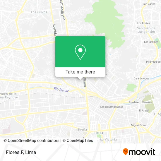
See Flores.F, San Martin, on the map
Public Transit to Flores.F in San Martin
Wondering how to get to Flores.F in San Martin? Moovit helps you find the best way to get to Flores.F with step-by-step directions from the nearest public transit station.
Moovit provides free maps and live directions to help you navigate through your city. View schedules, routes, timetables, and find out how long does it take to get to Flores.F in real time.
Looking for the nearest stop or station to Flores.F? Check out this list of stops closest to your destination: Avenida Miguel Grau 436; Estación Parque Del Trabajo; Parque Del Trabajo; Pinonate 369; Caja De Agua.
Bus: 1005, 1181, 1199, IM47, A, B, D, 1017, 1020, 1033, 1195, CR07, 1097, 1258, 1302, 1473, 1475.Metro: LINEA 1.
Want to see if there’s another route that gets you there at an earlier time? Moovit helps you find alternative routes or times. Get directions from and directions to Flores.F easily from the Moovit App or Website.
We make riding to Flores.F easy, which is why over 1.5 million users, including users in San Martin, trust Moovit as the best app for public transit. You don’t need to download an individual bus app or train app, Moovit is your all-in-one transit app that helps you find the best bus time or train time available.
For information on prices of bus, costs and ride fares to Flores.F, please check the Moovit app.
Use the app to navigate to popular places including to the airport, hospital, stadium, grocery store, mall, coffee shop, school, college, and university.
Flores.F Address: Avenida Miguel Grau Obrero, 15102 San Martín de Porres street in San Martin
- Fernández Castillo Juan Manuel,
- Ingenieria de Tableros Eléctricos,
- Espinoza Lopezniky Eloy,
- Bodega Espinoza,
- Cancho Inga Armengol Alfonso,
- Avenida Miguel Grau,
- La Casita de las Mises,
- Grupo Limpieza Total Eirl - Servicios de Limpieza y Lavandería Industrial,
- Las Cucardas,
- Bellido Montes Carlos Jesús,
- Bellido Rosas Elizabeth,
- La Nueva Lima,
- Cei 366 Blanca Nieves,
- Caballero Gutiérrez Beltra Luz,
- Parque del trabajo!,
- Av. Nestor Gambetta,
- Servicio de Grúas y Auxilios,
- Astocondor Fuertes Alindor Sanelly,
- DJ Raul Eventos & Catering,
- Herrera Martínez Julia Emilia
Places Near Flores.F (San Martin)
- Plaza San Miguel, San Miguel,
- Paradero Av.Brasil,
- Parque Kennedy, Miraflores,
- Gamarra,
- Av. Abancay, Lima,
- Hospital Edgardo Rebagliati Martins, Jesus Mari,
- Pontificia Universidad Católica del Perú - PUCP, San Miguel,
- Barranco, Barranco,
- av arequipa, Lima,
- Av. Salaverry, Jesus Mari,
- Real Plaza Puruchuco, Ate,
- Larcomar, Miraflores,
- Centro Comercial Plaza Norte, Independen,
- Mall Del Sur,
- Av. La Marina, San Miguel,
- Parque de las Leyendas, San Miguel,
- Miraflores, Miraflores,
- Circuito Mágico Del Agua, Lima,
- Jockey Plaza, Santiago D,
- Aeropuerto Internacional Jorge Chávez, Ventanilla
How to get to popular places in Lima with public transit
Get around San Martin by public transit!
Traveling around San Martin has never been so easy. See step by step directions as you travel to any attraction, street or major public transit station. View bus and train schedules, arrival times, service alerts and detailed routes on a map, so you know exactly how to get to anywhere in San Martin.
When traveling to any destination around San Martin use Moovit's Live Directions with Get Off Notifications to know exactly where and how far to walk, how long to wait for your line, and how many stops are left. Moovit will alert you when it's time to get off — no need to constantly re-check whether yours is the next stop.
Wondering how to use public transit in San Martin or how to pay for public transit in San Martin? Moovit public transit app can help you navigate your way with public transit easily, and at minimum cost. It includes public transit fees, ticket prices, and costs. Looking for a map of San Martin public transit lines? Moovit public transit app shows all public transit maps in San Martin with all Bus, Metro and Ferry routes and stops on an interactive map.
Lima has 3 transit type(s), including: Bus, Metro and Ferry, operated by several transit agencies, including Metro de Lima Línea 2 , Metro de Lima, Corredor Rojo, Metropolitano, Metropolitano - Alimentadores, Corredor Morado, Corredor Azul, Rutas Tradicionales, Transportes y Servicios La Esperanza S.A., Las Flores S.A., Virgen de la Asunción S.A., Consorcio HAM, Transportes y Service Canadá S.A., ETUL4SA and ETUCHISA