How to get to Flores de Kisk by bus?
Click on the bus route to see step by step directions with maps, line arrival times and updated time schedules.
From Avenida de la Industria, Alcobendas
46 minFrom San Sebastián De Los Reyes the Style Outlets, Área Metropolitana De Madrid Y Corredor Del Henares
22 minFrom Universidad Europea de Madrid, Alcobendas
34 minFrom Centro Comercial Plaza Norte 2, Área Metropolitana De Madrid Y Corredor Del Henares
30 minFrom Cantoblanco, Área Metropolitana De Madrid Y Corredor Del Henares
80 minFrom Antena 3 Televisión, San Sebastián De Los Reyes
28 minFrom San Sebastián de los Reyes, San Sebastián De Los Reyes
34 minFrom Tanatorio La Paz, Alcobendas
85 minFrom Diversia, Alcobendas
38 minFrom Universidad Europea Campus Alcobendas, Alcobendas
39 min
Bus stops near Flores de Kisk in San Sebastián De Los Reyes
Bus lines to Flores de Kisk in San Sebastián De Los Reyes
- 8, Circular Ciudalcampo,VIEW
- 171, Intercambiador De Plaza De Castilla (Nivel 0, Isla 4),VIEW
- 166, San Sebastián de los Reyes - Urbanización Valdelagua,VIEW
- 191, Madrid (Plaza de Castilla) - Buitrago,VIEW
- 193, Madrid (Plaza de Castilla) - Pedrezuela - El Vellón,VIEW
- 194, Madrid (Plaza de Castilla) - Rascafria,VIEW
- 195, Madrid (Plaza de Castilla) - Braojos,VIEW
- 196, Madrid (Plaza de Castilla) - La Acebeda,VIEW
- N104, Madrid (Plaza de Castilla) - El Molar,VIEW
What are the closest stations to Flores de Kisk?
The closest stations to Flores de Kisk are:
- Av. Encinas - Urb. Puertas Verdes is 478 meters away, 7 min walk.
- Pza. La Fuente - Urb. Ciudalcampo is 1035 meters away, 14 min walk.
- Ctra. A-1 - Urb. Ciudalcampo is 1053 meters away, 14 min walk.
Which bus lines stop near Flores de Kisk?
These bus lines stop near Flores de Kisk: 171, 193, 196.
What’s the nearest bus station to Flores de Kisk in San Sebastián De Los Reyes?
The nearest bus station to Flores de Kisk in San Sebastián De Los Reyes is Av. Encinas - Urb. Puertas Verdes. It’s a 7 min walk away.
What time is the first bus to Flores de Kisk in San Sebastián De Los Reyes?
The N104 is the first bus that goes to Flores de Kisk in San Sebastián De Los Reyes. It stops nearby at 3:10 AM.
What time is the last bus to Flores de Kisk in San Sebastián De Los Reyes?
The N104 is the last bus that goes to Flores de Kisk in San Sebastián De Los Reyes. It stops nearby at 2:48 AM.
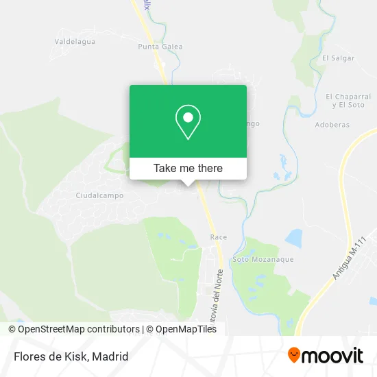
See Flores de Kisk, San Sebastián De Los Reyes, on the map
Public Transit to Flores de Kisk in San Sebastián De Los Reyes
Wondering how to get to Flores de Kisk in San Sebastián De Los Reyes? Moovit helps you find the best way to get to Flores de Kisk with step-by-step directions from the nearest public transit station.
Moovit provides free maps and live directions to help you navigate through your city. View schedules, routes, timetables, and find out how long does it take to get to Flores de Kisk in real time.
Looking for the nearest stop or station to Flores de Kisk? Check out this list of stops closest to your destination: Av. Encinas - Urb. Puertas Verdes; Pza. La Fuente - Urb. Ciudalcampo; Ctra. A-1 - Urb. Ciudalcampo.
Bus: 171, 193, 196, 8, 166, 191, 194, 195.
Want to see if there’s another route that gets you there at an earlier time? Moovit helps you find alternative routes or times. Get directions from and directions to Flores de Kisk easily from the Moovit App or Website.
We make riding to Flores de Kisk easy, which is why over 1.5 million users, including users in San Sebastián De Los Reyes, trust Moovit as the best app for public transit. You don’t need to download an individual bus app or train app, Moovit is your all-in-one transit app that helps you find the best bus time or train time available.
For information on prices of bus, costs and ride fares to Flores de Kisk, please check the Moovit app.
Use the app to navigate to popular places including to the airport, hospital, stadium, grocery store, mall, coffee shop, school, college, and university.
Flores de Kisk Address: Paseo Perdices, 14 28707 Ciudalcampo San Sebastián de los Reyes street in San Sebastián De Los Reyes
- Expresión Internacional,
- Sek International Schools,
- Correos,
- Colegio Internacional SEK-Ciudalcampo,
- Cañon Mendaro Eva,
- Urbanización Ciudalcampo,
- Arreglos de Ropa Ciudalcampo,
- Urbanización Ciudalcampo,
- Cans College,
- Urbanizacion Puertas Verdes 9,
- Filial Española,
- Golf Shot,
- Norte y Sur Viviendas,
- Avenida de las Encinas, 6,
- Inggy Kids,
- S.S.Reyes - Puertas Verdes 64,
- Colonia de las Puertas Verdes 10,
- Helipuerto Circuito Del Jarama,
- A-1 km 28,
- Catergest
Places Near Flores de Kisk (San Sebastián De Los Reyes)
- Hospital Clínico Universitario San Carlos, Madrid,
- Plaza Mayor, Madrid,
- Wizink Center, Madrid,
- Palacio De Vistalegre, Área Metropolitana De Madrid Y Corredor Del Henares,
- Mendez Alvaro, Madrid,
- Estacion de Chamartin, Madrid,
- Nassica, Área Metropolitana De Madrid Y Corredor Del Henares,
- Centro Comercial La Vaguada, Área Metropolitana De Madrid Y Corredor Del Henares,
- Hospital Universitario Ramón y Cajal, Madrid,
- Tres Aguas, Alcorcón,
- Hospital Universitario La Paz, Madrid,
- Centro Comercial Islazul, Área Metropolitana De Madrid Y Corredor Del Henares,
- Centro Comercial Oasiz Madrid, Área Metropolitana De Madrid Y Corredor Del Henares,
- Plenilunio, Área Metropolitana De Madrid Y Corredor Del Henares,
- Estadio Wanda Metropolitano, Área Metropolitana De Madrid Y Corredor Del Henares,
- Calle de López de Hoyos 169, Madrid,
- Mercadillo de Majadahonda, Majadahonda,
- Sala La Riviera, Madrid,
- Centro Comercial La Gavia, Área Metropolitana De Madrid Y Corredor Del Henares,
- Rastro De Madrid, Área Metropolitana De Madrid Y Corredor Del Henares
How to get to popular places in Madrid with public transit
Get around San Sebastián De Los Reyes by public transit!
Traveling around San Sebastián De Los Reyes has never been so easy. See step by step directions as you travel to any attraction, street or major public transit station. View bus and train schedules, arrival times, service alerts and detailed routes on a map, so you know exactly how to get to anywhere in San Sebastián De Los Reyes.
When traveling to any destination around San Sebastián De Los Reyes use Moovit's Live Directions with Get Off Notifications to know exactly where and how far to walk, how long to wait for your line, and how many stops are left. Moovit will alert you when it's time to get off — no need to constantly re-check whether yours is the next stop.
Wondering how to use public transit in San Sebastián De Los Reyes or how to pay for public transit in San Sebastián De Los Reyes? Moovit public transit app can help you navigate your way with public transit easily, and at minimum cost. It includes public transit fees, ticket prices, and costs. Looking for a map of San Sebastián De Los Reyes public transit lines? Moovit public transit app shows all public transit maps in San Sebastián De Los Reyes with all Bus, Train, Metro and Light Rail routes and stops on an interactive map.
Madrid has 4 transit type(s), including: Bus, Train, Metro and Light Rail, operated by several transit agencies, including Metro de Madrid, Metro Ligero, Tranvía de Parla, Renfe Cercanías - Servicios de Autobús especiales, Renfe Cercanias, Renfe Cercanías, EMT, Interurbanos, Urbanos de Alcalá de Henares, Urbanos de Alcobendas, Urbanos de Alcorcón, Urbanos de Algete, Urbanos de Aranjuez, Urbanos de Arganda del Rey and Urbanos de Arroyomolinos