Flossmoor station - Wednesday schedule
| Line | Direction | Time |
|---|---|---|
| UP-NW | Chicago OTC | 5:29 AM |
| UP-NW | Harvard/McHenry | 5:48 AM |
| UP-NW | Chicago OTC | 5:59 AM |
| UP-NW | Harvard/McHenry | 6:19 AM |
| UP-NW | Chicago OTC | 6:31 AM |
| UP-NW | Chicago OTC | 6:51 AM |
| UP-NW | Chicago OTC | 7:11 AM |
| UP-NW | Chicago OTC | 7:26 AM |
| UP-NW | Harvard/McHenry | 7:27 AM |
| UP-NW | Chicago OTC | 7:43 AM |
| UP-NW | Chicago OTC | 8:01 AM |
| UP-NW | Harvard/McHenry | 8:30 AM |
| UP-NW | Chicago OTC | 8:43 AM |
| UP-NW | Harvard/McHenry | 9:11 AM |
| UP-NW | Chicago OTC | 9:13 AM |
| UP-NW | Chicago OTC | 10:09 AM |
| UP-NW | Harvard/McHenry | 10:15 AM |
| UP-NW | Chicago OTC | 11:09 AM |
| UP-NW | Harvard/McHenry | 11:15 AM |
| UP-NW | Chicago OTC | 12:09 PM |
| UP-NW | Harvard/McHenry | 12:15 PM |
| UP-NW | Chicago OTC | 1:09 PM |
| UP-NW | Harvard/McHenry | 1:15 PM |
| UP-NW | Chicago OTC | 2:09 PM |
| UP-NW | Harvard/McHenry | 2:15 PM |
Directions to Flossmoor station with public transit
The following transit lines have routes that pass near Flossmoor
 Bus: 356.
- Train: ME, CITY OF NEW ORLEANS, ILLINI, SALUKI.
How to get to Flossmoor station by bus?
Click on the bus route to see step by step directions with maps, line arrival times and updated time schedules.
How to get to Flossmoor station by train?
Click on the train route to see step by step directions with maps, line arrival times and updated time schedules.
Train stations near Flossmoor station
- Olympia Fields, 12 min walk,
- Homewood, 25 min walk,
What are the closest stations to Flossmoor?
The closest stations to Flossmoor are:
- Olympia Fields station is 968 yards away, 12 min walk.
- Homewood station is 2135 yards away, 25 min walk.
Which bus line stops near Flossmoor?
356 (18624 W Creek Dr)
Which train line stops near Flossmoor?
ME (University Park (South))
What’s the nearest train station to Flossmoor?
The nearest train station to Flossmoor is Olympia Fields. It’s a 12 min walk away.
What time is the first train to Flossmoor?
The ME is the first train that goes to Flossmoor. It stops nearby at 4:26 AM.
What time is the last train to Flossmoor?
The CITY OF NEW ORLEANS is the last train that goes to Flossmoor. It stops nearby at 10:11 AM.
See Flossmoor station on the map
Public transit to Flossmoor station
Looking for directions to Flossmoor in Flossmoor, United States?
Download the Moovit App to find the current schedule and step-by-step directions for Bus or Train routes that pass through Flossmoor.
Looking for the nearest stops closest to Flossmoor ? Check out this list of closest stops to your destination: Olympia Fields; Homewood.
Bus: 356.Train: ME, CITY OF NEW ORLEANS, ILLINI, SALUKI.
We make riding on public transit to Flossmoor easy, which is why over 1.7 billion users, including users in Flossmoor trust Moovit as the best app for public transit.
Use the app to navigate to popular places including to the airport, hospital, stadium, grocery store, mall, coffee shop, school, college, and university.
The station has the following entrances: Sterling Ave
The first line to this station is UP-NW, at 5:29 AM, and the last line is UP-NW at 4:29 AM.
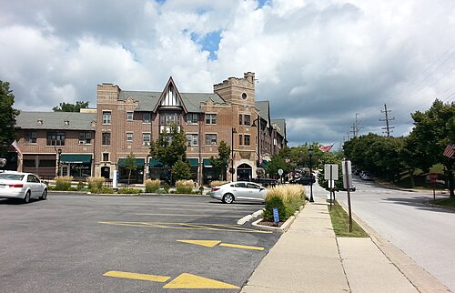
1035 Sterling Avenue, Flossmoor, IL, USA
This station serves Metra’s lines
Popular routes from Flossmoor station
- Olympia Fields,
- Homewood
Train stations near Flossmoor station
- Harlem Ave & 47th St/46th St,
- Cottage Grove & 81st Street (North),
- 75th Street & Kingston (West),
- Museum Campus/11th St.,
- 95th St & Claremont Ave,
- Illinois Medical District,
- Busse Rd & Devon Ave,
- Archer & Pershing/Rockwell (Sw),
- Chicago Union Station,
- Grand Ave & Harlem Ave,
- Wilson,
- Chicago Premium Outlet Mall,
- Fullerton & Ashland (West),
- Jackson & Chicago River (East),
- Harlem / Milwaukee,
- Millsdale Rd & Brandon Rd,
- Harlem Ave & Jackson Blvd,
- Skokie Courthouse,
- 119th Street & Ashland (West),
- California & Granville (South)
Popular public transit stations in Flossmoor
Get around Flossmoor by public transit!
Traveling around Flossmoor has never been so easy. See step by step directions as you travel to any attraction, street or major public transit station. View bus and train schedules, arrival times, service alerts and detailed routes on a map, so you know exactly how to get to anywhere in Flossmoor.
When traveling to any destination around Flossmoor use Moovit's Live Directions with Get Off Notifications to know exactly where and how far to walk, how long to wait for your line, and how many stops are left. Moovit will alert you when it's time to get off — no need to constantly re-check whether yours is the next stop.
Wondering how to use public transit in Flossmoor or how to pay for public transit in Flossmoor? Moovit public transit app can help you navigate your way with public transit easily, and at minimum cost. It includes public transit fees, ticket prices, and costs. Looking for a map of Flossmoor public transit lines? Moovit public transit app shows all public transit maps in Flossmoor with all Bus, Train and Chicago 'L' routes and stops on an interactive map.
Chicago has 3 transit type(s), including: Bus, Train and Chicago 'L', operated by several transit agencies, including CTA 'L', Metra, Northern Indiana Commuter Transportation District, CTA, PACE, O'Hare International Airport Shuttle Bus, Gary Public Transit, Amtrak, River Valley Metro, Valpo Transit, DeKalb Public Transit, FlixBus-us, Greyhound-us, Van Galder (Coach USA) and Wisconsin Coach Lines