Flower St & 9th St stop - Thursday schedule
| Line | Direction | Time |
|---|---|---|
| DASH F | Figueroa St & 30th St | 6:06 AM |
| DASH F | Figueroa St & 30th St | 6:16 AM |
| DASH F | Figueroa St & 30th St | 6:26 AM |
| DASH F | Figueroa St & 30th St | 6:36 AM |
| DASH F | Figueroa St & 30th St | 6:46 AM |
| DASH F | Figueroa St & 30th St | 6:56 AM |
| CE534 | Westbound | 7:02 AM |
| DASH F | Figueroa St & 30th St | 7:06 AM |
| DASH F | Figueroa St & 30th St | 7:16 AM |
| DASH F | Figueroa St & 30th St | 7:26 AM |
| CE534 | Westbound | 7:27 AM |
| DASH F | Figueroa St & 30th St | 7:36 AM |
| DASH F | Figueroa St & 30th St | 7:46 AM |
| CE534 | Westbound | 7:52 AM |
| DASH F | Figueroa St & 30th St | 7:56 AM |
| DASH F | Figueroa St & 30th St | 8:06 AM |
| DASH F | Figueroa St & 30th St | 8:16 AM |
| CE534 | Westbound | 8:22 AM |
| DASH F | Figueroa St & 30th St | 8:26 AM |
| DASH F | Figueroa St & 30th St | 8:36 AM |
| DASH F | Figueroa St & 30th St | 8:46 AM |
| DASH F | Figueroa St & 30th St | 8:56 AM |
| DASH F | Figueroa St & 30th St | 9:06 AM |
| DASH F | Figueroa St & 30th St | 9:16 AM |
| DASH F | Figueroa St & 30th St | 9:26 AM |
Directions to Flower St & 9th St stop (Downtown) with public transit
The following transit lines have routes that pass near Flower St & 9th St
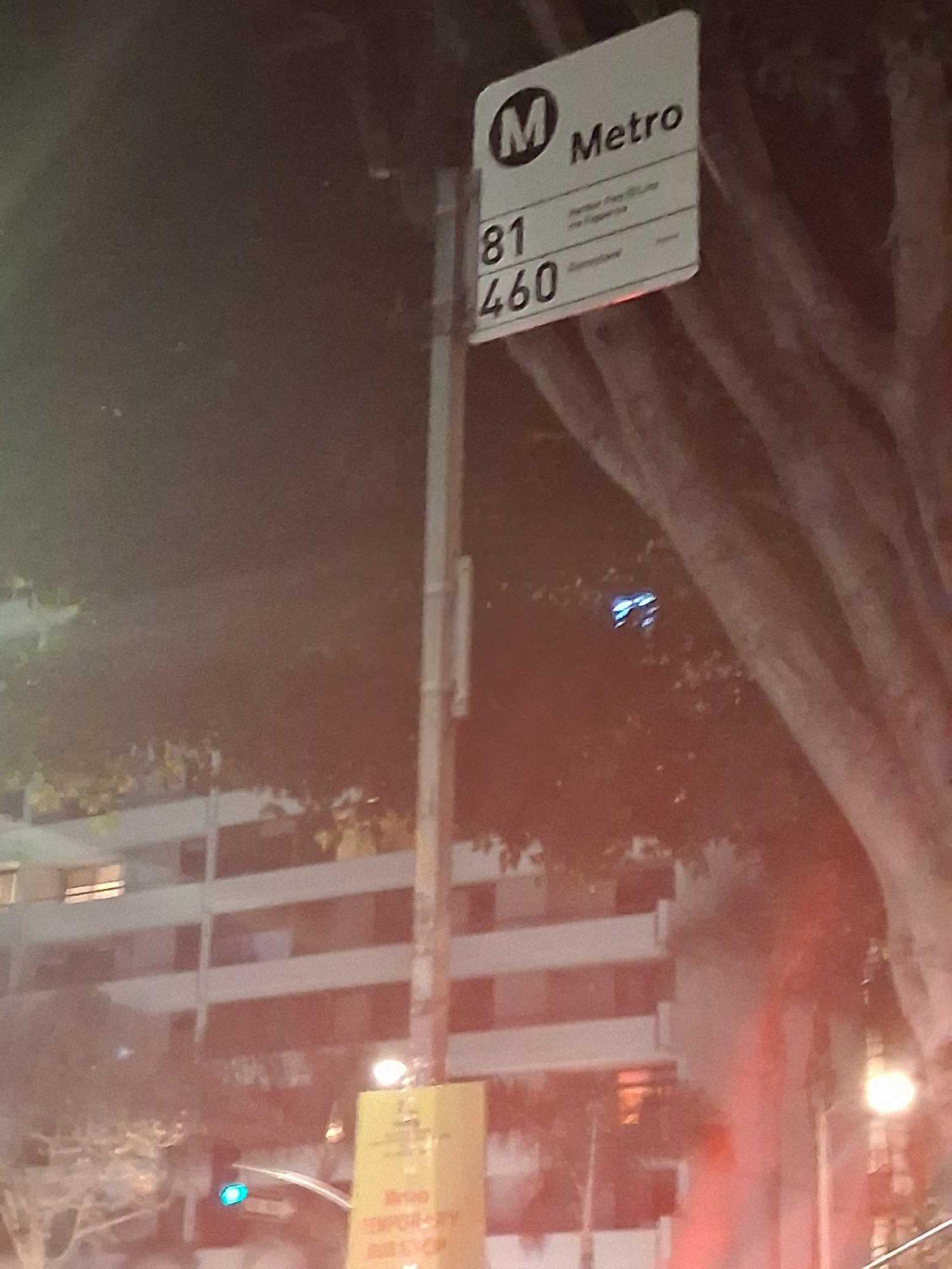
 Bus: 14/37, 66, 70, 81, 460.
- Subway: B LINE, D LINE, E LINE, A LINE.
- Funicular: ANGELS FLIGHT.
How to get to Flower St & 9th St stop by bus?
Click on the bus route to see step by step directions with maps, line arrival times and updated time schedules.
How to get to Flower St & 9th St stop by subway?
Click on the subway route to see step by step directions with maps, line arrival times and updated time schedules.
Bus stops near Flower St & 9th St stop in Downtown
- Flower / 9th, 1 min walk,
- 9th / Hope, 2 min walk,
- Figueroa St and 9th St E, 3 min walk,
- Flower St & 8th St, 3 min walk,
- Flower St & Olympic Blvd, 3 min walk,
- 8th St & Flower St, 3 min walk,
- West 8th St & STH Flower St, 3 min walk,
- Olympic / Flower, 3 min walk,
Funicular stations near Flower St & 9th St station in Downtown
- Angels Flight Lower Station, 13 min walk,
Subway stations near Flower St & 9th St station in Downtown
- Pico Station, 14 min walk,
- 7th Street / Metro Center, 22 min walk,
Bus lines to Flower St & 9th St stop in Downtown
- 81, Figueroa - LA Loma,
- 460, Disneyland,
- CE419, Southbound,
- 66, Commerce Center,
- CE423, Downtown LA/Encino,
- CE534, West LA/Downtown LA,
- 490, Express-Grand Av Park N Ride-Covina-DTLA,
- 493, Express-Rowland Hts-Puente Hills-DTLA,
- 495, Express - Industry Park N Ride - DTLA,
- 498, Express Service - West Covina - DTLA,
- 499, Express - Via Verde Park N Ride - DTLA,
- 699, Express - Montclair - Fairplex - DTLA,
- DASH F, (Southbound) Dash F / Expo Park - USC /,
- CE422, Woodland Hills,
- CE438, Northbound,
- CE438B, Southbound,
- CE448, Southbound,
- CE431, Downtown LA/Westwood,
- CE431B, CE431B,
- CE437A, Downtown LA/Culver City,
What are the closest stations to Flower St & 9th St?
The closest stations to Flower St & 9th St are:
- Flower / 9th is 35 yards away, 1 min walk.
- 9th / Hope is 145 yards away, 2 min walk.
- Figueroa St and 9th St E is 170 yards away, 3 min walk.
- Flower St & 8th St is 172 yards away, 3 min walk.
- Flower St & Olympic Blvd is 183 yards away, 3 min walk.
- 8th St & Flower St is 223 yards away, 3 min walk.
- West 8th St & STH Flower St is 225 yards away, 3 min walk.
- Olympic / Flower is 229 yards away, 3 min walk.
- Angels Flight Lower Station is 1037 yards away, 13 min walk.
- Pico Station is 1107 yards away, 14 min walk.
- 7th Street / Metro Center is 1809 yards away, 22 min walk.
Which bus lines stop near Flower St & 9th St?
These bus lines stop near Flower St & 9th St: 14/37, 66, 70, 81.
Which subway lines stop near Flower St & 9th St?
These subway lines stop near Flower St & 9th St: B LINE, D LINE, E LINE.
What’s the nearest subway station to Flower St & 9th St in Downtown?
The nearest subway station to Flower St & 9th St in Downtown is Pico Station. It’s a 14 min walk away.
What’s the nearest bus station to Flower St & 9th St in Downtown?
The nearest bus station to Flower St & 9th St in Downtown is Flower / 9th. It’s a 1 min walk away.
What’s the nearest funicular station to Flower St & 9th St in Downtown?
The nearest funicular station to Flower St & 9th St in Downtown is Angels Flight Lower Station. It’s a 13 min walk away.
What time is the first subway to Flower St & 9th St in Downtown?
The E LINE is the first subway that goes to Flower St & 9th St in Downtown. It stops nearby at 3:57 AM.
What time is the last subway to Flower St & 9th St in Downtown?
The A LINE is the last subway that goes to Flower St & 9th St in Downtown. It stops nearby at 12:51 AM.
What time is the first bus to Flower St & 9th St in Downtown?
The 81 is the first bus that goes to Flower St & 9th St in Downtown. It stops nearby at 3:00 AM.
What time is the last bus to Flower St & 9th St in Downtown?
The 81 is the last bus that goes to Flower St & 9th St in Downtown. It stops nearby at 3:08 AM.
What time is the first funicular to Flower St & 9th St in Downtown?
The ANGELS FLIGHT is the first funicular that goes to Flower St & 9th St in Downtown. It stops nearby at 6:45 AM.
What time is the last funicular to Flower St & 9th St in Downtown?
The ANGELS FLIGHT is the last funicular that goes to Flower St & 9th St in Downtown. It stops nearby at 10:05 PM.
Flower St & 9th St station
 Taken by Anonymous
See Flower St & 9th St stop, Downtown, on the map
Public transit to Flower St & 9th St stop in Downtown
Looking for directions to Flower St & 9th St in Downtown, United States?
Download the Moovit App to find the current schedule and step-by-step directions for Bus or Subway routes that pass through Flower St & 9th St.
Looking for the nearest stops closest to Flower St & 9th St ? Check out this list of closest stops to your destination: Flower / 9th; 9th / Hope; Figueroa St and 9th St E; Flower St & 8th St; Flower St & Olympic Blvd; 8th St & Flower St; West 8th St & STH Flower St; Olympic / Flower; Angels Flight Lower Station; Pico Station; 7th Street / Metro Center.
Bus: 14/37, 66, 70, 81, 460, CE419, DASH F.Subway: B LINE, D LINE, E LINE, A LINE.Funicular: ANGELS FLIGHT.
We make riding on public transit to Flower St & 9th St easy, which is why over 1.5 million users, including users in Downtown trust Moovit as the best app for public transit.
Use the app to navigate to popular places including to the airport, hospital, stadium, grocery store, mall, coffee shop, school, college, and university.
The first line to this stop is DASH F, at 6:06 AM, and the last line is DASH F at 9:06 PM.
857 S Flower St, Los Angeles, CA, USA
This stop serves LADOT’s lines
- Flower / 9th,
- 9th / Hope,
- Figueroa St and 9th St E,
- Flower St & 8th St,
- Flower St & Olympic Blvd,
- 8th St & Flower St,
- West 8th St & STH Flower St,
- Olympic / Flower
Bus stops near Flower St & 9th St stop
- Angels Flight Lower Station
Funicular station near Flower St & 9th St station
- Pico Station,
- 7th Street / Metro Center
Subway stations near Flower St & 9th St station
- Rosecrans Ave. /Sepulveda Blvd.,
- Century Blvd & Yukon Ave,
- Broadway / 1st,
- Sunset / Vine,
- Katella-Euclid,
- Raymond / Holly,
- Santa Monica / Wilcox,
- Olive View Medical Center,
- Olive St & 6th St,
- LAX Terminal 1 Lower Level Flyaway Stop,
- Orangethorpe / East Entry Park & Ride,
- Garvey / Alhambra,
- Los Angeles St & 9th St,
- 1st / Indiana,
- Willow & Atlantic SE,
- Washington Blvd & Lambert Rd,
- Vineland / Chandler,
- Lincoln-Harbor,
- Sherman Way / Etiwanda,
- Alvarado / 6th
Popular public transit stations in Downtown
Get around Downtown by public transit!
Traveling around Downtown has never been so easy. See step by step directions as you travel to any attraction, street or major public transit station. View bus and train schedules, arrival times, service alerts and detailed routes on a map, so you know exactly how to get to anywhere in Downtown.
When traveling to any destination around Downtown use Moovit's Live Directions with Get Off Notifications to know exactly where and how far to walk, how long to wait for your line, and how many stops are left. Moovit will alert you when it's time to get off — no need to constantly re-check whether yours is the next stop.
Wondering how to use public transit in Downtown or how to pay for public transit in Downtown? Moovit public transit app can help you navigate your way with public transit easily, and at minimum cost. It includes public transit fees, ticket prices, and costs. Looking for a map of Downtown public transit lines? Moovit public transit app shows all public transit maps in Downtown with all Bus, Train, Subway, Ferry and Funicular routes and stops on an interactive map.
Los Angeles has 5 transit type(s), including: Bus, Train, Subway, Ferry and Funicular, operated by several transit agencies, including Metro, Alhambra Community Transit, Arcadia Transit, Artesia Transit, AVTA, Baldwin Park Transit, Beach Cities Transit, Beaumont Transit, Bell Gardens Town Trolley, Bellflower Bus, Big Blue Bus, Burbank Bus, Calabasas Trolley, Camarillo Area Transit and Carson Circuit