Directions to Fluence (Portão) with public transportation
The following transit lines have routes that pass near Fluence
How to get to Fluence by bus?
Click on the bus route to see step by step directions with maps, line arrival times and updated time schedules.
From Hospital Oswaldo Cruz, Centro
32 minFrom Centro De Treinamento Clube Atlético Paranaense, Umbará
60 minFrom Auto Shopping Curitiba, Tarumã
50 minFrom Copel - Agência de Atendimento, Boqueirão
44 minFrom Rua Ourizona, Sítio Cercado
53 minFrom Rua Nova Aurora, Sítio Cercado
52 minFrom Rua Doutor Ovande do Amaral, Jardim Das Américas
48 minFrom Vitoria Regia, Cic
59 minFrom Rua Oliveira Viana, Hauer
44 minFrom Hospital Vita, Bairro Alto
54 min
Bus stops near Fluence in Portão
Bus lines to Fluence in Portão
- 762 VILA ROSINHA, Vila Rosinha → Praça Rui Barbosa,VIEW
- 020 INTERBAIRROS II (HORÁRIO), INTERBAIRROS II (HORÁRIO),VIEW
- 027 CAPÃO RASO / CAMPINA DO SIQUEIRA, CAPÃO RASO / CAMPINA DO SIQUEIRA,VIEW
- 701 FAZENDINHA, FAZENDINHA,VIEW
- 703 CAIUÁ, CAIUÁ,VIEW
- 706 CAIUÁ - FAZENDINHA / CENTRO, CAIUÁ - FAZENDINHA / CENTRO,VIEW
- 779 ESPECIAL LOS ANGELES, Santa Quitéria → Los Angeles,VIEW
- 779 VILA VELHA / BURITI, Estação Santa Quitéria → Buriti,VIEW
- 024 CAPÃO RASO / CAMPINA DO SIQUEIRA (LD), Terminal Capão Raso → Terminal Campina do Siqueira,VIEW
- X36 REFORÇO GUADALUPE / FAZENDINHA, Terminal Fazendinha → Guadalupe,VIEW
- 022 INTER 2 (HORÁRIO), Capão Raso → Campina do Siqueira,VIEW
- 023 INTER 2 (ANTI-HORÁRIO), Campina do Siqueira → Capão Raso,VIEW
- 702 CAIUÁ / CACHOEIRA, Terminal Caiuá → Terminal Cachoeira,VIEW
- 021 INTERBAIRROS II (ANTI-HORÁRIO), Campina do Siqueira → Capão Raso,VIEW
What are the closest stations to Fluence?
The closest stations to Fluence are:
- R. Pedro Collere, 682 is 73 meters away, 2 min walk.
- Av. Presidente Arthur da Silva Bernardes, 607 is 279 meters away, 4 min walk.
- Santa Quitéria (sentido Buriti) is 324 meters away, 5 min walk.
- Santa Quitéria is 330 meters away, 5 min walk.
- Av. Presidente Arthur da Silva Bernardes, 1000 is 360 meters away, 6 min walk.
Which bus lines stop near Fluence?
These bus lines stop near Fluence: 020 INTERBAIRROS II (HORÁRIO), 022 INTER 2 (HORÁRIO), 702 CAIUÁ / CACHOEIRA.
What’s the nearest bus station to Fluence in Portão?
The nearest bus station to Fluence in Portão is R. Pedro Collere, 682. It’s a 2 min walk away.
What time is the first bus to Fluence in Portão?
The 021 INTERBAIRROS II (ANTI-HORÁRIO) is the first bus that goes to Fluence in Portão. It stops nearby at 5:11 AM.
What time is the last bus to Fluence in Portão?
The 703 CAIUÁ is the last bus that goes to Fluence in Portão. It stops nearby at 12:45 AM.
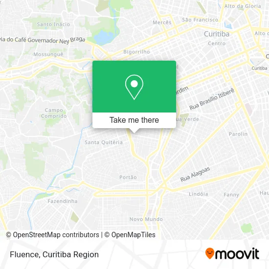
See Fluence, Portão, on the map
Public Transit to Fluence in Portão
Wondering how to get to Fluence in Portão? Moovit helps you find the best way to get to Fluence with step-by-step directions from the nearest public transit station.
Moovit provides free maps and live directions to help you navigate through your city. View schedules, routes, timetables, and find out how long does it take to get to Fluence in real time.
Looking for the nearest stop or station to Fluence? Check out this list of stops closest to your destination: R. Pedro Collere; Av. Presidente Arthur da Silva Bernardes; Santa Quitéria (sentido Buriti); Santa Quitéria; Av. Presidente Arthur da Silva Bernardes.
Bus: 020 INTERBAIRROS II (HORÁRIO), 022 INTER 2 (HORÁRIO), 702 CAIUÁ / CACHOEIRA, 762 VILA ROSINHA, 027 CAPÃO RASO / CAMPINA DO SIQUEIRA, 701 FAZENDINHA, 703 CAIUÁ, 706 CAIUÁ - FAZENDINHA / CENTRO, 779 ESPECIAL LOS ANGELES, 779 VILA VELHA / BURITI, 024 CAPÃO RASO / CAMPINA DO SIQUEIRA (LD), X36 REFORÇO GUADALUPE / FAZENDINHA, 023 INTER 2 (ANTI-HORÁRIO), 021 INTERBAIRROS II (ANTI-HORÁRIO).
Want to see if there’s another route that gets you there at an earlier time? Moovit helps you find alternative routes or times. Get directions from and directions to Fluence easily from the Moovit App or Website.
We make riding to Fluence easy, which is why over 1.5 million users, including users in Portão, trust Moovit as the best app for public transit. You don’t need to download an individual bus app or train app, Moovit is your all-in-one transit app that helps you find the best bus time or train time available.
For information on prices of bus, costs and ride fares to Fluence, please check the Moovit app.
Use the app to navigate to popular places including to the airport, hospital, stadium, grocery store, mall, coffee shop, school, college, and university.
Fluence Address: Rua Professor Ulisses Vieira, 1020 Vila Izabel Curitiba-PR 80320-090 street in Portão
- Rua Professor Doutor Pedro Ribeiro Macedo da Costa,
- Faccia Odontologia,
- Acs Techsupport,
- Desentupidora Absoluta,
- Rua Professor Ulisses Vieira 959,
- 2gr Comunicacao e Eventos,
- Yz Formaturas Ltda,
- Wemultiply Marketing e Entretenimento,
- Hanceld Centro Pedagogico Ltda,
- Papelaria Zodiaco,
- Dufiori Sorvetes and Acai,
- Studio Victoria,
- Sheila Nail Designer,
- Repasse Curitiba,
- Awa Projects,
- Escola Municipal Campo Mourão,
- Suprema Sistemas,
- A M M Assessoria Gestao de Projetos e Engenharia,
- Staz Representacao Comercial,
- Master Burguer
Places Near Fluence (Portão)
- Hospital Da Cruz Vermelha, Batel,
- Hospital Angelina Caron, Campina Grande Do Sul,
- Hospital Nossa Senhora Das Graças, Mercês,
- Rua Martim Afonso 558, Mercês,
- Hhhhh, Fazendinha,
- Arena Da Baixada - Curitiba,
- Shopping Palladium, Portão,
- Jockey Plaza Shopping Center, Tarumã,
- Hospital do Rocio, Campo,
- Park Shopping Barigüi, Mossunguê,
- Pontifícia Universidade Católica do Paraná (PUCPR), Prado Velho,
- Hospital Erasto Gaertner, Jardim Das Américas,
- Hospital Do Senhor - Madre Virgínia, São José Dos Pinhais,
- Hospital de Clínicas (HC - UFPR), Centro,
- Shopping Estação, Rebouças,
- Hospital Madalena Sofia, Bairro Alto,
- Hospital Universitário Evangélico de Curitiba, Bigorrilho,
- Jardim Botânico de Curitiba PR, Centro,
- Parque Barigui, Mercês,
- Rua General Mário Tourinho, Campina Do Siqueira
How to get to popular places in Curitiba Region with public transit
Get around Portão by public transit!
Traveling around Portão has never been so easy. See step by step directions as you travel to any attraction, street or major public transit station. View bus and train schedules, arrival times, service alerts and detailed routes on a map, so you know exactly how to get to anywhere in Portão.
When traveling to any destination around Portão use Moovit's Live Directions with Get Off Notifications to know exactly where and how far to walk, how long to wait for your line, and how many stops are left. Moovit will alert you when it's time to get off — no need to constantly re-check whether yours is the next stop.
Wondering how to use public transit in Portão or how to pay for public transit in Portão? Moovit public transit app can help you navigate your way with public transit easily, and at minimum cost. It includes public transit fees, ticket prices, and costs. Looking for a map of Portão public transit lines? Moovit public transit app shows all public transit maps in Portão with all Bus and Cable Car routes and stops on an interactive map.
Curitiba Region has 2 transit type(s), including: Bus and Cable Car, operated by several transit agencies, including Sistema Integrado de Mobilidade (URBS), Sistema Integrado de Mobilidade (AMEP), URBS (Cartões bancários e Dinheiro), URBS (Cartões bancários / Cartão URBS), AMEP (Cartões bancários / Cartão MetroCard), AMEP (Cartões bancários / Cartão MetroCard / Dinheiro), Viação Colombo (Dinheiro), TRIAR (Cartão TRIAR / Dinheiro), Empresa Curitiba Cerro Azul (Dinheiro), Expresso Nossa Senhora da Penha (Dinheiro), Empresa Campo Alto Tijucas (Dinheiro), Auto Viação São José (Cartão VEM / Dinheiro), BRT S/A (Cartão VEM / Dinheiro), TransPiedade (Cartão Cidadão / Dinheiro) and Oceânica Sul (Cartão Transporte / Dinheiro)