Directions to Focus Point Solution (Baltimore) with public transportation
The following transit lines have routes that pass near Focus Point Solution
 Bus: 78, CITYLINK PURPLE, 34.
- Train: MARC.
How to get to Focus Point Solution by bus?
Click on the bus route to see step by step directions with maps, line arrival times and updated time schedules.
From Bwi2 Employee Shuttles, Baltimore
46 minFrom Johns Hopkins Mountcastle Auditorium, Baltimore
42 minFrom Mva, Baltimore
59 minFrom Eastern Ave (eastern avenue and dundalk av), Baltimore
56 minFrom National Aquarium, Baltimore
38 minFrom Morgan State University, Baltimore
63 minFrom Pier Six Pavilion, Baltimore
39 minFrom Hilton Baltimore, Baltimore
30 minFrom Johns Hopkins Bayview Medical Center, Baltimore
59 minFrom MVA Glen Burnie, Anne Arundel County
58 min
Bus stops near Focus Point Solution in Baltimore
Train station near Focus Point Solution in Baltimore
- West Baltimore Marc Nb, 47 min walk,VIEW
Bus lines to Focus Point Solution in Baltimore
What are the closest stations to Focus Point Solution?
The closest stations to Focus Point Solution are:
- Yale Ave & Walrad St Nb is 285 yards away, 4 min walk.
- Old Frederick Rd & Collinsave is 673 yards away, 8 min walk.
- West Baltimore Marc Nb is 3921 yards away, 47 min walk.
Which bus lines stop near Focus Point Solution?
These bus lines stop near Focus Point Solution: 78, CITYLINK PURPLE.
What’s the nearest bus station to Focus Point Solution in Baltimore?
The nearest bus station to Focus Point Solution in Baltimore is Yale Ave & Walrad St Nb. It’s a 4 min walk away.
What time is the first train to Focus Point Solution in Baltimore?
The MARC is the first train that goes to Focus Point Solution in Baltimore. It stops nearby at 4:39 AM.
What time is the last train to Focus Point Solution in Baltimore?
The MARC is the last train that goes to Focus Point Solution in Baltimore. It stops nearby at 10:53 PM.
What time is the first bus to Focus Point Solution in Baltimore?
The CITYLINK PURPLE is the first bus that goes to Focus Point Solution in Baltimore. It stops nearby at 4:16 AM.
What time is the last bus to Focus Point Solution in Baltimore?
The CITYLINK PURPLE is the last bus that goes to Focus Point Solution in Baltimore. It stops nearby at 2:36 AM.
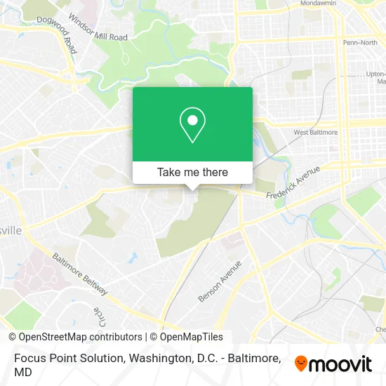
See Focus Point Solution, Baltimore, on the map
Public Transit to Focus Point Solution in Baltimore
Wondering how to get to Focus Point Solution in Baltimore? Moovit helps you find the best way to get to Focus Point Solution with step-by-step directions from the nearest public transit station.
Moovit provides free maps and live directions to help you navigate through your city. View schedules, routes, timetables, and find out how long does it take to get to Focus Point Solution in real time.
Looking for the nearest stop or station to Focus Point Solution? Check out this list of stops closest to your destination: Yale Ave & Walrad St Nb; Old Frederick Rd & Collinsave; West Baltimore Marc Nb.
Bus: 78, CITYLINK PURPLE, 34.Train: MARC.
Want to see if there’s another route that gets you there at an earlier time? Moovit helps you find alternative routes or times. Get directions from and directions to Focus Point Solution easily from the Moovit App or Website.
We make riding to Focus Point Solution easy, which is why over 1.5 million users, including users in Baltimore, trust Moovit as the best app for public transit. You don’t need to download an individual bus app or train app, Moovit is your all-in-one transit app that helps you find the best bus time or train time available.
For information on prices of bus and metro, costs and ride fares to Focus Point Solution, please check the Moovit app.
Use the app to navigate to popular places including to the airport, hospital, stadium, grocery store, mall, coffee shop, school, college, and university.
Focus Point Solution Address: 323 Collins Ave street in Baltimore
- Arts Project,
- Post Office,
- Elne Clare Designs,
- Brookline Mini Mart,
- Good Golden Grocery Inc Shanghui,
- The Smith Center,
- Dixon and Associates,
- Mobile Land,
- Shay B's,
- My Brothers Keeper,
- Digicomm Media,
- My Brother's Keeper Covid-19 Vaccination Site,
- Hair Studio 104,
- MD Lot Irvington Crown,
- Krispy Krunchy Chicken,
- Dollar General,
- Damon's Rental Hall,
- Bruhova Productions,
- Dixon Hall,
- Gs Marketing
Places Near Focus Point Solution (Baltimore)
- Pennsylvania Ave NW (3rd st and pennsylvania), Washington,
- Marriott Marquis Washington, DC, Washington,
- Washington DC VA Medical Center, Washington,
- Rock Creek Tennis Center, Washington,
- Westfield Montgomery Mall, Montgomery County,
- The Anthem, Washington,
- M&T Bank Stadium, Baltimore,
- Warner Theatre, Washington,
- Sibley Memorial Hospital, Washington,
- Washington National Cathedral, Washington,
- National Theatre, Washington,
- National Zoo, Washington,
- Amazon Hq2, Arlington County,
- Georgetown, Washington,
- Capital One Arena, Washington,
- National Museum of African American History and Culture, Washington,
- Museum Of The Bible, Washington,
- Basilica of the National Shrine, Washington,
- Camden Yards, Baltimore,
- PG Mall, Prince George's County
How to get to popular places in Washington, D.C. - Baltimore, MD with public transit
Get around Baltimore by public transit!
Traveling around Baltimore has never been so easy. See step by step directions as you travel to any attraction, street or major public transit station. View bus and train schedules, arrival times, service alerts and detailed routes on a map, so you know exactly how to get to anywhere in Baltimore.
When traveling to any destination around Baltimore use Moovit's Live Directions with Get Off Notifications to know exactly where and how far to walk, how long to wait for your line, and how many stops are left. Moovit will alert you when it's time to get off — no need to constantly re-check whether yours is the next stop.
Wondering how to use public transit in Baltimore or how to pay for public transit in Baltimore? Moovit public transit app can help you navigate your way with public transit easily, and at minimum cost. It includes public transit fees, ticket prices, and costs. Looking for a map of Baltimore public transit lines? Moovit public transit app shows all public transit maps in Baltimore with all Bus, Train, Metro, Light Rail and Ferry routes and stops on an interactive map.
Washington, D.C. - Baltimore, MD has 5 transit type(s), including: Bus, Train, Metro, Light Rail and Ferry, operated by several transit agencies, including WMATA, Montgomery County Ride On, Fairfax Connector, TheBus, PRTC, DASH - Alexandria, Arlington Transit (ART), RTA of Central Maryland, MDOT MTA, MDOT MTA Light RailLink, MDOT MTA Commuter Bus, MDOT MTA Local Bus, FXBGO!, Virginia Railway Express (VRE) and MARC