Directions to Folcroft with public transportation
The following transit lines have routes that pass near Folcroft
 Bus: 114, 115, 113.
- Train: WIL.
- Metro: D2.
How to get to Folcroft by bus?
Click on the bus route to see step by step directions with maps, line arrival times and updated time schedules.
How to get to Folcroft by train?
Click on the train route to see step by step directions with maps, line arrival times and updated time schedules.
How to get to Folcroft by metro?
Click on the metro route to see step by step directions with maps, line arrival times and updated time schedules.
Bus stops near Folcroft
- Chester Pk & Folcroft Av, 2 min walk,
- Macdade Blvd & Willows Av, 15 min walk,
Train station near Folcroft
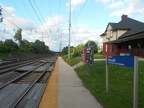
- Folcroft, 15 min walk,
Metro station near Folcroft
- Macdade Blvd Station, 17 min walk,
Bus lines to Folcroft
- 114, Wawa Station,
- 115, Delaware County Community College,
- 113, Ridge-Market,
What are the closest stations to Folcroft?
The closest stations to Folcroft are:
- Chester Pk & Folcroft Av stop is 101 yards away, 2 min walk.
- Macdade Blvd & Willows Av stop is 1225 yards away, 15 min walk.
- Folcroft station is 1290 yards away, 15 min walk.
- Macdade Blvd Station is 1429 yards away, 17 min walk.
Which bus lines stop near Folcroft?
These bus lines stop near Folcroft: 114, 115.
Which train line stops near Folcroft?
WIL (#Wil213 - Wilmington)
Which metro line stops near Folcroft?
D2 (Sharon Hill)
What’s the nearest metro station to Folcroft?
The nearest metro station to Folcroft is Macdade Blvd Station. It’s a 17 min walk away.
What’s the nearest train station to Folcroft?
The nearest train station to Folcroft is Folcroft. It’s a 15 min walk away.
What’s the nearest bus station to Folcroft?
The nearest bus station to Folcroft is Chester Pk & Folcroft Av. It’s a 2 min walk away.
See Folcroft on the map
Public Transportation to Folcroft
Wondering how to get to Folcroft? Moovit helps you find the best way to get to Folcroft with step-by-step directions from the nearest public transit station.
Moovit provides free maps and live directions to help you navigate through your city. View schedules, routes, timetables, and find out how long does it take to get to Folcroft in real time.
Looking for the nearest stop or station to Folcroft? Check out this list of stops closest to your destination: Chester Pk & Folcroft Av; Macdade Blvd & Willows Av; Folcroft; Macdade Blvd Station.
Bus: 114, 115, 113.Train: WIL.Metro: D2.
Want to see if there’s another route that gets you there at an earlier time? Moovit helps you find alternative routes or times. Get directions from and directions to Folcroft easily from the Moovit App or Website.
We make riding to Folcroft easy, which is why over 1.7 billion users, including users in Philadelphia, trust Moovit as the best app for public transit. You don’t need to download an individual bus app or train app, Moovit is your all-in-one transit app that helps you find the best bus time or train time available.
For information on prices of bus, metro and train, costs and ride fares to Folcroft, please check the Moovit app.
Use the app to navigate to popular places including to the airport, hospital, stadium, grocery store, mall, coffee shop, school, college, and university.
Location: Philadelphia
Folcroft is a borough in Delaware County, Pennsylvania, United States. As of the 2020 census, Folcroft had a population of 6,792.Wiki
Popular routes to Folcroft
- Sharon Hill,
- Glenolden,
- Collingdale,
- Aldan,
- Darby,
- Norwood,
- Ridley,
- Colwyn,
- Clifton Heights,
- Yeadon,
- Prospect Park,
- Lansdowne,
- Tinicum,
- East Lansdowne,
- Morton,
- Folsom,
- Drexel Hill,
- Ridley Park,
- Swarthmore,
- Springfield
Places Near Folcroft
- Belmont Plateau, Philadelphia,
- City Line Ave, Philadelphia,
- The Fillmore, Philadelphia,
- Lemon Hill Park, Philadelphia,
- Live! Casino & Hotel Philadelphia, Philadelphia,
- Perelman Center for Advanced Medicine, Philadelphia,
- Academy Of Music, Philadelphia,
- Rittenhouse Square, Philadelphia,
- The Wanamaker Building, Philadelphia,
- Lincoln Financial Field, Philadelphia,
- Yqqqq, Philadelphia,
- Citizens Bank Park, Philadelphia,
- Aronimink Golf Club,
- The Barnes Foundation, Philadelphia,
- Love Park, Philadelphia,
- The Navy Yard, Philadelphia,
- Philadelphia Museum Of Art, Philadelphia,
- Fairmount Park, Philadelphia,
- La Salle College High School, Springfield,
- Liberty Bell, Philadelphia
How to get to popular places in Philadelphia with public transit
Get around Philadelphia by public transit!
Traveling around Philadelphia has never been so easy. See step by step directions as you travel to any attraction, street or major public transit station. View bus and train schedules, arrival times, service alerts and detailed routes on a map, so you know exactly how to get to anywhere in Philadelphia.
When traveling to any destination around Philadelphia use Moovit's Live Directions with Get Off Notifications to know exactly where and how far to walk, how long to wait for your line, and how many stops are left. Moovit will alert you when it's time to get off — no need to constantly re-check whether yours is the next stop.
Wondering how to use public transit in Philadelphia or how to pay for public transit in Philadelphia? Moovit public transit app can help you navigate your way with public transit easily, and at minimum cost. It includes public transit fees, ticket prices, and costs. Looking for a map of Philadelphia public transit lines? Moovit public transit app shows all public transit maps in Philadelphia with all Bus, Train, Metro, Light Rail and Cable Car routes and stops on an interactive map.
Philadelphia has 5 transit type(s), including: Bus, Train, Metro, Light Rail and Cable Car, operated by several transit agencies, including SEPTA Subway, SEPTA Rail, SEPTA, SEPTA Trolley, NJ Transit Rail, NJ Transit, Port Authority Transit Corporation, Navy Yard, Penn Transit, Drexel University, Pottstown Area Rapid Transit (PART), Fullington Tours, Chescobus, Amtrak and Greyhound-us