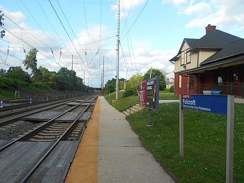
Folcroft station - Tuesday schedule
| Line | Direction | Time |
|---|---|---|
| WIL | #Wil278 - Center City Philadelphia | 5:53 AM |
| WIL | #Wil2882 - Temple University | 6:43 AM |
| WIL | #Wil207 - Marcus Hook | 6:59 AM |
| WIL | #Wil209 - Wilmington | 7:21 AM |
| WIL | #Wil9204 - Temple University | 8:01 AM |
| WIL | #Wil3285 - Newark De | 8:01 AM |
| WIL | #Wil9208 - Temple University | 8:57 AM |
| WIL | #Wil213 - Wilmington | 9:00 AM |
| WIL | #Wil9210 - Temple University | 9:57 AM |
| WIL | #Wil219 - Marcus Hook | 10:06 AM |
| WIL | #Wil9212 - Temple University | 10:37 AM |
| WIL | #Wil3289 - Wilmington | 10:39 AM |
| WIL | #Wil9214 - Temple University | 11:39 AM |
| WIL | #Wil9215 - Marcus Hook | 11:58 AM |
| WIL | #Wil9216 - Temple University | 12:45 PM |
| WIL | #Wil9217 - Wilmington | 12:56 PM |
| WIL | #Wil3291 - Marcus Hook | 1:37 PM |
| WIL | #Wil9218 - Temple University | 1:45 PM |
| WIL | #Wil221 - Newark De | 2:29 PM |
| WIL | #Wil9220 - Temple University | 2:53 PM |
| WIL | #Wil9223 - Newark De | 3:30 PM |
| WIL | #Wil284 - Center City Philadelphia | 4:00 PM |
| WIL | #Wil9227 - Marcus Hook | 4:57 PM |
| WIL | #Wil2388 - Center City Philadelphia | 5:28 PM |
| WIL | #Wil9225 - Marcus Hook | 5:53 PM |
Directions to Folcroft station with public transit
The following transit lines have routes that pass near Folcroft
 Bus: 113, 114, 115.
- Train: MED, WIL.
- Metro: D2.
How to get to Folcroft station by bus?
Click on the bus route to see step by step directions with maps, line arrival times and updated time schedules.
How to get to Folcroft station by train?
Click on the train route to see step by step directions with maps, line arrival times and updated time schedules.
How to get to Folcroft station by metro?
Click on the metro route to see step by step directions with maps, line arrival times and updated time schedules.
Bus stops near Folcroft stop
- Primos Av & Elmwood Av, 2 min walk,
- Chester Pk & Oak Ln, 6 min walk,
Metro stations near Folcroft station
- Chester Pike/Sharon Hill, 12 min walk,
Train stations near Folcroft station
- Sharon Hill, 13 min walk,
Bus lines to Folcroft station
- 115, Delaware County Community College,
- 114, Wawa Station,
What are the closest stations to Folcroft?
The closest stations to Folcroft are:
- Primos Av & Elmwood Av stop is 139 yards away, 2 min walk.
- Chester Pk & Oak Ln stop is 490 yards away, 6 min walk.
- Chester Pike/Sharon Hill station is 1021 yards away, 12 min walk.
- Sharon Hill station is 1126 yards away, 13 min walk.
Which bus lines stop near Folcroft?
These bus lines stop near Folcroft: 113, 114, 115.
Which train lines stop near Folcroft?
These train lines stop near Folcroft: MED, WIL.
Which metro line stops near Folcroft?
D2 (Sharon Hill)
What’s the nearest metro station to Folcroft?
The nearest metro station to Folcroft is Chester Pike/Sharon Hill. It’s a 12 min walk away.
What’s the nearest train station to Folcroft?
The nearest train station to Folcroft is Sharon Hill. It’s a 13 min walk away.
What’s the nearest bus station to Folcroft?
The nearest bus station to Folcroft is Primos Av & Elmwood Av. It’s a 2 min walk away.
See Folcroft station on the map
Public transit to Folcroft station
Looking for directions to Folcroft in Folcroft, United States?
Download the Moovit App to find the current schedule and step-by-step directions for Bus, Train or Metro routes that pass through Folcroft.
Looking for the nearest stops closest to Folcroft ? Check out this list of closest stops to your destination: Primos Av & Elmwood Av; Chester Pk & Oak Ln; Chester Pike/Sharon Hill; Sharon Hill.
Bus: 113, 114, 115.Train: MED, WIL.Metro: D2.
We make riding on public transit to Folcroft easy, which is why over 1.7 billion users, including users in Folcroft trust Moovit as the best app for public transit.
Use the app to navigate to popular places including to the airport, hospital, stadium, grocery store, mall, coffee shop, school, college, and university.
The station has the following entrances: Primos Ave, Primos Ave and Baltimore Ave
The first line to this station is WIL, at 5:53 AM, and the last line is WIL at 4:28 AM.
This station serves SEPTA Rail’s lines
Folcroft is a borough in Delaware County, Pennsylvania, United States. As of the 2020 census, Folcroft had a population of 6,792.Wiki
Popular routes from Folcroft station
- Primos Av & Elmwood Av,
- Chester Pk & Oak Ln
Bus stops near Folcroft stop
- Chester Pike/Sharon Hill
Metro station near Folcroft station
- Sharon Hill
Train station near Folcroft station
- Berwyn,
- Glenside,
- Front St & Champlost St - Fs,
- 5th St & Cambria St ,
- Morris St & Broad St,
- Oregon Av & Broad St - Fs,
- Locust St & 9th St ,
- Harrah's Chester Casino,
- Township Line Rd Station,
- Secane,
- Vine St & 55th St,
- 33rd St & Diamond St,
- Knights Rd & Woodhaven Rd - FS,
- Main Street at Sicklerville Road,
- 60th St & Market St,
- Frankford Av & Stanwood St ,
- Broad Street at Red Bank Avenue,
- 7th St & Spring Garden St ,
- 20th St & Market St ,
- Pennco Tech
Popular public transit stations in Folcroft
Get around Folcroft by public transit!
Traveling around Folcroft has never been so easy. See step by step directions as you travel to any attraction, street or major public transit station. View bus and train schedules, arrival times, service alerts and detailed routes on a map, so you know exactly how to get to anywhere in Folcroft.
When traveling to any destination around Folcroft use Moovit's Live Directions with Get Off Notifications to know exactly where and how far to walk, how long to wait for your line, and how many stops are left. Moovit will alert you when it's time to get off — no need to constantly re-check whether yours is the next stop.
Wondering how to use public transit in Folcroft or how to pay for public transit in Folcroft? Moovit public transit app can help you navigate your way with public transit easily, and at minimum cost. It includes public transit fees, ticket prices, and costs. Looking for a map of Folcroft public transit lines? Moovit public transit app shows all public transit maps in Folcroft with all Bus, Train, Metro, Light Rail and Cable Car routes and stops on an interactive map.
Philadelphia has 5 transit type(s), including: Bus, Train, Metro, Light Rail and Cable Car, operated by several transit agencies, including SEPTA Subway, SEPTA Rail, SEPTA, SEPTA Trolley, NJ Transit Rail, NJ Transit, Port Authority Transit Corporation, Navy Yard, Penn Transit, Drexel University, Pottstown Area Rapid Transit (PART), Fullington Tours, Chescobus, Amtrak and Greyhound-us