How to get to FoodMaxx by bus?
Click on the bus route to see step by step directions with maps, line arrival times and updated time schedules.
From Quebec-Florida Chamber of Commerce, Fort Lauderdale
90 minFrom E Oakland Park Blvd / US-1, Fort Lauderdale
62 minFrom Cam Transfer, Coral Springs-Margate
45 minFrom Coral Ridge Mall, Fort Lauderdale
62 minFrom Xtreme Action Park, Fort Lauderdale
69 minFrom Harrah's Pompano Beach, Pompano Beach
95 minFrom Davie, FL, Davie
97 minFrom City of Oakland Park, Fort Lauderdale
64 minFrom Hotel Soap, Fort Lauderdale
69 minFrom Brandsmart USA - Clearance Center, Fl, Davie
52 min
Bus stop near FoodMaxx in Plantation
- Northwest 21st Street/Northwest 49th Avenue, 2 min walk,VIEW
Bus lines to FoodMaxx in Plantation
- 81, Sunset Strip - University Via Inverrary,VIEW
What are the closest stations to FoodMaxx?
The closest stations to FoodMaxx are:
- Northwest 21st Street/Northwest 49th Avenue is 109 yards away, 2 min walk.
Which bus lines stop near FoodMaxx?
These bus lines stop near FoodMaxx: 441, 81.
What’s the nearest bus station to FoodMaxx in Plantation?
The nearest bus station to FoodMaxx in Plantation is Northwest 21st Street/Northwest 49th Avenue. It’s a 2 min walk away.
What time is the first bus to FoodMaxx in Plantation?
The 81 is the first bus that goes to FoodMaxx in Plantation. It stops nearby at 5:09 AM.
What time is the last bus to FoodMaxx in Plantation?
The 81 is the last bus that goes to FoodMaxx in Plantation. It stops nearby at 12:16 AM.
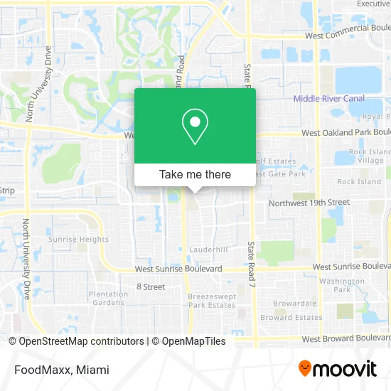
See FoodMaxx, Plantation, on the map
Public Transit to FoodMaxx in Plantation
Wondering how to get to FoodMaxx in Plantation? Moovit helps you find the best way to get to FoodMaxx with step-by-step directions from the nearest public transit station.
Moovit provides free maps and live directions to help you navigate through your city. View schedules, routes, timetables, and find out how long does it take to get to FoodMaxx in real time.
Looking for the nearest stop or station to FoodMaxx? Check out this list of stops closest to your destination: Northwest 21st Street/Northwest 49th Avenue.
Bus: 441, 81.
Want to see if there’s another route that gets you there at an earlier time? Moovit helps you find alternative routes or times. Get directions from and directions to FoodMaxx easily from the Moovit App or Website.
We make riding to FoodMaxx easy, which is why over 1.5 million users, including users in Plantation, trust Moovit as the best app for public transit. You don’t need to download an individual bus app or train app, Moovit is your all-in-one transit app that helps you find the best bus time or train time available.
For information on prices of bus, costs and ride fares to FoodMaxx, please check the Moovit app.
Use the app to navigate to popular places including to the airport, hospital, stadium, grocery store, mall, coffee shop, school, college, and university.
FoodMaxx Address: 2040 NW 49th Ave Lauderhill, FL 33313 street in Plantation
- ATM,
- Kids Town Center,
- Benchmark Property Management,
- New Destiny International,
- Lauderhill 6-12,
- A Regal Transportation,
- Deepside,
- Teaching Young Girls Holiness,
- Cypress Preserve Conservation Park,
- Boys & Girls Clubs of America,
- John E. Mullin Park and the Lauderhill Aquatic Center,
- Dorlusplumbing,
- Temple Aron Hakodesh,
- West Harbour Woodworking,
- Y M C A,
- Etienne Investment Group,
- All Brite Pressure Cleaning,
- BW Tree Company,
- Arbor Treez,
- Quick Trimms Lawn Care
Places Near FoodMaxx (Plantation)
- Bayside Marketplace, Miami,
- Miami Design District, Miami,
- Little Havana, Miami,
- Keiser University Flagship Campus, West Palm Beach,
- Dolphin Mall Bus, Miami,
- Wynwood, Miami,
- Marlins Park, Miami,
- Port of Miami Cruise Terminal, Miami,
- Zoo Miami, Miami,
- Brickell City Centre, Miami,
- 1351 NW 12th St, Miami,
- Aventura Mall, Miami,
- Sawgrass mall ( FL ), Miami Beach,
- Dolphin Mall, Miami,
- Hard Rock Stadium, Miami Gardens,
- Sawgrass Mall, Miami,
- Aventura Mall, Miami Beach,
- Miami Freedom Park, Miami,
- Richard E. Gerstein Justice Building, Miami,
- Miami-Dade County Courthouse, Miami
How to get to popular places in Miami with public transit
Get around Plantation by public transit!
Traveling around Plantation has never been so easy. See step by step directions as you travel to any attraction, street or major public transit station. View bus and train schedules, arrival times, service alerts and detailed routes on a map, so you know exactly how to get to anywhere in Plantation.
When traveling to any destination around Plantation use Moovit's Live Directions with Get Off Notifications to know exactly where and how far to walk, how long to wait for your line, and how many stops are left. Moovit will alert you when it's time to get off — no need to constantly re-check whether yours is the next stop.
Wondering how to use public transit in Plantation or how to pay for public transit in Plantation? Moovit public transit app can help you navigate your way with public transit easily, and at minimum cost. It includes public transit fees, ticket prices, and costs. Looking for a map of Plantation public transit lines? Moovit public transit app shows all public transit maps in Plantation with all Bus, Train, Light Rail and Ferry routes and stops on an interactive map.
Miami has 4 transit type(s), including: Bus, Train, Light Rail and Ferry, operated by several transit agencies, including Broward County Transit, Miami-Dade Transit, Metrorail, Palm Tran, Tri-Rail, Brightline, MARTY, City of Homestead Trolley, Key West Transit, Treasure Coast Connector, GoLine IRT, Amtrak, Greyhound-us, FlixBus-us and Aventura Express Shuttle Bus