How to get to Food Loop by bus?
Click on the bus route to see step by step directions with maps, line arrival times and updated time schedules.
Bus stops near Food Loop in Verwaltungsgemeinschaft Ettenheim
Bus lines to Food Loop in Verwaltungsgemeinschaft Ettenheim
What are the closest stations to Food Loop?
The closest stations to Food Loop are:
- Rust Rathaus is 70 meters away, 2 min walk.
- Rust Schule is 377 meters away, 5 min walk.
Which bus lines stop near Food Loop?
These bus lines stop near Food Loop: 113, 7200, 7231.
What’s the nearest bus station to Food Loop in Verwaltungsgemeinschaft Ettenheim?
The nearest bus station to Food Loop in Verwaltungsgemeinschaft Ettenheim is Rust Rathaus. It’s a 2 min walk away.
What time is the first bus to Food Loop in Verwaltungsgemeinschaft Ettenheim?
The 7200 is the first bus that goes to Food Loop in Verwaltungsgemeinschaft Ettenheim. It stops nearby at 4:39 AM.
What time is the last bus to Food Loop in Verwaltungsgemeinschaft Ettenheim?
The 7200 is the last bus that goes to Food Loop in Verwaltungsgemeinschaft Ettenheim. It stops nearby at 1:39 AM.
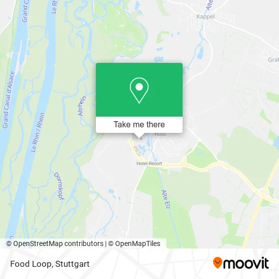
See Food Loop, Verwaltungsgemeinschaft Ettenheim, on the map
Public Transit to Food Loop in Verwaltungsgemeinschaft Ettenheim
Wondering how to get to Food Loop in Verwaltungsgemeinschaft Ettenheim? Moovit helps you find the best way to get to Food Loop with step-by-step directions from the nearest public transit station.
Moovit provides free maps and live directions to help you navigate through your city. View schedules, routes, timetables, and find out how long does it take to get to Food Loop in real time.
Looking for the nearest stop or station to Food Loop? Check out this list of stops closest to your destination: Rust Rathaus; Rust Schule.
Bus: 113, 7200, 7231, 50, 54.
Want to see if there’s another route that gets you there at an earlier time? Moovit helps you find alternative routes or times. Get directions from and directions to Food Loop easily from the Moovit App or Website.
We make riding to Food Loop easy, which is why over 1.5 million users, including users in Verwaltungsgemeinschaft Ettenheim, trust Moovit as the best app for public transit. You don’t need to download an individual bus app or train app, Moovit is your all-in-one transit app that helps you find the best bus time or train time available.
For information on prices of train, bus and light rail, costs and ride fares to Food Loop, please check the Moovit app.
Use the app to navigate to popular places including to the airport, hospital, stadium, grocery store, mall, coffee shop, school, college, and university.
Food Loop Address: Europa-Park-Straße 2 77977 Rust street in Verwaltungsgemeinschaft Ettenheim
- Penelope Glykos,
- Ladies Only Festival,
- Santa Isabel,
- Europa Park Baumanagement,
- Madame Freudenreich-Epicerie,
- ED und Eddas Fundus,
- Majorette Factory,
- Coca-Cola Fan-Shop,
- Einkaufspassage Deutsche Allee,
- Tiroler Wildwasserbahn,
- Snorri Touren,
- Themenbereich Kroatien,
- Whale Adventures Northern Lights,
- Nord Stream 2 Dome,
- Pegasus die Youngstar-Achterbahn,
- Jim Knopf - Journey Through Lummerland,
- Vindjammer,
- Columbus Jolle,
- Eurosat - Cancan Coaster,
- Ballpool
Places Near Food Loop (Verwaltungsgemeinschaft Ettenheim)
- Hanns-Martin-Schleyer-Halle (Stuttgart Hans-Martin-Schleyerhalle), Bad Cannstatt,
- Mercedes-Benz Museum (Mercedes Museum Stuttgart), Bad Cannstatt,
- Porsche Museum, Zuffenhausen,
- Mercedes-Benz Museum, Bad Cannstatt,
- Hanns-Martin-Schleyer-Halle, Bad Cannstatt,
- Gasometer Pforzheim, Pforzheim,
- Porsche-Arena, Bad Cannstatt,
- Schleyerhalle, Bad Cannstatt,
- Mettingen Eros-Center Puff Laufhaus, Esslingen Am Neckar,
- Pariser Platz Stuttgart, Stuttgart-Mitte,
- SI-Centrum, Möhringen,
- Waldfriedhof, Degerloch,
- Wilhelma (U-Bahn Wilhelma), Bad Cannstatt,
- FlixBus Haltestelle, Stuttgart,
- Hauptbahnhof Stuttgart, Stuttgart-Mitte,
- Marmorsaal Im Weissenburgpark, Stuttgart-Süd,
- Gleis 101/102 (tief), Stuttgart-Mitte,
- Geilhaus Haus 33a, Reutlingen-Betzingen,
- Im Wizemann (Halle), Bad Cannstatt,
- Klinikum Stuttgart - Katharinenhospital, Stuttgart-Mitte
How to get to popular places in Stuttgart with public transit
Get around Verwaltungsgemeinschaft Ettenheim by public transit!
Traveling around Verwaltungsgemeinschaft Ettenheim has never been so easy. See step by step directions as you travel to any attraction, street or major public transit station. View bus and train schedules, arrival times, service alerts and detailed routes on a map, so you know exactly how to get to anywhere in Verwaltungsgemeinschaft Ettenheim.
When traveling to any destination around Verwaltungsgemeinschaft Ettenheim use Moovit's Live Directions with Get Off Notifications to know exactly where and how far to walk, how long to wait for your line, and how many stops are left. Moovit will alert you when it's time to get off — no need to constantly re-check whether yours is the next stop.
Wondering how to use public transit in Verwaltungsgemeinschaft Ettenheim or how to pay for public transit in Verwaltungsgemeinschaft Ettenheim? Moovit public transit app can help you navigate your way with public transit easily, and at minimum cost. It includes public transit fees, ticket prices, and costs. Looking for a map of Verwaltungsgemeinschaft Ettenheim public transit lines? Moovit public transit app shows all public transit maps in Verwaltungsgemeinschaft Ettenheim with all Bus, Train, Subway, Light Rail, Ferry, S-Bahn and Funicular routes and stops on an interactive map.
Stuttgart has 7 transit type(s), including: Bus, Train, Subway, Light Rail, Ferry, S-Bahn and Funicular, operated by several transit agencies, including SSB - Stadtbahn, SSB, SSB - Seilbahn / Zacke, S-Bahn Stuttgart, Rhein-Neckar-Verkehr GmbH (rnv), Karlsruher Verkehrsverbund, DB AG, DB Regiobus BW, Arverio Baden-Württemberg GmbH, DB RegioNetz Verkehrs GmbH Westfrankenbahn, DB Regio AG Baden-Württemberg, Südwestdeutsche Verkehrs-AG, DB Regio AG Mitte Region Hessen, DB and Bodensee-Oberschwaben-Bahn