How to get to Footloose by bus?
Click on the bus route to see step by step directions with maps, line arrival times and updated time schedules.
From Universidad Agraria La Molina, La Molina
41 minFrom Hospital Carlos Alcántara Butterfield, La Molina
28 minFrom Molicentro, La Molina
48 minFrom Clínica Montefiori, La Molina
38 minFrom Centro De Convenciones Scencia, La Molina
34 minFrom Óvalo Santa Anita, Santa Anit
39 minFrom Universidad Peruana Unión - UPeU, Lurigancho
37 minFrom Av. Los Frutales, La Molina
36 minFrom Urbanización Mangomarca San Juan de Lurigancho, San Juan D
52 minFrom Mall Aventura Plaza Santa Anita, Santa Anit
27 min
Bus stops near Footloose in Ate
Bus lines to Footloose in Ate
- 1066, Ate - Lima,VIEW
- 1068, Ate - Lima,VIEW
- 1069, Chosica - Lima,VIEW
- 1080, Ate - La Victoria,VIEW
- 1081, Ate - La Victoria,VIEW
- 1085, Lima - Chosica,VIEW
- 1100, V. Maria T. - Ate [P],VIEW
- 1218, Chosica- San Miguel,VIEW
- 1228, Ate - Callao [Z],VIEW
- 1260, Ventanilla - Ate [El Lorito],VIEW
- 1319, Chosica - La Perla,VIEW
- 1479, Chosica - San Miguel [78],VIEW
- 1480, Chosica - San Miguel,VIEW
- 1488, Lurín - C.Central [C],VIEW
- 4604, Ate - La victoria,VIEW
- 4612, Ate - La Victoria,VIEW
- CR44, Callao - Ate,VIEW
- CR25, Pacasmayo (Callao) - Santa Clara (Ate),VIEW
- 2407, Rimac - Ate,VIEW
- 1360, Santa Clara (Ate) - Av. Huarochirí (Cieneguilla),VIEW
What are the closest stations to Footloose?
The closest stations to Footloose are:
- Real Plaza Santa Clara is 66 meters away, 1 min walk.
- Avenida 28 De Julio, 104 is 274 meters away, 4 min walk.
- La Estrella, 246 is 408 meters away, 6 min walk.
- Mercado Mega Plaza Santa Clara / San Alfonso is 678 meters away, 9 min walk.
Which bus lines stop near Footloose?
These bus lines stop near Footloose: 1066, 1080, 1085, 1100, 1228, 1488.
What’s the nearest bus station to Footloose in Ate?
The nearest bus station to Footloose in Ate is Real Plaza Santa Clara. It’s a 1 min walk away.
What time is the first bus to Footloose in Ate?
The 1218 is the first bus that goes to Footloose in Ate. It stops nearby at 3:00 AM.
What time is the last bus to Footloose in Ate?
The 1319 is the last bus that goes to Footloose in Ate. It stops nearby at 3:49 AM.
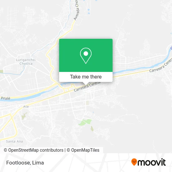
See Footloose, Ate, on the map
Public Transit to Footloose in Ate
Wondering how to get to Footloose in Ate? Moovit helps you find the best way to get to Footloose with step-by-step directions from the nearest public transit station.
Moovit provides free maps and live directions to help you navigate through your city. View schedules, routes, timetables, and find out how long does it take to get to Footloose in real time.
Looking for the nearest stop or station to Footloose? Check out this list of stops closest to your destination: Real Plaza Santa Clara; Avenida 28 De Julio; La Estrella; Mercado Mega Plaza Santa Clara / San Alfonso.
Bus: 1066, 1080, 1085, 1100, 1228, 1488, 1068, 1069, 1081, CR25, 2407, 1360, 1395.
Want to see if there’s another route that gets you there at an earlier time? Moovit helps you find alternative routes or times. Get directions from and directions to Footloose easily from the Moovit App or Website.
We make riding to Footloose easy, which is why over 1.5 million users, including users in Ate, trust Moovit as the best app for public transit. You don’t need to download an individual bus app or train app, Moovit is your all-in-one transit app that helps you find the best bus time or train time available.
For information on prices of bus, costs and ride fares to Footloose, please check the Moovit app.
Use the app to navigate to popular places including to the airport, hospital, stadium, grocery store, mall, coffee shop, school, college, and university.
Footloose Address: Avenida Carretera Central Centro Poblado Santa Clara, 15487 Ate street in Ate
- McDonald's,
- Happyland - Santa Clara,
- Laive,
- Plaza Vea Santa Clara,
- Librerías Crisol,
- BBVA Continental Of. CC Real Plaza Santa Clara,
- CAC Claro Santa Clara,
- Patio de Comidas Real Plaza Santa Clara,
- Centro Comercial Real Plaza Santa Clara,
- La Ribera de Santa Clara,
- Escuela de Barbería Joos Barber,
- Cineplanet,
- CAV Movistar Santa Clara,
- KM 10 5 CARRETERA CENTRAL CONDOMINIO BESCO COSTADO PLAZA REAL SANTA CLARA,
- Plaza Vea,
- Av Pedro Ruiz Gallo 2991 altura 11 5 Km Carretera Central Frente al CC CC Real Plaza,
- Av Estrella s n alt km 11 5 Carretera Central Santa Clara Ate,
- Promart - Santa Clara,
- Pelo de Oso,
- Terminal Terrestre Ate Vitarte
Places Near Footloose (Ate)
- Paradero Av.Brasil,
- Barranco, Barranco,
- Parque Kennedy, Miraflores,
- Centro Comercial Plaza Norte, Independen,
- Miraflores, Miraflores,
- Real Plaza Puruchuco, Ate,
- Mall Del Sur,
- Av. Salaverry, Jesus Mari,
- Hospital Edgardo Rebagliati Martins, Jesus Mari,
- Aeropuerto Internacional Jorge Chávez, Ventanilla,
- Jockey Plaza, Santiago D,
- Gamarra,
- Av. Abancay, Lima,
- Av. La Marina, San Miguel,
- Larcomar, Miraflores,
- Pontificia Universidad Católica del Perú - PUCP, San Miguel,
- Parque de las Leyendas, San Miguel,
- Plaza San Miguel, San Miguel,
- Circuito Mágico Del Agua, Lima,
- av arequipa, Lima
How to get to popular places in Lima with public transit
Get around Ate by public transit!
Traveling around Ate has never been so easy. See step by step directions as you travel to any attraction, street or major public transit station. View bus and train schedules, arrival times, service alerts and detailed routes on a map, so you know exactly how to get to anywhere in Ate.
When traveling to any destination around Ate use Moovit's Live Directions with Get Off Notifications to know exactly where and how far to walk, how long to wait for your line, and how many stops are left. Moovit will alert you when it's time to get off — no need to constantly re-check whether yours is the next stop.
Wondering how to use public transit in Ate or how to pay for public transit in Ate? Moovit public transit app can help you navigate your way with public transit easily, and at minimum cost. It includes public transit fees, ticket prices, and costs. Looking for a map of Ate public transit lines? Moovit public transit app shows all public transit maps in Ate with all Bus, Metro and Ferry routes and stops on an interactive map.
Lima has 3 transit type(s), including: Bus, Metro and Ferry, operated by several transit agencies, including Metro de Lima Línea 2 , Metro de Lima, Corredor Rojo, Metropolitano, Metropolitano - Alimentadores, Corredor Morado, Corredor Azul, Rutas Tradicionales, Transportes y Servicios La Esperanza S.A., Las Flores S.A., Virgen de la Asunción S.A., Consorcio HAM, Transportes y Service Canadá S.A., ETUL4SA and ETUCHISA