How to get to Forgeworks by bus?
Click on the bus route to see step by step directions with maps, line arrival times and updated time schedules.
How to get to Forgeworks by train?
Click on the train route to see step by step directions with maps, line arrival times and updated time schedules.
From Lotto-Annahmestelle, Schopfheim
127 minFrom Parkplatz Bauhaus, Verwaltungsgemeinschaft Offenburg
96 minFrom Hotel Palmenwald, Vereinbarte Verwaltungsgemeinschaft Freudenstadt
175 minFrom Stadtwerke Villingen-Schwenningen GmbH, Villingen-Schwenningen
121 minFrom Klinik Hohenfreudenstadt, Vereinbarte Verwaltungsgemeinschaft Freudenstadt
214 minFrom Krankenhaus Freudenstadt, Vereinbarte Verwaltungsgemeinschaft Freudenstadt
207 min
Light Rail stations near Forgeworks in Stuttgart
Bus stops near Forgeworks in Stuttgart
Bus lines to Forgeworks in Stuttgart
- 21, Freiburg, Munzinger Straße,VIEW
- 11, Freiburg Hauptbahnhof Bstg 14 - Freiburg, Munzinger Straße Bstg 12,VIEW
- 23, Freiburg, Gundelfinger Straße Bstg 7 - Freiburg Hauptbahnhof Bstg 4,VIEW
- 27, Freiburg, Europaplatz Bstg 4 - Freiburg, Richard-Strauss-Str.,VIEW
- 37, Munzingen, Windhäuslegasse - Freiburg Hauptbahnhof Bstg 4,VIEW
- 5, Freiburg, Europaplatz Bstg 12 - Freiburg, Bollerstaudenstraße,VIEW
- 7208, Bad Krozingen Bahnhof Bstg 1 - Freiburg Hauptbahnhof Bstg 11,VIEW
- 7240, Freiburg Hauptbahnhof Bstg 9 - Bad Krozingen Bahnhof Bstg 4,VIEW
- 7240, Bad Krozingen Bahnhof Bstg 1 - Freiburg Hauptbahnhof Bstg 11,VIEW
- 7240, Staufen (Brsg) Bahnhof - Freiburg Hauptbahnhof Bstg 11,VIEW
- 7240, Freiburg Hauptbahnhof Bstg 10 - Staufen Süd / Gymnasium,VIEW
- N40, Freiburg Hauptbahnhof Bstg 14 - Munzingen, Windhäuslegasse,VIEW
- 17, Freiburg, Laßbergstraße Bstg 4 - Freiburg, Molzhofsiedlung,VIEW
- 18, Freiburg, Langmatten - Freiburg, Laßbergstraße Bstg 4,VIEW
What are the closest stations to Forgeworks?
The closest stations to Forgeworks are:
- Freiburg, Lorettostraße is 235 meters away, 4 min walk.
- Freiburg Weddigenstraße is 668 meters away, 9 min walk.
- Freiburg, H.-Von-Stephan-Straße is 836 meters away, 11 min walk.
- Freiburg Reiterstraße is 924 meters away, 13 min walk.
Which train lines stop near Forgeworks?
These train lines stop near Forgeworks: RE 7, RE7, S10, S11.
Which bus lines stop near Forgeworks?
These bus lines stop near Forgeworks: 200, 221, 7208.
What’s the nearest light rail station to Forgeworks in Stuttgart?
The nearest light rail station to Forgeworks in Stuttgart is Freiburg, Lorettostraße. It’s a 4 min walk away.
What’s the nearest bus station to Forgeworks in Stuttgart?
The nearest bus stations to Forgeworks in Stuttgart are Freiburg, Lorettostraße and Freiburg, H.-Von-Stephan-Straße. The closest one is a 11 min walk away.
What time is the first light rail to Forgeworks in Stuttgart?
The 5 is the first light rail that goes to Forgeworks in Stuttgart. It stops nearby at 5:02 AM.
What time is the last light rail to Forgeworks in Stuttgart?
The 5 is the last light rail that goes to Forgeworks in Stuttgart. It stops nearby at 1:07 AM.
What time is the first bus to Forgeworks in Stuttgart?
The 17 is the first bus that goes to Forgeworks in Stuttgart. It stops nearby at 4:59 AM.
What time is the last bus to Forgeworks in Stuttgart?
The 17 is the last bus that goes to Forgeworks in Stuttgart. It stops nearby at 1:29 AM.
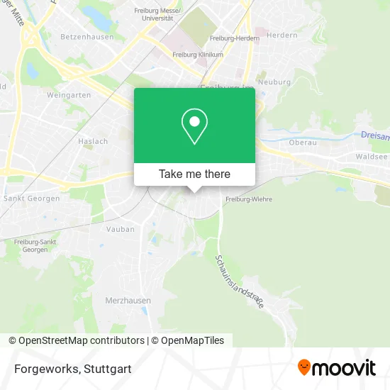
See Forgeworks, Stuttgart, on the map
Public Transit to Forgeworks in Stuttgart
Wondering how to get to Forgeworks in Stuttgart? Moovit helps you find the best way to get to Forgeworks with step-by-step directions from the nearest public transit station.
Moovit provides free maps and live directions to help you navigate through your city. View schedules, routes, timetables, and find out how long does it take to get to Forgeworks in real time.
Looking for the nearest stop or station to Forgeworks? Check out this list of stops closest to your destination: Freiburg; Freiburg Weddigenstraße; Freiburg; Freiburg Reiterstraße.
Train: RE 7, RE7, S10, S11.Bus: 200, 221, 7208, 21, 11, 23, 27, 37, 5, 17, 18.
Want to see if there’s another route that gets you there at an earlier time? Moovit helps you find alternative routes or times. Get directions from and directions to Forgeworks easily from the Moovit App or Website.
We make riding to Forgeworks easy, which is why over 1.5 million users, including users in Stuttgart, trust Moovit as the best app for public transit. You don’t need to download an individual bus app or train app, Moovit is your all-in-one transit app that helps you find the best bus time or train time available.
For information on prices of train and bus, costs and ride fares to Forgeworks, please check the Moovit app.
Use the app to navigate to popular places including to the airport, hospital, stadium, grocery store, mall, coffee shop, school, college, and university.
Forgeworks Address: Silberbachstraße 33 Wiehre, 79100 Freiburg im Breisgau street in Stuttgart
- Barbara Baedeker,
- Dr. med. Stefan Mies,
- Praxis am Silberbach Freiburg,
- Unterwiehre-Süd,
- Ingolf Matys,
- Imatys,
- Wolters-Verwaltung,
- Rheinfelden Karl-Fürstenbergstraße 17,
- Grand Nagus Capital,
- Architektur Dipl. Ing. Ulrich Steller Architektur,
- Aikido Dojo Freiburg E. V,
- Münstermarkt Frühstückstour,
- Integrativer Montessori-Kindergarten,
- Terpsichore,
- Wiehremer Montessori Kindergarten,
- Movin Centrum,
- Therapiezentrum Lorettoberg,
- Damm Verwaltungs-und Beteiligungs,
- Hercynia,
- Hui Invest
Places Near Forgeworks (Stuttgart)
- Im Wizemann (Halle), Bad Cannstatt,
- Porsche-Arena, Bad Cannstatt,
- Geilhaus Haus 33a, Reutlingen-Betzingen,
- Wilhelma (U-Bahn Wilhelma), Bad Cannstatt,
- Mercedes-Benz Museum (Mercedes Museum Stuttgart), Bad Cannstatt,
- Gleis 101/102 (tief), Stuttgart-Mitte,
- Klinikum Stuttgart - Katharinenhospital, Stuttgart-Mitte,
- Waldfriedhof, Degerloch,
- Hanns-Martin-Schleyer-Halle (Stuttgart Hans-Martin-Schleyerhalle), Bad Cannstatt,
- Mercedes-Benz Museum, Bad Cannstatt,
- Mettingen Eros-Center Puff Laufhaus, Esslingen Am Neckar,
- Gasometer Pforzheim, Pforzheim,
- SI-Centrum, Möhringen,
- Schleyerhalle, Bad Cannstatt,
- Hanns-Martin-Schleyer-Halle, Bad Cannstatt,
- Marmorsaal Im Weissenburgpark, Stuttgart-Süd,
- Pariser Platz Stuttgart, Stuttgart-Mitte,
- Hauptbahnhof Stuttgart, Stuttgart-Mitte,
- Porsche Museum, Zuffenhausen,
- FlixBus Haltestelle, Stuttgart
How to get to popular places in Stuttgart with public transit
Get around Stuttgart by public transit!
Traveling around Stuttgart has never been so easy. See step by step directions as you travel to any attraction, street or major public transit station. View bus and train schedules, arrival times, service alerts and detailed routes on a map, so you know exactly how to get to anywhere in Stuttgart.
When traveling to any destination around Stuttgart use Moovit's Live Directions with Get Off Notifications to know exactly where and how far to walk, how long to wait for your line, and how many stops are left. Moovit will alert you when it's time to get off — no need to constantly re-check whether yours is the next stop.
Wondering how to use public transit in Stuttgart or how to pay for public transit in Stuttgart? Moovit public transit app can help you navigate your way with public transit easily, and at minimum cost. It includes public transit fees, ticket prices, and costs. Looking for a map of Stuttgart public transit lines? Moovit public transit app shows all public transit maps in Stuttgart with all Bus, Train, Subway, Light Rail, Ferry, S-Bahn and Funicular routes and stops on an interactive map.
Stuttgart has 7 transit type(s), including: Bus, Train, Subway, Light Rail, Ferry, S-Bahn and Funicular, operated by several transit agencies, including SSB - Stadtbahn, SSB, SSB - Seilbahn / Zacke, S-Bahn Stuttgart, Rhein-Neckar-Verkehr GmbH (rnv), Karlsruher Verkehrsverbund, DB AG, DB Regiobus BW, Arverio Baden-Württemberg GmbH, DB RegioNetz Verkehrs GmbH Westfrankenbahn, DB Regio AG Baden-Württemberg, Südwestdeutsche Verkehrs-AG, DB Regio AG Mitte Region Hessen, DB and Bodensee-Oberschwaben-Bahn
Public transit lines with stations closest to Forgeworks in Stuttgart
Bus lines with stations closest to Forgeworks in Stuttgart
Freiburg, H.-Von-Stephan-Straße
 11Freiburg Hauptbahnhof Bstg 14 - Freiburg, Munzinger Straße Bstg 12
- 23Freiburg, Gundelfinger Straße Bstg 7 - Freiburg Hauptbahnhof Bstg 4
- 27Freiburg, Europaplatz Bstg 4 - Freiburg, Richard-Strauss-Str.
- 37Munzingen, Windhäuslegasse - Freiburg Hauptbahnhof Bstg 4
- 5Freiburg, Europaplatz Bstg 12 - Freiburg, Bollerstaudenstraße