How to get to Form Lab by bus?
Click on the bus route to see step by step directions with maps, line arrival times and updated time schedules.
Bus stops near Form Lab in Portland, ME
Train station near Form Lab in Portland, ME
- Portland Station, 29 min walk,VIEW
Ferry station near Form Lab in Portland, ME
- Casco Bay Lines Terminal, 55 min walk,VIEW
Bus lines to Form Lab in Portland, ME
What are the closest stations to Form Lab?
The closest stations to Form Lab are:
- India St + 65 India St is 287 yards away, 4 min walk.
- Hancock St + Thames St is 348 yards away, 5 min walk.
- Congress St + Washington Ave is 371 yards away, 5 min walk.
- Washington Ave + Cumberland Ib is 402 yards away, 5 min walk.
- Congress St + India St is 427 yards away, 6 min walk.
- Portland Station is 2437 yards away, 29 min walk.
- Casco Bay Lines Terminal is 4666 yards away, 55 min walk.
Which bus lines stop near Form Lab?
These bus lines stop near Form Lab: 60, 7, 8, 9A, HSK.
Which ferry line stops near Form Lab?
PK (To Portland)
What’s the nearest train station to Form Lab in Portland, ME?
The nearest train station to Form Lab in Portland, ME is Portland Station. It’s a 29 min walk away.
What’s the nearest bus station to Form Lab in Portland, ME?
The nearest bus station to Form Lab in Portland, ME is India St + 65 India St. It’s a 4 min walk away.
What time is the first train to Form Lab in Portland, ME?
The DOWNEASTER is the first train that goes to Form Lab in Portland, ME. It stops nearby at 5:18 AM.
What time is the last train to Form Lab in Portland, ME?
The DOWNEASTER is the last train that goes to Form Lab in Portland, ME. It stops nearby at 1:00 AM.
What time is the first bus to Form Lab in Portland, ME?
The 7 is the first bus that goes to Form Lab in Portland, ME. It stops nearby at 5:13 AM.
What time is the last bus to Form Lab in Portland, ME?
The 1 is the last bus that goes to Form Lab in Portland, ME. It stops nearby at 10:57 PM.
What time is the first ferry to Form Lab in Portland, ME?
The DB is the first ferry that goes to Form Lab in Portland, ME. It stops nearby at 5:00 AM.
What time is the last ferry to Form Lab in Portland, ME?
The PK is the last ferry that goes to Form Lab in Portland, ME. It stops nearby at 11:10 PM.
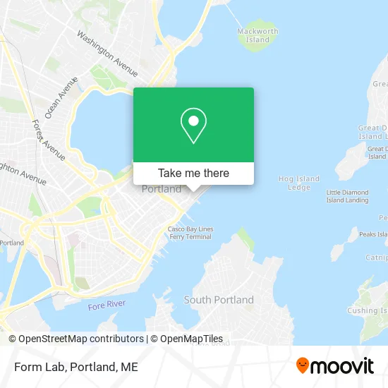
See Form Lab, Portland, ME, on the map
Public Transit to Form Lab in Portland, ME
Wondering how to get to Form Lab in Portland, ME? Moovit helps you find the best way to get to Form Lab with step-by-step directions from the nearest public transit station.
Moovit provides free maps and live directions to help you navigate through your city. View schedules, routes, timetables, and find out how long does it take to get to Form Lab in real time.
Looking for the nearest stop or station to Form Lab? Check out this list of stops closest to your destination: India St + 65 India St; Hancock St + Thames St; Congress St + Washington Ave; Washington Ave + Cumberland Ib; Congress St + India St; Portland Station; Casco Bay Lines Terminal.
Bus: 60, 7, 8, 9A, HSK, 1.Train: DOWNEASTER.Ferry: PK, DB, IB.
Want to see if there’s another route that gets you there at an earlier time? Moovit helps you find alternative routes or times. Get directions from and directions to Form Lab easily from the Moovit App or Website.
We make riding to Form Lab easy, which is why over 1.5 million users, including users in Portland, ME, trust Moovit as the best app for public transit. You don’t need to download an individual bus app or train app, Moovit is your all-in-one transit app that helps you find the best bus time or train time available.
For information on prices of bus and ferry, costs and ride fares to Form Lab, please check the Moovit app.
Use the app to navigate to popular places including to the airport, hospital, stadium, grocery store, mall, coffee shop, school, college, and university.
Form Lab Address: 144 Fore St Portland, ME 04101 street in Portland, ME
- VA Portland Clinic,
- Trine Bodywork,
- Thames Landing,
- Angoor Wine Bar,
- Roux Institute at Northeastern University,
- Mesa Grande Taqueria,
- Portland VA Clinic,
- AC Hotels by Marriott,
- Blink Charging,
- Residence Inn-Portland Waterfront,
- Grand Residences by Marriott-Portland Waterfront,
- Covetrus Connect,
- Veterinary Software Applications,
- Avimark,
- Bernalillo Pet Care Center,
- AC Hotel-Portland Waterfront,
- Ac Hotel by Marriott Portland Downtown / Waterfront, Me,
- Maine Aesthetic Medicine,
- Market Street Settlement,
- 180 Property Solutions
Places Near Form Lab (Portland, ME)
- Walmart,
- Cape Elizabeth, ME, Cape Elizabeth,
- Casco Bay Ferry Terminal,
- Portland Transportation Center,
- Southern Maine Community College, South Portland,
- Mercy Hospital - Fore River Campus,
- Fort Gorges,
- Exit 45 Park And Ride, South Portland,
- House Island,
- On a bus to Kennebunkport,
- Maine Medical Center,
- Portland International Jetport (PWM) (Portland International Jetport),
- Fort Williams Park, Cape Elizabeth,
- Cross Insurance Arena,
- The Old Port,
- Walmart Scarborough Supercenter,
- L. L. Bean Outlet,
- ZzZzZzZzZzZ, Westbrook,
- Jewell Island,
- Clarion Hotel Portland
How to get to popular places in Portland, ME with public transit
Get around Portland, ME by public transit!
Traveling around Portland, ME has never been so easy. See step by step directions as you travel to any attraction, street or major public transit station. View bus and train schedules, arrival times, service alerts and detailed routes on a map, so you know exactly how to get to anywhere in Portland, ME.
When traveling to any destination around Portland, ME use Moovit's Live Directions with Get Off Notifications to know exactly where and how far to walk, how long to wait for your line, and how many stops are left. Moovit will alert you when it's time to get off — no need to constantly re-check whether yours is the next stop.
Wondering how to use public transit in Portland, ME or how to pay for public transit in Portland, ME? Moovit public transit app can help you navigate your way with public transit easily, and at minimum cost. It includes public transit fees, ticket prices, and costs. Looking for a map of Portland, ME public transit lines? Moovit public transit app shows all public transit maps in Portland, ME with all Bus, Train and Ferry routes and stops on an interactive map.
Portland, ME has 3 transit type(s), including: Bus, Train and Ferry, operated by several transit agencies, including Greater Portland Metro, City of South Portland, Biddeford Saco Old Orchard Beach Transit, Casco Bay Lines, Amtrak, Greyhound-us and FlixBus-us