Directions to Formenti (Fatih) with public transportation
The following transit lines have routes that pass near Formenti
 Bus: 145T, 146B, 146T, 28T, 30D.
- Metro: M2.
- Train: B1.
- Dolmus & Minibus: TAKSIM - AKSARAY - KOCAMUSTAFAPAŞA, TAKSIM - BAKIRKÖY.
How to get to Formenti by bus?
Click on the bus route to see step by step directions with maps, line arrival times and updated time schedules.
From Kadıköy Cuma Pazarı, Kadıköy
97 minFrom Star City AVM, Bagcilar
48 minFrom Kadikoy-Yenikapi Vapuru, Kadıköy
122 minFrom Çengelköy / Üsküdar, Çengelköy, Üsküdar
104 minFrom Ihlamur Kasrı, Teşvikiye, Şişli
63 minFrom Giyimkent, Esenler
85 minFrom Caddebostan Kültür Merkezi, Caddebostan, Kadıköy
160 minFrom Oruç Reis, Esenler
53 minFrom Trump Alışveriş Merkezi, Şişli
60 minFrom Kanyon AVM, Levent, Beşiktaş
80 min
How to get to Formenti by train?
Click on the train route to see step by step directions with maps, line arrival times and updated time schedules.
How to get to Formenti by metro?
Click on the metro route to see step by step directions with maps, line arrival times and updated time schedules.
Bus stops near Formenti in Fatih
- Yenikapı Marmaray - Sondurak Y1 Yönü, 6 min walk,VIEW
- Yenikapı Transit / Aksaray Yönü, 8 min walk,VIEW
- Şehzadebaşı - Vezneciler Yönü, 8 min walk,VIEW
- Pertevniyal Valide Sultan - Topkapı Yönü, 8 min walk,VIEW
- Laleli - Beyazıt Yönü, 9 min walk,VIEW
- Pertevniyal Valide Sultan - Taksim Yönü, 9 min walk,VIEW
- Aksaray Ring - Aksaray Yönü, 11 min walk,VIEW
Tram stations near Formenti in Fatih
- Aksaray (T1), 6 min walk,VIEW
Dolmus & Minibus station near Formenti in Fatih
- Valide Sultan Camii, 7 min walk,VIEW
Metro station near Formenti in Fatih
- Vezneciler, 10 min walk,VIEW
Bus lines to Formenti in Fatih
- 30D, Yenikapı Marmaray-Vadi,VIEW
- 70KY, Yenikapı Marmaray-Kurtuluş,VIEW
- 31, Kuyumcukent - Yenikapı / Ring,VIEW
- 31Y, Toki Ayazma - Yenikapı / Ring,VIEW
- 50Y, Yenikapı Etkinlik Alanı-Alibeyköy Metro,VIEW
- 70FY, Feriköy - Yenikapı / Ring,VIEW
- 76A, Vaditepe 1.Bölge-Vaditepe 1. Bölge,VIEW
- 77, Yenikapı Etkinlik Alanı-Langa,VIEW
- 88A, Sultangazi Peronlar-Tuz Deposu,VIEW
- 146T, Boğazköy Son Durak-Yenikapı Etkinlik Alanı,VIEW
- 336Y, Cebeci Peronlar-Yenikapı Etkinlik Alanı,VIEW
- 36A, Vezneciler-Cebeci Peronlar,VIEW
- 36V, Yayla Mahallesi - Vezneciler / Ring,VIEW
- 38B, Vezneciler-Sultangazi Peronlar,VIEW
- 50V, Vezneciler-Alibeyköy Metro,VIEW
- 77A, Vezneciler-Şişli / Ring,VIEW
- 86V, Sakarya Mahallesi-Vezneciler,VIEW
- PD1, Yenikapı-Yenikapı Etkinlik Alanı,VIEW
- 28T, Topkapı - Beşiktaş,VIEW
- 32T, Cevatpaşa - Taksim,VIEW
What are the closest stations to Formenti?
The closest stations to Formenti are:
- Yenikapı Marmaray - Sondurak Y1 Yönü is 411 meters away, 6 min walk.
- Aksaray (T1) is 464 meters away, 6 min walk.
- Valide Sultan Camii is 514 meters away, 7 min walk.
- Yenikapı Transit / Aksaray Yönü is 569 meters away, 8 min walk.
- Şehzadebaşı - Vezneciler Yönü is 572 meters away, 8 min walk.
- Laleli - Beyazıt Yönü is 605 meters away, 9 min walk.
- Pertevniyal Valide Sultan - Topkapı Yönü is 615 meters away, 8 min walk.
- Pertevniyal Valide Sultan - Taksim Yönü is 636 meters away, 9 min walk.
- Vezneciler is 782 meters away, 10 min walk.
- Aksaray Ring - Aksaray Yönü is 838 meters away, 11 min walk.
Which bus lines stop near Formenti?
These bus lines stop near Formenti: 145T, 146B, 146T, 28T, 30D, 77A, 97GE, E-56.
Which metro line stops near Formenti?
M2 (Hacıosman→Yenikapı)
Which train line stops near Formenti?
B1 (Halkalı)
What’s the nearest tram station to Formenti in Fatih?
The nearest tram station to Formenti in Fatih is Aksaray (T1). It’s a 6 min walk away.
What’s the nearest metro station to Formenti in Fatih?
The nearest metro station to Formenti in Fatih is Vezneciler. It’s a 10 min walk away.
What’s the nearest bus station to Formenti in Fatih?
The nearest bus station to Formenti in Fatih is Yenikapı Marmaray - Sondurak Y1 Yönü. It’s a 6 min walk away.
What’s the nearest Dolmus & Minibus station to Formenti in Fatih?
The nearest Dolmus & Minibus station to Formenti in Fatih is Valide Sultan Camii. It’s a 7 min walk away.
What time is the first tram to Formenti in Fatih?
The T1 is the first tram that goes to Formenti in Fatih. It stops nearby at 6:20 AM.
What time is the last tram to Formenti in Fatih?
The T1 is the last tram that goes to Formenti in Fatih. It stops nearby at 12:22 AM.
What time is the first metro to Formenti in Fatih?
The M2 is the first metro that goes to Formenti in Fatih. It stops nearby at 3:02 AM.
What time is the last metro to Formenti in Fatih?
The M2 is the last metro that goes to Formenti in Fatih. It stops nearby at 12:24 AM.
What time is the first bus to Formenti in Fatih?
The 35C is the first bus that goes to Formenti in Fatih. It stops nearby at 6:05 AM.
What time is the last bus to Formenti in Fatih?
The 89C is the last bus that goes to Formenti in Fatih. It stops nearby at 1:22 AM.
What time is the first Dolmus & Minibus to Formenti in Fatih?
The TAKSIM - BAKIRKÖY is the first Dolmus & Minibus that goes to Formenti in Fatih. It stops nearby at 3:07 AM.
What time is the last Dolmus & Minibus to Formenti in Fatih?
The TAKSIM - BAKIRKÖY is the last Dolmus & Minibus that goes to Formenti in Fatih. It stops nearby at 3:35 AM.
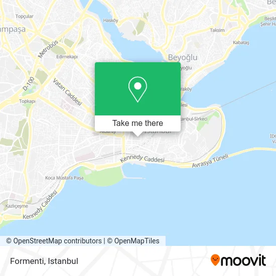
See Formenti, Fatih, on the map
Public Transit to Formenti in Fatih
Wondering how to get to Formenti in Fatih? Moovit helps you find the best way to get to Formenti with step-by-step directions from the nearest public transit station.
Moovit provides free maps and live directions to help you navigate through your city. View schedules, routes, timetables, and find out how long does it take to get to Formenti in real time.
Looking for the nearest stop or station to Formenti? Check out this list of stops closest to your destination: Yenikapı Marmaray - Sondurak Y1 Yönü; Aksaray (T1); Valide Sultan Camii; Yenikapı Transit / Aksaray Yönü; Şehzadebaşı - Vezneciler Yönü; Laleli - Beyazıt Yönü; Pertevniyal Valide Sultan - Topkapı Yönü; Pertevniyal Valide Sultan - Taksim Yönü; Vezneciler; Aksaray Ring - Aksaray Yönü.
Bus: 145T, 146B, 146T, 28T, 30D, 77A, 97GE, E-56, 70KY, 36A, 36V, 38B, 50V, 31, 31Y, 50Y, 70FY, 76A, 32T, 33, 33B, 33E.Metro: M2.Train: B1.Dolmus & Minibus: TAKSIM - AKSARAY - KOCAMUSTAFAPAŞA, TAKSIM - BAKIRKÖY.
Want to see if there’s another route that gets you there at an earlier time? Moovit helps you find alternative routes or times. Get directions from and directions to Formenti easily from the Moovit App or Website.
We make riding to Formenti easy, which is why over 1.5 million users, including users in Fatih, trust Moovit as the best app for public transit. You don’t need to download an individual bus app or train app, Moovit is your all-in-one transit app that helps you find the best bus time or train time available.
For information on prices of metro, bus, train and Dolmus & Minibus, costs and ride fares to Formenti, please check the Moovit app.
Use the app to navigate to popular places including to the airport, hospital, stadium, grocery store, mall, coffee shop, school, college, and university.
Location: Fatih, Istanbul
- SİGNORE - HSM TEKSTİL - LALELİ,
- Escetic sports Wear,
- ALSACE SHOES Showroom 👜👡👠👢,
- G-POINT JEANS,
- Tucino Shoes,
- Monaco Hotel Istanbul Turkey,
- Euro Fashion Jeans,
- Kos,
- Koska Caddesi, Laleli,
- Koska Caddesi / Şair Haşmet Sokak,
- La Peron Prn,
- Yuksel,
- Alpiro Women Fashion,
- Occo Big,
- Stefano,
- Hotel Montenegro,
- Hotel Buyuk Sahinler Istanbul,
- Nude,
- Nelly & Co Laleli Store,
- Rodina-Danish Kargo
Places Near Formenti (Fatih)
- VİALAND AVM, Eyüp,
- 212 AVM, Bagcilar,
- METROPOL IsTaNBuL, Ataşehir,
- 41 Burda AVM, Kocaeli Merkezi,
- İstanbul,
- Mall Of İstanbul, Basaksehir,
- Gebze Koop Durağı, Gebze,
- Mehmet Emin Tokadî Hz. Türbesi, Fatih,
- 2 Nolu Minibüss, Beylikduzu,
- Beylikdüzü - 4 Nolu Minibüs Hattı, Beylikduzu,
- Şehit Prof. Dr. İlhan Varank Eğitim Ve Araştırma Hastanesi, Sancaktepe,
- Hilltown AVM, Maltepe,
- İstinye Park, Sariyer,
- Başakşehir Çam Ve Sakura Şehir Hastanesi, Basaksehir,
- Gebze-Harem Minibüs Hattı, Gebze,
- Hz. Yuşa Tepesi, Beykoz,
- Topkule Kışlası 47.Komando Tugay Komutanlığı, Esenler,
- Karaköy Genelevi, Karaköy, Beyoğlu,
- Bakırköy Sosyete Pazarı, Bakirköy,
- Tersane İstanbul, Beyoğlu
How to get to popular places in Istanbul with public transit
Get around Fatih by public transit!
Traveling around Fatih has never been so easy. See step by step directions as you travel to any attraction, street or major public transit station. View bus and train schedules, arrival times, service alerts and detailed routes on a map, so you know exactly how to get to anywhere in Fatih.
When traveling to any destination around Fatih use Moovit's Live Directions with Get Off Notifications to know exactly where and how far to walk, how long to wait for your line, and how many stops are left. Moovit will alert you when it's time to get off — no need to constantly re-check whether yours is the next stop.
Wondering how to use public transit in Fatih or how to pay for public transit in Fatih? Moovit public transit app can help you navigate your way with public transit easily, and at minimum cost. It includes public transit fees, ticket prices, and costs. Looking for a map of Fatih public transit lines? Moovit public transit app shows all public transit maps in Fatih with all Bus, Train, Metro, Tram, Ferry, Metrobus and Dolmus & Minibus routes and stops on an interactive map.
Istanbul has 7 transit type(s), including: Bus, Train, Metro, Tram, Ferry, Metrobus and Dolmus & Minibus, operated by several transit agencies, including Marmaray, Metro İstanbul, Metrobüs, UAB, İETT, İETT ÇIFT KATLI HATLAR, İETT BÖLGESEL HATLAR, TCDD, Şehir Hatları, Dentur Avrasya, Beyden, Turyol, Mavi Marmara, Havaist and Prenstur
