Directions to Fort Lee Regency (Petersburg) with public transportation
The following transit lines have routes that pass near Fort Lee Regency
 Bus: 3, 95, 4, 5, 6.
- Train: PALMETTO, CAROLINIAN, FLORIDIAN, NORTHEAST REGIONAL, SILVER METEOR.
How to get to Fort Lee Regency by bus?
Click on the bus route to see step by step directions with maps, line arrival times and updated time schedules.
From Lorton, VA - Amtrak Auto Train Station (LOR), Fairfax County
527 minFrom Rose Gaming Resort, Prince William County
537 minFrom Lorton, VA, Fairfax County
522 minFrom Busch Gardens Williamsburg (Employee Parking Lot), James City County
333 minFrom Potomac Mills Mall, Prince William County
512 minFrom Woodbridge, VA, Prince William County
269 minFrom Amazon Fulfillment Center-Ric3, Richmond
189 minFrom UVA Hospital Medical Center, Charlottesville
602 min
How to get to Fort Lee Regency by train?
Click on the train route to see step by step directions with maps, line arrival times and updated time schedules.
Bus stops near Fort Lee Regency in Petersburg
Train station near Fort Lee Regency in Petersburg
- Petersburg Amtrak Station, 38 min walk,VIEW
Bus lines to Fort Lee Regency in Petersburg
What are the closest stations to Fort Lee Regency?
The closest stations to Fort Lee Regency are:
- E Washington Street And Madison Street is 74 yards away, 2 min walk.
- Adams St And E Bank St is 915 yards away, 12 min walk.
- Petersburg Amtrak Station is 3181 yards away, 38 min walk.
Which bus lines stop near Fort Lee Regency?
These bus lines stop near Fort Lee Regency: 3, 95.
Which train line stops near Fort Lee Regency?
PALMETTO (Savannah)
What’s the nearest bus station to Fort Lee Regency in Petersburg?
The nearest bus station to Fort Lee Regency in Petersburg is E Washington Street And Madison Street. It’s a 2 min walk away.
What time is the first train to Fort Lee Regency in Petersburg?
The NORTHEAST REGIONAL is the first train that goes to Fort Lee Regency in Petersburg. It stops nearby at 10:25 AM.
What time is the last train to Fort Lee Regency in Petersburg?
The SILVER METEOR is the last train that goes to Fort Lee Regency in Petersburg. It stops nearby at 2:53 AM.
What time is the first bus to Fort Lee Regency in Petersburg?
The 21 is the first bus that goes to Fort Lee Regency in Petersburg. It stops nearby at 6:15 AM.
What time is the last bus to Fort Lee Regency in Petersburg?
The 21 is the last bus that goes to Fort Lee Regency in Petersburg. It stops nearby at 10:08 PM.
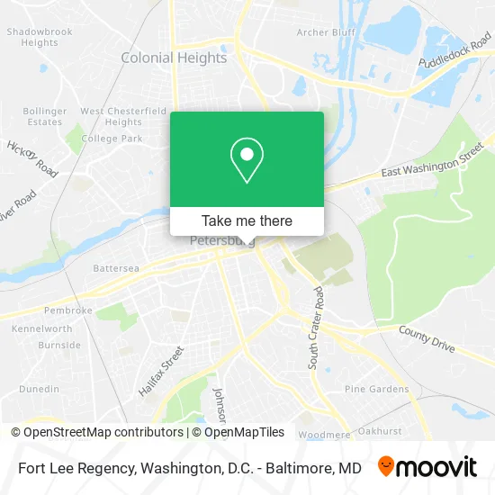
See Fort Lee Regency, Petersburg, on the map
Public Transit to Fort Lee Regency in Petersburg
Wondering how to get to Fort Lee Regency in Petersburg? Moovit helps you find the best way to get to Fort Lee Regency with step-by-step directions from the nearest public transit station.
Moovit provides free maps and live directions to help you navigate through your city. View schedules, routes, timetables, and find out how long does it take to get to Fort Lee Regency in real time.
Looking for the nearest stop or station to Fort Lee Regency? Check out this list of stops closest to your destination: E Washington Street And Madison Street; Adams St And E Bank St; Petersburg Amtrak Station.
Bus: 3, 95, 4, 5, 6, 21, 22 - SOUTH PARK/ETTRICK.Train: PALMETTO, CAROLINIAN, FLORIDIAN, NORTHEAST REGIONAL, SILVER METEOR.
Want to see if there’s another route that gets you there at an earlier time? Moovit helps you find alternative routes or times. Get directions from and directions to Fort Lee Regency easily from the Moovit App or Website.
We make riding to Fort Lee Regency easy, which is why over 1.5 million users, including users in Petersburg, trust Moovit as the best app for public transit. You don’t need to download an individual bus app or train app, Moovit is your all-in-one transit app that helps you find the best bus time or train time available.
For information on prices of bus, train and metro, costs and ride fares to Fort Lee Regency, please check the Moovit app.
Use the app to navigate to popular places including to the airport, hospital, stadium, grocery store, mall, coffee shop, school, college, and university.
Fort Lee Regency Address: 380 E Washington St Petersburg, VA 23803 street in Petersburg
- ATM,
- Petersburg Economic Devmnt,
- G & T Body Shop,
- Goodman's Marine & Upholstery,
- Glenn's Body Shop,
- Historic Petersburg Foundation,
- Karr Construction,
- Accurate Business Solutions,
- Flower Mart,
- DSS Design Systems and Services Corporation,
- Petersburg Chamber of Commerce,
- Caribbean Tropics Restaurant,
- Resurrection Life Christian Center Church,
- Riggs and Company Investment Management,
- Holy Temple Church,
- Exit 52/Bank St/N,
- Alex Auto Sales,
- Elite Auto Nation of Petersburg,
- U-Haul,
- Mikes Auto Sales
Places Near Fort Lee Regency (Petersburg)
- PG Mall, Prince George's County,
- Georgetown, Washington,
- Amazon Hq2, Arlington County,
- Museum Of The Bible, Washington,
- Camden Yards, Baltimore,
- National Museum of African American History and Culture, Washington,
- Basilica of the National Shrine, Washington,
- Rock Creek Tennis Center, Washington,
- Marriott Marquis Washington, DC, Washington,
- The Anthem, Washington,
- Capital One Arena, Washington,
- Washington DC VA Medical Center, Washington,
- Sibley Memorial Hospital, Washington,
- Pennsylvania Ave NW (3rd st and pennsylvania), Washington,
- M&T Bank Stadium, Baltimore,
- National Zoo, Washington,
- Warner Theatre, Washington,
- National Mall, Washington,
- Westfield Montgomery Mall, Montgomery County,
- Washington National Cathedral, Washington
How to get to popular places in Washington, D.C. - Baltimore, MD with public transit
Get around Petersburg by public transit!
Traveling around Petersburg has never been so easy. See step by step directions as you travel to any attraction, street or major public transit station. View bus and train schedules, arrival times, service alerts and detailed routes on a map, so you know exactly how to get to anywhere in Petersburg.
When traveling to any destination around Petersburg use Moovit's Live Directions with Get Off Notifications to know exactly where and how far to walk, how long to wait for your line, and how many stops are left. Moovit will alert you when it's time to get off — no need to constantly re-check whether yours is the next stop.
Wondering how to use public transit in Petersburg or how to pay for public transit in Petersburg? Moovit public transit app can help you navigate your way with public transit easily, and at minimum cost. It includes public transit fees, ticket prices, and costs. Looking for a map of Petersburg public transit lines? Moovit public transit app shows all public transit maps in Petersburg with all Bus, Train, Metro, Light Rail and Ferry routes and stops on an interactive map.
Washington, D.C. - Baltimore, MD has 5 transit type(s), including: Bus, Train, Metro, Light Rail and Ferry, operated by several transit agencies, including WMATA, Montgomery County Ride On, Fairfax Connector, TheBus, PRTC, DASH - Alexandria, Arlington Transit (ART), RTA of Central Maryland, MDOT MTA, MDOT MTA Light RailLink, MDOT MTA Commuter Bus, MDOT MTA Local Bus, FXBGO!, Virginia Railway Express (VRE) and MARC