Directions to Fort Multimarcas (São Lourenço) with public transportation
The following transit lines have routes that pass near Fort Multimarcas
How to get to Fort Multimarcas by bus?
Click on the bus route to see step by step directions with maps, line arrival times and updated time schedules.
From Terminal Guaraituba, Colombo
42 minFrom Rua Fulvio José Alice 381, Bairro Alto
49 minFrom Alphaville Graciosa, Pinhais
72 minFrom Alameda Princesa Izabel, Bigorrilho
31 minFrom Avenida Comendador Franco, Uberaba
49 minFrom Água Verde, Água Verde
49 minFrom Hospital Ônix Batel, Seminário
50 minFrom Rua Estrada da Graciosa, Colombo
56 minFrom Colônia Faria, Colombo
42 minFrom Estação Tubo Fanny, Fanny
41 min
Bus stops near Fort Multimarcas in São Lourenço
Bus lines to Fort Multimarcas in São Lourenço
- A01 CACHOEIRA / CURITIBA (MOREIRA GARCEZ), Terminal Cachoeira → Moreira Garcez,VIEW
- A05 MAD. CURITIBA / TAMANDARÉ (VIA GRAZIELA), Praça Rui Barbosa → Tamandaré,VIEW
- A18 TAMANDARÉ / CABRAL, Terminal Cabral → Terminal Tamandaré,VIEW
- A89 CACHOEIRA / CURITIBA (TAMANDARÉ / CABRAL), Terminal Tamandaré → Terminal Cabral (Ultima Viagem),VIEW
- 205 BARREIRINHA, Terminal Barreirinha → Travessa Moreira Garcez,VIEW
- 245 ANITA GARIBALDI, Terminal Cabral → Anita Garibaldi,VIEW
- 260 MARECHAL HERMES / SANTA EFIGÊNIA, Marechal Floriano Peixoto → Santa Efigênia,VIEW
- 272 PAINEIRAS, Paineiras → Travessa Moreira Garcez,VIEW
- 274 SANTA GEMA, Santa Gema → Travessa Moreira Garcez,VIEW
- 021 INTERBAIRROS II (ANTI-HORÁRIO), Cabral → Campina do Siqueira,VIEW
- 177 CABRAL / PARQUE TANGUÁ, Terminal Cabral → Parque Tanguá,VIEW
- 266 ESTRIBO AHÚ, Travessa Moreira Garcez → Estribo Ahú,VIEW
- 020 INTERBAIRROS II (HORÁRIO), Campina do Siqueira → Cabral,VIEW
- 275 FERNANDO DE NORONHA / LARANJEIRAS, Travessa Moreira Garcez → Laranjeiras,VIEW
What are the closest stations to Fort Multimarcas?
The closest stations to Fort Multimarcas are:
- Av. Anita Garibaldi, 2816 is 101 meters away, 2 min walk.
- R. Simão Mansur, 70 is 322 meters away, 5 min walk.
- R. Simão Mansur, 72 is 341 meters away, 5 min walk.
- Rua Flávio Dallegrave, 6725-6827 is 405 meters away, 6 min walk.
Which bus lines stop near Fort Multimarcas?
These bus lines stop near Fort Multimarcas: 020 INTERBAIRROS II (HORÁRIO), 021 INTERBAIRROS II (ANTI-HORÁRIO), 205 BARREIRINHA, 260 MARECHAL HERMES / SANTA EFIGÊNIA, A01 CACHOEIRA / CURITIBA (MOREIRA GARCEZ), A18 TAMANDARÉ / CABRAL.
What’s the nearest bus station to Fort Multimarcas in São Lourenço?
The nearest bus station to Fort Multimarcas in São Lourenço is Av. Anita Garibaldi, 2816. It’s a 2 min walk away.
What time is the first bus to Fort Multimarcas in São Lourenço?
The A05 MAD. CURITIBA / TAMANDARÉ (VIA GRAZIELA) is the first bus that goes to Fort Multimarcas in São Lourenço. It stops nearby at 3:18 AM.
What time is the last bus to Fort Multimarcas in São Lourenço?
The A05 MAD. CURITIBA / TAMANDARÉ (VIA GRAZIELA) is the last bus that goes to Fort Multimarcas in São Lourenço. It stops nearby at 3:19 AM.
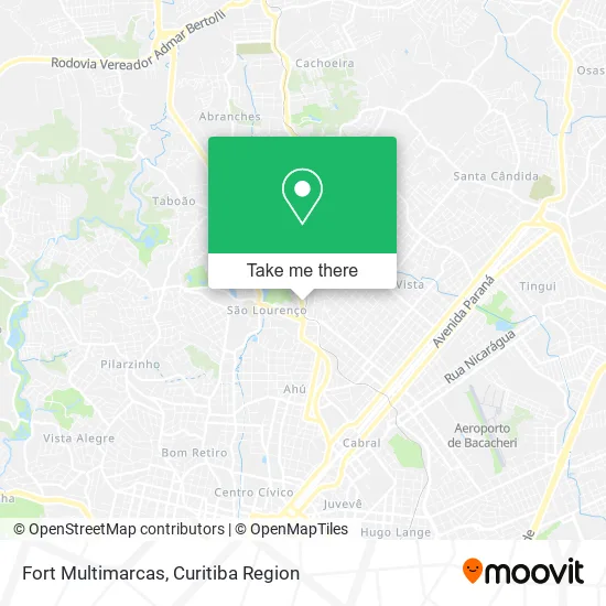
See Fort Multimarcas, São Lourenço, on the map
Public Transit to Fort Multimarcas in São Lourenço
Wondering how to get to Fort Multimarcas in São Lourenço? Moovit helps you find the best way to get to Fort Multimarcas with step-by-step directions from the nearest public transit station.
Moovit provides free maps and live directions to help you navigate through your city. View schedules, routes, timetables, and find out how long does it take to get to Fort Multimarcas in real time.
Looking for the nearest stop or station to Fort Multimarcas? Check out this list of stops closest to your destination: Av. Anita Garibaldi; R. Simão Mansur; R. Simão Mansur; Rua Flávio Dallegrave.
Bus: 020 INTERBAIRROS II (HORÁRIO), 021 INTERBAIRROS II (ANTI-HORÁRIO), 205 BARREIRINHA, 260 MARECHAL HERMES / SANTA EFIGÊNIA, A01 CACHOEIRA / CURITIBA (MOREIRA GARCEZ), A18 TAMANDARÉ / CABRAL, A05 MAD. CURITIBA / TAMANDARÉ (VIA GRAZIELA), A89 CACHOEIRA / CURITIBA (TAMANDARÉ / CABRAL), 177 CABRAL / PARQUE TANGUÁ, 266 ESTRIBO AHÚ, 275 FERNANDO DE NORONHA / LARANJEIRAS.
Want to see if there’s another route that gets you there at an earlier time? Moovit helps you find alternative routes or times. Get directions from and directions to Fort Multimarcas easily from the Moovit App or Website.
We make riding to Fort Multimarcas easy, which is why over 1.5 million users, including users in São Lourenço, trust Moovit as the best app for public transit. You don’t need to download an individual bus app or train app, Moovit is your all-in-one transit app that helps you find the best bus time or train time available.
For information on prices of bus, costs and ride fares to Fort Multimarcas, please check the Moovit app.
Use the app to navigate to popular places including to the airport, hospital, stadium, grocery store, mall, coffee shop, school, college, and university.
Fort Multimarcas Address: Avenida Anita Garibaldi, 2864 Boa Vista Curitiba-PR 82210-000 street in São Lourenço
- Calita Calçados,
- Empório da Gula Express,
- Emporio da Gula Comércio de Alimentos,
- Unimed Laboratorio - Unidade Ahú,
- Rua Anita Garibaldi 2881,
- Pagfácil Mais Bb,
- Dom Carlo Incorporadora de Imóveis,
- Churrascaria Terra Gaúcha,
- Orjan Esquadrias,
- Chaveiro Garibaldi 24 Horas,
- Com. Meta Locadora de Veículos,
- Planet Children's,
- RR Sanme,
- Borracharia Anita Garibaldi,
- Princess Dog,
- Confeitaria Piegel - São Lourenço,
- Piegel Pães e Conveniências,
- Hagana Seguranca,
- Hc Motos Peças e Serviços,
- Neoeng Paineis Eletricos
Places Near Fort Multimarcas (São Lourenço)
- Hospital Nossa Senhora Das Graças, Mercês,
- Park Shopping Barigüi, Mossunguê,
- Parque Barigui, Mercês,
- Hospital Da Cruz Vermelha, Batel,
- Hospital do Rocio, Campo,
- Hospital Madalena Sofia, Bairro Alto,
- Hospital Universitário Evangélico de Curitiba, Bigorrilho,
- Jockey Plaza Shopping Center, Tarumã,
- Jardim Botânico de Curitiba PR, Centro,
- Hospital de Clínicas (HC - UFPR), Centro,
- Rua Martim Afonso 558, Mercês,
- Hospital Erasto Gaertner, Jardim Das Américas,
- Rua General Mário Tourinho, Campina Do Siqueira,
- Shopping Estação, Rebouças,
- Campo Largo, Campo,
- Shopping Palladium, Portão,
- Hospital Angelina Caron, Campina Grande Do Sul,
- Pontifícia Universidade Católica do Paraná (PUCPR), Prado Velho,
- Arena Da Baixada - Curitiba,
- Hhhhh, Fazendinha
How to get to popular places in Curitiba Region with public transit
Get around São Lourenço by public transit!
Traveling around São Lourenço has never been so easy. See step by step directions as you travel to any attraction, street or major public transit station. View bus and train schedules, arrival times, service alerts and detailed routes on a map, so you know exactly how to get to anywhere in São Lourenço.
When traveling to any destination around São Lourenço use Moovit's Live Directions with Get Off Notifications to know exactly where and how far to walk, how long to wait for your line, and how many stops are left. Moovit will alert you when it's time to get off — no need to constantly re-check whether yours is the next stop.
Wondering how to use public transit in São Lourenço or how to pay for public transit in São Lourenço? Moovit public transit app can help you navigate your way with public transit easily, and at minimum cost. It includes public transit fees, ticket prices, and costs. Looking for a map of São Lourenço public transit lines? Moovit public transit app shows all public transit maps in São Lourenço with all Bus and Cable Car routes and stops on an interactive map.
Curitiba Region has 2 transit type(s), including: Bus and Cable Car, operated by several transit agencies, including Sistema Integrado de Mobilidade (URBS), Sistema Integrado de Mobilidade (AMEP), URBS (Cartões bancários e Dinheiro), URBS (Cartões bancários / Cartão URBS), AMEP (Cartões bancários / Cartão MetroCard), AMEP (Cartões bancários / Cartão MetroCard / Dinheiro), Viação Colombo (Dinheiro), TRIAR (Cartão TRIAR / Dinheiro), Empresa Curitiba Cerro Azul (Dinheiro), Expresso Nossa Senhora da Penha (Dinheiro), Empresa Campo Alto Tijucas (Dinheiro), Auto Viação São José (Cartão VEM / Dinheiro), BRT S/A (Cartão VEM / Dinheiro), TransPiedade (Cartão Cidadão / Dinheiro) and Oceânica Sul (Cartão Transporte / Dinheiro)
Public transit lines with stations closest to Fort Multimarcas in São Lourenço
Bus lines with stations closest to Fort Multimarcas in São Lourenço
Av. Anita Garibaldi, 2816
 A01 CACHOEIRA / CURITIBA (MOREIRA GARCEZ)CACHOEIRA / CURITIBA (MOREIRA GARCEZ)
- A05 MAD. CURITIBA / TAMANDARÉ (VIA GRAZIELA)MAD. CURITIBA / TAMANDARÉ (via GRAZIELA)
- A18 TAMANDARÉ / CABRALTAMANDARÉ / CABRAL
- A89 CACHOEIRA / CURITIBA (TAMANDARÉ / CABRAL)CACHOEIRA / CURITIBA (TAMANDARÉ / CABRAL)
- 205 BARREIRINHABARREIRINHA