Directions to Boccea Fortress (Roma) with public transportation
The following transit lines have routes that pass near Boccea Fortress
 Bus: 46, 889, 904, 906, 916.
- Train: FL3.
- Metro: A.
How to get to Boccea Fortress by bus?
Click on the bus route to see step by step directions with maps, line arrival times and updated time schedules.
How to get to Boccea Fortress by train?
Click on the train route to see step by step directions with maps, line arrival times and updated time schedules.
How to get to Boccea Fortress by metro?
Click on the metro route to see step by step directions with maps, line arrival times and updated time schedules.
Bus stops near Boccea Fortress in Roma
- Boccea/Gregory XIII, 1 min walk,
- Battistini/De Luca, 5 min walk,
- Battistini (Ma), 8 min walk,
Metro station near Boccea Fortress in Roma
- Cornelia, 33 min walk,
Train station near Boccea Fortress in Roma
- Appiano, 41 min walk,
Bus lines to Boccea Fortress in Roma
- NMA, Sostitutiva MA | Anagnina (MA) - Battistini (MA),
- 46, Monte Mario (FS) - Piazza Venezia,
- 190F, Venice Square - Casalotti,
- 904, Selva Candida - Cornelia (MA),
- N904, Selva Candida - Piazza Venezia,
- 905, Cornelia (MA) - Malagrotta,
- 906, Valle Aurelia (Metro A) - Massimina,
- 916, Venezia Square - Primavalle,
- 916F, Venezia Square - Primavalle,
- 980, Montespaccato - Ospedale S. Filippo Neri,
- 981, Cornelia (MA) - Rimessa Magliana,
- 983, Circolare | Cornelia (MA) - Montespaccato - Cornelia (MA),
- 546, Ipogeo degli Ottavi (FS) - Via Val Cannuta,
- 889, Corviale - Via Val Cannuta,
- 907, La Giustiniana (Railway) - Cornelia (Metro A),
- 907L, Circolare | Cornelia (MA) - Policlinico Gemelli - Cornelia (MA),
- 993, Ipogeo degli Ottavi (Rail) - Cornelia (Metro A),
- 46B, Battistini/Soria,
- 146, Mombasiglio,
- 985, Eugenio Frate,
What are the closest stations to Boccea Fortress?
The closest stations to Boccea Fortress are:
- Boccea/Gregory XIII stop is 23 meters away, 1 min walk.
- Battistini/De Luca stop is 358 meters away, 5 min walk.
- Battistini (Ma) stop is 601 meters away, 8 min walk.
- Cornelia station is 2632 meters away, 33 min walk.
- Appiano station is 3230 meters away, 41 min walk.
Which bus lines stop near Boccea Fortress?
These bus lines stop near Boccea Fortress: 46, 889, 904, 906, 916, 993.
Which train line stops near Boccea Fortress?
FL3 (Viterbo)
Which metro line stops near Boccea Fortress?
A (Battistini)
What’s the nearest bus station to Boccea Fortress in Roma?
The nearest bus station to Boccea Fortress in Roma is Boccea/Gregory XIII. It’s a 1 min walk away.
What time is the first metro to Boccea Fortress in Roma?
The A is the first metro that goes to Boccea Fortress in Roma. It stops nearby at 5:30 AM.
What time is the last metro to Boccea Fortress in Roma?
The A is the last metro that goes to Boccea Fortress in Roma. It stops nearby at 12:11 AM.
What time is the first train to Boccea Fortress in Roma?
The FL3 is the first train that goes to Boccea Fortress in Roma. It stops nearby at 5:48 AM.
What time is the last train to Boccea Fortress in Roma?
The FL3 is the last train that goes to Boccea Fortress in Roma. It stops nearby at 11:09 PM.
What time is the first bus to Boccea Fortress in Roma?
The NMA is the first bus that goes to Boccea Fortress in Roma. It stops nearby at 3:02 AM.
What time is the last bus to Boccea Fortress in Roma?
The NMA is the last bus that goes to Boccea Fortress in Roma. It stops nearby at 4:03 AM.
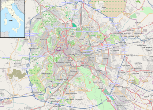
See Boccea Fortress, Roma, on the map
Public Transit to Boccea Fortress in Roma
Wondering how to get to Boccea Fortress in Roma? Moovit helps you find the best way to get to Boccea Fortress with step-by-step directions from the nearest public transit station.
Moovit provides free maps and live directions to help you navigate through your city. View schedules, routes, timetables, and find out how long does it take to get to Boccea Fortress in real time.
Looking for the nearest stop or station to Boccea Fortress? Check out this list of stops closest to your destination: Boccea/Gregory XIII; Battistini/De Luca; Battistini (Ma); Cornelia; Appiano.
Bus: 46, 889, 904, 906, 916, 993, NMA, 190F, N904, 46B, 146, 985, N46.Train: FL3.Metro: A.
Want to see if there’s another route that gets you there at an earlier time? Moovit helps you find alternative routes or times. Get directions from and directions to Boccea Fortress easily from the Moovit App or Website.
We make riding to Boccea Fortress easy, which is why over 1.7 billion users, including users in Roma, trust Moovit as the best app for public transit. You don’t need to download an individual bus app or train app, Moovit is your all-in-one transit app that helps you find the best bus time or train time available.
For information on prices of bus, metro and train, costs and ride fares to Boccea Fortress, please check the Moovit app.
Use the app to navigate to popular places including to the airport, hospital, stadium, grocery store, mall, coffee shop, school, college, and university.
Location: Roma, Rome and Lazio
- Ahd Hair S.,
- Dynasty Gym,
- Gandhi 3 Indian Restaurant,
- Via di Boccea / Via di Val Cannuta,
- Pio VII Street,
- Adriano I Street 23,
- ASL Roma E - Boccea Polyclinic,
- Michele De Vita,
- Gregorio XIII Street / Boccea Street,
- Romani Optics,
- Espresso in Pods,
- Gregorio XIII Street, 129,
- One Shot by Renato Tanda and Ilaria Panecaldo,
- Castrum Boccea Relais,
- Gregory XIII Street,
- Maria Capozzi,
- Badawi Salah Eldin,
- Casa di Ele,
- Maria Capozzi School,
- Italian Post Office
Places Near Boccea Fortress (Roma)
- Paths, Roma,
- Gemelli Polyclinic, Roma,
- Tiber Island, Roma,
- Roma Est Shopping Center, Roma,
- The Sail, Roma,
- Sandro Pertini Hospital, Roma,
- Coppedè Quarter, Roma,
- Gravity, Roma,
- Casilino Polyclinic, Roma,
- Tor Vergata, Roma,
- Cristo Re Hospital, Roma,
- Olympic Stadium, Rome, Roma,
- The Wow Side, Fiumicino,
- Termini Station, Roma,
- IDI (Dermopatico Dell'Immacolata Institute), Roma,
- Scuderie Del Quirinale, Roma,
- Villa Borghese, Roma,
- Trastevere Quarter, Roma,
- Santa Maria Maggiore, Roma,
- Auditorium Music Park, Roma
How to get to popular places in Rome and Lazio with public transit
Get around Roma by public transit!
Traveling around Roma has never been so easy. See step by step directions as you travel to any attraction, street or major public transit station. View bus and train schedules, arrival times, service alerts and detailed routes on a map, so you know exactly how to get to anywhere in Roma.
When traveling to any destination around Roma use Moovit's Live Directions with Get Off Notifications to know exactly where and how far to walk, how long to wait for your line, and how many stops are left. Moovit will alert you when it's time to get off — no need to constantly re-check whether yours is the next stop.
Wondering how to use public transit in Roma or how to pay for public transit in Roma? Moovit public transit app can help you navigate your way with public transit easily, and at minimum cost. It includes public transit fees, ticket prices, and costs. Looking for a map of Roma public transit lines? Moovit public transit app shows all public transit maps in Roma with all Bus, Train, Metro, Light Rail, Ferry, Funicular and Gondola routes and stops on an interactive map.
Rome and Lazio has 7 transit type(s), including: Bus, Train, Metro, Light Rail, Ferry, Funicular and Gondola, operated by several transit agencies, including ATAC, Cotral, Trenitalia, Troiani Transportation Services, BIS, ATR Mobility, Tuscia, Shuttle, Seatour, Troiani Bus Lines, CSC Mobility, Terravision, ATRAL, Tambus and Sitbus