Directions to Forward Technologies (Xaxim) with public transportation
The following transit lines have routes that pass near Forward Technologies
How to get to Forward Technologies by bus?
Click on the bus route to see step by step directions with maps, line arrival times and updated time schedules.
From Rpc Tv, Mercês
75 minFrom Avenida João Gualberto, Alto Da Glória
61 minFrom tim shopping estação, Centro
46 minFrom Ambulatório Hospital Evangélico Mackenzie, Rebouças
50 minFrom Rua João Negrão, Centro
35 minFrom Avenida Victor Ferreira do Amaral, Tarumã
72 minFrom Estação Tubo Praça da Bandeira - Inter 2 (Horário ), São Francisco
71 minFrom Estação Tubo Paiol, Prado Velho
31 minFrom Onibus Nilo Peçanha, Centro
54 minFrom Auditorio Mario Lobo, Centro Cívico
60 min
Bus stops near Forward Technologies in Xaxim
Bus lines to Forward Technologies in Xaxim
- 525 HAUER / CAPÃO RASO, Terminal Capão Raso → Terminal Hauer,VIEW
- 689 MAD. SÃO PEDRO / RIO NEGRO, Praça Rui Barbosa ↺ São Pedro / Rio Negro (Circular),VIEW
- 526 ITAMARATI / VILA SÃO PEDRO, Terminal Hauer → Terminal Capão Raso ,VIEW
- 030 INTERBAIRROS III, Terminal Santa Cândida → Terminal Capão Raso,VIEW
- 625 GRAMADOS, Terminal Sítio Cercado → Terminal Capão Raso,VIEW
What are the closest stations to Forward Technologies?
The closest stations to Forward Technologies are:
- R. Cel. Rivadávia Pereira De Morães, 237 is 433 meters away, 6 min walk.
- Rua Gabriel Frecceiro de Miranda 883 is 483 meters away, 7 min walk.
- R. Leôncio Lopes Cortiano, 866 is 640 meters away, 9 min walk.
- R. Omar Raymundo Picheth, 1151 is 776 meters away, 11 min walk.
Which bus line stops near Forward Technologies?
525 HAUER / CAPÃO RASO (Terminal Capão Raso → Terminal Hauer)
What’s the nearest bus station to Forward Technologies in Xaxim?
The nearest bus station to Forward Technologies in Xaxim is R. Cel. Rivadávia Pereira De Morães, 237. It’s a 6 min walk away.
What time is the first bus to Forward Technologies in Xaxim?
The 689 MAD. SÃO PEDRO / RIO NEGRO is the first bus that goes to Forward Technologies in Xaxim. It stops nearby at 3:17 AM.
What time is the last bus to Forward Technologies in Xaxim?
The 689 MAD. SÃO PEDRO / RIO NEGRO is the last bus that goes to Forward Technologies in Xaxim. It stops nearby at 3:18 AM.
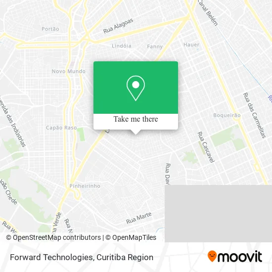
See Forward Technologies, Xaxim, on the map
Public Transit to Forward Technologies in Xaxim
Wondering how to get to Forward Technologies in Xaxim? Moovit helps you find the best way to get to Forward Technologies with step-by-step directions from the nearest public transit station.
Moovit provides free maps and live directions to help you navigate through your city. View schedules, routes, timetables, and find out how long does it take to get to Forward Technologies in real time.
Looking for the nearest stop or station to Forward Technologies? Check out this list of stops closest to your destination: R. Cel. Rivadávia Pereira De Morães; Rua Gabriel Frecceiro de Miranda 883; R. Leôncio Lopes Cortiano; R. Omar Raymundo Picheth.
Bus: 525 HAUER / CAPÃO RASO, 689 MAD. SÃO PEDRO / RIO NEGRO, 526 ITAMARATI / VILA SÃO PEDRO, 030 INTERBAIRROS III, 625 GRAMADOS.
Want to see if there’s another route that gets you there at an earlier time? Moovit helps you find alternative routes or times. Get directions from and directions to Forward Technologies easily from the Moovit App or Website.
We make riding to Forward Technologies easy, which is why over 1.5 million users, including users in Xaxim, trust Moovit as the best app for public transit. You don’t need to download an individual bus app or train app, Moovit is your all-in-one transit app that helps you find the best bus time or train time available.
For information on prices of bus, costs and ride fares to Forward Technologies, please check the Moovit app.
Use the app to navigate to popular places including to the airport, hospital, stadium, grocery store, mall, coffee shop, school, college, and university.
Forward Technologies Address: Rua Eurico Fonseca dos Santos, 1179 Xaxim Curitiba-PR 81810-490 street in Xaxim
- Alvaro Cintra,
- Tania VIVI Centro de Beleza,
- Oz3 Automação Industrial,
- Adriana Francisco de Oliveira,
- Mehi Montagens Eletricas e Hidraulicas Industriais,
- Swanp Termic,
- Auto Mecânica Motor 100,
- Mcm Reformas e Pinturas,
- Hotel Amigo Cão,
- Trans Minas,
- F J M Repres,
- Estado do Paraná Corretora de Seguros,
- Mercado Franca,
- Bar Mercearia e Bilharito N Sra das Gracas,
- Gliters Hair,
- Steli Fries Joias & Rainbow Boutique,
- Trunfo Topografia,
- Nena's Clear,
- Matheus Sudul,
- Jms Transporte
Places Near Forward Technologies (Xaxim)
- Hhhhh, Fazendinha,
- Pontifícia Universidade Católica do Paraná (PUCPR), Prado Velho,
- Shopping Estação, Rebouças,
- Jockey Plaza Shopping Center, Tarumã,
- Hospital Angelina Caron, Campina Grande Do Sul,
- Hospital Erasto Gaertner, Jardim Das Américas,
- Hospital de Clínicas (HC - UFPR), Centro,
- Rua Martim Afonso 558, Mercês,
- Parque Barigui, Mercês,
- Jardim Botânico de Curitiba PR, Centro,
- Arena Da Baixada - Curitiba,
- Hospital Universitário Evangélico de Curitiba, Bigorrilho,
- Hospital Da Cruz Vermelha, Batel,
- Park Shopping Barigüi, Mossunguê,
- Shopping Palladium, Portão,
- Rua General Mário Tourinho, Campina Do Siqueira,
- Hospital Nossa Senhora Das Graças, Mercês,
- Hospital do Rocio, Campo,
- Campo Largo, Campo,
- Hospital Madalena Sofia, Bairro Alto
How to get to popular places in Curitiba Region with public transit
Get around Xaxim by public transit!
Traveling around Xaxim has never been so easy. See step by step directions as you travel to any attraction, street or major public transit station. View bus and train schedules, arrival times, service alerts and detailed routes on a map, so you know exactly how to get to anywhere in Xaxim.
When traveling to any destination around Xaxim use Moovit's Live Directions with Get Off Notifications to know exactly where and how far to walk, how long to wait for your line, and how many stops are left. Moovit will alert you when it's time to get off — no need to constantly re-check whether yours is the next stop.
Wondering how to use public transit in Xaxim or how to pay for public transit in Xaxim? Moovit public transit app can help you navigate your way with public transit easily, and at minimum cost. It includes public transit fees, ticket prices, and costs. Looking for a map of Xaxim public transit lines? Moovit public transit app shows all public transit maps in Xaxim with all Bus and Cable Car routes and stops on an interactive map.
Curitiba Region has 2 transit type(s), including: Bus and Cable Car, operated by several transit agencies, including Sistema Integrado de Mobilidade (URBS), Sistema Integrado de Mobilidade (AMEP), URBS (Cartões bancários e Dinheiro), URBS (Cartões bancários / Cartão URBS), AMEP (Cartões bancários / Cartão MetroCard), AMEP (Cartões bancários / Cartão MetroCard / Dinheiro), Viação Colombo (Dinheiro), TRIAR (Cartão TRIAR / Dinheiro), Empresa Curitiba Cerro Azul (Dinheiro), Expresso Nossa Senhora da Penha (Dinheiro), Empresa Campo Alto Tijucas (Dinheiro), Auto Viação São José (Cartão VEM / Dinheiro), BRT S/A (Cartão VEM / Dinheiro), TransPiedade (Cartão Cidadão / Dinheiro) and Oceânica Sul (Cartão Transporte / Dinheiro)