Directions to Forza Auto Rodas (Cic) with public transportation
The following transit lines have routes that pass near Forza Auto Rodas
How to get to Forza Auto Rodas by bus?
Click on the bus route to see step by step directions with maps, line arrival times and updated time schedules.
From Rua Doutor Pedrosa, Centro
42 minFrom Faculdades Opet, Rebouças
47 minFrom Rua Euclides da Cunha, Bigorrilho
66 minFrom Hospital de Olhos do Paraná, Batel
61 minFrom Rua Doutor Bley Zornig, Boqueirão
58 minFrom CETAC, Batel
38 minFrom Campina Do Siqueira, Campina Do Siqueira
49 minFrom Alameda Princesa Izabel, Bigorrilho
55 minFrom Rua Desembargador Motta, Batel
49 minFrom Teatro Positivo, Cic
38 min
Bus stops near Forza Auto Rodas in Cic
Bus lines to Forza Auto Rodas in Cic
- F05 FAZENDA / CIC, Terminal Fazenda → Terminal CIC,VIEW
- 545 TRABALHADOR, Terminal Boqueirão → Terminal Fazendinha,VIEW
- 609 MAD. CIC, Terminal CIC → Praça Rui Barbosa,VIEW
- 619 SANTA RITA / CIC, Terminal Tatuquara → Terminal CIC,VIEW
- 628 CARBOMAFRA, Carbomafra → Terminal Capão Raso,VIEW
- 652 VILA VERDE, Vila Verde → Terminal CIC,VIEW
- 685 RIO BONITO / CIC, Terminal CIC → Rio Bonito,VIEW
- 723 EMÍLIO ROMANI, Terminal CIC ↺ Emílio Romani (Circular),VIEW
- 627 BOSCH, Terminal Capão Raso → Bosch (Vila Verde),VIEW
- 040 INTERBAIRROS IV, Terminal Pinheirinho → Terminal Santa Felicidade,VIEW
- X55 REFORÇO CIC / AV. J.K., Av. JK (Viaduto Eduardo Sprada) → Terminal CIC ,VIEW
- 653 SABARÁ, Moradias Corbélia → Terminal CIC,VIEW
- 709 VILA TIRADENTES / CIC, Terminal CIC → Vila Tiradentes (Recolhe),VIEW
- 712 JARDIM INDEPENDÊNCIA / CIC, Terminal CIC → Terminal Fazendinha,VIEW
- 773 VIZINHANÇA / SANTA RITA, Terminal Tatuquara → Terminal CIC,VIEW
- 826 CAMPO COMPRIDO / CIC, Terminal CIC → Terminal Campo Comprido,VIEW
- 644 PINHEIRINHO / CIC, Terminal CIC → Terminal Pinheirinho,VIEW
- 679 MAD. TATUQUARA, Terminal Pinheirinho ↺ Tatuquara (Circular),VIEW
What are the closest stations to Forza Auto Rodas?
The closest stations to Forza Auto Rodas are:
- R. Desembargador Cid Campelo, 3690 is 130 meters away, 2 min walk.
- R. Nelson Pizzani, 350 is 378 meters away, 5 min walk.
- R. Pedro Gusso, 4311 is 438 meters away, 6 min walk.
- R. João Chede, 3185 is 481 meters away, 7 min walk.
- R. Vicente Micheloto, 408 is 664 meters away, 9 min walk.
Which bus lines stop near Forza Auto Rodas?
These bus lines stop near Forza Auto Rodas: 040 INTERBAIRROS IV, 545 TRABALHADOR, 627 BOSCH, 628 CARBOMAFRA, 826 CAMPO COMPRIDO / CIC, F05 FAZENDA / CIC.
What’s the nearest bus station to Forza Auto Rodas in Cic?
The nearest bus station to Forza Auto Rodas in Cic is R. Desembargador Cid Campelo, 3690. It’s a 2 min walk away.
What time is the first bus to Forza Auto Rodas in Cic?
The 609 MAD. CIC is the first bus that goes to Forza Auto Rodas in Cic. It stops nearby at 3:00 AM.
What time is the last bus to Forza Auto Rodas in Cic?
The 609 MAD. CIC is the last bus that goes to Forza Auto Rodas in Cic. It stops nearby at 3:01 AM.
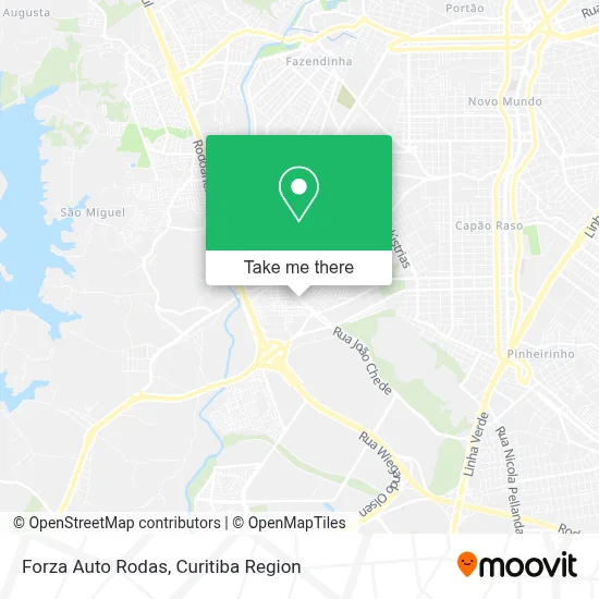
See Forza Auto Rodas, Cic, on the map
Public Transit to Forza Auto Rodas in Cic
Wondering how to get to Forza Auto Rodas in Cic? Moovit helps you find the best way to get to Forza Auto Rodas with step-by-step directions from the nearest public transit station.
Moovit provides free maps and live directions to help you navigate through your city. View schedules, routes, timetables, and find out how long does it take to get to Forza Auto Rodas in real time.
Looking for the nearest stop or station to Forza Auto Rodas? Check out this list of stops closest to your destination: R. Desembargador Cid Campelo; R. Nelson Pizzani; R. Pedro Gusso; R. João Chede; R. Vicente Micheloto.
Bus: 040 INTERBAIRROS IV, 545 TRABALHADOR, 627 BOSCH, 628 CARBOMAFRA, 826 CAMPO COMPRIDO / CIC, F05 FAZENDA / CIC, 609 MAD. CIC, 619 SANTA RITA / CIC, X55 REFORÇO CIC / AV. J.K., 653 SABARÁ, 709 VILA TIRADENTES / CIC, 712 JARDIM INDEPENDÊNCIA / CIC, 644 PINHEIRINHO / CIC, 679 MAD. TATUQUARA.
Want to see if there’s another route that gets you there at an earlier time? Moovit helps you find alternative routes or times. Get directions from and directions to Forza Auto Rodas easily from the Moovit App or Website.
We make riding to Forza Auto Rodas easy, which is why over 1.5 million users, including users in Cic, trust Moovit as the best app for public transit. You don’t need to download an individual bus app or train app, Moovit is your all-in-one transit app that helps you find the best bus time or train time available.
For information on prices of bus, costs and ride fares to Forza Auto Rodas, please check the Moovit app.
Use the app to navigate to popular places including to the airport, hospital, stadium, grocery store, mall, coffee shop, school, college, and university.
Forza Auto Rodas Address: Rua Desembargador Cid Campelo, 3735 Cidade Industrial de Curitiba Curitiba-PR 81170-350 street in Cic
- Rua Desembargador Cid Campêlo 3695,
- Irmãos Passaúra S.A,
- Otica Mais Visao,
- Shekinah Maquinas,
- Didicos Pub,
- Dinarte Baterias,
- Dende Sushi Comércio de Alimentos,
- Joel Cunha Sirino,
- Comunidade Evangélica Koinonya,
- Studio Rd,
- Nargs Tabacaria e Distribuidora,
- Emilar,
- Mgs Ferramentas,
- Nova Geracao Refrigeracao Automotiva,
- Tintas Victória,
- C P V Construcao Civil,
- Vieira's Beer's Distribuidora e Conveniencias,
- Agricer Supermercados,
- Banco 24horas,
- LINHA 619 - SANTA RITA CIC
Places Near Forza Auto Rodas (Cic)
- Hospital Nossa Senhora Das Graças, Mercês,
- Campo Largo, Campo,
- Parque Barigui, Mercês,
- Jockey Plaza Shopping Center, Tarumã,
- Jardim Botânico de Curitiba PR, Centro,
- Hospital Erasto Gaertner, Jardim Das Américas,
- Rua Martim Afonso 558, Mercês,
- Hospital de Clínicas (HC - UFPR), Centro,
- Hospital Universitário Evangélico de Curitiba, Bigorrilho,
- Arena Da Baixada - Curitiba,
- Hospital Da Cruz Vermelha, Batel,
- Park Shopping Barigüi, Mossunguê,
- Hospital Angelina Caron, Campina Grande Do Sul,
- Pontifícia Universidade Católica do Paraná (PUCPR), Prado Velho,
- Hospital Madalena Sofia, Bairro Alto,
- Shopping Estação, Rebouças,
- Rua General Mário Tourinho, Campina Do Siqueira,
- Hhhhh, Fazendinha,
- Hospital do Rocio, Campo,
- Shopping Palladium, Portão
How to get to popular places in Curitiba Region with public transit
Get around Cic by public transit!
Traveling around Cic has never been so easy. See step by step directions as you travel to any attraction, street or major public transit station. View bus and train schedules, arrival times, service alerts and detailed routes on a map, so you know exactly how to get to anywhere in Cic.
When traveling to any destination around Cic use Moovit's Live Directions with Get Off Notifications to know exactly where and how far to walk, how long to wait for your line, and how many stops are left. Moovit will alert you when it's time to get off — no need to constantly re-check whether yours is the next stop.
Wondering how to use public transit in Cic or how to pay for public transit in Cic? Moovit public transit app can help you navigate your way with public transit easily, and at minimum cost. It includes public transit fees, ticket prices, and costs. Looking for a map of Cic public transit lines? Moovit public transit app shows all public transit maps in Cic with all Bus and Cable Car routes and stops on an interactive map.
Curitiba Region has 2 transit type(s), including: Bus and Cable Car, operated by several transit agencies, including Sistema Integrado de Mobilidade (URBS), Sistema Integrado de Mobilidade (AMEP), URBS (Cartões bancários e Dinheiro), URBS (Cartões bancários / Cartão URBS), AMEP (Cartões bancários / Cartão MetroCard), AMEP (Cartões bancários / Cartão MetroCard / Dinheiro), Viação Colombo (Dinheiro), TRIAR (Cartão TRIAR / Dinheiro), Empresa Curitiba Cerro Azul (Dinheiro), Expresso Nossa Senhora da Penha (Dinheiro), Empresa Campo Alto Tijucas (Dinheiro), Auto Viação São José (Cartão VEM / Dinheiro), BRT S/A (Cartão VEM / Dinheiro), TransPiedade (Cartão Cidadão / Dinheiro) and Oceânica Sul (Cartão Transporte / Dinheiro)