How to get to Foto-Design Gerth by bus?
Click on the bus route to see step by step directions with maps, line arrival times and updated time schedules.
How to get to Foto-Design Gerth by train?
Click on the train route to see step by step directions with maps, line arrival times and updated time schedules.
Bus stops near Foto-Design Gerth in Dresden
Light Rail stations near Foto-Design Gerth in Dresden
- Chemnitz, Reineckerstr, 17 min walk,VIEW
Bus lines to Foto-Design Gerth in Dresden
What are the closest stations to Foto-Design Gerth?
The closest stations to Foto-Design Gerth are:
- Chemnitz, Hofer Str is 24 meters away, 1 min walk.
- Chemnitz, Cfc-Stadion is 409 meters away, 6 min walk.
- Chemnitz, Würzburger Str is 672 meters away, 9 min walk.
- Chemnitz, Reineckerstr is 1255 meters away, 17 min walk.
Which bus line stops near Foto-Design Gerth?
51 (Chemnitz, Zeisigwald, Klinik Bethanien)
Which train lines stop near Foto-Design Gerth?
These train lines stop near Foto-Design Gerth: C11, RB30, RB80, RE6.
What’s the nearest light rail station to Foto-Design Gerth in Dresden?
The nearest light rail station to Foto-Design Gerth in Dresden is Chemnitz, Reineckerstr. It’s a 17 min walk away.
What’s the nearest bus station to Foto-Design Gerth in Dresden?
The nearest bus station to Foto-Design Gerth in Dresden is Chemnitz, Hofer Str. It’s a 1 min walk away.
What time is the first light rail to Foto-Design Gerth in Dresden?
The 5 is the first light rail that goes to Foto-Design Gerth in Dresden. It stops nearby at 4:32 AM.
What time is the last light rail to Foto-Design Gerth in Dresden?
The 5 is the last light rail that goes to Foto-Design Gerth in Dresden. It stops nearby at 11:21 PM.
What time is the first bus to Foto-Design Gerth in Dresden?
The N12 is the first bus that goes to Foto-Design Gerth in Dresden. It stops nearby at 3:30 AM.
What time is the last bus to Foto-Design Gerth in Dresden?
The N12 is the last bus that goes to Foto-Design Gerth in Dresden. It stops nearby at 2:53 AM.
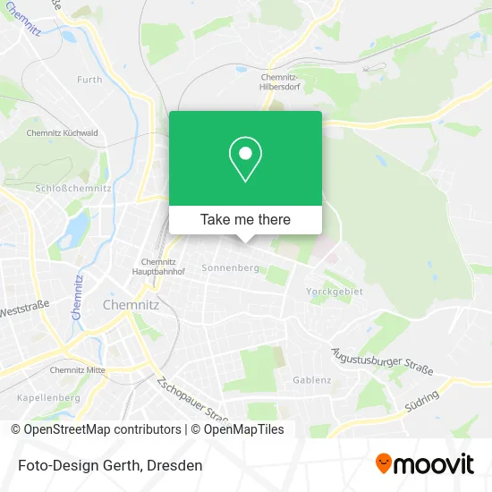
See Foto-Design Gerth, Dresden, on the map
Public Transit to Foto-Design Gerth in Dresden
Wondering how to get to Foto-Design Gerth in Dresden? Moovit helps you find the best way to get to Foto-Design Gerth with step-by-step directions from the nearest public transit station.
Moovit provides free maps and live directions to help you navigate through your city. View schedules, routes, timetables, and find out how long does it take to get to Foto-Design Gerth in real time.
Looking for the nearest stop or station to Foto-Design Gerth? Check out this list of stops closest to your destination: Chemnitz; Chemnitz; Chemnitz; Chemnitz.
Bus: 51, N12, 82, 31.Train: C11, RB30, RB80, RE6.
Want to see if there’s another route that gets you there at an earlier time? Moovit helps you find alternative routes or times. Get directions from and directions to Foto-Design Gerth easily from the Moovit App or Website.
We make riding to Foto-Design Gerth easy, which is why over 1.5 million users, including users in Dresden, trust Moovit as the best app for public transit. You don’t need to download an individual bus app or train app, Moovit is your all-in-one transit app that helps you find the best bus time or train time available.
For information on prices of bus, train and light rail, costs and ride fares to Foto-Design Gerth, please check the Moovit app.
Use the app to navigate to popular places including to the airport, hospital, stadium, grocery store, mall, coffee shop, school, college, and university.
Foto-Design Gerth Address: Heinrich-Schütz-Straße street in Dresden
- Fotostudio Gerth,
- Hofer Str.,
- Dangler,
- Cet,
- 33max Web Design Seo sem,
- Hofer Straße,
- Selbsthilfe Wohnprojekt Further Straße,
- Kjh Substanz,
- Kinder- Und Jugendhaus Substanz,
- Autoservice Bsg,
- Küchen Megamarkt,
- Gigantmöbel,
- Autohaus Arnold,
- Netto Marken-Discount,
- Schäfer's,
- EDEKA,
- Sparkasse,
- Sparkasse Karlsruhe Ettlingen,
- Hebamme Juliane Preller, Babyglück-Chemnitz,
- Preller Ergotherapie Sylvia Ergotherapie
Places Near Foto-Design Gerth (Dresden)
- Waldmax, Dresden,
- Oskarshausen, Freital,
- Ikea, Dresden,
- Schloß Übigau, Dresden,
- Carolaschlösschen, Dresden,
- Schloss Pillnitz, Dresden,
- Amedia Hotel Dresden Elbpromenade, Dresden,
- Elbepark, Dresden,
- Biergarten "Gohliser Windmühle", Dresden,
- Kaufpark Dresden-Nickern, Dresden,
- Dresden, Hauptbahnhof (Strehlener Straße), Dresden,
- Hans-Erlwein-Gymnasium, Dresden,
- Freilichtbühne Junge Garde, Dresden,
- Heinz-Steyer-Stadion, Dresden,
- Altstadt, Dresden,
- Krankenhaus St. Joseph-Stift, Dresden,
- Weisser Hirsch, Dresden,
- Pfunds Molkerei, Dresden,
- Landschloß Zuschendorf, Pirna,
- Dresden Hbf, Dresden
How to get to popular places in Dresden with public transit
Get around Dresden by public transit!
Traveling around Dresden has never been so easy. See step by step directions as you travel to any attraction, street or major public transit station. View bus and train schedules, arrival times, service alerts and detailed routes on a map, so you know exactly how to get to anywhere in Dresden.
When traveling to any destination around Dresden use Moovit's Live Directions with Get Off Notifications to know exactly where and how far to walk, how long to wait for your line, and how many stops are left. Moovit will alert you when it's time to get off — no need to constantly re-check whether yours is the next stop.
Wondering how to use public transit in Dresden or how to pay for public transit in Dresden? Moovit public transit app can help you navigate your way with public transit easily, and at minimum cost. It includes public transit fees, ticket prices, and costs. Looking for a map of Dresden public transit lines? Moovit public transit app shows all public transit maps in Dresden with all Bus, Train, Light Rail, Ferry, Cable Car and Gondola routes and stops on an interactive map.
Dresden has 6 transit type(s), including: Bus, Train, Light Rail, Ferry, Cable Car and Gondola, operated by several transit agencies, including Trilex, DB AG - S-Bahn, DVB AG, alita, RVSOE, Müller.Bus.Reisen, SATRA Eberhardt, VGM, RBO, DB AG, MRB, SDG, Sächsisch-Oberlausitzer Eisenbahngesellschaft, DB Fernverkehr (Codesharing) and Hanseatische Eisenbahn GmbH