How to get to Foto Lennon Lab. by bus?
Click on the bus route to see step by step directions with maps, line arrival times and updated time schedules.
From Primera de Pro, Los Olivos
40 minFrom Av. La Paz, San Miguel
42 minFrom Cementerio Parque del Recuerdo - Oquendo/Callao, Ventanilla
45 minFrom Clinica Pulso, San Borja
47 minFrom Hospital De San Juan De Lurigancho, San Juan D
57 minFrom AV PARINACOCHAS LA VICTORIA, La Victori
31 minFrom ovalo huandoy, Los Olivos
33 minFrom Metropolitano Centro Civico, Lima
29 minFrom Ate Vitarte, Ate
54 minFrom Instituto Nacional De Salud Del Niño, San Borja
51 min
Bus stops near Foto Lennon Lab. in San Martin
Bus lines to Foto Lennon Lab. in San Martin
- 1181, Ensenada (Puente Piedra) - Pumacahua (Chorrillos),VIEW
- 1012, Comas - Magdalena,VIEW
- 1197, Chuquitanta (San Martin De Porres) - Ovalo Higuereta (Santiago De Surco) - Chuquitanta (San Martin De Porres),VIEW
- 1226, Ceres Medio (Ate) - Av. Perú (San Martin De Porres),VIEW
- 1233, Puente Camote (San Martin De Porres),VIEW
- 1244, Las Palmas (Pachacamac) - Pan de Azúcar (San Martín De Porres),VIEW
- 1249, Chuquitanta (San Martín De Porres) - Av. Lima (Villa El Salvador),VIEW
- 1280, Tablada (Villa María Del Triunfo) - Profam (Santa Rosa),VIEW
- 1284, Canta Callao (San Martin De Porres),VIEW
- 1303, Pachacútec (Ventanilla) - Av. México (El Agustino),VIEW
- CR24, Manylsa,VIEW
- CR25, Pacasmayo (Callao) - Santa Clara (Ate),VIEW
- CR44, Ate - Callao,VIEW
- CR57, Puente Nuevo (El Agustino) - Parque Porcino (Ventanilla),VIEW
- IO30B, 28 De Julio (Lima) - Pacasmayo (S.M.P.),VIEW
- CR62, Carabayllo - Lima - Carabayllo,VIEW
- 372, Av. Tacna (Lima) - Quilca (San Martín de Porres),VIEW
- CR43, Ventanilla - Carabayllo,VIEW
- IM47, Km. 22 - Caquetá - Brasil - La Marina - Faucett - Km. 22,VIEW
What are the closest stations to Foto Lennon Lab.?
The closest stations to Foto Lennon Lab. are:
- Santa Fe 471 is 82 meters away, 2 min walk.
- Santa Fe is 88 meters away, 2 min walk.
- Monterrey is 214 meters away, 4 min walk.
- Avenida Perú is 223 meters away, 4 min walk.
- Pinar is 278 meters away, 4 min walk.
Which bus lines stop near Foto Lennon Lab.?
These bus lines stop near Foto Lennon Lab.: 1181, 1226, 1233, 1249, 1303, CR57, IO30B.
What’s the nearest bus station to Foto Lennon Lab. in San Martin?
The nearest bus stations to Foto Lennon Lab. in San Martin are Santa Fe 471 and Santa Fe. The closest one is a 2 min walk away.
What time is the first bus to Foto Lennon Lab. in San Martin?
The CR24 is the first bus that goes to Foto Lennon Lab. in San Martin. It stops nearby at 4:47 AM.
What time is the last bus to Foto Lennon Lab. in San Martin?
The 1280 is the last bus that goes to Foto Lennon Lab. in San Martin. It stops nearby at 12:46 AM.
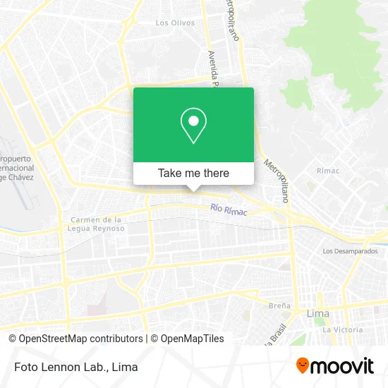
See Foto Lennon Lab., San Martin, on the map
Public Transit to Foto Lennon Lab. in San Martin
Wondering how to get to Foto Lennon Lab. in San Martin? Moovit helps you find the best way to get to Foto Lennon Lab. with step-by-step directions from the nearest public transit station.
Moovit provides free maps and live directions to help you navigate through your city. View schedules, routes, timetables, and find out how long does it take to get to Foto Lennon Lab. in real time.
Looking for the nearest stop or station to Foto Lennon Lab.? Check out this list of stops closest to your destination: Santa Fe 471; Santa Fe; Monterrey; Avenida Perú; Pinar.
Bus: 1181, 1226, 1233, 1249, 1303, CR57, IO30B, 1012, 1197, 1244, CR62, 372, CR43, IM47.
Want to see if there’s another route that gets you there at an earlier time? Moovit helps you find alternative routes or times. Get directions from and directions to Foto Lennon Lab. easily from the Moovit App or Website.
We make riding to Foto Lennon Lab. easy, which is why over 1.5 million users, including users in San Martin, trust Moovit as the best app for public transit. You don’t need to download an individual bus app or train app, Moovit is your all-in-one transit app that helps you find the best bus time or train time available.
For information on prices of bus, costs and ride fares to Foto Lennon Lab., please check the Moovit app.
Use the app to navigate to popular places including to the airport, hospital, stadium, grocery store, mall, coffee shop, school, college, and university.
Foto Lennon Lab. Address: Avenida Perú Perú I Zona, 15101 San Martín de Porres street in San Martin
- 2023 - Augusto Salazar Bondy,
- Sole,
- Calle Galicia 380 Pueblo Libre,
- Enkanta Clinicas Dentales,
- Botica Moderna,
- Book Away Lima,
- Flores Hernández Jorge Ricardo,
- Casa de Fotografía Kodak y Otras-Foto Lennon,
- Casa de Fotografía Kodak y Otras-J + C Revelados,
- Alomia Sotomayor Felipe Dante,
- Ferretería Mundial,
- Gym Alvarado San Martín de Porres,
- Veracruz,
- Anticuchos Pochita,
- Team Bad Boys,
- Farmacom Botica Farma El Sol,
- Carsa Smp,
- Dolares-Oro/Plata,
- La Curacao,
- Western Union Av Perú Cdra 18
Places Near Foto Lennon Lab. (San Martin)
- av arequipa, Lima,
- Gamarra,
- Av. Salaverry, Jesus Mari,
- Miraflores, Miraflores,
- Aeropuerto Internacional Jorge Chávez, Ventanilla,
- Hospital Edgardo Rebagliati Martins, Jesus Mari,
- Centro Comercial Plaza Norte, Independen,
- Av. La Marina, San Miguel,
- Pontificia Universidad Católica del Perú - PUCP, San Miguel,
- Parque de las Leyendas, San Miguel,
- Larcomar, Miraflores,
- Jockey Plaza, Santiago D,
- Parque Kennedy, Miraflores,
- Circuito Mágico Del Agua, Lima,
- Plaza San Miguel, San Miguel,
- Barranco, Barranco,
- Paradero Av.Brasil,
- Av. Abancay, Lima,
- Real Plaza Puruchuco, Ate,
- Mall Del Sur
How to get to popular places in Lima with public transit
Get around San Martin by public transit!
Traveling around San Martin has never been so easy. See step by step directions as you travel to any attraction, street or major public transit station. View bus and train schedules, arrival times, service alerts and detailed routes on a map, so you know exactly how to get to anywhere in San Martin.
When traveling to any destination around San Martin use Moovit's Live Directions with Get Off Notifications to know exactly where and how far to walk, how long to wait for your line, and how many stops are left. Moovit will alert you when it's time to get off — no need to constantly re-check whether yours is the next stop.
Wondering how to use public transit in San Martin or how to pay for public transit in San Martin? Moovit public transit app can help you navigate your way with public transit easily, and at minimum cost. It includes public transit fees, ticket prices, and costs. Looking for a map of San Martin public transit lines? Moovit public transit app shows all public transit maps in San Martin with all Bus, Metro and Ferry routes and stops on an interactive map.
Lima has 3 transit type(s), including: Bus, Metro and Ferry, operated by several transit agencies, including Metro de Lima Línea 2 , Metro de Lima, Corredor Rojo, Metropolitano, Metropolitano - Alimentadores, Corredor Morado, Corredor Azul, Rutas Tradicionales, Transportes y Servicios La Esperanza S.A., Las Flores S.A., Virgen de la Asunción S.A., Consorcio HAM, Transportes y Service Canadá S.A., ETUL4SA and ETUCHISA