Directions to Four2tech (Colombo) with public transportation
The following transit lines have routes that pass near Four2tech
How to get to Four2tech by bus?
Click on the bus route to see step by step directions with maps, line arrival times and updated time schedules.
From Rua Barão do Rio Branco 122, Centro
49 minFrom Rua Candido De Abreu, Centro Cívico
62 minFrom Rua do Rosário, Centro
45 minFrom Rpc Tv, Mercês
68 minFrom Travessa da Lapa, Centro
44 minFrom Expotrade Convention Center, Pinhais
69 minFrom Vista Alegre, Vista Alegre
84 minFrom Ponto de Ônibus Teatro Guaíra, Centro
46 minFrom Rua Fernando Amaro, Alto Da Rua XV
45 minFrom Linha C42 Pinhais/Bairro Alto, Bairro Alto
52 min
Bus stops near Four2tech in Colombo
Bus lines to Four2tech in Colombo
What are the closest stations to Four2tech?
The closest stations to Four2tech are:
- Rua André Nadolny, 1610 is 169 meters away, 3 min walk.
- R. Santo Pascoal Franceschi, 876 is 213 meters away, 4 min walk.
- Rua Reynaldo Cavalli, 193 is 575 meters away, 8 min walk.
- Rua Prefeito Pio Alberti, 14 is 864 meters away, 12 min walk.
Which bus lines stop near Four2tech?
These bus lines stop near Four2tech: B73 JARDIM OSASCO / GUADALUPE, B78 SÃO GABRIEL / GUADALUPE, S02 ROÇA GRANDE / ESTAÇÃO ATUBA.
What’s the nearest bus station to Four2tech in Colombo?
The nearest bus station to Four2tech in Colombo is Rua André Nadolny, 1610. It’s a 3 min walk away.
What time is the first bus to Four2tech in Colombo?
The B78 SÃO GABRIEL / GUADALUPE is the first bus that goes to Four2tech in Colombo. It stops nearby at 5:12 AM.
What time is the last bus to Four2tech in Colombo?
The S02 ROÇA GRANDE / ESTAÇÃO ATUBA is the last bus that goes to Four2tech in Colombo. It stops nearby at 12:06 AM.
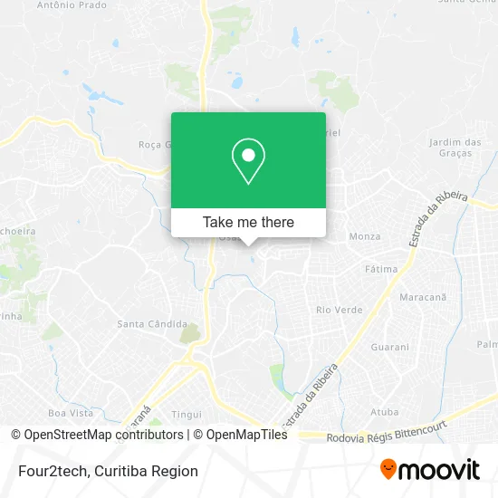
See Four2tech, Colombo, on the map
Public Transit to Four2tech in Colombo
Wondering how to get to Four2tech in Colombo? Moovit helps you find the best way to get to Four2tech with step-by-step directions from the nearest public transit station.
Moovit provides free maps and live directions to help you navigate through your city. View schedules, routes, timetables, and find out how long does it take to get to Four2tech in real time.
Looking for the nearest stop or station to Four2tech? Check out this list of stops closest to your destination: Rua André Nadolny; R. Santo Pascoal Franceschi; Rua Reynaldo Cavalli; Rua Prefeito Pio Alberti.
Bus: B73 JARDIM OSASCO / GUADALUPE, B78 SÃO GABRIEL / GUADALUPE, S02 ROÇA GRANDE / ESTAÇÃO ATUBA, I90 CACHOEIRA / MARACANÃ.
Want to see if there’s another route that gets you there at an earlier time? Moovit helps you find alternative routes or times. Get directions from and directions to Four2tech easily from the Moovit App or Website.
We make riding to Four2tech easy, which is why over 1.5 million users, including users in Colombo, trust Moovit as the best app for public transit. You don’t need to download an individual bus app or train app, Moovit is your all-in-one transit app that helps you find the best bus time or train time available.
For information on prices of bus, costs and ride fares to Four2tech, please check the Moovit app.
Use the app to navigate to popular places including to the airport, hospital, stadium, grocery store, mall, coffee shop, school, college, and university.
Four2tech Address: Rua Luíz Gulin, 687 Osasco Colombo-PR 83403-150 street in Colombo
- Prev10 - Consultoria e Treinamento,
- Mannelli Alimentos,
- Rua Luís Gulin 723,
- Hoshina Agro Alimentos,
- Nelson Hiroshi Toeda,
- Vegoor Tecnologia Aplicada,
- Higipel Sistemas de Higiene,
- Frytbel Industria e Comercio,
- Escola Sementinha - Educação Infantil e Ensino Fundamental,
- G5 Interlog Transportes,
- Condomínio Residencial Monterey,
- Rua André Nadolny 1560,
- Associação Paranaense de Apoio a Crianças,
- Unidade de Pronto Atendimento Osasco,
- Condominio Residencial Nouva Vita,
- Residencial Deoville,
- Condomínio Edifício Solar Firenze,
- André Leone,
- Marciareginade,
- Morena Flor PR
Places Near Four2tech (Colombo)
- Shopping Estação, Rebouças,
- Hospital Da Cruz Vermelha, Batel,
- Hhhhh, Fazendinha,
- Park Shopping Barigüi, Mossunguê,
- Campo Largo, Campo,
- Shopping Palladium, Portão,
- Hospital Universitário Evangélico de Curitiba, Bigorrilho,
- Hospital Erasto Gaertner, Jardim Das Américas,
- Arena Da Baixada - Curitiba,
- Jockey Plaza Shopping Center, Tarumã,
- Hospital Madalena Sofia, Bairro Alto,
- Jardim Botânico de Curitiba PR, Centro,
- Parque Barigui, Mercês,
- Hospital Nossa Senhora Das Graças, Mercês,
- Pontifícia Universidade Católica do Paraná (PUCPR), Prado Velho,
- Rua General Mário Tourinho, Campina Do Siqueira,
- Hospital do Rocio, Campo,
- Hospital Angelina Caron, Campina Grande Do Sul,
- Rua Martim Afonso 558, Mercês,
- Hospital de Clínicas (HC - UFPR), Centro
How to get to popular places in Curitiba Region with public transit
Get around Colombo by public transit!
Traveling around Colombo has never been so easy. See step by step directions as you travel to any attraction, street or major public transit station. View bus and train schedules, arrival times, service alerts and detailed routes on a map, so you know exactly how to get to anywhere in Colombo.
When traveling to any destination around Colombo use Moovit's Live Directions with Get Off Notifications to know exactly where and how far to walk, how long to wait for your line, and how many stops are left. Moovit will alert you when it's time to get off — no need to constantly re-check whether yours is the next stop.
Wondering how to use public transit in Colombo or how to pay for public transit in Colombo? Moovit public transit app can help you navigate your way with public transit easily, and at minimum cost. It includes public transit fees, ticket prices, and costs. Looking for a map of Colombo public transit lines? Moovit public transit app shows all public transit maps in Colombo with all Bus and Cable Car routes and stops on an interactive map.
Curitiba Region has 2 transit type(s), including: Bus and Cable Car, operated by several transit agencies, including Sistema Integrado de Mobilidade (URBS), Sistema Integrado de Mobilidade (AMEP), URBS (Cartões bancários e Dinheiro), URBS (Cartões bancários / Cartão URBS), AMEP (Cartões bancários / Cartão MetroCard), AMEP (Cartões bancários / Cartão MetroCard / Dinheiro), Viação Colombo (Dinheiro), TRIAR (Cartão TRIAR / Dinheiro), Empresa Curitiba Cerro Azul (Dinheiro), Expresso Nossa Senhora da Penha (Dinheiro), Empresa Campo Alto Tijucas (Dinheiro), Auto Viação São José (Cartão VEM / Dinheiro), BRT S/A (Cartão VEM / Dinheiro), TransPiedade (Cartão Cidadão / Dinheiro) and Oceânica Sul (Cartão Transporte / Dinheiro)