How to get to Fp Formaction by bus?
Click on the bus route to see step by step directions with maps, line arrival times and updated time schedules.
From Technocentre Renault, Guyancourt
116 minFrom Les Ulis, Les Ulis
78 minFrom Limours, Limours
35 minFrom Magny-Les-Hameaux, Rambouillet
88 minFrom Gymnase André Raquin Bâtiment 225 - Suaps, Palaiseau
63 minFrom Guyancourt, Guyancourt
118 minFrom Marcoussis, Marcoussis
101 minFrom Les Ulis, Les Ulis
81 minFrom Station D'Écoute de la Dgsi, Boullay-Les-Troux
72 minFrom Janvry, Janvry
70 min
Bus stops near Fp Formaction in Saint-Arnoult-En-Yvelines
Bus lines to Fp Formaction in Saint-Arnoult-En-Yvelines
What are the closest stations to Fp Formaction?
The closest stations to Fp Formaction are:
- Poste is 123 meters away, 2 min walk.
- Mairie is 351 meters away, 5 min walk.
- Muette is 747 meters away, 10 min walk.
Which bus lines stop near Fp Formaction?
These bus lines stop near Fp Formaction: 5307, 7810.
What’s the nearest bus station to Fp Formaction in Saint-Arnoult-En-Yvelines?
The nearest bus station to Fp Formaction in Saint-Arnoult-En-Yvelines is Poste. It’s a 2 min walk away.
What time is the first bus to Fp Formaction in Saint-Arnoult-En-Yvelines?
The 7810 is the first bus that goes to Fp Formaction in Saint-Arnoult-En-Yvelines. It stops nearby at 5:36 AM.
What time is the last bus to Fp Formaction in Saint-Arnoult-En-Yvelines?
The 5307 is the last bus that goes to Fp Formaction in Saint-Arnoult-En-Yvelines. It stops nearby at 10:37 PM.
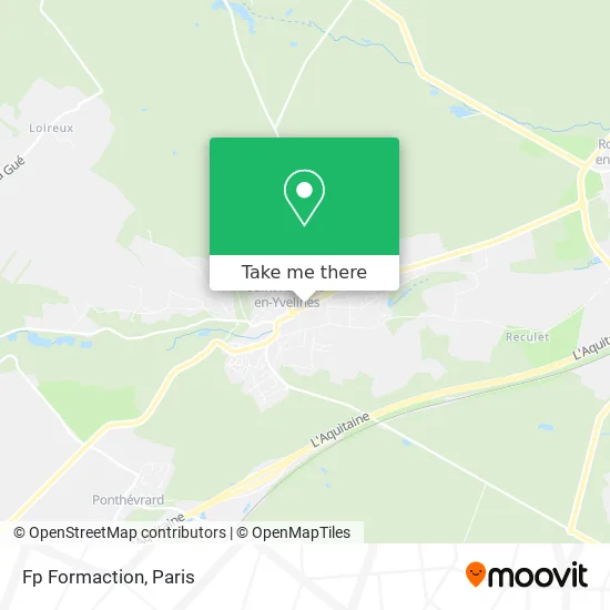
See Fp Formaction, Saint-Arnoult-En-Yvelines, on the map
Public Transit to Fp Formaction in Saint-Arnoult-En-Yvelines
Wondering how to get to Fp Formaction in Saint-Arnoult-En-Yvelines? Moovit helps you find the best way to get to Fp Formaction with step-by-step directions from the nearest public transit station.
Moovit provides free maps and live directions to help you navigate through your city. View schedules, routes, timetables, and find out how long does it take to get to Fp Formaction in real time.
Looking for the nearest stop or station to Fp Formaction? Check out this list of stops closest to your destination: Poste; Mairie; Muette.
Bus: 5307, 7810, 5226, 5233, 5242, 5252, 5333.
Want to see if there’s another route that gets you there at an earlier time? Moovit helps you find alternative routes or times. Get directions from and directions to Fp Formaction easily from the Moovit App or Website.
We make riding to Fp Formaction easy, which is why over 1.5 million users, including users in Saint-Arnoult-En-Yvelines, trust Moovit as the best app for public transit. You don’t need to download an individual bus app or train app, Moovit is your all-in-one transit app that helps you find the best bus time or train time available.
For information on prices of bus and RER, costs and ride fares to Fp Formaction, please check the Moovit app.
Use the app to navigate to popular places including to the airport, hospital, stadium, grocery store, mall, coffee shop, school, college, and university.
Fp Formaction Address: 6 Avenue Henri Grivot 78730 Saint-Arnoult-en-Yvelines street in Saint-Arnoult-En-Yvelines
- Sarl Bertrand Moutinho,
- Sandra Roques,
- Virginie Monsigny,
- 20 Rue des Remparts Parking,
- 25 27,
- La Cabane d'Elsandre,
- Power Dot,
- Cebria Rodriguez Daniel,
- Parc du Docteur Arsonneau,
- Guillaume Kévin,
- Boli Zeoua Irie Bi Zephirin Diehoue,
- 3 C,
- Cercle des Agriculteurs de la Région de Dourdan-Limours,
- Lopes Henrique,
- Commune de Saint Arnoult en Yvelines,
- Merrifield Yves,
- Magnan Benjamin,
- L'Arc en Ciel,
- R.M.E,
- Extern'US
Places Near Fp Formaction (Saint-Arnoult-En-Yvelines)
- Galeries Lafayette Haussmann, Paris,
- Institut Curie, Paris,
- Atelier Des Lumieres, Paris,
- Hôpital Beaujon, Clichy,
- Théâtre Mogador, Paris,
- Hopital Lariboisière, Paris,
- Gare Routière Flixbus, Paris,
- Hôpital Necker, Paris,
- Hôpital Pitié Salpêtrière, Paris,
- Centre Hospitalier des 15/20, Paris,
- 29 Rue Manin, Paris,
- Hôpital Saint-Joseph, Paris,
- Marché Saint-Pierre, Paris,
- Hôpital de la Pitié-Salpêtrière, Paris,
- Hôpital Cochin, Paris,
- Galeries Lafayette, Paris,
- Hopital Foch, Suresnes,
- Créteil Soleil, Creteil,
- Fondation Louis Vuitton, Paris,
- Hôpital Henri Mondor, Creteil
How to get to popular places in Paris with public transit
Get around Saint-Arnoult-En-Yvelines by public transit!
Traveling around Saint-Arnoult-En-Yvelines has never been so easy. See step by step directions as you travel to any attraction, street or major public transit station. View bus and train schedules, arrival times, service alerts and detailed routes on a map, so you know exactly how to get to anywhere in Saint-Arnoult-En-Yvelines.
When traveling to any destination around Saint-Arnoult-En-Yvelines use Moovit's Live Directions with Get Off Notifications to know exactly where and how far to walk, how long to wait for your line, and how many stops are left. Moovit will alert you when it's time to get off — no need to constantly re-check whether yours is the next stop.
Wondering how to use public transit in Saint-Arnoult-En-Yvelines or how to pay for public transit in Saint-Arnoult-En-Yvelines? Moovit public transit app can help you navigate your way with public transit easily, and at minimum cost. It includes public transit fees, ticket prices, and costs. Looking for a map of Saint-Arnoult-En-Yvelines public transit lines? Moovit public transit app shows all public transit maps in Saint-Arnoult-En-Yvelines with all Bus, Train, Metro, Light Rail, RER, Funicular and Gondola routes and stops on an interactive map.
Paris has 7 transit type(s), including: Bus, Train, Metro, Light Rail, RER, Funicular and Gondola, operated by several transit agencies, including RATP, RER, RER Bus de remplacement, Train, Train Bus de remplacement, Tramway Bus de remplacement, TER, ADP, Magical Shuttle, Argenteuil - Boucles de Seine, Autocars Dominique, Bièvre, Brie et 2 Morin, Le Bus - C.C. du Clermontois and Cœur d’Essonne