How to get to Fraud Protection Network, Inc. by bus?
Click on the bus route to see step by step directions with maps, line arrival times and updated time schedules.
From Calder Casino, Miami Gardens
73 minFrom Seminole Hard Rock Hotel & Casino, Hollywood
76 minFrom Calder Race Course (Calder Casino), Miami Gardens
68 minFrom Walmart Supercenter, Hollywood
57 minFrom Haulover Park (Haulover Beach), Miami Beach
32 minFrom Broward College South Campus, Miramar-Pembroke Pines
69 minFrom NE 125th St / N Miami Ave, Miami
86 minFrom Hard Rock Stadium, Miami Gardens
81 minFrom Hollywood Blvd & 441, Hollywood
66 minFrom Bal Harbour, Miami Beach
36 min
Bus stops near Fraud Protection Network, Inc. in Miami
Train station near Fraud Protection Network, Inc. in Miami
- Aventura, 59 min walk,VIEW
Bus lines to Fraud Protection Network, Inc. in Miami
- AVTPUR, Purple,VIEW
- BLUE EXPRESS ROUTE, Blue Express Route,VIEW
- RED EXPRESS ROUTE, Red Express Route,VIEW
- SATURDAY NIGHT EXPRESS NORTH ROUTE, Saturday Night Express North Route,VIEW
- 01, Us 1 Local,VIEW
- 101, Us 1 Breeze,VIEW
- AVTGRN, Green,VIEW
- SATURDAY NIGHT EXPRESS SOUTH ROUTE, Aventura Mall Transit Terminal,VIEW
- 95, 95a - Civic Center Via Golden Glades Park & Ride,VIEW
- 199, 199 - Red Rd Transit Hub,VIEW
- GREEN EXPRESS ROUTE, Circular with library,VIEW
What are the closest stations to Fraud Protection Network, Inc.?
The closest stations to Fraud Protection Network, Inc. are:
- Park Square is 32 yards away, 1 min walk.
- NE 207 St/ Aventura Lakes is 287 yards away, 4 min walk.
- Us1/Ne 209 S - (Aventura Hosp) is 478 yards away, 6 min walk.
- Biscaya is 501 yards away, 7 min walk.
- Coronado is 516 yards away, 7 min walk.
- Ne 203 St & Ne 29 Ct is 586 yards away, 8 min walk.
- Promenade Shops is 597 yards away, 8 min walk.
- Aventura is 5028 yards away, 59 min walk.
Which bus lines stop near Fraud Protection Network, Inc.?
These bus lines stop near Fraud Protection Network, Inc.: 01, 100, 199, AVTPUR.
What’s the nearest bus station to Fraud Protection Network, Inc. in Miami?
The nearest bus station to Fraud Protection Network, Inc. in Miami is Park Square. It’s a 1 min walk away.
What time is the first train to Fraud Protection Network, Inc. in Miami?
The BLFM is the first train that goes to Fraud Protection Network, Inc. in Miami. It stops nearby at 6:09 AM.
What time is the last train to Fraud Protection Network, Inc. in Miami?
The BLFM is the last train that goes to Fraud Protection Network, Inc. in Miami. It stops nearby at 12:07 AM.
What time is the first bus to Fraud Protection Network, Inc. in Miami?
The 199 is the first bus that goes to Fraud Protection Network, Inc. in Miami. It stops nearby at 5:02 AM.
What time is the last bus to Fraud Protection Network, Inc. in Miami?
The 01 is the last bus that goes to Fraud Protection Network, Inc. in Miami. It stops nearby at 12:13 AM.
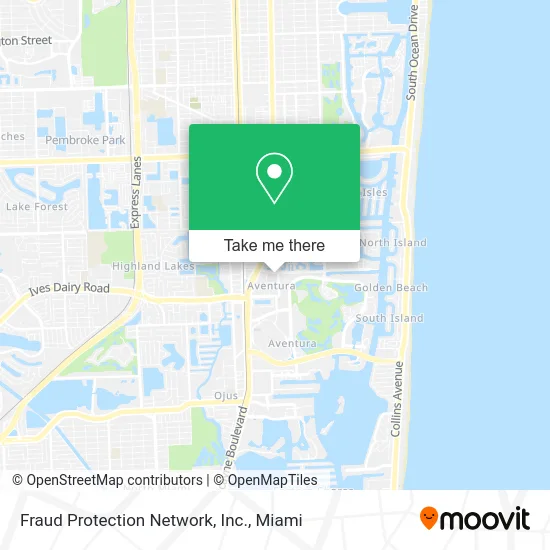
See Fraud Protection Network, Inc., Miami, on the map
Public Transit to Fraud Protection Network, Inc. in Miami
Wondering how to get to Fraud Protection Network, Inc. in Miami? Moovit helps you find the best way to get to Fraud Protection Network, Inc. with step-by-step directions from the nearest public transit station.
Moovit provides free maps and live directions to help you navigate through your city. View schedules, routes, timetables, and find out how long does it take to get to Fraud Protection Network, Inc. in real time.
Looking for the nearest stop or station to Fraud Protection Network, Inc.? Check out this list of stops closest to your destination: Park Square; NE 207 St/ Aventura Lakes; Us1/Ne 209 S - (Aventura Hosp); Biscaya; Coronado; Ne 203 St & Ne 29 Ct; Promenade Shops; Aventura.
Bus: 01, 100, 199, AVTPUR, BLUE EXPRESS ROUTE, RED EXPRESS ROUTE, SATURDAY NIGHT EXPRESS NORTH ROUTE, 101, AVTGRN, SATURDAY NIGHT EXPRESS SOUTH ROUTE.Train: BLFM.
Want to see if there’s another route that gets you there at an earlier time? Moovit helps you find alternative routes or times. Get directions from and directions to Fraud Protection Network, Inc. easily from the Moovit App or Website.
We make riding to Fraud Protection Network, Inc. easy, which is why over 1.5 million users, including users in Miami, trust Moovit as the best app for public transit. You don’t need to download an individual bus app or train app, Moovit is your all-in-one transit app that helps you find the best bus time or train time available.
For information on prices of bus, costs and ride fares to Fraud Protection Network, Inc., please check the Moovit app.
Use the app to navigate to popular places including to the airport, hospital, stadium, grocery store, mall, coffee shop, school, college, and university.
Fraud Protection Network, Inc. Address: 2980 NE 207th St Miami, FL 33180 street in Miami
- MB Floor Solutions,
- Souza Estates,
- Space H E,
- Table Length,
- Kensington Financial Associates,
- 24hr Sliding Door Repair,
- Alliance Title & Escrow Group LLC,
- Aissa Meleck Jofre Foncueva PA,
- Spanndekker,
- Wattum Management,
- Lèlior Home and Business Fragrances,
- Palm Beach Gardens Fl,
- FPN,
- Northwest Software Technologies,
- American Wire Group,
- Dayan & Associates,
- Royal Senior Care Management,
- Metrostudio,
- Haratz & Stubbe, LLC,
- Urbis Real Estate
Places Near Fraud Protection Network, Inc. (Miami)
- Bayside Marketplace, Miami,
- Aventura Mall, Miami,
- Richard E. Gerstein Justice Building, Miami,
- Brickell City Centre, Miami,
- Miami VA Hospital, Miami,
- Dolphin Mall Bus, Miami,
- Hard Rock Stadium, Miami Gardens,
- Sawgrass Mall, Miami,
- Miami-Dade County Courthouse, Miami,
- Miami Design District, Miami,
- Sawgrass mall ( FL ), Miami Beach,
- Zoo Miami, Miami,
- Wynwood, Miami,
- Miami Freedom Park, Miami,
- Port of Miami Cruise Terminal, Miami,
- Marlins Park, Miami,
- Dolphin Mall, Miami,
- Little Havana, Miami,
- Keiser University Flagship Campus, West Palm Beach,
- Aventura Mall, Miami Beach
How to get to popular places in Miami with public transit
Get around Miami by public transit!
Traveling around Miami has never been so easy. See step by step directions as you travel to any attraction, street or major public transit station. View bus and train schedules, arrival times, service alerts and detailed routes on a map, so you know exactly how to get to anywhere in Miami.
When traveling to any destination around Miami use Moovit's Live Directions with Get Off Notifications to know exactly where and how far to walk, how long to wait for your line, and how many stops are left. Moovit will alert you when it's time to get off — no need to constantly re-check whether yours is the next stop.
Wondering how to use public transit in Miami or how to pay for public transit in Miami? Moovit public transit app can help you navigate your way with public transit easily, and at minimum cost. It includes public transit fees, ticket prices, and costs. Looking for a map of Miami public transit lines? Moovit public transit app shows all public transit maps in Miami with all Bus, Train, Light Rail and Ferry routes and stops on an interactive map.
Miami has 4 transit type(s), including: Bus, Train, Light Rail and Ferry, operated by several transit agencies, including Broward County Transit, Miami-Dade Transit, Metrorail, Palm Tran, Tri-Rail, Brightline, MARTY, City of Homestead Trolley, Key West Transit, Treasure Coast Connector, GoLine IRT, Amtrak, Greyhound-us, FlixBus-us and Aventura Express Shuttle Bus