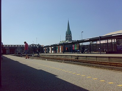
Frederikshavn St. station - Tuesday schedule
| Line | Direction | Time |
|---|---|---|
| 710R | Nakskov | 4:15 AM |
| 710R | Nakskov | 5:15 AM |
| 710R | Nykøbing F | 5:40 AM |
| 710R | Nakskov | 6:15 AM |
| 710R | Nykøbing F | 6:40 AM |
| 710R | Nakskov | 7:15 AM |
| 710R | Nykøbing F | 7:40 AM |
| 710R | Nakskov | 8:15 AM |
| 710R | Nykøbing F | 8:40 AM |
| 710R | Nakskov | 9:15 AM |
| 710R | Nykøbing F | 9:40 AM |
| 710R | Nakskov | 10:15 AM |
| 710R | Nykøbing F | 10:40 AM |
| 710R | Nakskov | 10:45 AM |
| 710R | Nakskov | 11:15 AM |
| 710R | Nykøbing F | 11:40 AM |
| 710R | Nakskov | 11:45 AM |
| 710R | Nykøbing F | 12:10 PM |
| 710R | Nakskov | 12:15 PM |
| 710R | Nykøbing F | 12:40 PM |
| 710R | Nakskov | 12:45 PM |
| 710R | Nykøbing F | 1:10 PM |
| 710R | Nakskov | 1:15 PM |
| 710R | Nykøbing F | 1:40 PM |
| 710R | Nykøbing F | 2:10 PM |
Directions to Frederikshavn St. station with public transit
The following transit lines have routes that pass near Frederikshavn St.
 Bus: 73, 77, BUS75, 2, 3.
- Train: 75.
- Ferry: LÆSØ.
How to get to Frederikshavn St. station by bus?
Click on the bus route to see step by step directions with maps, line arrival times and updated time schedules.
How to get to Frederikshavn St. station by train?
Click on the train route to see step by step directions with maps, line arrival times and updated time schedules.
Bus stops near Frederikshavn St. stop
- Rådhuspladsen (Frederikshavn), 2 min walk,
- Svømmehallen (Parallelvej / Frederikshavn), 4 min walk,
- Frederikshavn St., 7 min walk,
Ferry stations near Frederikshavn St. station
- Havnepladsen (Frederikshavn Færgeleje), 43 min walk,
Bus lines to Frederikshavn St. station
- 2, Frederikshavn St. - EUC Nord Hånbækvej og Martec (Frederikshavn),
- 3, Frederikshavn St. - Frederikshavn St.,
- 13, Frederikshavn St. - Anlægsvej (Dybvad / Aalborgvej / Fr.havn Komm.),
- 73, Aalborg St. (Perron C9) - Frederikshavn St.,
- 73N, Aalborg St. (Perron C5) - Frederikshavn St.,
- 77, Blokhus (Møllevej / Jammerbugt Kommune) - Frederikshavn St.,
- 77F, Østervrå Torv (Vrængmosevej) - Frederikshavn St.,
- 4, Suensonsvej Øst (Frederikshavn),
- 273, Sæby Vest Via Brolæggervej,
- 1, Lendum Kirke,
- 973X, Frederikshavn St. Direkte,
What are the closest stations to Frederikshavn St.?
The closest stations to Frederikshavn St. are:
- Rådhuspladsen (Frederikshavn) stop is 77 meters away, 2 min walk.
- Svømmehallen (Parallelvej / Frederikshavn) stop is 280 meters away, 4 min walk.
- Frederikshavn St. stop is 484 meters away, 7 min walk.
- Havnepladsen (Frederikshavn Færgeleje) station is 3340 meters away, 43 min walk.
Which bus lines stop near Frederikshavn St.?
These bus lines stop near Frederikshavn St.: 73, 77, BUS75.
Which train line stops near Frederikshavn St.?
75 (Mod syd)
What’s the nearest bus station to Frederikshavn St.?
The nearest bus station to Frederikshavn St. is Rådhuspladsen (Frederikshavn). It’s a 2 min walk away.
What time is the first bus to Frederikshavn St.?
The 73N is the first bus that goes to Frederikshavn St.. It stops nearby at 5:00 AM.
What time is the last bus to Frederikshavn St.?
The 973X is the last bus that goes to Frederikshavn St.. It stops nearby at 12:01 AM.
What time is the first ferry to Frederikshavn St.?
The LÆSØ is the first ferry that goes to Frederikshavn St.. It stops nearby at 9:10 AM.
What time is the last ferry to Frederikshavn St.?
The LÆSØ is the last ferry that goes to Frederikshavn St.. It stops nearby at 8:30 PM.
See Frederikshavn St. station on the map
Public transit to Frederikshavn St. station
Looking for directions to Frederikshavn St. in Frederikshavn, Denmark?
Download the Moovit App to find the current schedule and step-by-step directions for Bus or Train routes that pass through Frederikshavn St..
Looking for the nearest stops closest to Frederikshavn St. ? Check out this list of closest stops to your destination: Rådhuspladsen (Frederikshavn); Svømmehallen (Parallelvej / Frederikshavn); Frederikshavn St.; Havnepladsen (Frederikshavn Færgeleje).
Bus: 73, 77, BUS75, 2, 3, 13, 73N, 4, 273, 1, 973X.Train: 75.Ferry: LÆSØ.
We make riding on public transit to Frederikshavn St. easy, which is why over 1.7 billion users, including users in Frederikshavn trust Moovit as the best app for public transit.
Use the app to navigate to popular places including to the airport, hospital, stadium, grocery store, mall, coffee shop, school, college, and university.
The station has the following entrances: Havnepladsen
The first line to this station is 710R, at 4:15 AM, and the last line is 710R at 1:54 AM.
Havnepladsen 30, Frederikshavn, Denmark
This station serves Lokaltog A/S’s lines
Popular routes to Frederikshavn St. station
Popular routes from Frederikshavn St. station
- Rådhuspladsen (Frederikshavn),
- Svømmehallen (Parallelvej / Frederikshavn),
- Frederikshavn St.
Bus stops near Frederikshavn St. stop
- Havnepladsen (Frederikshavn Færgeleje)
Ferry station near Frederikshavn St. station
- Dyrskuepladsen (Viborg Kom),
- Peter Bangs Vej (Søndre Fasanvej),
- Transportcenter Nord (E45 / Vangen / Fr.Havn K.),
- Langelinieparken/Skovvejen (Aarhus Kom),
- Parkering Odense Syd (Odense Letbane),
- CPH Business Park (Avedøre Havnevej),
- Smørum Kro (Smørum Bygade),
- Sølvtorvet (Sølvgade),
- Søborg Torv (Søborg Hovedgade),
- Birkerød St.,
- Mejrup Kirke (Holstebro Kom),
- Avedørelejren (Avedøre Tværvej),
- Vemb St.,
- Klippinge St.,
- Vissenbjerg Centret (Assens Kommune),
- Gribskovvej Bispebjerg Hospital (Lersø Parkallé),
- Vesterbros Torv (Vesterbrogade),
- Vibenshus Runddel St. (Lyngbyvej),
- Vandtårnsvej (Søborg Hovedgade),
- Gentofte Hospital (Kildegårdsvej)
Popular public transit stations in Frederikshavn
Get around Frederikshavn by public transit!
Traveling around Frederikshavn has never been so easy. See step by step directions as you travel to any attraction, street or major public transit station. View bus and train schedules, arrival times, service alerts and detailed routes on a map, so you know exactly how to get to anywhere in Frederikshavn.
When traveling to any destination around Frederikshavn use Moovit's Live Directions with Get Off Notifications to know exactly where and how far to walk, how long to wait for your line, and how many stops are left. Moovit will alert you when it's time to get off — no need to constantly re-check whether yours is the next stop.
Wondering how to use public transit in Frederikshavn or how to pay for public transit in Frederikshavn? Moovit public transit app can help you navigate your way with public transit easily, and at minimum cost. It includes public transit fees, ticket prices, and costs. Looking for a map of Frederikshavn public transit lines? Moovit public transit app shows all public transit maps in Frederikshavn with all Bus, Train, Metro, Light Rail and Ferry routes and stops on an interactive map.
Denmark has 5 transit type(s), including: Bus, Train, Metro, Light Rail and Ferry, operated by several transit agencies, including Metroselskabet, DSB S-tog, Lokaltog A/S, Midttrafik, Odense Letbane, DSB, NT, GoCollective, Skånetrafiken, Movia, FYNBUS, Sydtrafik, Bornholms Trafik, Samsø Bus and Citybus