Directions to Freeman Victorius (Charlottesville) with public transportation
The following transit lines have routes that pass near Freeman Victorius
 Bus: AFTON EXPRESS, GREYHOUND US0600, BUCKINGHAM, 29, FOOTHILLS EXPRESS.
- Train: NORTHEAST REGIONAL, CARDINAL, CRESCENT.
How to get to Freeman Victorius by bus?
Click on the bus route to see step by step directions with maps, line arrival times and updated time schedules.
How to get to Freeman Victorius by train?
Click on the train route to see step by step directions with maps, line arrival times and updated time schedules.
Bus stops near Freeman Victorius in Charlottesville
Train station near Freeman Victorius in Charlottesville
- Charlottesville Amtrak Station, 14 min walk,VIEW
Bus lines to Freeman Victorius in Charlottesville
- BUCKINGHAM, Barracks Road Mcdonalds,VIEW
- 29, 29 North Connect,VIEW
- FOOTHILLS EXPRESS, Charlottesville,VIEW
- BUCKINGHAM, Westminster Canterbury,VIEW
- T, Inbound,VIEW
- AFTON EXPRESS, Afton Express,VIEW
- CROZET, Crozet Evening Loop,VIEW
- CROZET, Crozet Connect East,VIEW
- CROZET, Crozet Connect West,VIEW
- LOVINGSTON, Virginia Institute For the Blind,VIEW
- 6, Outbound,VIEW
What are the closest stations to Freeman Victorius?
The closest stations to Freeman Victorius are:
- Northgate Primary Care is 8 yards away, 1 min walk.
- Uva Hospital is 85 yards away, 2 min walk.
- Lee St @ Uva Cancer Center is 106 yards away, 2 min walk.
- Jpa at Uva Hospital is 164 yards away, 3 min walk.
- Jpa at Pinn Hall is 185 yards away, 3 min walk.
- Charlottesville Amtrak Station is 1163 yards away, 14 min walk.
Which bus lines stop near Freeman Victorius?
These bus lines stop near Freeman Victorius: AFTON EXPRESS, GREYHOUND US0600.
Which train line stops near Freeman Victorius?
NORTHEAST REGIONAL (Roanoke)
What’s the nearest train station to Freeman Victorius in Charlottesville?
The nearest train station to Freeman Victorius in Charlottesville is Charlottesville Amtrak Station. It’s a 14 min walk away.
What’s the nearest bus station to Freeman Victorius in Charlottesville?
The nearest bus station to Freeman Victorius in Charlottesville is Northgate Primary Care. It’s a 1 min walk away.
What time is the first train to Freeman Victorius in Charlottesville?
The NORTHEAST REGIONAL is the first train that goes to Freeman Victorius in Charlottesville. It stops nearby at 10:07 AM.
What time is the last train to Freeman Victorius in Charlottesville?
The CRESCENT is the last train that goes to Freeman Victorius in Charlottesville. It stops nearby at 8:52 PM.
What time is the first bus to Freeman Victorius in Charlottesville?
The AFTON EXPRESS is the first bus that goes to Freeman Victorius in Charlottesville. It stops nearby at 6:11 AM.
What time is the last bus to Freeman Victorius in Charlottesville?
The T is the last bus that goes to Freeman Victorius in Charlottesville. It stops nearby at 10:30 PM.
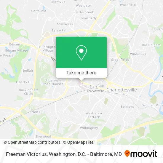
See Freeman Victorius, Charlottesville, on the map
Public Transit to Freeman Victorius in Charlottesville
Wondering how to get to Freeman Victorius in Charlottesville? Moovit helps you find the best way to get to Freeman Victorius with step-by-step directions from the nearest public transit station.
Moovit provides free maps and live directions to help you navigate through your city. View schedules, routes, timetables, and find out how long does it take to get to Freeman Victorius in real time.
Looking for the nearest stop or station to Freeman Victorius? Check out this list of stops closest to your destination: Northgate Primary Care; Uva Hospital; Lee St @ Uva Cancer Center; Jpa at Uva Hospital; Jpa at Pinn Hall; Charlottesville Amtrak Station.
Bus: AFTON EXPRESS, GREYHOUND US0600, BUCKINGHAM, 29, FOOTHILLS EXPRESS, BUCKINGHAM, T, CROZET, CROZET, CROZET, 6.Train: NORTHEAST REGIONAL, CARDINAL, CRESCENT.
Want to see if there’s another route that gets you there at an earlier time? Moovit helps you find alternative routes or times. Get directions from and directions to Freeman Victorius easily from the Moovit App or Website.
We make riding to Freeman Victorius easy, which is why over 1.5 million users, including users in Charlottesville, trust Moovit as the best app for public transit. You don’t need to download an individual bus app or train app, Moovit is your all-in-one transit app that helps you find the best bus time or train time available.
For information on prices of bus and train, costs and ride fares to Freeman Victorius, please check the Moovit app.
Use the app to navigate to popular places including to the airport, hospital, stadium, grocery store, mall, coffee shop, school, college, and university.
Freeman Victorius Address: 1413 University Ave Charlottesville, VA 22903 street in Charlottesville
- Juice Laundry,
- Jack Wills,
- Corner Market,
- RMC Events,
- Natty Beau,
- Insomnia Cookies,
- High Peak Sportswear,
- Food Tours by Charlottesville Guide,
- White Spot,
- Chase,
- The White Spot,
- Qdoba,
- Charlottesville Agile Heating & Cooling Repair Hva,
- Innovations Nail Salon,
- Special Threading & Accessories,
- University of Virginia Hospital,
- Poke Sushi Bowl,
- Aveda Concept Salon,
- House of Cuts Barber Studio,
- Innovations for Hair
Places Near Freeman Victorius (Charlottesville)
- Capital One Arena, Washington,
- Washington National Cathedral, Washington,
- PG Mall, Prince George's County,
- Rock Creek Tennis Center, Washington,
- Pennsylvania Ave NW (3rd st and pennsylvania), Washington,
- Camden Yards, Baltimore,
- Amazon Hq2, Arlington County,
- Westfield Montgomery Mall, Montgomery County,
- Museum Of The Bible, Washington,
- M&T Bank Stadium, Baltimore,
- National Mall, Washington,
- Sibley Memorial Hospital, Washington,
- National Museum of African American History and Culture, Washington,
- Marriott Marquis Washington, DC, Washington,
- Basilica of the National Shrine, Washington,
- The Anthem, Washington,
- Washington DC VA Medical Center, Washington,
- Warner Theatre, Washington,
- National Zoo, Washington,
- Georgetown, Washington
How to get to popular places in Washington, D.C. - Baltimore, MD with public transit
Get around Charlottesville by public transit!
Traveling around Charlottesville has never been so easy. See step by step directions as you travel to any attraction, street or major public transit station. View bus and train schedules, arrival times, service alerts and detailed routes on a map, so you know exactly how to get to anywhere in Charlottesville.
When traveling to any destination around Charlottesville use Moovit's Live Directions with Get Off Notifications to know exactly where and how far to walk, how long to wait for your line, and how many stops are left. Moovit will alert you when it's time to get off — no need to constantly re-check whether yours is the next stop.
Wondering how to use public transit in Charlottesville or how to pay for public transit in Charlottesville? Moovit public transit app can help you navigate your way with public transit easily, and at minimum cost. It includes public transit fees, ticket prices, and costs. Looking for a map of Charlottesville public transit lines? Moovit public transit app shows all public transit maps in Charlottesville with all Bus, Train, Metro, Light Rail and Ferry routes and stops on an interactive map.
Washington, D.C. - Baltimore, MD has 5 transit type(s), including: Bus, Train, Metro, Light Rail and Ferry, operated by several transit agencies, including WMATA, Montgomery County Ride On, Fairfax Connector, TheBus, PRTC, DASH - Alexandria, Arlington Transit (ART), RTA of Central Maryland, MDOT MTA, MDOT MTA Light RailLink, MDOT MTA Commuter Bus, MDOT MTA Local Bus, FXBGO!, Virginia Railway Express (VRE) and MARC