How to get to Freiduría El Chaval by bus?
Click on the bus route to see step by step directions with maps, line arrival times and updated time schedules.
From Real Jardín Botánico Alfonso XIII, Área Metropolitana De Madrid Y Corredor Del Henares
92 minFrom Matadero Madrid, Madrid
63 minFrom Calle de Ramón Luján 3, Madrid
77 minFrom Metro Buenos Aires, Madrid
68 minFrom Telecinco, Área Metropolitana De Madrid Y Corredor Del Henares
76 minFrom La Gavia, Madrid
87 minFrom Calle caleruega, Madrid
78 minFrom Plaza De Las Comendadoras, Área Metropolitana De Madrid Y Corredor Del Henares
70 minFrom Amor Hermoso 52, Madrid
75 minFrom Mediaset España, Área Metropolitana De Madrid Y Corredor Del Henares
77 min
How to get to Freiduría El Chaval by metro?
Click on the metro route to see step by step directions with maps, line arrival times and updated time schedules.
From Real Jardín Botánico Alfonso XIII, Área Metropolitana De Madrid Y Corredor Del Henares
50 minFrom Matadero Madrid, Madrid
50 minFrom Calle de Ramón Luján 3, Madrid
51 minFrom Metro Buenos Aires, Madrid
59 minFrom La Gavia, Madrid
84 minFrom Calle caleruega, Madrid
59 minFrom Plaza De Las Comendadoras, Área Metropolitana De Madrid Y Corredor Del Henares
46 minFrom Amor Hermoso 52, Madrid
56 min
Bus stops near Freiduría El Chaval in Madrid
Metro stations near Freiduría El Chaval in Madrid
Bus lines to Freiduría El Chaval in Madrid
What are the closest stations to Freiduría El Chaval?
The closest stations to Freiduría El Chaval are:
- Barrio Canillejas is 62 meters away, 1 min walk.
- Lucano - Aquiles is 337 meters away, 5 min walk.
- Las Musas is 1083 meters away, 14 min walk.
- Canillejas is 1232 meters away, 16 min walk.
Which bus lines stop near Freiduría El Chaval?
These bus lines stop near Freiduría El Chaval: 140, 28.
Which metro lines stop near Freiduría El Chaval?
These metro lines stop near Freiduría El Chaval: M-5, M-7.
What’s the nearest metro station to Freiduría El Chaval in Madrid?
The nearest metro station to Freiduría El Chaval in Madrid is Las Musas. It’s a 14 min walk away.
What’s the nearest bus station to Freiduría El Chaval in Madrid?
The nearest bus station to Freiduría El Chaval in Madrid is Barrio Canillejas. It’s a 1 min walk away.
What time is the first metro to Freiduría El Chaval in Madrid?
The M-5 is the first metro that goes to Freiduría El Chaval in Madrid. It stops nearby at 6:05 AM.
What time is the last metro to Freiduría El Chaval in Madrid?
The M-5 is the last metro that goes to Freiduría El Chaval in Madrid. It stops nearby at 2:20 AM.
What time is the first bus to Freiduría El Chaval in Madrid?
The 28 is the first bus that goes to Freiduría El Chaval in Madrid. It stops nearby at 7:00 AM.
What time is the last bus to Freiduría El Chaval in Madrid?
The N5 is the last bus that goes to Freiduría El Chaval in Madrid. It stops nearby at 3:27 AM.
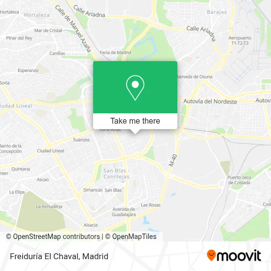
See Freiduría El Chaval, Madrid, on the map
Public Transit to Freiduría El Chaval in Madrid
Wondering how to get to Freiduría El Chaval in Madrid? Moovit helps you find the best way to get to Freiduría El Chaval with step-by-step directions from the nearest public transit station.
Moovit provides free maps and live directions to help you navigate through your city. View schedules, routes, timetables, and find out how long does it take to get to Freiduría El Chaval in real time.
Looking for the nearest stop or station to Freiduría El Chaval? Check out this list of stops closest to your destination: Barrio Canillejas; Lucano - Aquiles; Las Musas; Canillejas.
Bus: 140, 28, 48, N5.Metro: M-5, M-7.
Want to see if there’s another route that gets you there at an earlier time? Moovit helps you find alternative routes or times. Get directions from and directions to Freiduría El Chaval easily from the Moovit App or Website.
We make riding to Freiduría El Chaval easy, which is why over 1.5 million users, including users in Madrid, trust Moovit as the best app for public transit. You don’t need to download an individual bus app or train app, Moovit is your all-in-one transit app that helps you find the best bus time or train time available.
For information on prices of bus and metro, costs and ride fares to Freiduría El Chaval, please check the Moovit app.
Use the app to navigate to popular places including to the airport, hospital, stadium, grocery store, mall, coffee shop, school, college, and university.
Freiduría El Chaval Address: Calle De la Esfinge, 74 street in Madrid
- Centro Estético Elena Blanes. Depilación Láser Diodo,
- Calle de la Esfinge,
- Bar Los Mellizos,
- Calle de la Esfinge 77,
- Parque Del Arquitecto Antonio Palacios,
- Calle Circe 52,
- Calle San Herculano,
- Parroquia Nuestra Señora Del Camino,
- Calle de San Faustino,
- Iglesia Evangelica Canillejas,
- Calle de San Herculano, 11,
- El Barrio,
- Calle de Ribadumia, 1,
- Depósito Nº 4. Recinto De Canillejas,
- Calle de Fenelón,
- Calle de San Mariano,
- Calle de San Mariano / Calle de San Herculano,
- Cementerio De Canillejas,
- Calle Musas 11,
- Calle Circe
Places Near Freiduría El Chaval (Madrid)
- Centro Comercial Islazul, Área Metropolitana De Madrid Y Corredor Del Henares,
- Centro Comercial Oasiz Madrid, Área Metropolitana De Madrid Y Corredor Del Henares,
- Mendez Alvaro, Madrid,
- Hospital Universitario Ramón y Cajal, Madrid,
- Sala La Riviera, Madrid,
- Nassica, Área Metropolitana De Madrid Y Corredor Del Henares,
- Estacion de Chamartin, Madrid,
- Hospital Universitario La Paz, Madrid,
- Tres Aguas, Alcorcón,
- Plaza Mayor, Madrid,
- Hospital Clínico Universitario San Carlos, Madrid,
- Centro Comercial La Vaguada, Área Metropolitana De Madrid Y Corredor Del Henares,
- Centro Comercial La Gavia, Área Metropolitana De Madrid Y Corredor Del Henares,
- Rastro De Madrid, Área Metropolitana De Madrid Y Corredor Del Henares,
- Estadio Wanda Metropolitano, Área Metropolitana De Madrid Y Corredor Del Henares,
- Palacio De Vistalegre, Área Metropolitana De Madrid Y Corredor Del Henares,
- Mercadillo de Majadahonda, Majadahonda,
- Plenilunio, Área Metropolitana De Madrid Y Corredor Del Henares,
- Calle de López de Hoyos 169, Madrid,
- Wizink Center, Madrid
How to get to popular places in Madrid with public transit
Get around Madrid by public transit!
Traveling around Madrid has never been so easy. See step by step directions as you travel to any attraction, street or major public transit station. View bus and train schedules, arrival times, service alerts and detailed routes on a map, so you know exactly how to get to anywhere in Madrid.
When traveling to any destination around Madrid use Moovit's Live Directions with Get Off Notifications to know exactly where and how far to walk, how long to wait for your line, and how many stops are left. Moovit will alert you when it's time to get off — no need to constantly re-check whether yours is the next stop.
Wondering how to use public transit in Madrid or how to pay for public transit in Madrid? Moovit public transit app can help you navigate your way with public transit easily, and at minimum cost. It includes public transit fees, ticket prices, and costs. Looking for a map of Madrid public transit lines? Moovit public transit app shows all public transit maps in Madrid with all Bus, Train, Metro and Light Rail routes and stops on an interactive map.
Madrid has 4 transit type(s), including: Bus, Train, Metro and Light Rail, operated by several transit agencies, including Metro de Madrid, Metro Ligero, Tranvía de Parla, Renfe Cercanías - Servicios de Autobús especiales, Renfe Cercanias, Renfe Cercanías, EMT, Interurbanos, Urbanos de Alcalá de Henares, Urbanos de Alcobendas, Urbanos de Alcorcón, Urbanos de Algete, Urbanos de Aranjuez, Urbanos de Arganda del Rey and Urbanos de Arroyomolinos