How to get to Freyssinet by bus?
Click on the bus route to see step by step directions with maps, line arrival times and updated time schedules.
From Lincoln Tech, Howard County
107 minFrom Columbia, MD, Howard County
86 minFrom Walmart, Baltimore County
127 minFrom Howard Community College, Howard County
106 minFrom The Mall In Columbia, Howard County
69 minFrom Walmart Supercenter, Baltimore County
129 minFrom Guinness Open Gate Brewery & Barrel House, Baltimore County
168 minFrom Glen Burnie, MD, Anne Arundel County
146 minFrom Saint Agnes Hospital, Baltimore
143 minFrom Maryland, Baltimore
143 min
Bus stops near Freyssinet in Howard County
Train station near Freyssinet in Howard County
- Dorsey Marc Sb, 46 min walk,VIEW
Bus lines to Freyssinet in Howard County
What are the closest stations to Freyssinet?
The closest stations to Freyssinet are:
- Washington Blvd & Amberton Dr Nb is 405 yards away, 6 min walk.
- Washington Blvd / Troy Hill Dr is 944 yards away, 12 min walk.
- Dorsey Marc Sb is 3880 yards away, 46 min walk.
Which bus lines stop near Freyssinet?
These bus lines stop near Freyssinet: 409, 501.
What’s the nearest bus station to Freyssinet in Howard County?
The nearest bus station to Freyssinet in Howard County is Washington Blvd & Amberton Dr Nb. It’s a 6 min walk away.
What time is the first train to Freyssinet in Howard County?
The MARC is the first train that goes to Freyssinet in Howard County. It stops nearby at 5:18 AM.
What time is the last train to Freyssinet in Howard County?
The MARC is the last train that goes to Freyssinet in Howard County. It stops nearby at 8:24 PM.
What time is the first bus to Freyssinet in Howard County?
The 320 is the first bus that goes to Freyssinet in Howard County. It stops nearby at 5:36 AM.
What time is the last bus to Freyssinet in Howard County?
The 409 is the last bus that goes to Freyssinet in Howard County. It stops nearby at 7:01 PM.
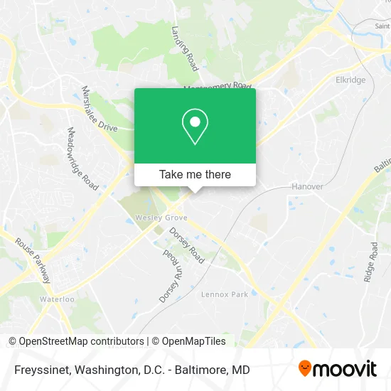
See Freyssinet, Howard County, on the map
Public Transit to Freyssinet in Howard County
Wondering how to get to Freyssinet in Howard County? Moovit helps you find the best way to get to Freyssinet with step-by-step directions from the nearest public transit station.
Moovit provides free maps and live directions to help you navigate through your city. View schedules, routes, timetables, and find out how long does it take to get to Freyssinet in real time.
Looking for the nearest stop or station to Freyssinet? Check out this list of stops closest to your destination: Washington Blvd & Amberton Dr Nb; Washington Blvd / Troy Hill Dr; Dorsey Marc Sb.
Bus: 409, 501, 320.Train: MARC.
Want to see if there’s another route that gets you there at an earlier time? Moovit helps you find alternative routes or times. Get directions from and directions to Freyssinet easily from the Moovit App or Website.
We make riding to Freyssinet easy, which is why over 1.5 million users, including users in Howard County, trust Moovit as the best app for public transit. You don’t need to download an individual bus app or train app, Moovit is your all-in-one transit app that helps you find the best bus time or train time available.
For information on prices of bus, light rail and train, costs and ride fares to Freyssinet, please check the Moovit app.
Get to Freyssinet with public transit and pay for the ride in the Moovit app. In addition to all info you may need for your trip to Freyssinet, including live directions, real-time arrivals and fare prices, you can also buy public transit passes for your rides. No need for cash or paper tickets to get to Freyssinet - everything you need is accessible in the app with a click of the button.
Use the app to navigate to popular places including to the airport, hospital, stadium, grocery store, mall, coffee shop, school, college, and university.
Freyssinet Address: 6625 Selnick Dr Elkridge, MD 21075 street in Howard County
- Mid Maryland Baptist Association,
- Crosslife Community Church,
- hancock albanese inc,
- Sapna Foods,
- Rounding Third Sportswear and Graphics,
- Theresa Arawole - Intuit Turbotax Verified Pro,
- Cunningham's RugCleaning.net,
- Global Executive Security Solutions,
- Medicare Insurance Advisors Elkridge,
- COIN ACCEPTORS, COINCO,
- Blueprint Appliance Repair,
- USPS Collection Box - Blue Box,
- Xfinity,
- CyberCore Technologies,
- Mutiny Bar (Mutiny Pirate Bar & Island Grille),
- Wine Culture,
- Mutiny Pirate Bar & Island Grille,
- Soluna Cocina + Tequila Bar,
- FLIR Systems,
- Afterglow Lighting
Places Near Freyssinet (Howard County)
- The Anthem, Washington,
- Museum Of The Bible, Washington,
- M&T Bank Stadium, Baltimore,
- Marriott Marquis Washington, DC, Washington,
- National Museum of African American History and Culture, Washington,
- National Zoo, Washington,
- Sibley Memorial Hospital, Washington,
- Washington National Cathedral, Washington,
- Camden Yards, Baltimore,
- Georgetown, Washington,
- Rock Creek Tennis Center, Washington,
- Basilica of the National Shrine, Washington,
- Warner Theatre, Washington,
- Amazon Hq2, Arlington County,
- Westfield Montgomery Mall, Montgomery County,
- Capital One Arena, Washington,
- National Mall, Washington,
- PG Mall, Prince George's County,
- Pennsylvania Ave NW (3rd st and pennsylvania), Washington,
- Washington DC VA Medical Center, Washington
How to get to popular places in Washington, D.C. - Baltimore, MD with public transit
Get around Howard County by public transit!
Traveling around Howard County has never been so easy. See step by step directions as you travel to any attraction, street or major public transit station. View bus and train schedules, arrival times, service alerts and detailed routes on a map, so you know exactly how to get to anywhere in Howard County.
When traveling to any destination around Howard County use Moovit's Live Directions with Get Off Notifications to know exactly where and how far to walk, how long to wait for your line, and how many stops are left. Moovit will alert you when it's time to get off — no need to constantly re-check whether yours is the next stop.
Wondering how to use public transit in Howard County or how to pay for public transit in Howard County? Moovit public transit app can help you navigate your way with public transit easily, and at minimum cost. It includes public transit fees, ticket prices, and costs. Looking for a map of Howard County public transit lines? Moovit public transit app shows all public transit maps in Howard County with all Bus, Train, Metro, Light Rail and Ferry routes and stops on an interactive map.
Washington, D.C. - Baltimore, MD has 5 transit type(s), including: Bus, Train, Metro, Light Rail and Ferry, operated by several transit agencies, including WMATA, Montgomery County Ride On, Fairfax Connector, TheBus, PRTC, DASH - Alexandria, Arlington Transit (ART), RTA of Central Maryland, MDOT MTA, MDOT MTA Light RailLink, MDOT MTA Commuter Bus, MDOT MTA Local Bus, FXBGO!, Virginia Railway Express (VRE) and MARC