How to get to Friends' Health Connection by bus?
Click on the bus route to see step by step directions with maps, line arrival times and updated time schedules.
From Long Branch Beach & Boardwalk, Long Branch
129 minFrom Edison NJ, Edison
104 minFrom PNC Bank Arts Center, Holmdel
160 minFrom Gunnison Beach, Highlands
104 minFrom Highland Park, NJ, Highland Park
97 minFrom Baps Shri Swaminarayan Mandir, Edison, NJ, USA, Edison
109 minFrom Perth Amboy, NJ, Perth Amboy
121 minFrom Amdur Ambulatory Care Center, Neptune
52 min
Bus stops near Friends' Health Connection in Freehold
Bus lines to Friends' Health Connection in Freehold
What are the closest stations to Friends' Health Connection?
The closest stations to Friends' Health Connection are:
- Main St at Jackson St is 552 yards away, 7 min walk.
- Freehold Center is 840 yards away, 10 min walk.
Which bus lines stop near Friends' Health Connection?
These bus lines stop near Friends' Health Connection: 139, 836, 838.
What’s the nearest bus station to Friends' Health Connection in Freehold?
The nearest bus station to Friends' Health Connection in Freehold is Main St at Jackson St. It’s a 7 min walk away.
What time is the first bus to Friends' Health Connection in Freehold?
The 139 is the first bus that goes to Friends' Health Connection in Freehold. It stops nearby at 3:25 AM.
What time is the last bus to Friends' Health Connection in Freehold?
The 139 is the last bus that goes to Friends' Health Connection in Freehold. It stops nearby at 3:38 AM.
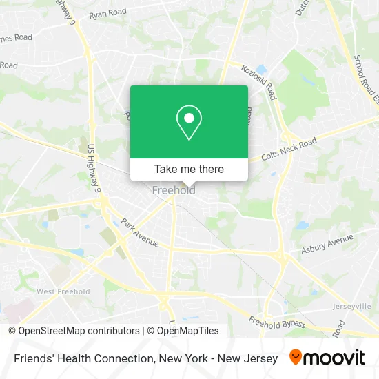
See Friends' Health Connection, Freehold, on the map
Public Transit to Friends' Health Connection in Freehold
Wondering how to get to Friends' Health Connection in Freehold? Moovit helps you find the best way to get to Friends' Health Connection with step-by-step directions from the nearest public transit station.
Moovit provides free maps and live directions to help you navigate through your city. View schedules, routes, timetables, and find out how long does it take to get to Friends' Health Connection in real time.
Looking for the nearest stop or station to Friends' Health Connection? Check out this list of stops closest to your destination: Main St at Jackson St; Freehold Center.
Bus: 139, 836, 838, 64, 67, 135.
Want to see if there’s another route that gets you there at an earlier time? Moovit helps you find alternative routes or times. Get directions from and directions to Friends' Health Connection easily from the Moovit App or Website.
We make riding to Friends' Health Connection easy, which is why over 1.5 million users, including users in Freehold, trust Moovit as the best app for public transit. You don’t need to download an individual bus app or train app, Moovit is your all-in-one transit app that helps you find the best bus time or train time available.
For information on prices of bus and train, costs and ride fares to Friends' Health Connection, please check the Moovit app.
Use the app to navigate to popular places including to the airport, hospital, stadium, grocery store, mall, coffee shop, school, college, and university.
Friends' Health Connection Address: 54 Hudson St street in Freehold
- Tona Executive Suites Llc,
- Five Star Seo,
- Tonacchio Compitello, Llc,
- Illusia Agency,
- Paul Nader - Ameriprise Financial Services, Llc,
- Gillman, Bruton, & Capone Llc,
- Freehold Knights Of Columbus Council 1672,
- Freehold Columbian Club,
- Elena Dance,
- Prime Time Insurance Agency,
- Nikki Taylor-Prime Time Insurance Broker Nj, Pa, Ny, Md,
- Lenny Lopresti - State Farm Insurance,
- Nomad Lacrosse Distributers,
- Affordable Chimney,
- Rug Mill Towers,
- Wellcare Holistics,
- Freehold Municipal Court,
- Family Wellness Center,
- James T Callahan Commercial Photographer,
- One Honest Doula
Places Near Friends' Health Connection (Freehold)
- Katz's Deli, Manhattan,
- 911 Memorial, Manhattan,
- San Gennaro Feast, Manhattan,
- 26 Federal Plaza, Manhattan,
- Chinatown, Manhattan,
- Mountainside Hospital, Glen Ridge,
- Wall Street, Manhattan,
- 111 Centre New York City Supreme Court, Manhattan,
- Queens Center Mall, Queens,
- qqqq, Manhattan,
- Bellevue Hospital, Manhattan,
- 1 Police Plaza, Manhattan,
- Rockefeller Center, Manhattan,
- 3 Stone St, Manhattan,
- Hudson Yards, Manhattan,
- 66 John Street, Manhattan,
- Pier 83, Manhattan,
- SoHo, Manhattan,
- Times Square, Manhattan,
- 376 Hudson Street, Manhattan
How to get to popular places in New York - New Jersey with public transit
Get around Freehold by public transit!
Traveling around Freehold has never been so easy. See step by step directions as you travel to any attraction, street or major public transit station. View bus and train schedules, arrival times, service alerts and detailed routes on a map, so you know exactly how to get to anywhere in Freehold.
When traveling to any destination around Freehold use Moovit's Live Directions with Get Off Notifications to know exactly where and how far to walk, how long to wait for your line, and how many stops are left. Moovit will alert you when it's time to get off — no need to constantly re-check whether yours is the next stop.
Wondering how to use public transit in Freehold or how to pay for public transit in Freehold? Moovit public transit app can help you navigate your way with public transit easily, and at minimum cost. It includes public transit fees, ticket prices, and costs. Looking for a map of Freehold public transit lines? Moovit public transit app shows all public transit maps in Freehold with all Bus, Train, Subway, Light Rail, Ferry and Cable Car routes and stops on an interactive map.
New York - New Jersey has 6 transit type(s), including: Bus, Train, Subway, Light Rail, Ferry and Cable Car, operated by several transit agencies, including MTA Subway, Metro-North Railroad, LIRR, PATH, MTA New York City Transit - Express routes, MTA Bus, NJ Transit, NYC Ferry, NICE bus, Bee-Line Bus, NJ Transit Rail, Norwalk Transit District, Hartford Line, River Valley Transit and HART