Directions to Front Row (Roanoke) with public transportation
The following transit lines have routes that pass near Front Row
 Bus: GREYHOUND US0600, 12, 66, 76, SWB.
- Train: NORTHEAST REGIONAL.
How to get to Front Row by bus?
Click on the bus route to see step by step directions with maps, line arrival times and updated time schedules.
How to get to Front Row by train?
Click on the train route to see step by step directions with maps, line arrival times and updated time schedules.
Bus stops near Front Row in Roanoke
- Salem Eb at 4th, 2 min walk,VIEW
- 3rd St Station Slip D, 2 min walk,VIEW
- 3rd St Station Slip K, 2 min walk,VIEW
- 3rd St Station Slip C, 3 min walk,VIEW
- 3rd St Station Slip L, 3 min walk,VIEW
- 3rd St Station Slip J, 3 min walk,VIEW
- Salem Avenue Wb at 5th, 3 min walk,VIEW
- 3rd St Station Slip M, 3 min walk,VIEW
- Roanoke Bus Stop, 3 min walk,VIEW
- 3rd St Station Slip H, 3 min walk,VIEW
- 3rd St Station Slip N, 3 min walk,VIEW
- 3rd St Station Slip I, 3 min walk,VIEW
- 3rd St Station Slip O, 3 min walk,VIEW
- Campbell Eb at 5th, 3 min walk,VIEW
Train station near Front Row in Roanoke
- Roanoke, 5 min walk,VIEW
Bus lines to Front Row in Roanoke
- 12, 12 - Valley View Mall To Third Street Station,VIEW
- 66, 66 - Carlton & Grandin To Third Street Station,VIEW
- 76, 76 - Veterans Hospital To Third Street Station,VIEW
- SWB, 3rd St Station Slip D,VIEW
- 41, 11th Sb at Jamison,VIEW
- 42, 3rd St Station Slip K,VIEW
- 91, Apperson Eb at Riverview,VIEW
- 92, 3rd St Station Slip C,VIEW
- 35, 35 - Third Street Station To Vinton,VIEW
- 36, 3rd St Station Slip L,VIEW
- 51, Tanglewood Mall (Barnes And Noble),VIEW
- 11, 11-Third Street Station To Valley View Mall,VIEW
- 65, 65 - Third Street Station To Carlton & Grandin,VIEW
- 75, 75 - Third Street Station To Veterans Hospital,VIEW
- 31, 31 - Third Street Station To Blue Hills,VIEW
- 32, Westbound,VIEW
- GREYHOUND US0600, Nashville Bus Station,VIEW
- 22, 3rd St Station Slip H,VIEW
- 61, Red Rock Nb at Brambleton (Shell Station),VIEW
- 25, 25 - Third Street Station To Airport,VIEW
What are the closest stations to Front Row?
The closest stations to Front Row are:
- Salem Eb at 4th is 78 yards away, 2 min walk.
- 3rd St Station Slip D is 120 yards away, 2 min walk.
- 3rd St Station Slip K is 127 yards away, 2 min walk.
- 3rd St Station Slip C is 143 yards away, 3 min walk.
- 3rd St Station Slip L is 144 yards away, 3 min walk.
- 3rd St Station Slip J is 154 yards away, 3 min walk.
- Salem Avenue Wb at 5th is 154 yards away, 3 min walk.
- 3rd St Station Slip M is 163 yards away, 3 min walk.
- Roanoke Bus Stop is 177 yards away, 3 min walk.
- 3rd St Station Slip H is 183 yards away, 3 min walk.
- 3rd St Station Slip N is 191 yards away, 3 min walk.
- 3rd St Station Slip I is 196 yards away, 3 min walk.
- 3rd St Station Slip O is 199 yards away, 3 min walk.
- Campbell Eb at 5th is 218 yards away, 3 min walk.
- Roanoke is 397 yards away, 5 min walk.
Which bus line stops near Front Row?
GREYHOUND US0600 (Nashville Bus Station)
Which train line stops near Front Row?
NORTHEAST REGIONAL (Roanoke)
What’s the nearest train station to Front Row in Roanoke?
The nearest train station to Front Row in Roanoke is Roanoke. It’s a 5 min walk away.
What’s the nearest bus station to Front Row in Roanoke?
The nearest bus stations to Front Row in Roanoke are Salem Eb at 4th, 3rd St Station Slip D and 3rd St Station Slip K. The closest one is a 2 min walk away.
What time is the first train to Front Row in Roanoke?
The NORTHEAST REGIONAL is the first train that goes to Front Row in Roanoke. It stops nearby at 9:35 AM.
What time is the last train to Front Row in Roanoke?
The NORTHEAST REGIONAL is the last train that goes to Front Row in Roanoke. It stops nearby at 10:13 PM.
What time is the first bus to Front Row in Roanoke?
The GREYHOUND US0600 is the first bus that goes to Front Row in Roanoke. It stops nearby at 4:35 AM.
What time is the last bus to Front Row in Roanoke?
The GREYHOUND US0600 is the last bus that goes to Front Row in Roanoke. It stops nearby at 4:35 AM.
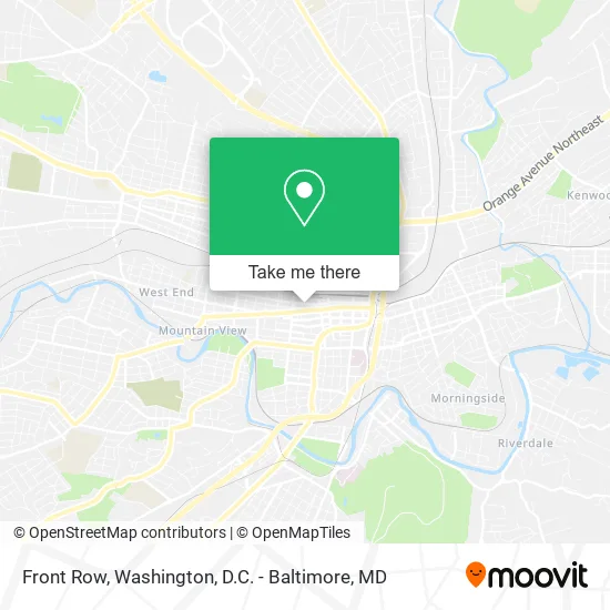
See Front Row, Roanoke, on the map
Public Transit to Front Row in Roanoke
Wondering how to get to Front Row in Roanoke? Moovit helps you find the best way to get to Front Row with step-by-step directions from the nearest public transit station.
Moovit provides free maps and live directions to help you navigate through your city. View schedules, routes, timetables, and find out how long does it take to get to Front Row in real time.
Looking for the nearest stop or station to Front Row? Check out this list of stops closest to your destination: Salem Eb at 4th; 3rd St Station Slip D; 3rd St Station Slip K; 3rd St Station Slip C; 3rd St Station Slip L; 3rd St Station Slip J; Salem Avenue Wb at 5th; 3rd St Station Slip M; Roanoke Bus Stop; 3rd St Station Slip H; 3rd St Station Slip N; 3rd St Station Slip I; 3rd St Station Slip O; Campbell Eb at 5th; Roanoke.
Bus: GREYHOUND US0600, 12, 66, 76, SWB, 41, 42, 91, 92, 35, 36.Train: NORTHEAST REGIONAL.
Want to see if there’s another route that gets you there at an earlier time? Moovit helps you find alternative routes or times. Get directions from and directions to Front Row easily from the Moovit App or Website.
We make riding to Front Row easy, which is why over 1.5 million users, including users in Roanoke, trust Moovit as the best app for public transit. You don’t need to download an individual bus app or train app, Moovit is your all-in-one transit app that helps you find the best bus time or train time available.
For information on prices of bus and train, costs and ride fares to Front Row, please check the Moovit app.
Use the app to navigate to popular places including to the airport, hospital, stadium, grocery store, mall, coffee shop, school, college, and university.
Front Row Address: 356 Salem Ave SW Roanoke, VA 24016 street in Roanoke
- Michael Vest Photography,
- MVP Total Image Salon,
- Union Jack,
- Arthur's Car Care,
- Food Equipment Part Service,
- Old Dominion Services of Roanoke,
- Glenn Robinson & Cathey,
- Southern Sun Landscaping,
- Bruce Mahin,
- Beamer's 25,
- Fee-Only Financial Planning LC,
- Hustle/Haven,
- 218 4th St SW Parking,
- The Quarters,
- The Edge Lofts,
- Goosehead Insurance - Justin Miller,
- Lofts at West Station,
- Habitat for Humanity,
- Peyton Geneva P,
- Southeast Rural Community Assistance Project
Places Near Front Row (Roanoke)
- National Theatre, Washington,
- Museum Of The Bible, Washington,
- Capital One Arena, Washington,
- National Museum of African American History and Culture, Washington,
- National Zoo, Washington,
- M&T Bank Stadium, Baltimore,
- The Anthem, Washington,
- Washington DC VA Medical Center, Washington,
- Rock Creek Tennis Center, Washington,
- Washington National Cathedral, Washington,
- Marriott Marquis Washington, DC, Washington,
- Basilica of the National Shrine, Washington,
- Camden Yards, Baltimore,
- Georgetown, Washington,
- Pennsylvania Ave NW (3rd st and pennsylvania), Washington,
- PG Mall, Prince George's County,
- Sibley Memorial Hospital, Washington,
- Warner Theatre, Washington,
- Westfield Montgomery Mall, Montgomery County,
- Amazon Hq2, Arlington County
How to get to popular places in Washington, D.C. - Baltimore, MD with public transit
Get around Roanoke by public transit!
Traveling around Roanoke has never been so easy. See step by step directions as you travel to any attraction, street or major public transit station. View bus and train schedules, arrival times, service alerts and detailed routes on a map, so you know exactly how to get to anywhere in Roanoke.
When traveling to any destination around Roanoke use Moovit's Live Directions with Get Off Notifications to know exactly where and how far to walk, how long to wait for your line, and how many stops are left. Moovit will alert you when it's time to get off — no need to constantly re-check whether yours is the next stop.
Wondering how to use public transit in Roanoke or how to pay for public transit in Roanoke? Moovit public transit app can help you navigate your way with public transit easily, and at minimum cost. It includes public transit fees, ticket prices, and costs. Looking for a map of Roanoke public transit lines? Moovit public transit app shows all public transit maps in Roanoke with all Bus, Train, Metro, Light Rail and Ferry routes and stops on an interactive map.
Washington, D.C. - Baltimore, MD has 5 transit type(s), including: Bus, Train, Metro, Light Rail and Ferry, operated by several transit agencies, including WMATA, Montgomery County Ride On, Fairfax Connector, TheBus, PRTC, DASH - Alexandria, Arlington Transit (ART), RTA of Central Maryland, MDOT MTA, MDOT MTA Light RailLink, MDOT MTA Commuter Bus, MDOT MTA Local Bus, FXBGO!, Virginia Railway Express (VRE) and MARC